MAP SKILLS PHYSICAL MAPS Show physical features mountains

 of an area")
")


, south (S),")


- Slides: 28
MAP SKILLS
PHYSICAL MAPS � Show physical features (mountains, rivers, oceans, etc. ) of an area
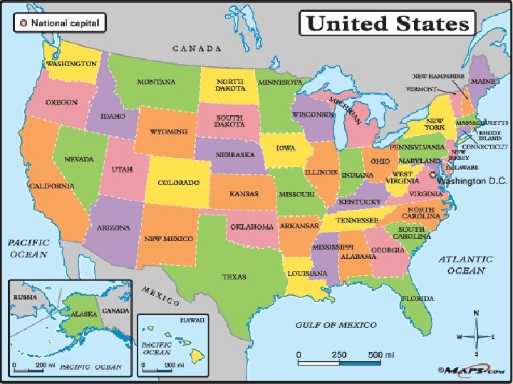
POLITICAL MAPS � Shows political units or boundaries (countries, states, counties, districts, towns)
HISTORICAL MAPS � Shows illustrations for things like economic activity, migrations, battles and changing national boundaries
OTHER MAPS � Topographic Climate
COMPASS ROSE �A compass rose shows which way the directions north (N), south (S), east (E), and west (W) point on a map � Never � Eat � Soggy � Waffles
ANOTHER NAME FOR THE MAJOR DIRECTIONS? � What is another name for the major directions? Turn to your neighbors and share.
� Cardinal West Directions – North, South, East and
INTERMEDIATE DIRECTIONS � Now that we have discussed cardinal directions, what do you think the intermediate directions are?
INTERMEDIATE DIRECTIONS � Northwest, Southeast Southwest, Northeast, and
SCALE � Shows the ratio between a unit of length on the map and a unit of distance on the earth. � EX: 1 inch on a map = 1 mile in real life
LEGEND OR KEY � Lists and explains the symbols, lines, and colors on a map
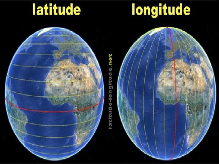
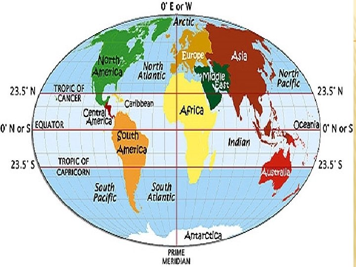
LONGITUDE LINES � Imaginary lines that run North to South. Also known as Meridians � Shows distance in degrees East or West of the Prime Meridian
PRIME MERIDIAN �A longitude line that runs from the North Pole to the South Pole. Passes through Greenwich, England, and measures at 0° longitude
LATITUDE LINES � Imaginary lines that run east to west. Also known as parallels � Shows distance in degrees north or south of the equator. � Latitude Lat = Flatitude Flat � Lat sounds like ladder…steps of a ladder
EQUATOR �A latitude line that circles the earth halfway between the North and South Poles. It measures at 0° latitude
CANCER AND CAPRICORN � Parallels that form the boundaries of the Tropics, a region that stays warm all year long.
PURPOSE OF LATITUDE AND LONGITUDE? � They help you pinpoint the absolute location of cities and other geographic features by using coordinates of intersecting lines.
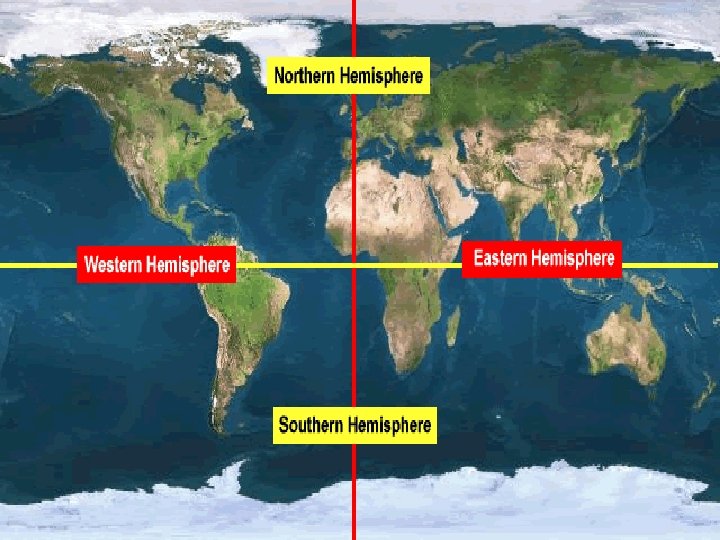
HEMISPHERE � Term for half the globe � The earth can be split into Southern and Northern hemispheres separated by the equator or into Eastern and Western.
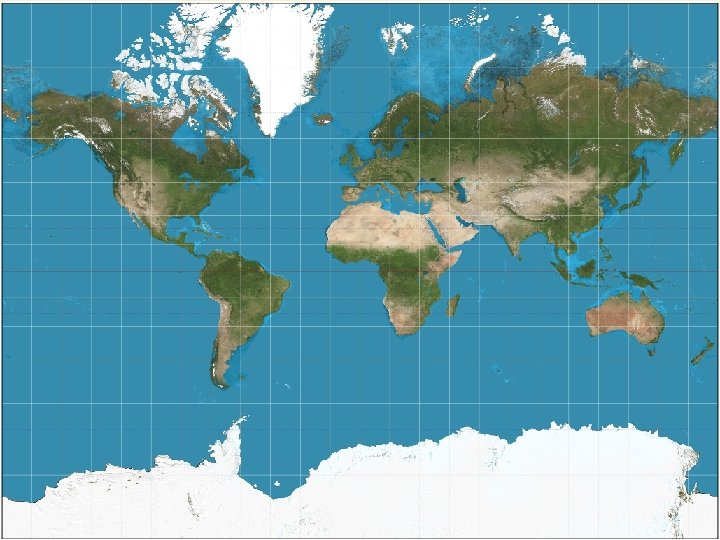
MERCATOR VS ROBINSON Mercator � Shows most of the continents as they look on a globe, yet it stretches out the land near the poles � Used for all kinds of navigation
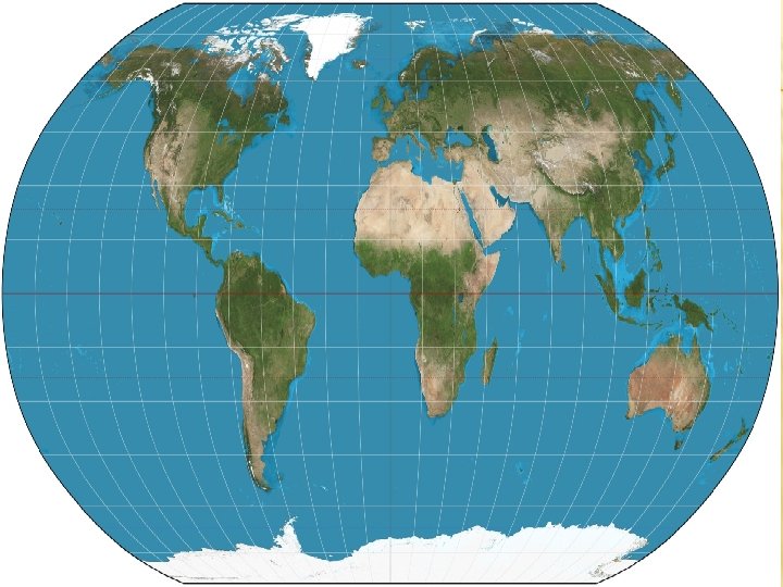
MERCATOR VS ROBINSON Robinson � Shows the earth with nearly true sizes and shapes of the continents and oceans, but the shapes near the poles are rounded � Used in most textbooks
NOTEBOOK � Label your Table of Contents – Page 8 - Map Skills � Tape into your SS Notebook onto page 8