
Map Reading Navigation Version 1 2 Jan Developed
- Slides: 53
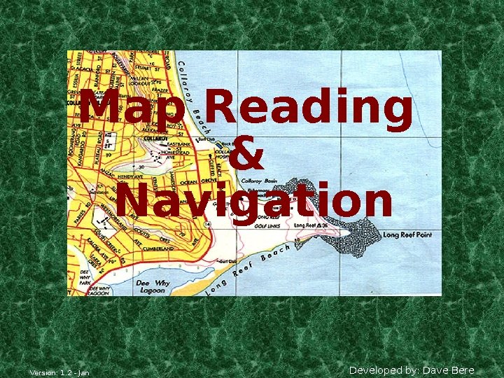
Map Reading & Navigation Version: 1. 2 - Jan Developed by: Dave Bere
Presentation Overview • Types of maps used within SES • How to use various maps – Scale, Grid references, Ground shape, Gradient etc • Compasses & Bearings • Cross country navigation • Remote area preparedness – (supplement) Version: 1. 2 - Jan Developed by: Dave Bere
Aim of Map Reading. . . • To navigate & recognise features on the ground & map. • To picture the ground even though it hasn’t been seen, and. • To understand pass information quickly. • Determine and plan a safe route. Version: 1. 2 - Jan Developed by: Dave Bere
Definition of a Map… • Its a scaled representation of the earths surface shown on a plane surface. • It shows natural and/or artificial features. • Used as a form of communication, used to convey land features. • However, its only accurate at time of aerial photo or field revision. Version: 1. 2 - Jan Developed by: Dave Bere
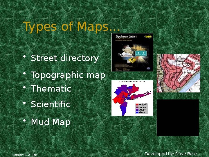
Types of Maps. . . • Street directory • Topographic map • Thematic • Scientific • Mud Map Version: 1. 2 - Jan Developed by: Dave Bere
Street Directory • Edition • Facility index • Key map • Street index • Suburb index • Map & reference Version: 1. 2 - Jan Developed by: Dave Bere
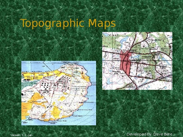
Topographic Maps Version: 1. 2 - Jan Developed by: Dave Bere
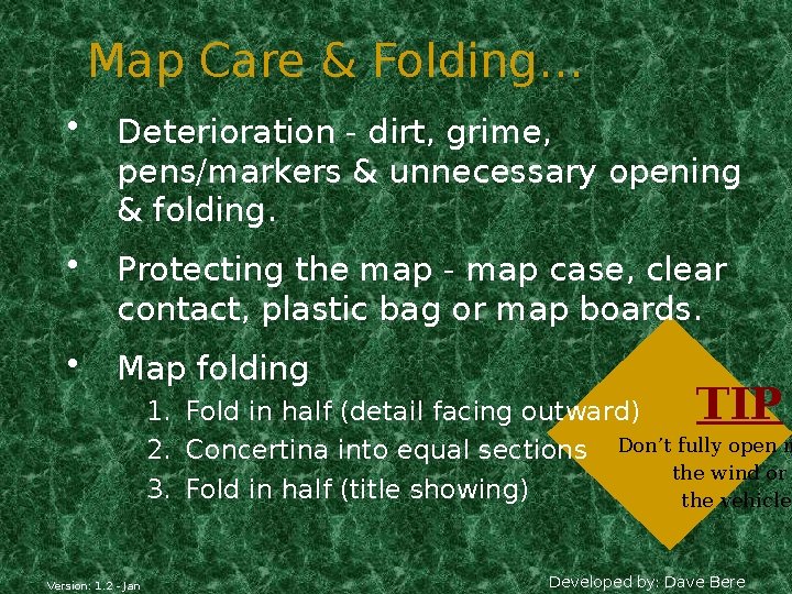
Map Care & Folding… • Deterioration - dirt, grime, pens/markers & unnecessary opening & folding. • Protecting the map - map case, clear contact, plastic bag or map boards. • Map folding TIP 1. Fold in half (detail facing outward) 2. Concertina into equal sections Don’t fully open m the wind or 3. Fold in half (title showing) the vehicle. Version: 1. 2 - Jan Developed by: Dave Bere
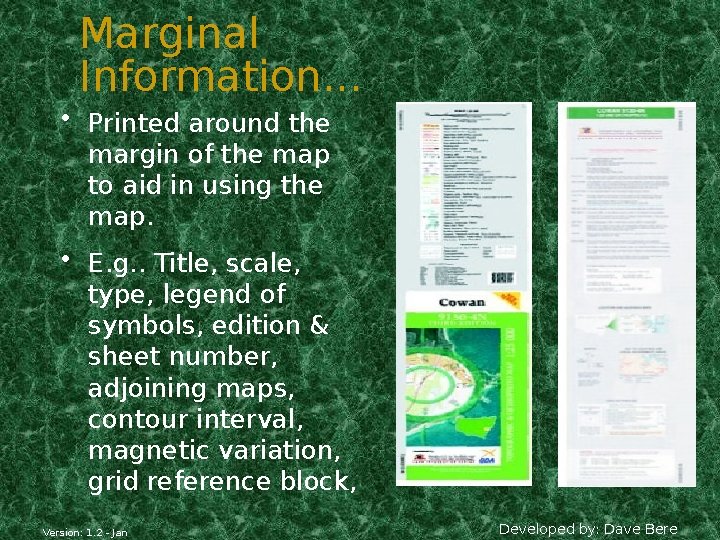
Marginal Information. . . • Printed around the margin of the map to aid in using the map. • E. g. . Title, scale, type, legend of symbols, edition & sheet number, adjoining maps, contour interval, magnetic variation, grid reference block, Version: 1. 2 - Jan Developed by: Dave Bere
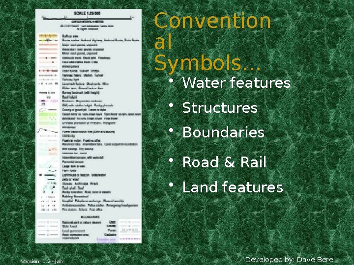
Convention al Symbols… • Water features • Structures • Boundaries • Road & Rail • Land features Version: 1. 2 - Jan Developed by: Dave Bere
Mapping Datum • All mapping & coordinate systems are based on a datum • It’s a mathematical surface (overlay) that best fits the shape of the earth. • AGD 66 = Aust Geodetic Datum 1966 – Aust region only • AGD 84 = Updated version of AGD 66 - USED ON 2 ND EDITION TOPO MAPS • GDA 94 = Geocentric Datum of Australia - Adopted cause it best fits the earths surface as a whole - USED ON 3 RD EDITION TOPO MAPS • WGS 84 = Used for Satellite based TIP See map for da navigation conversion • WGS 84 & GDA 94 for practical purposes are the same Version: 1. 2 - Jan Developed by: Dave Bere
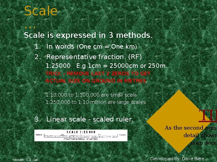
Scale … Scale is expressed in 3 methods. 1. In words (One cm = One km) 2. Representative fraction. (RF) 1: 25000 E. g 1 cm = 25000 cm or 250 m. TRICK - REMOVE LAST 2 ZEROS TO GET ACTUAL SIZE ON GROUND IN METRES 1: 10, 000 to 1: 100, 000 are small scale 1: 250, 000 to 1: 10 million are large scales 3. Linear scale - scaled ruler. TIP As the second num detail shown map decre Version: 1. 2 - Jan Developed by: Dave Bere
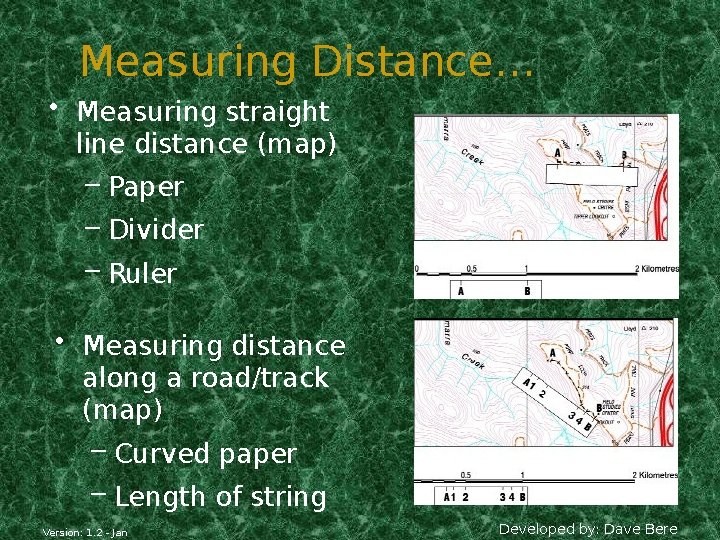
Measuring Distance… • Measuring straight line distance (map) – Paper – Divider – Ruler • Measuring distance along a road/track (map) – Curved paper – Length of string Version: 1. 2 - Jan Developed by: Dave Bere
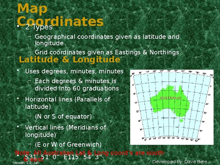
Map Coordinates • 2 Types – Geographical coordinates given as latitude and longitude – Grid coordinates given as Eastings & Northings Latitude & Longitude • Uses degrees, minutes – Each degrees & minutes is divided into 60 graduations • Horizontal lines (Parallels of latitude) – (N or S of equator) • Vertical lines (Meridians of longitude) – (E or W of Greenwich) Note: All & Long coord’s are south 0 Australian Lat 0 • S 31 & east 51’ 0” E 115 54’ 3” Developed by: Dave Bere Version: 1. 2 - Jan
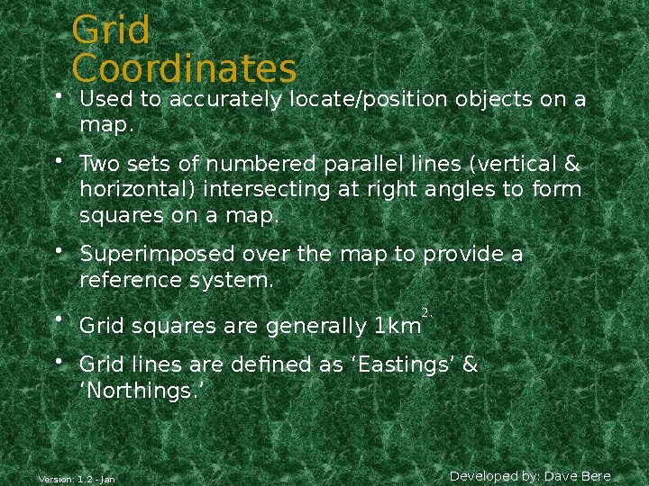
Grid Coordinates • Used to accurately locate/position objects on a map. • Two sets of numbered parallel lines (vertical & horizontal) intersecting at right angles to form squares on a map. • Superimposed over the map to provide a reference system. • Grid squares are generally 1 km 2. • Grid lines are defined as ‘Eastings’ & ‘Northings. ’ Version: 1. 2 - Jan Developed by: Dave Bere
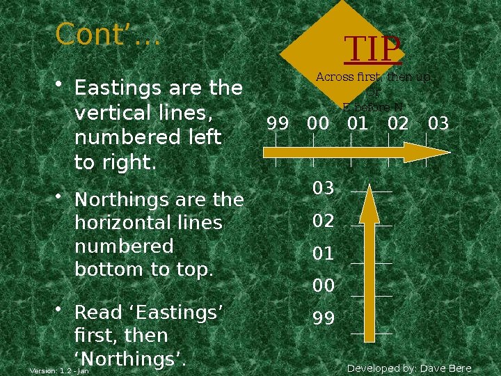
Cont’… • Eastings are the vertical lines, numbered left to right. • Northings are the horizontal lines numbered bottom to top. • Read ‘Eastings’ first, then ‘Northings’. Version: 1. 2 - Jan TIP Across first, then up Or E before N 99 00 01 02 03 03 02 01 00 99 Developed by: Dave Bere
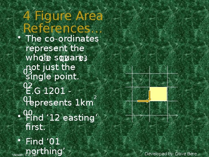
4 Figure Area References… • The co-ordinates represent the whole 11 square, 12 13 not just the 03 single point. 02 E. G 1201 2 01 represents 1 km • 00 Find ‘ 12 easting’ first. • Find ‘ 01 northing’ Version: 1. 2 - Jan Developed by: Dave Bere
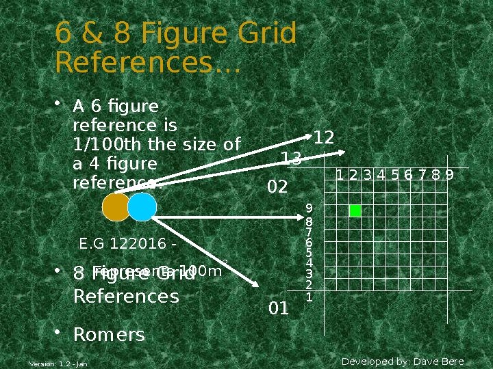
6 & 8 Figure Grid References… • A 6 figure reference is 1/100 th the size of a 4 figure reference. 12 13 02 E. G 122016 represents 100 m Figure Grid • 8 References 123456789 2 01 9 8 7 6 5 4 3 2 1 • Romers Version: 1. 2 - Jan Developed by: Dave Bere
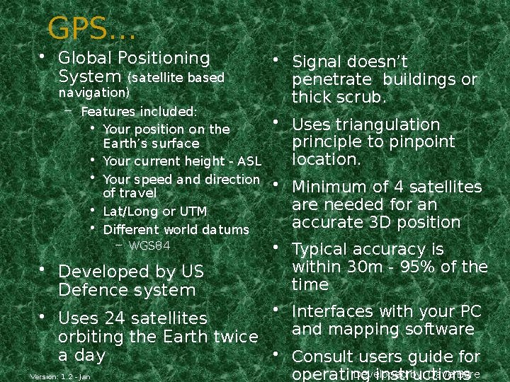
GPS… • Global Positioning System (satellite based navigation) – Features included: • Your position on the Earth’s surface • Your current height - ASL • Your speed and direction of travel • Lat/Long or UTM • Different world datums – WGS 84 • Developed by US Defence system • Signal doesn’t penetrate buildings or thick scrub. • Uses triangulation principle to pinpoint location. • Minimum of 4 satellites are needed for an accurate 3 D position • Typical accuracy is within 30 m - 95% of the time • Interfaces with your PC • Uses 24 satellites and mapping software orbiting the Earth twice • Consult users guide for a day Developed by: Dave Bere Version: 1. 2 - Jan operating instructions
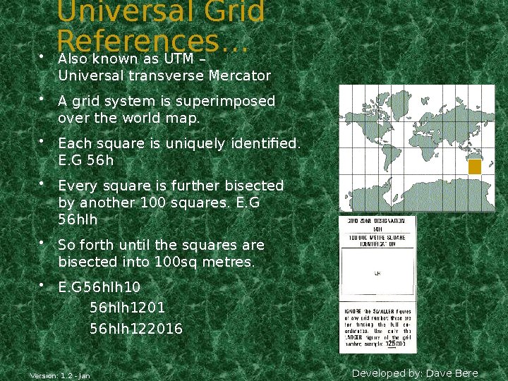
• Universal Grid References… Also known as UTM – Universal transverse Mercator • A grid system is superimposed over the world map. • Each square is uniquely identified. E. G 56 h • Every square is further bisected by another 100 squares. E. G 56 hlh • So forth until the squares are bisected into 100 sq metres. • E. G 56 hlh 10 56 hlh 1201 56 hlh 122016 Version: 1. 2 - Jan Developed by: Dave Bere
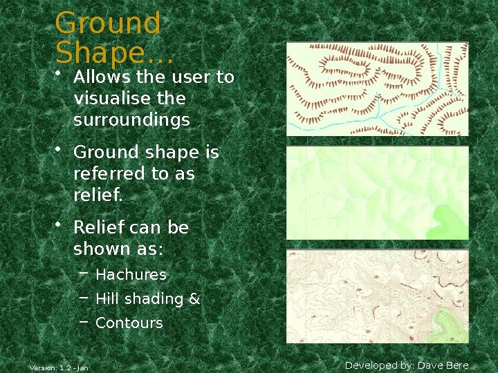
Ground Shape… • Allows the user to visualise the surroundings • Ground shape is referred to as relief. • Relief can be shown as: – Hachures – Hill shading & – Contours Version: 1. 2 - Jan Developed by: Dave Bere
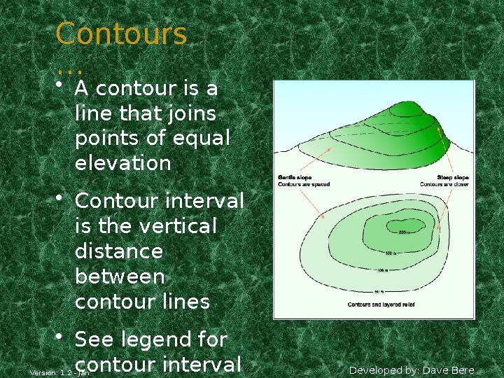
Contours … • A contour is a line that joins points of equal elevation • Contour interval is the vertical distance between contour lines • See legend for contour interval Version: 1. 2 - Jan Developed by: Dave Bere
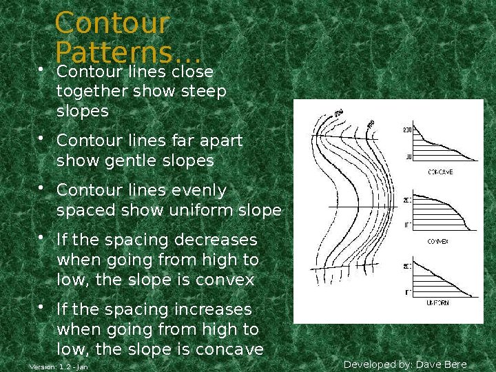
• Contour Patterns… Contour lines close together show steep slopes • Contour lines far apart show gentle slopes • Contour lines evenly spaced show uniform slope • If the spacing decreases when going from high to low, the slope is convex • If the spacing increases when going from high to low, the slope is concave Version: 1. 2 - Jan Developed by: Dave Bere
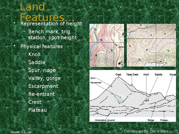
• Land Features… Representation of height – Bench mark, trig station, spot height • Physical features – Knoll – Saddle – Spur, ridge – Valley, gorge – Escarpment – Re-entrant – Crest – Plateau Version: 1. 2 - Jan Developed by: Dave Bere
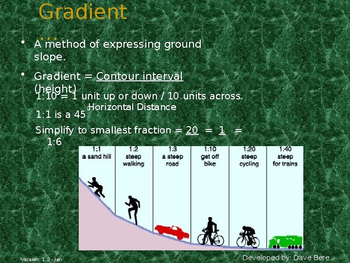
• Gradient … A method of expressing ground slope. • Gradient = Contour interval (height) 1: 10 = 1 unit up or down / 10 units across. 1: 1 is a 45 Horizontal Distance 0 Simplify to smallest fraction = 20 = 1: 6 120 Version: 1. 2 - Jan 6 Developed by: Dave Bere
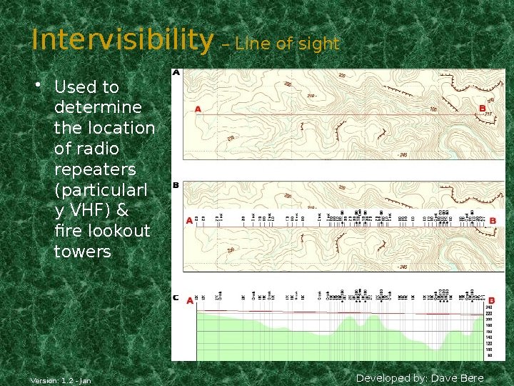
Intervisibility – Line of sight • Used to determine the location of radio repeaters (particularl y VHF) & fire lookout towers Version: 1. 2 - Jan Developed by: Dave Bere
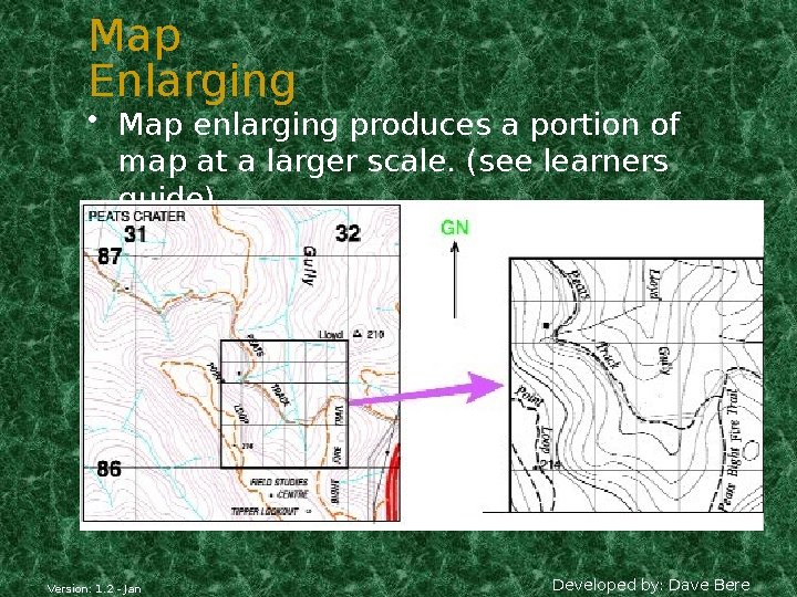
Map Enlarging • Map enlarging produces a portion of map at a larger scale. (see learners guide) Version: 1. 2 - Jan Developed by: Dave Bere
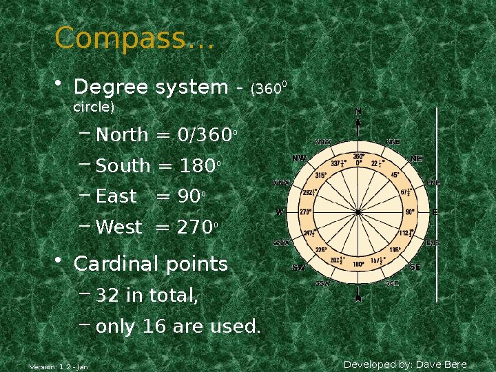
Compass… • Degree system - (3600 circle) – North = 0/360 – South = 180 0 0 – East = 90 – West = 270 0 0 • Cardinal points – 32 in total, – only 16 are used. Version: 1. 2 - Jan Developed by: Dave Bere
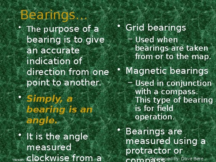
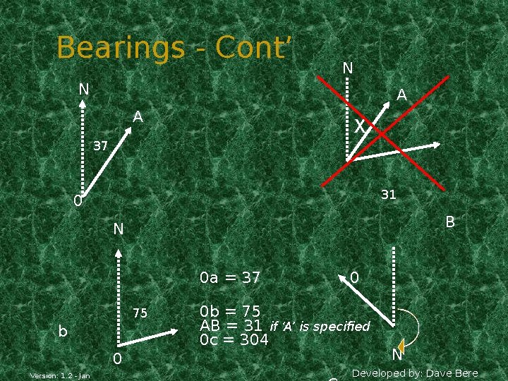
Bearings… • The purpose of a • Grid bearings – Used when bearing is to give bearings are taken an accurate from or to the map. indication of direction from one • Magnetic bearings – Used in conjunction point to another. • Simply, a bearing is an angle. • It is the angle measured clockwise from a Version: 1. 2 - Jan with a compass. This type of bearing is for field operation. • Bearings are measured using a protractor or Developed by: Dave Bere
Bearings - Cont’ N N A A X 37 31 0 B N 0 a = 37 75 b 0 Version: 1. 2 - Jan 0 0 b = 75 AB = 31 if ‘A’ is specified 0 c = 304 N Developed by: Dave Bere
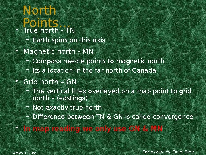
• North Points… True north - TN – Earth spins on this axis • Magnetic north - MN – Compass needle points to magnetic north – Its a location in the far north of Canada • Grid north – GN – The vertical lines overlayed on a map point to grid north – (eastings) – Not exactly true north. – Difference between TN & GN is called convergence • In map reading we only use GN & MN Version: 1. 2 - Jan Developed by: Dave Bere
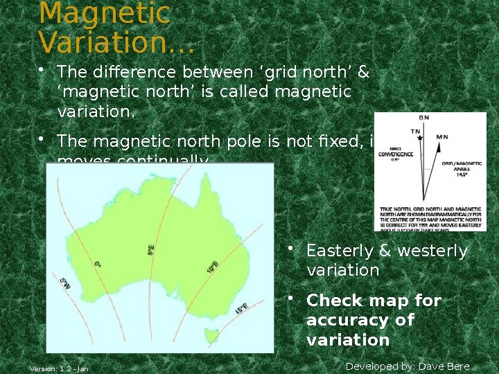
Magnetic Variation… • The difference between ‘grid north’ & ‘magnetic north’ is called magnetic variation. • The magnetic north pole is not fixed, it moves continually • Easterly & westerly variation • Check map for accuracy of variation Version: 1. 2 - Jan Developed by: Dave Bere
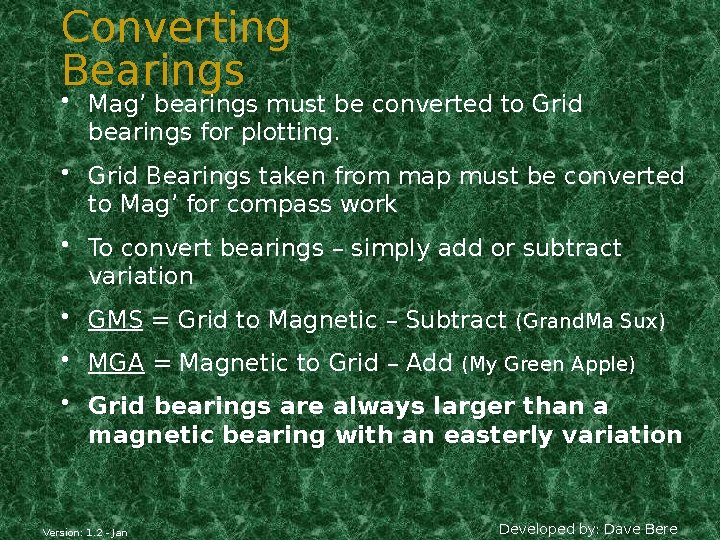
Converting Bearings • Mag’ bearings must be converted to Grid bearings for plotting. • Grid Bearings taken from map must be converted to Mag’ for compass work • To convert bearings – simply add or subtract variation • GMS = Grid to Magnetic – Subtract (Grand. Ma Sux) • MGA = Magnetic to Grid – Add (My Green Apple) • Grid bearings are always larger than a magnetic bearing with an easterly variation Version: 1. 2 - Jan Developed by: Dave Bere
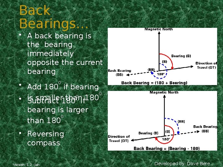
Back Bearings… • A back bearing is the bearing immediately opposite the current bearing • Add 1800 if bearing 0 0 is smaller 180 thanif 180 • Subtract bearing is larger 0 than 180 • Reversing compass Version: 1. 2 - Jan Developed by: Dave Bere
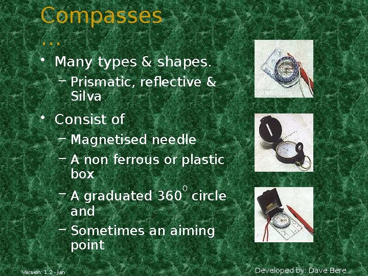
Compasses … • Many types & shapes. – Prismatic, reflective & Silva • Consist of – Magnetised needle – A non ferrous or plastic box – A graduated 3600 circle and – Sometimes an aiming point Version: 1. 2 - Jan Developed by: Dave Bere
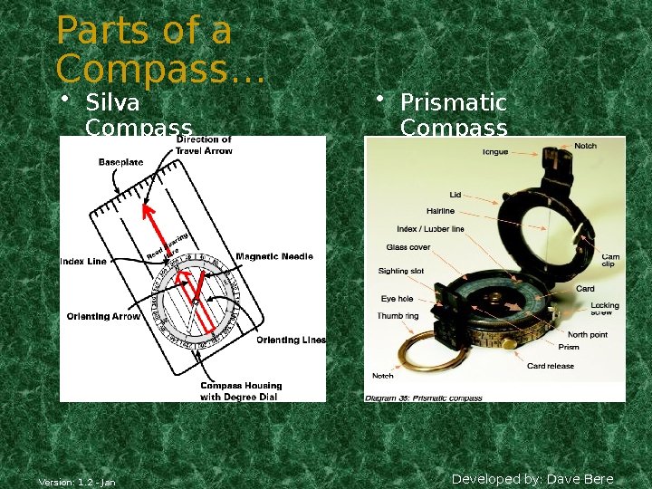
Parts of a Compass… • Silva Compass Version: 1. 2 - Jan • Prismatic Compass Developed by: Dave Bere
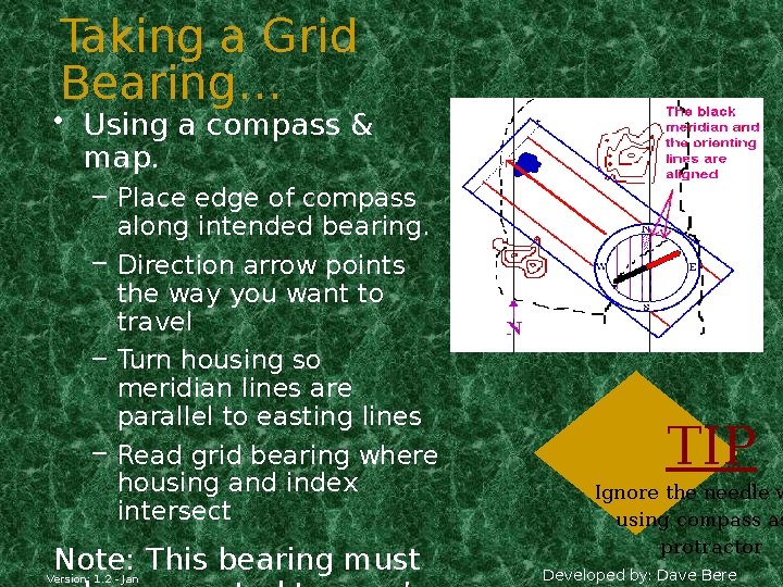
Taking a Grid Bearing… • Using a compass & map. – Place edge of compass along intended bearing. – Direction arrow points the way you want to travel – Turn housing so meridian lines are parallel to easting lines – Read grid bearing where housing and index intersect Note: This bearing must Version: 1. 2 - Jan TIP Ignore the needle w using compass as protractor Developed by: Dave Bere
Magnetic Bearings • Setting a Magnetic bearing – Hold compass flat in palm – Set bearing on compass by rotating housing – Turn yourself till red needle lines up with north – Now walk in direction of directional arrow Version: 1. 2 - Jan • Taking a Magnetic bearing – Hold compass with directional arrow pointing at intended object/direction – Rotate housing till north aligns with red arrow – Read bearing where index lines intersects Developed by: Dave Bere
Magnetic Bearings cont… • Compass back bearings – Face the opposite direction, turn compass around & walk with directional arrow pointing towards you. – Or use white needle as directional indicator • Compass Error – Individual compasses – Local magnetic attraction due to steel/iron ore • Transmission lines = 80 m • Car = 60 m • Wire fence = 10 m Version: 1. 2 - Jan • Pick, Axe or shovel = 3 m TIP The desk you’r has local magne Developed by: Dave Bere
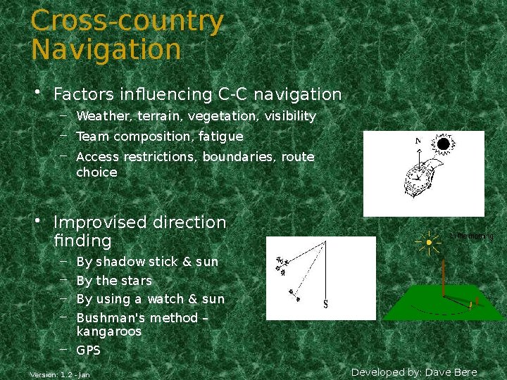
Cross-country Navigation • Factors influencing C-C navigation – Weather, terrain, vegetation, visibility – Team composition, fatigue – Access restrictions, boundaries, route choice • Improvised direction finding By shadow stick & sun By the stars By using a watch & sun Bushman's method – kangaroos – GPS – – Version: 1. 2 - Jan Developed by: Dave Bere
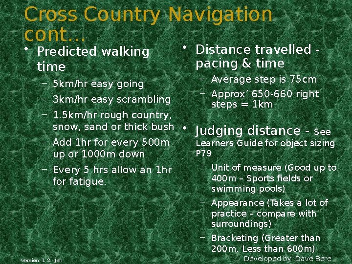
Cross Country Navigation cont… • Predicted walking time – 5 km/hr easy going – 3 km/hr easy scrambling – 1. 5 km/hr rough country, snow, sand or thick bush – Add 1 hr for every 500 m up or 1000 m down – Every 5 hrs allow an 1 hr for fatigue. Version: 1. 2 - Jan • Distance travelled pacing & time – Average step is 75 cm – Approx’ 650 -660 right steps = 1 km • Judging distance - See Learners Guide for object sizing P 79 – Unit of measure (Good up to 400 m – Sports fields or swimming pools) – Appearance (Takes a lot of practice – compare with surroundings) – Bracketing (Greater than 200 m, Less than 600 m) Developed by: Dave Bere
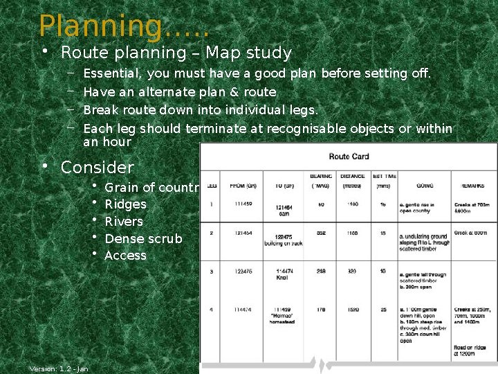
Planning…. . • Route planning – Map study – – Essential, you must have a good plan before setting off. Have an alternate plan & route Break route down into individual legs. Each leg should terminate at recognisable objects or within an hour • Consider • • • Version: 1. 2 - Jan Grain of country Ridges Rivers Dense scrub Access Developed by: Dave Bere
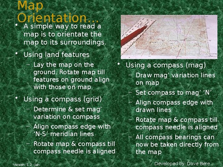
Map Orientation… • A simple way to read a map is to orientate the map to its surroundings. • Using land features – Lay the map on the ground. Rotate map till features on ground align with those on map. • Using a compass (grid) – Determine & set mag’ variation on compass – Align compass edge with ‘N-S’ meridian lines – Rotate map & compass till compass needle is aligned Version: 1. 2 - Jan • Using a compass (mag) – Draw mag’ variation lines on map – Set compass to mag’ ‘N’ – Align compass edge with drawn lines – Rotate map & compass till compass needle is aligned – All compass bearings can now be taken directly from the map Developed by: Dave Bere
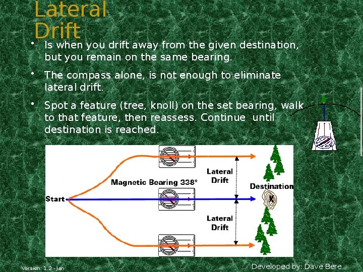
Lateral Drift • Is when you drift away from the given destination, but you remain on the same bearing. • The compass alone, is not enough to eliminate lateral drift. • Spot a feature (tree, knoll) on the set bearing, walk to that feature, then reassess. Continue until destination is reached. Version: 1. 2 - Jan Developed by: Dave Bere
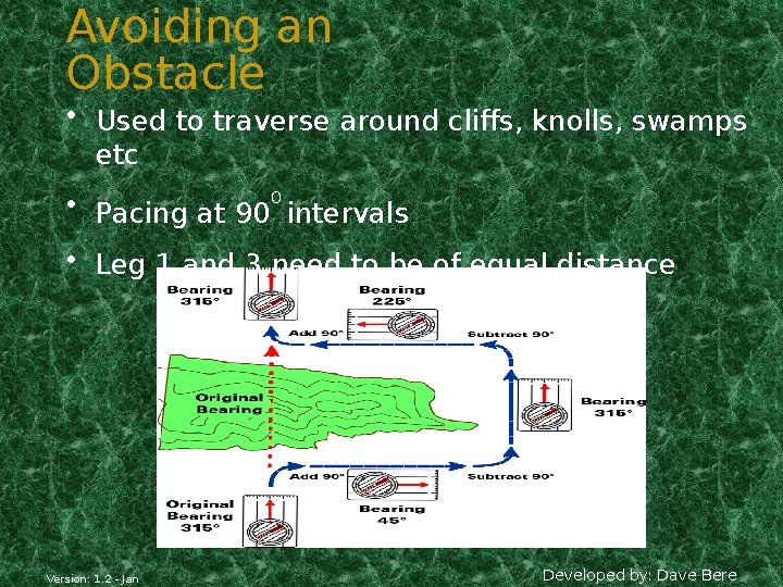
Avoiding an Obstacle • Used to traverse around cliffs, knolls, swamps etc • Pacing at 900 intervals • Leg 1 and 3 need to be of equal distance Version: 1. 2 - Jan Developed by: Dave Bere
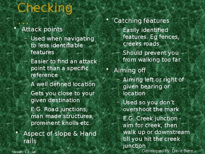
Checking … • Attack points – Used when navigating to less identifiable features – Easier to find an attack point than a specific reference – A well defined location – Gets you close to your given destination – E. G. Road junctions, man made structures, prominent knolls etc. • Aspect of slope & Hand rails Version: 1. 2 - Jan • Catching features – Easily identified features. Eg fences, creeks roads – Should prevent you from walking too far • Aiming off – Aiming left or right of given bearing or location – Used so you don’t overshoot the mark – E. G. Creek junction aim for creek, then walk up or downstream till you hit the creek junction Developed by: Dave Bere
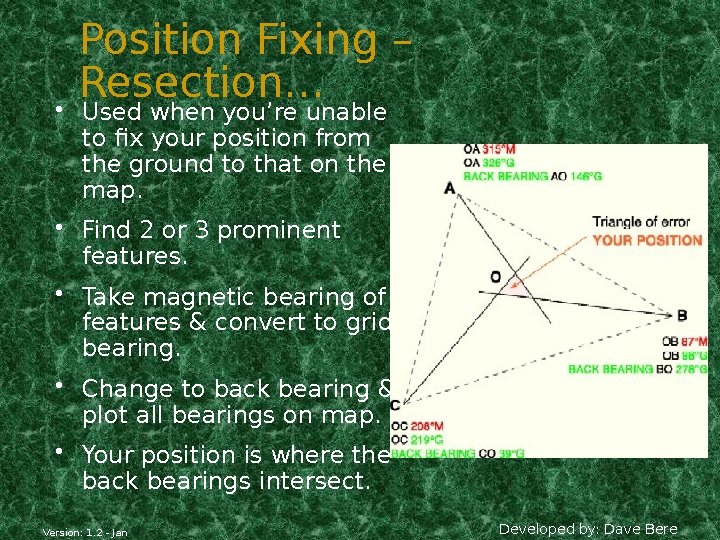
Position Fixing – Resection… • Used when you’re unable to fix your position from the ground to that on the map. • Find 2 or 3 prominent features. • Take magnetic bearing of features & convert to grid bearing. • Change to back bearing & plot all bearings on map. • Your position is where the back bearings intersect. Version: 1. 2 - Jan Developed by: Dave Bere
Action If Lost!!! • Don’t PANIC, remain calm • Re-think route & confirm ground covered • Position fixing -resection • Identify a bearing (track junction) & head for safety • Unable to identify your position, set up camp & wait for rescue • Initiate any distress beacons TIP You’re never lost, ju geographically misplaced Version: 1. 2 - Jan Developed by: Dave Bere
Remote Area Section… This section is not pitched at any level of expertise. Everyone should be well prepared before entering the bush. • 6 P’s = prior preparation and planning prevents poor performance. • Learn the area before departing • Have a navigational route planned – – Group details Route details Intended camp locations ETD and ETA Version: 1. 2 - Jan Developed by: Dave Bere
Basic Requirements for Survival… • Water – Minimum 2 ltr/day – Is there water in the area – Carrying capacity – Quality • Shelter – Tent or hutchie – Ground sheet – Improvisation Version: 1. 2 - Jan – E. G. Caves, overhangs, huts, sheds • Warmth – Dry clothes – Thermals – Matches/lighter – Strategies/procedures to cope with the cold • Food – Enough food/nourishing – Hunting & gathering food – Rationing – Cooking/disease Developed by: Dave Bere
Navigational Tips (Generalised) • Sparse & scratchy vegetation along ridges & spurs • Thicker vegetation through gullies & valleys • South facing terrain is thicker vegetation • Slower moving through creek beds • Night navigation - use of lighting and the moon • Pack light, pack right • You’re only as fast as your slowest team member • Continue relating features from the ground to the map • Carry safety equipment & have knowledge of remote first aid • Know your limitations - be mentally & physically prepared Version: 1. 2 - Jan Developed by: Dave Bere
Pack Checklist… • Clothing • Personal equipment – Boots & socks – Underwear & thermal – Backpack – Sleeping bag – Trousers/shorts – Shirts – Sleeping mat – Toiletries – Jumper/jacket – Headgear & gloves – Toilet paper – Water bottle & water – Food & utensils – Wet weather jacket & pants – Gaiters Version: 1. 2 - Jan – Insect repellent/sunscreen – Light source batteries Developed by: Dave Bere
Pack Checklist… • Emergency equipment – Maps & map case – Watch – Compass – Whistle – Fire starters – Knife – Note book & pen – GPS Version: 1. 2 - Jan • Group equipment – Tent or hutchie – Ground sheet – Stove & fuel – Water filter – Plastic shovel – Cordage The End Developed by: Dave Bere