Map Projections A map projection is defined as


- Slides: 20
Map Projections
A map projection is defined as a way of drawing a map to represent the rounded earth on a flat surface.
SOL WG 1 The student will use maps, globes and photographs to analyze the physical and human landscapes of the world in order to recognize the different map projections and explain the concept of distortion.
• All maps distort the Earth’s representation • The only true representation of the Earth’s surface is a globe. • Different map projections are developed for specific purposes.
The Earth’s image will be distorted in one or more of the following ways. • Area-is the size accurate? • Shapes-is the shape accurate? • Distance-is the scale accurate? • Directions-can directions be accurately shown?
Students must be able to identify and understand the following projections. • Mercator • Polar • Robinson
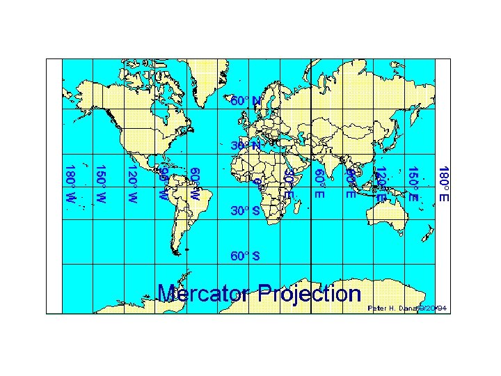
Mercator Projection Most Accurate in the tropics from Cancer to Capricorn Most Distortion at the North and South Poles
Mercator Projection Used for: • Locating Latitude and Longitude • Sea Captains use it for navigation at sea
Mercator Projection Characteristics: • All lines are at 90 degree angles • Simplest to read • Accurate direction • Distorted size, distance, shape
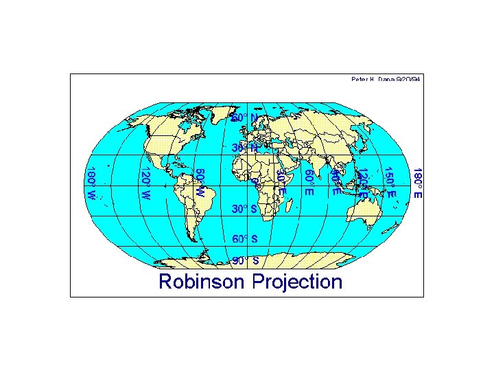
Robinson Projection Most Accurate at the equator Most Distortion around the outer edges
Robinson Projection Same characteristics as the Mercator except: • lines of longitude are curved • shapes at the poles are flat and not as distorted • used mostly in classrooms--one of the most accurate maps
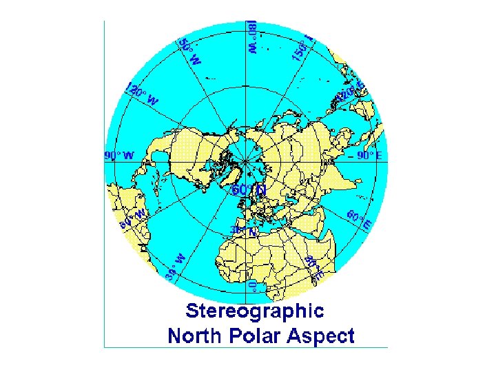
Polar Projection Most Accurate at the poles Most Distortion around the outer edges
Polar Projection Used for navigation of air planes
Polar Projection Characteristics: • Distances and direction are accurate from the center along the longitude lines. • Size and shape are accurate at the center of the map