Map Elements Learner Expectation Content Standard 3 0


- Slides: 21
Map Elements
Learner Expectation ►Content Standard: 3. 0 Geography § 3. 01 Understand how to use maps, globes, and other geographic representations, tools, and technologies to acquire, process and report information from a spatial perspective.
In this activity you will: ►Learn about the elements of a map: latitude, longitude, the hemispheres, directions, time zone, scale, and map legends.
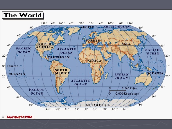
Latitude and Longitude ►The earth is divided into lots of lines called latitude and longitude.
Lines ►Longitude lines run north and south. ►Latitude lines run east and west. ►The lines measure distances in degrees. Latitude Longitude
Where is 0 degree? ►The equator is 0 degree latitude. ►It is an imaginary belt that runs halfway point between the North Pole and the South Pole. Equator
M E R R I I D ► The prime meridian Mis 0 I degrees longitude. This imaginary line runs the United E through A Kingdom, France, Spain, Nwestern Africa, and P Where is 0 degree? Antarctica.
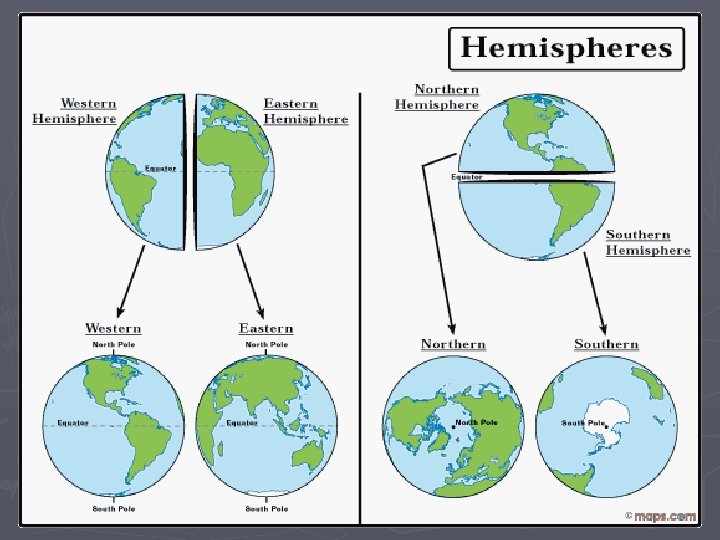
Hemispheres ►By using the equator and prime meridian, we can divide the world into four hemispheres, north, south, east, and west.
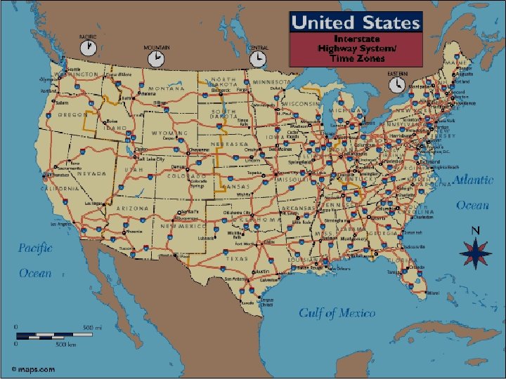
Compass ►A compass is a tool that helps the user know what direction one is headed. ►On a map, a compass or a compass rose helps the user locate these directions.
Compass Rose ►The needle on a compass is magnetized to point to the earth's north magnetic pole. Thus with a compass, a person can roughly tell which direction they are headed. ►There are four major or cardinal directions on a compass- north, south, east & west. In between are the directions northeast, northwest, southeast, southwest. Source: http: //aerocompass. larc. nasa. gov
Directions ► The cardinal directions are north, south, east, and west. ► The intermediate directions are northeast, southwest and northwest. ► They help describe the location of places in relation to other places.
Scale ►Maps are made to scale; that is, there is a direct connection between a unit of measurement on the map and the actual distance. ►For example, each inch on the map represents one mile on Earth. So, a map of a town would show a mile-long strip of fast food joints and auto dealers in one inch.
Scale
Time Zones ►The Earth is divided into 24 time zones, corresponding to 24 hours in a day. ►As the earth rotates, the sun shines in different areas, moving from east to west during the course of a day. ►Places that have the same longitude will be in the same time zone.
Map Legends ► The legend is the key to unlocking the secrets of a map. Objects or colors in the legend represent something on the map. Religions Legend
Can you understand this legend?
Age Expectancy Legend
Map Resources ► ► ► ► World Atlas: Explore Your World http: //www. worldatlas. com/aatlas/world. htm National Geographic Maps http: //maps. nationalgeographic. com/maps About. com Geography http: //geography. about. com/library/maps/blindex. htm Google Maps http: //maps. google. com/ More Maps http: //go. hrw. com/atlas/norm_htm/world. htm Atlas - World (Holt, Rinehart and Winston) Maps and Globes http: //www. mcwdn. org/MAPS&GLOBES/Maps. Globes. Home. html