Map Components Title Floating maps Grid Compass Key


- Slides: 8
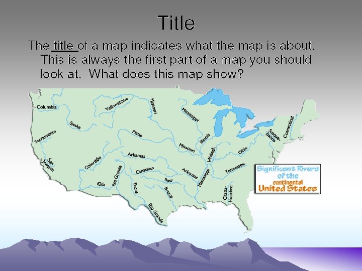
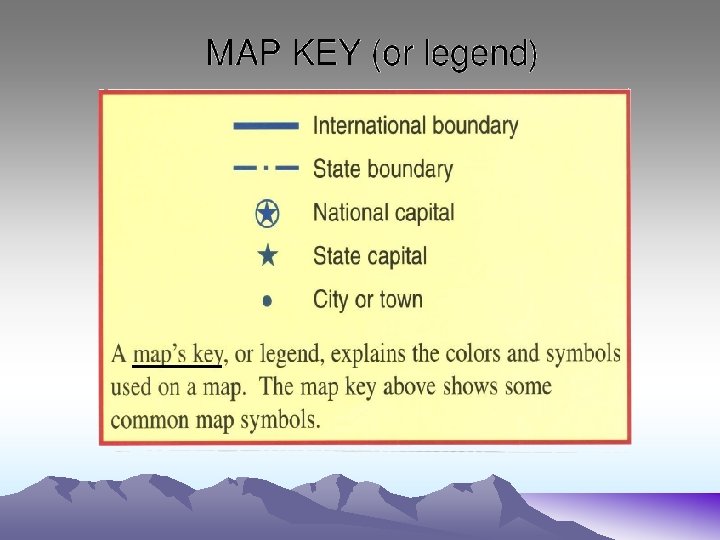
Map Components Title Floating maps Grid Compass Key or Legend Scale Kinds of Borders
Compass Rose Tells you directions when you are lost. The needle of a compass must always point north to work right. Cardinal Directions. These are the four primary directions of the compass. Intermediate Directions - These are your secondary directions of the compass. They are made up from a combination of the primary directions. Northwest Southwest Northeast Southeast
Insert maps • Insert maps are a mini map placed in the corner of a page to show a location that would not be able to be seen. Insert map examples
Scale By using maps we can also tell the distance from one place to another. Maps are made in a way so that we can see an entire area. When drawn the drawings are smaller then they actually are in real life. This mean if you need to measure distance you will use and scale that tells you how many miles away something is. Now lets learn about scales.
Grids * A grid is a pattern of lines that can help you find a location on a map.
Borders are what you use to divide land areas on a map. They can be made from physical features or man-made lines agreed on by humans. Physical Borders – – Mountains Grasslands Desserts Bodies of water • • Lakes Rivers Oceans Gulfs Man-made borders - State line borders - Lines dividing countries - City borders -County borders