MANOAH TEPA SOLOMON ISLANDS METEOROLOGICAL SERVICES SEVERE WEATHER
- Slides: 17

MANOAH TEPA SOLOMON ISLANDS METEOROLOGICAL SERVICES SEVERE WEATHER FORECASTING AND DISASTER REDUCTION DEMONSTRATION PROJECT (SWFDDP) ASSESSMENT

TOPICS • Benefits from SWFDDP. • Improvements on the lead times of alerting severe weather in the Solomon Islands Meteorological Services (SIMS) • SIMS With the Solomon Islands National Disaster Management Office (SI NDMO). • Gaps and areas for improvements from experience on SWFDDP. • Models. • Cascading process. • Verification from SIMS on the South Pacific Guidance(SPG) • S I Met. Service Improvements. • History on the forecasting section and expectations. ns in the SWFDDP

Benefits from Severe Weather Forecasting, Disaster Risk Reduction Demonstration Project (SWFDDP) (1) Training from James Lunny and Peter Fisher (2) Installation of METCONNECT SOUTHPACIFIC WEBSITE (SPG Chart) Improvement and ability of SIMS to forecast severe weather. . SIMS has the opportunity to access the Metconnect and the SPG Charts with a first experience of great confidence to issue warnings well on time. . SIMS becomes very confidence in doing the ordinary forecasts too (non severe weather). Using metconnect and the other models.

Improvements on the lead times of alerting severe weather by SIMS. • Lead times for severe weather were helped by the SPG. SIMS few times extends the warnings 12 to 24 hours ahead or delay to make sure people are safe and that the severe event has passed using SPG. To avoid ignorance and brave Islanders going out. • Now we are able to monitor 5 days ahead on severe weather (strong winds and heavy rain) • Lead time is excellent using SPG in any Low formation (early stage warning).

SIMS With the Solomon Islands National Disaster Management Office (SI NDMO • The relationship between SIMS and SI NDMO has been outstanding as confidence and timeliness of warnings has improved. SIMS Director has made several briefings with SI NDMO before and after events (severe weather). • The Solomon Islands New Government in power has recognised the close relationship between SIMS and NDMO so now we are under one Ministry (Ministry of Environment, Climate Change, Disaster Management and Meteorology(MECDM).

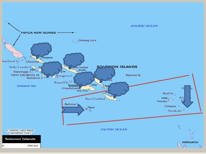
• SIMS now identify the most hazard areas. (1) Starts a new Met. Station in Rennell & Bellona province where cyclones and tropical lows pass through or an area of formation. (2) Planning to get a AWS over Tikopia or Anuta in the Temotu province. • Severe weather (TC & Gale winds) can not be verified or assessed in Rennell & Bellona and the outer islands of Temotu (Tikopia, Vanikoro or Anuta Islands). No AWS or Met. Station. • For Flooding we identify mainly bigger Islands with high Mountains and closer plains to or near big rivers. Namely Isabel, Western, Malaita , Guadalcanal and Makira Islands. Other Islands will be less flooding.

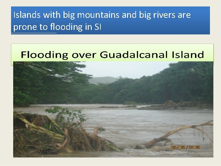
Islands with big mountains and big rivers are prone to flooding in SI

Solomon Islands

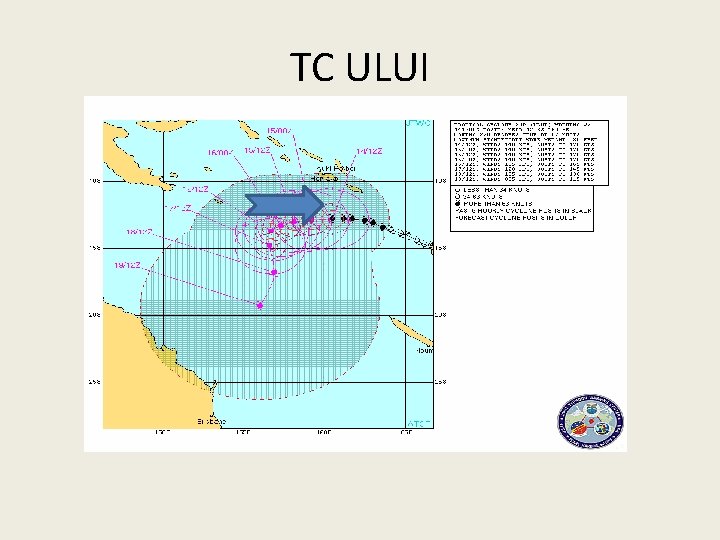
TC ULUI

MODELS • Metconnect becomes almost a one shop center for models needed like ECMWF, Ausy and UK models. • Please include American Models (NOAA) in the Metconnect because our forecasters also attend an important Pacific Desk training in Hawaii as a yearly program and we use NOAA models and others. • There is a good experience in our latitude on EPS Meteograms (ECMWF) and you will realise that we have added or included all Met. Stations to ECMWF EPS meteograms because of good results experienced. • Please include Balloon Flights (radio sondes) to metconnect.

CASCADING PROCESS • Nadi and Brisbane RSMCs are doing well and we need a lot of information from them. • Sometimes confusing and quite slow in the earliest stages which is very important to us. Whether a low is developing or not because we do not want to over warn people or delay in warning people. • SPG is helping out well in this cascading process as well during cyclones especially at the early stages and this tested excellent in cyclone ului. NDMO and the forecasting section used this for strong winds and near gales for specific areas during the very first warnings or local Advisories.

Verification from SI Forecasters on Pacific Guidance(SPG) • Experience on SPG gives more confidence to forecasters. It is a first page that is not forgotten before other tools to look at. • We come across low confidence on the guidance a few times that observations from met stations and public reports is really moderate chances or high confidences. SIMS therefore treats every confidence very carefully. To us there will be always chances of Severe Weather. • It gives forecasters confidence to name islands and warn them. • This guidance becomes very important to us in doing our non severe forecasts as well. It gives us a fair idea and fare weather. • During initial stages of tropical lows SPG helps SIMS to warn the communities at the earliest we can. As experienced Nadi and Brisbane are more concern when there is threats of gales.

Comparing SIMS local Forecasts using SPG. - Our Met Stations read low in wind speeds depends on the locations of stations. Mountains, trees and bays can be obstructions. (15 to 18 knots) - Guidance charts indicate higher values on Southeast Trade winds (25 to 30 knots) and they are accurate according to the public and reports from the media, Police, NDMO and SIMS Forecasters assessments after. - SIMS Forecasts (15 to 25 knots reaching 30 knots) - Verifying forecasts is always challenging in remote affected areas where there is no AWS and Met. Stations and we have to depend very much on reports from SI NDMO and Police. -For the recent events, the warning areas have been excellent as highlighted by reports from NDMO.

S I Met. Service Improvements (Summary) -There is now public confidence on our forecasts and warnings as people have realised the improvement in the forecasts and warnings during the past events. - The Forecasting Section can Monitor Severe Weather 5 days ahead and alert to make any warning using SPG. - Forecasters are starting to improve on daily forecasts using SPG , Metconnect and other tools available. - Forecasters have more confidence to specify warnings naming waters and islands. - A new Met. Station is taking shape over Rennell Island. - NDMO and SIMS now under one Ministry (MECDMM) - Good Media coverage

HISTORY ON THE FORECASTING SECTION AND EXPECTATIONS IN THE SWFDDP (1) (History) SIMS, the forecasting Section was set up in 1998 by only one Meteorologist the late Director Mr. Mike Ariki who was trained in New Zealand. He personally trained Observers to help him and later send three to become Assistant Forecasters in Melbourne. From his wisdom the Forecasting Section is alive until now although right on the Desk we still do not have Meteorologists except for two assistant Forecasters and five observers. (2) For TC Warning - Nadi and Brisbane RSMCS. Before this project (swfddp) started we do not warn people on strong winds above 25 knots or swells above 2. 5 m. We just give out general marine forecasts. SIMS only warn people on TC from Nadi and Brisbane , and Flood Advisory on Heavy rain without thresholds. (3) This Project (swfddp) and cascading process is expected to help SIMS for the next 15 to 20 years or more. (4) Only solution is every country must be given chances to train to become Meteorologists.

Finally what we want the project to do now. If possible help on Met. Stations and AWS for such areas. Add more new models to Metconnect, NOAA and others. Add Balloon flights (Radio sonde flights) to metconnect. Extend this Guidance to Aviation Forecasts and involve a cascading process. I can remember before Small Aircrafts Area forecasts for Solomon Islands was done by New Zealand Met. Service. Taf that is used internationally is done by PNG Met. office. But SIMS is doing taf on trial basis at the moment and is used locally now. • Continue training of forecasters and at least Meteorologist trainings for the future. • •

Conclusion • Now SIMS is looking forward to learn more from the Project and other colleague countries. • I therefore acknowledge that SWFDDP is serving its purpose and believe that there will be more of importance to us in this meeting. This will be benefiting many Countries who do not have qualified forecasters like SIMS. THANK YOU END………END……. .