
Managed Aquifer Recharge MAR and Hydrogeological Modeling in
- Slides: 21
Managed Aquifer Recharge (MAR) and Hydrogeological Modeling in the RAMOTSWA Manuel Magombeyi (IWMI) RAMOTSWA WORKSHOP 06 -09 MARCH 2018, GABORONE, BOTSWANA
Objective • The objectives this project component are: a) Review of MAR experiences in Africa and generate some guidance and lessons on which MAR approaches may have most potential for application in areas identified as suitable in the Ramotswa b) Assessment of MAR site suitability: assessment of site suitability for MAR using GIS and multi-criteria analysis c) Hydrogeological Modeling: quantifying storage and the relative impact of MAR activities on the aquifer system
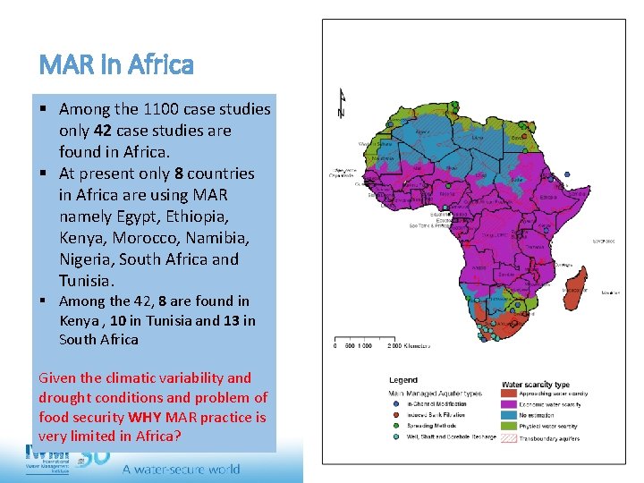
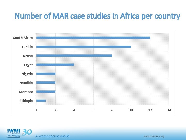
MAR in Africa § Among the 1100 case studies only 42 case studies are found in Africa. § At present only 8 countries in Africa are using MAR namely Egypt, Ethiopia, Kenya, Morocco, Namibia, Nigeria, South Africa and Tunisia. § Among the 42, 8 are found in Kenya , 10 in Tunisia and 13 in South Africa Given the climatic variability and drought conditions and problem of food security WHY MAR practice is very limited in Africa?
Number of MAR case studies in Africa per country South Africa Tunisia Kenya Egypt Nigeria Namibia Morocco Ethiopia 0 2 4 6 8 10 12 14
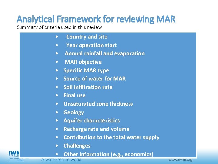
Analytical Framework for reviewing MAR Summary of criteria used in this review Country and site Year operation start Annual rainfall and evaporation MAR objective Specific MAR type Source of water for MAR Soil infiltration rate Final use Unsaturated zone thickness Geology Aquifer characteristics Recharge rate and volume Contribution to the total water supply Challenges Other information (e. g. , economics)
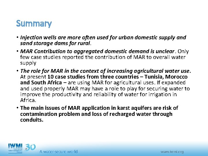
Summary • Injection wells are more often used for urban domestic supply and storage dams for rural. • MAR Contribution to aggregated domestic demand is unclear. Only few case studies reported the contribution of MAR to overall water supply • The role for MAR in the context of increasing agricultural water use. At present 10 case studies from three countries – Tunisia, Morocco and South Africa – are using MAR for agricultural uses. If expanded and used properly MAR may have a role to play for securing water to improve the productivity and reliability of water for irrigation in Africa. • The main issues of MAR application in karst aquifers are risk of contamination problem and loss of recharged water through conduits.
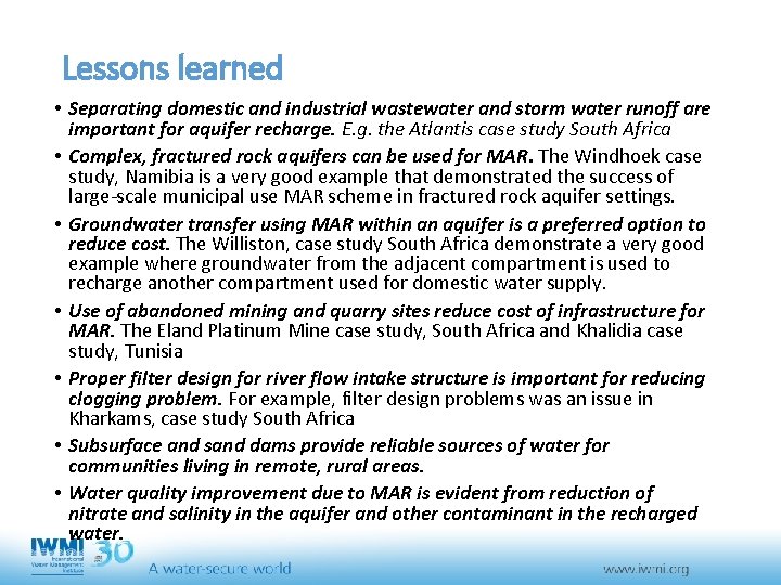
Lessons learned • Separating domestic and industrial wastewater and storm water runoff are important for aquifer recharge. E. g. the Atlantis case study South Africa • Complex, fractured rock aquifers can be used for MAR. The Windhoek case study, Namibia is a very good example that demonstrated the success of large-scale municipal use MAR scheme in fractured rock aquifer settings. • Groundwater transfer using MAR within an aquifer is a preferred option to reduce cost. The Williston, case study South Africa demonstrate a very good example where groundwater from the adjacent compartment is used to recharge another compartment used for domestic water supply. • Use of abandoned mining and quarry sites reduce cost of infrastructure for MAR. The Eland Platinum Mine case study, South Africa and Khalidia case study, Tunisia • Proper filter design for river flow intake structure is important for reducing clogging problem. For example, filter design problems was an issue in Kharkams, case study South Africa • Subsurface and sand dams provide reliable sources of water for communities living in remote, rural areas. • Water quality improvement due to MAR is evident from reduction of nitrate and salinity in the aquifer and other contaminant in the recharged water.
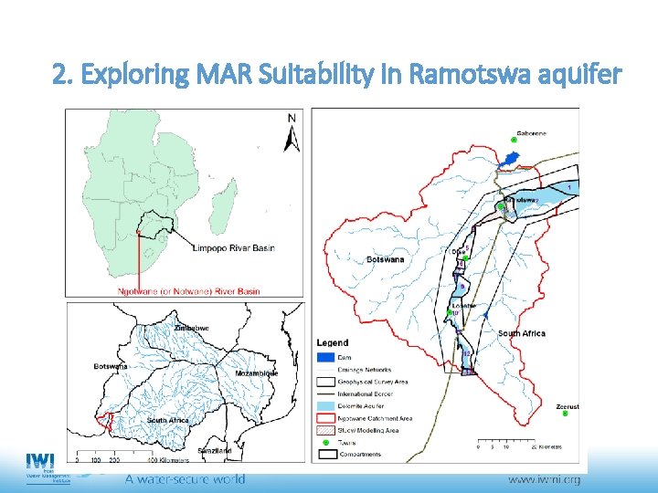
2. Exploring MAR Suitability in Ramotswa aquifer
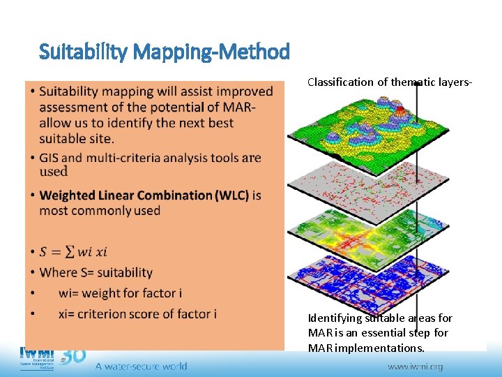
Suitability Mapping-Method • Classification of thematic layers- Identifying suitable areas for MAR is an essential step for MAR implementations.
Selection of MAR method • Spreading method for MAR selected for at least four reasons. 1. The spreading method is low cost and practically simple to apply. Second, data is easily available for suitability assessment according to this method. 2. Spreading methods are a preferred method for MAR in karstic aquifer as they allow spreading of recharge water through slow and diffuse infiltration. 3. The spreading method allows a natural treatment process (Daher et al. , 2011). 4. The suitability assessment through the spreading method is applicable for all kinds of measure that enhance natural recharge (e. g. infiltration basins, controlled flooding etc. ).
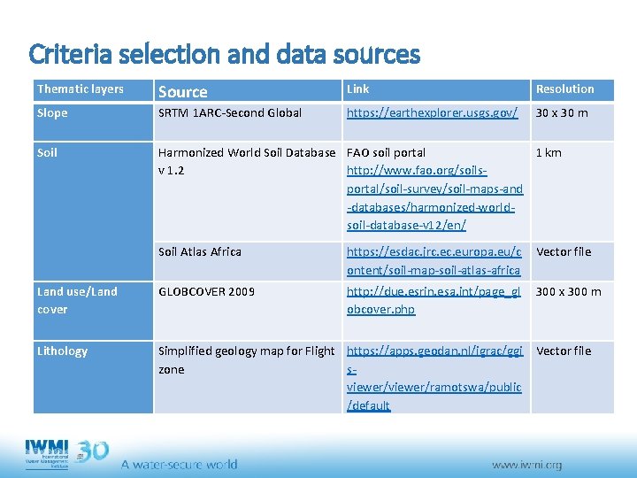
Criteria selection and data sources Thematic layers Source Link Resolution Slope SRTM 1 ARC-Second Global https: //earthexplorer. usgs. gov/ 30 x 30 m Soil Harmonized World Soil Database FAO soil portal 1 km v 1. 2 http: //www. fao. org/soilsportal/soil-survey/soil-maps-and -databases/harmonized-worldsoil-database-v 12/en/ Soil Atlas Africa https: //esdac. jrc. europa. eu/c ontent/soil-map-soil-atlas-africa Vector file Land use/Land cover GLOBCOVER 2009 http: //due. esrin. esa. int/page_gl obcover. php 300 x 300 m Lithology Simplified geology map for Flight https: //apps. geodan. nl/igrac/ggi Vector file zone sviewer/ramotswa/public /default
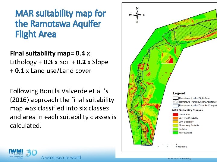
MAR suitability map for the Ramotswa Aquifer Flight Area Final suitability map= 0. 4 x Lithology + 0. 3 x Soil + 0. 2 x Slope + 0. 1 x Land use/Land cover Following Bonilla Valverde et al. ’s (2016) approach the final suitability map was classified into six classes and area in each suitability classes is calculated.
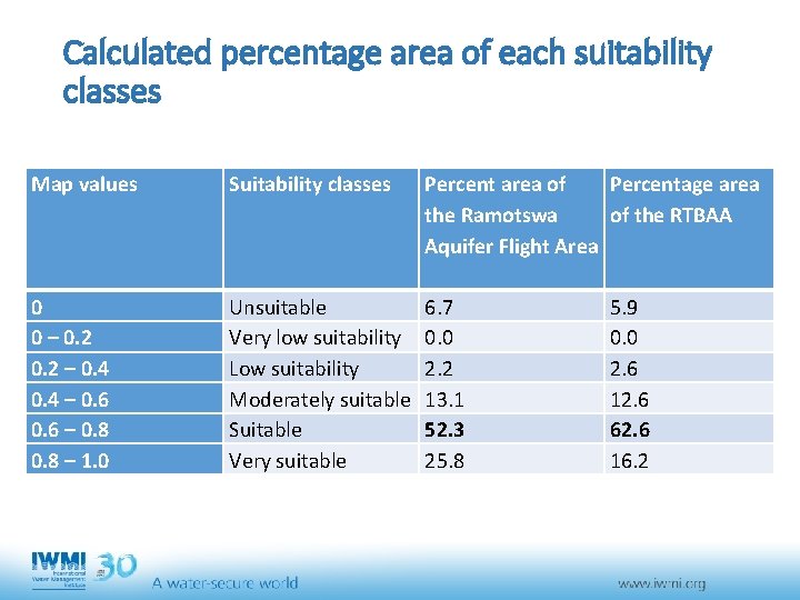
Calculated percentage area of each suitability classes Map values Suitability classes Percent area of Percentage area the Ramotswa of the RTBAA Aquifer Flight Area 0 0 – 0. 2 – 0. 4 – 0. 6 – 0. 8 – 1. 0 Unsuitable Very low suitability Low suitability Moderately suitable Suitable Very suitable 6. 7 0. 0 2. 2 13. 1 52. 3 25. 8 5. 9 0. 0 2. 6 12. 6 62. 6 16. 2
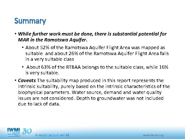
Summary • While further work must be done, there is substantial potential for MAR in the Ramotswa Aquifer. • About 52% of the Ramotswa Aquifer Flight Area was mapped as suitable and about 26% of the Ramotswa Aquifer Flight Area falls in a very suitable class • About 63% of the RTBAA belongs to the suitable class, while 16% is very suitable. • Caveats The suitability map produced in this report represents the intrinsic suitability, purely based on the intrinsic characteristics of the biophysical parameters. Water source, demand water quality issues are not considered. Depth to groundwater was not included due to lack of data.
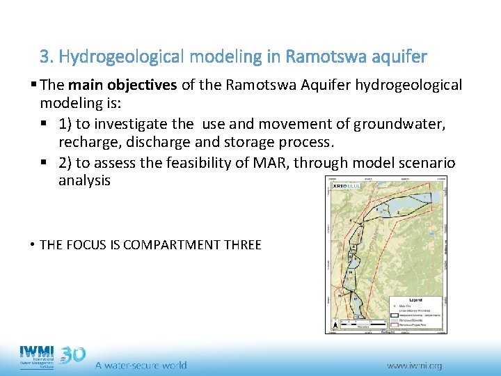
3. Hydrogeological modeling in Ramotswa aquifer § The main objectives of the Ramotswa Aquifer hydrogeological modeling is: § 1) to investigate the use and movement of groundwater, recharge, discharge and storage process. § 2) to assess the feasibility of MAR, through model scenario analysis • THE FOCUS IS COMPARTMENT THREE
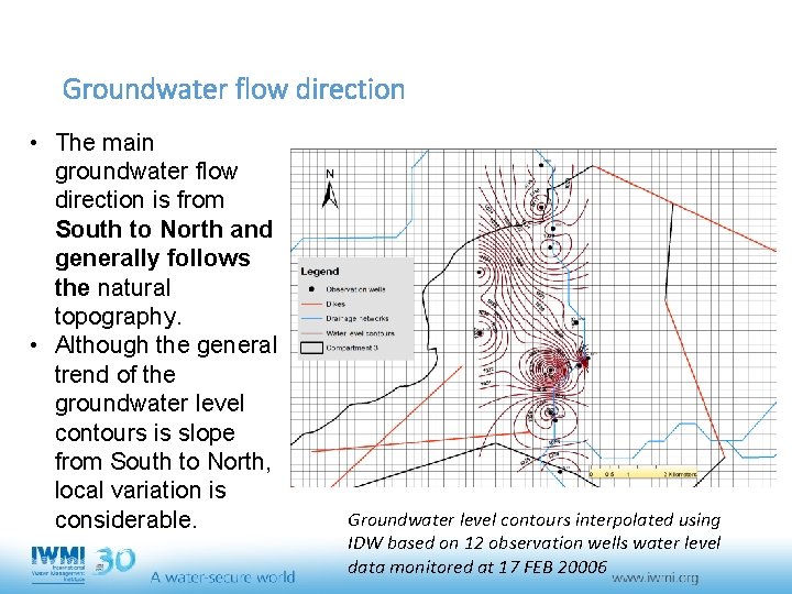
Groundwater flow direction • The main groundwater flow direction is from South to North and generally follows the natural topography. • Although the general trend of the groundwater level contours is slope from South to North, local variation is considerable. Groundwater level contours interpolated using IDW based on 12 observation wells water level data monitored at 17 FEB 20006
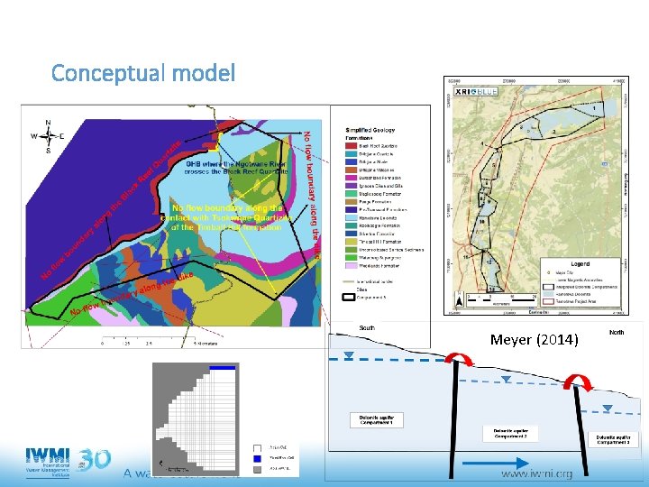
Conceptual model Meyer (2014)
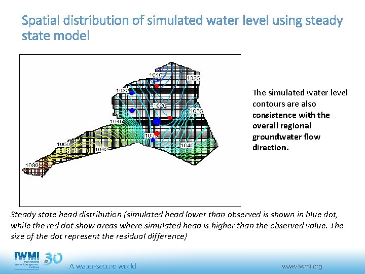
Spatial distribution of simulated water level using steady state model The simulated water level contours are also consistence with the overall regional groundwater flow direction. Steady state head distribution (simulated head lower than observed is shown in blue dot, while the red dot show areas where simulated head is higher than the observed value. The size of the dot represent the residual difference)
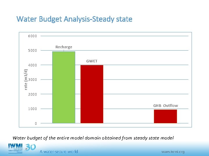
Water Budget Analysis-Steady state 6000 5000 rate (m 3/d) 4000 Recharge GWET 3000 2000 1000 GHB Outflow 0 Water budget of the entire model domain obtained from steady state model
Conclusions • The literature review helps to draw some lesson and essential design and operational that are useful for Ramotswa • The suitability assessment provide an initial assessment for further detailed / full feasibility assessment using hydrogeological modeling • The steady state model provides an initial condition or reference level for transient model calibration. • It is the forthcoming transient hydrogeological modeling that enable us: • to determined the assimilative capacity of the aquifer without causing undesirable groundwater mounding • to assess how the aquifer reacts for additional recharge • to assess the recharged water will be stay in the aquifer for the required period
Thank you!!