MaddenJulian Oscillation Recent Evolution Current Status and Predictions
- Slides: 14

Madden-Julian Oscillation: Recent Evolution, Current Status and Predictions Update prepared by the Climate Prediction Center / NCEP 11 November 2019

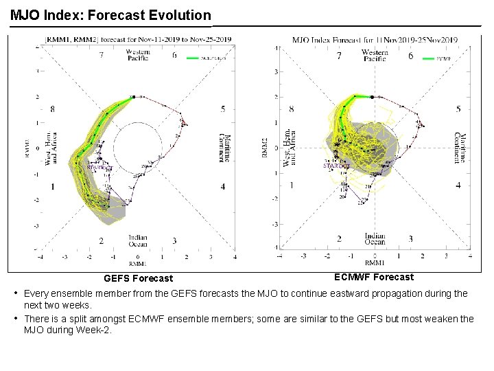
Overview The MJO is in RMM Phase 7 after moving anomalously quickly through Phase 6. All of the GFS and CFS ensemble members predict the MJO to remain strong and propagate through Phases 1 and 2 during Week-2. Although a few ECMWF ensemble members agree with the CFS & GFS’s solution, most ECMWF members forecast the MJO to weaken during Week-2 as it moves over Africa. A discussion of potential impacts for the global tropics and those related to the U. S. are updated on Tuesday at: http: //www. cpc. ncep. noaa. gov/products/precip/CWlink/ghazards/index. php

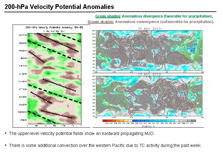
200 -h. Pa Velocity Potential Anomalies Green shades: Anomalous divergence (favorable for precipitation). Brown shades: Anomalous convergence (unfavorable for precipitation). • The upper-level velocity potential fields show an eastward propagating MJO. • There is some additional convection over the western Pacific due to TC activity during the past week.

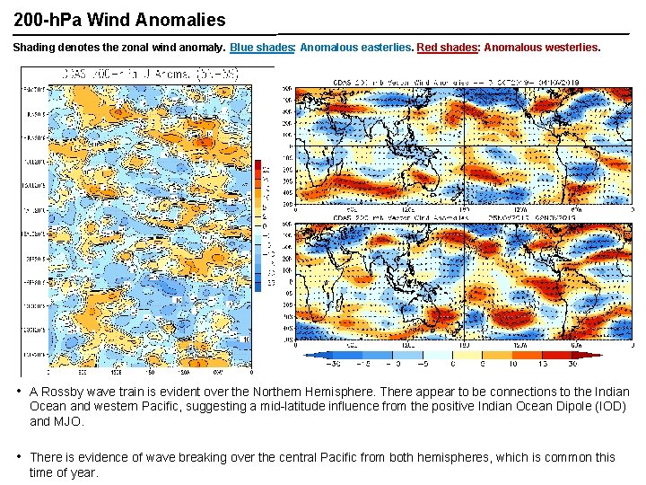
200 -h. Pa Wind Anomalies Shading denotes the zonal wind anomaly. Blue shades: Anomalous easterlies. Red shades: Anomalous westerlies. A A • A Rossby wave train is evident over the Northern Hemisphere. There appear to be connections to the Indian Ocean and western Pacific, suggesting a mid-latitude influence from the positive Indian Ocean Dipole (IOD) and MJO. • There is evidence of wave breaking over the central Pacific from both hemispheres, which is common this time of year.

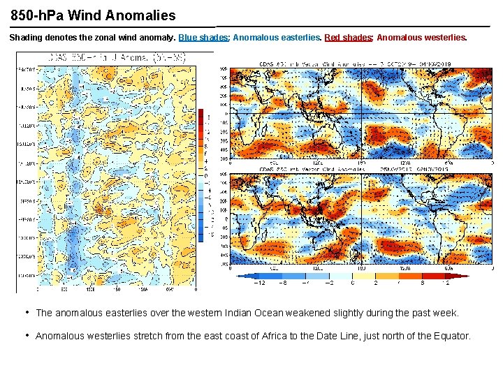
850 -h. Pa Wind Anomalies Shading denotes the zonal wind anomaly. Blue shades: Anomalous easterlies. Red shades: Anomalous westerlies. • The anomalous easterlies over the western Indian Ocean weakened slightly during the past week. • Anomalous westerlies stretch from the east coast of Africa to the Date Line, just north of the Equator.

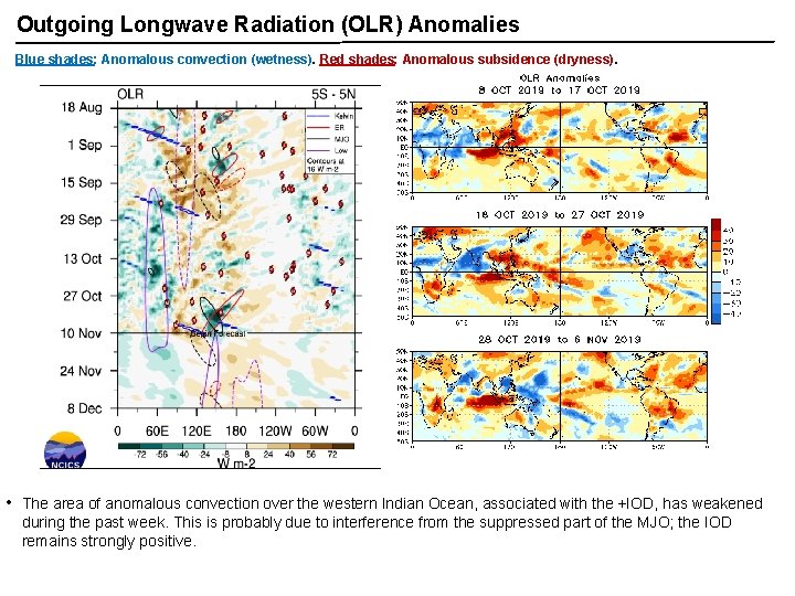
Outgoing Longwave Radiation (OLR) Anomalies Blue shades: Anomalous convection (wetness). Red shades: Anomalous subsidence (dryness). • The area of anomalous convection over the western Indian Ocean, associated with the +IOD, has weakened during the past week. This is probably due to interference from the suppressed part of the MJO; the IOD remains strongly positive.

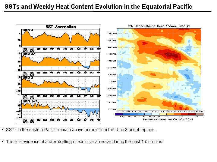
SSTs and Weekly Heat Content Evolution in the Equatorial Pacific • SSTs in the eastern Pacific remain above normal from the Nino 3 and 4 regions. • There is evidence of a downwelling oceanic Kelvin wave during the past 1. 5 months.

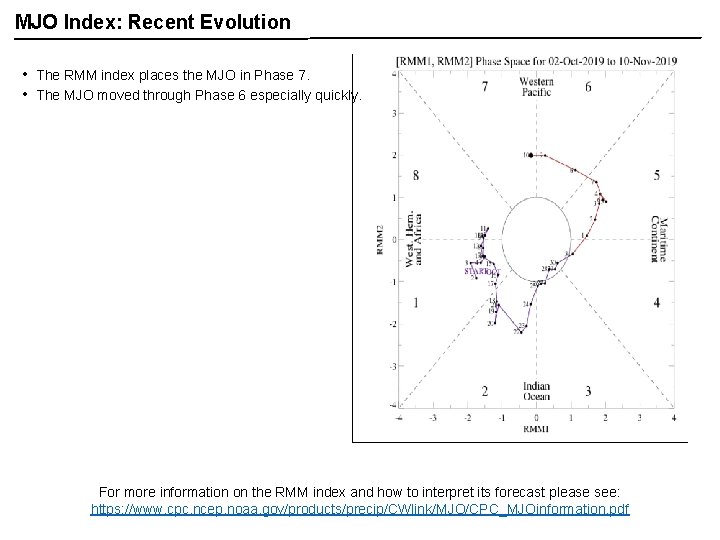
MJO Index: Recent Evolution • • The RMM index places the MJO in Phase 7. The MJO moved through Phase 6 especially quickly. For more information on the RMM index and how to interpret its forecast please see: https: //www. cpc. ncep. noaa. gov/products/precip/CWlink/MJO/CPC_MJOinformation. pdf

MJO Index: Forecast Evolution GEFS Forecast • • ECMWF Forecast Every ensemble member from the GEFS forecasts the MJO to continue eastward propagation during the next two weeks. There is a split amongst ECMWF ensemble members; some are similar to the GEFS but most weaken the MJO during Week-2.

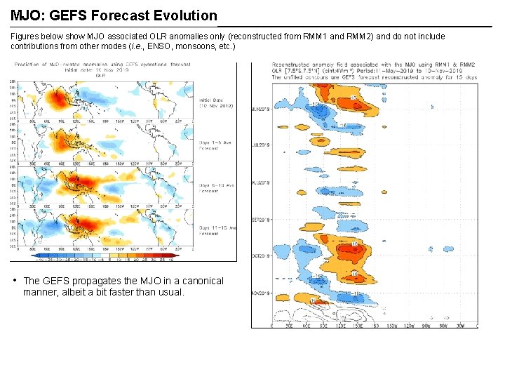
MJO: GEFS Forecast Evolution Figures below show MJO associated OLR anomalies only (reconstructed from RMM 1 and RMM 2) and do not include contributions from other modes (i. e. , ENSO, monsoons, etc. ) • The GEFS propagates the MJO in a canonical manner, albeit a bit faster than usual.

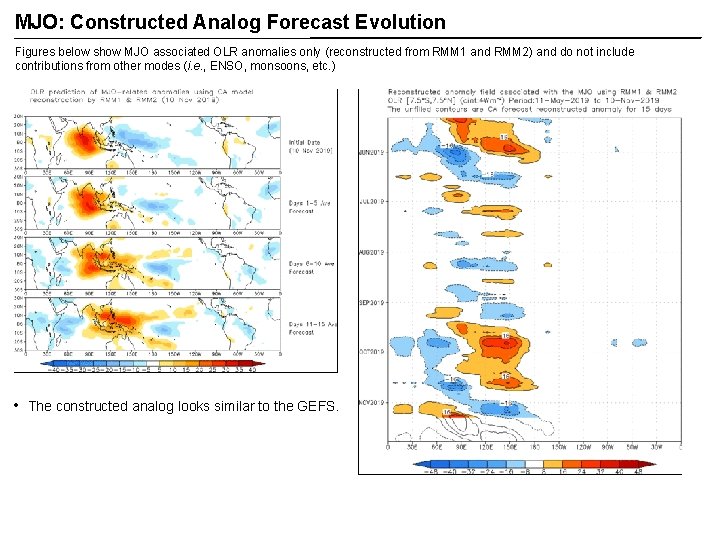
MJO: Constructed Analog Forecast Evolution Figures below show MJO associated OLR anomalies only (reconstructed from RMM 1 and RMM 2) and do not include contributions from other modes (i. e. , ENSO, monsoons, etc. ) • The constructed analog looks similar to the GEFS.

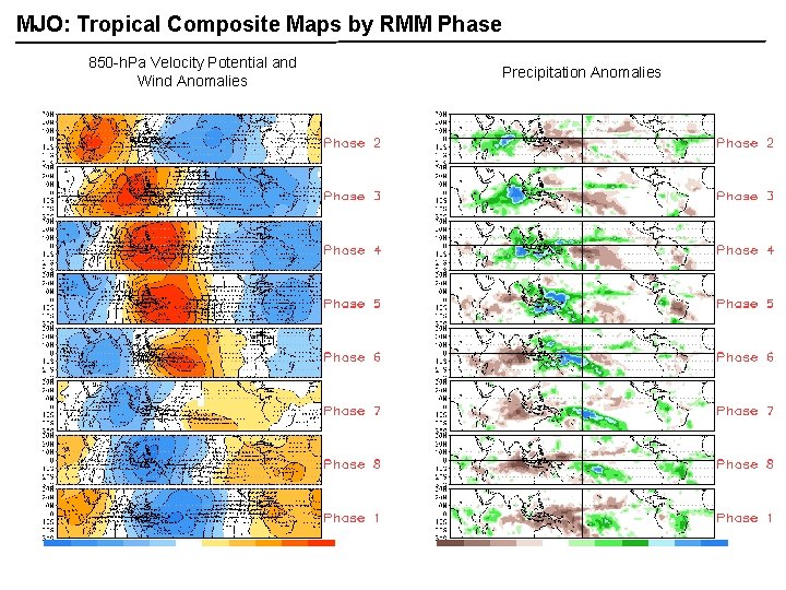
MJO: Tropical Composite Maps by RMM Phase 850 -h. Pa Velocity Potential and Wind Anomalies Precipitation Anomalies

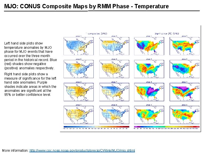
MJO: CONUS Composite Maps by RMM Phase - Temperature Left hand side plots show temperature anomalies by MJO phase for MJO events that have occurred over the three month period in the historical record. Blue (red) shades show negative (positive) anomalies respectively. Right hand side plots show a measure of significance for the left hand side anomalies. Purple shades indicate areas in which the anomalies are significant at the 95% or better confidence level. More information: http: //www. cpc. ncep. noaa. gov/products/precip/CWlink/MJO/mjo. shtml

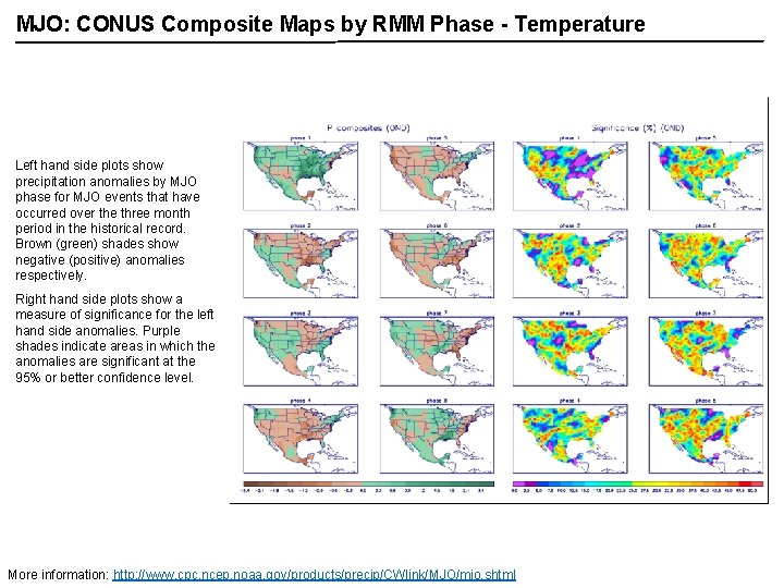
MJO: CONUS Composite Maps by RMM Phase - Temperature Left hand side plots show precipitation anomalies by MJO phase for MJO events that have occurred over the three month period in the historical record. Brown (green) shades show negative (positive) anomalies respectively. Right hand side plots show a measure of significance for the left hand side anomalies. Purple shades indicate areas in which the anomalies are significant at the 95% or better confidence level. More information: http: //www. cpc. ncep. noaa. gov/products/precip/CWlink/MJO/mjo. shtml