LOUISIANA COASTAL ZONE EROSION 100 YEARS OF LANDUSE


- Slides: 20
LOUISIANA COASTAL ZONE EROSION 100+ YEARS OF LANDUSE AND LOSS USING GIS AND REMOTE SENSING DATA Dr. Lionel D. Lyles and Dr. Fulbert Namwamba Southern University
GOALS • To establish a link between oil and gas well production and Louisiana wetlands land loss. • To establish a link between freshwater deprivation and increasing land loss south of the Intracoastal Canal.
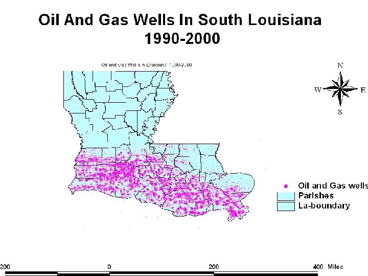
OBJECTIVES • To show the high concentration of oil and gas wells located throughout the Louisiana wetlands. • To establish a connection between the oil and gas infrastructure-service and distribution-and freshwater deprivation and saltwater intrusion. • To examine 100+ years of land loss in the Louisiana coastal wetlands.
STATUS OF OIL AND GAS PRODUCTION • 160, 000+ oil and gas wells located in the Louisiana wetlands. • Account for 18% U. S. oil production with an annual value of $6. 3 billion. • Account for 24% of U. S. natural gas production with an annual value of $10. 3 billion.
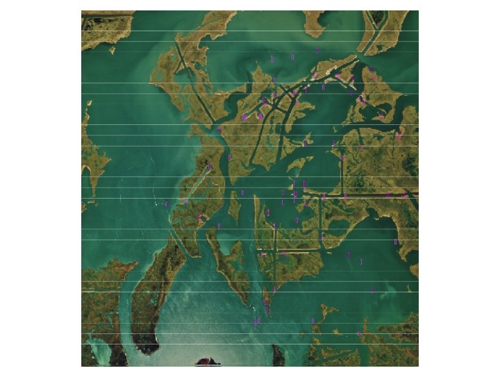
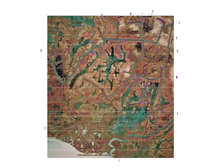
OIL/GAS INFRASTRUCTURE • Channeling: over the past 100 years, numerous channels and canals have been cut through the wetlands for transportation and oil exploration. • Result: Creation of the movement of unnatural water patterns, ultimately increasing erosion and wetland demise. • Result: Freshwater deprivation, vegetation decay, and increasing land loss.
Channeling Diagram
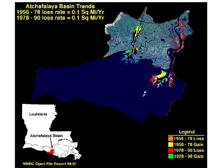
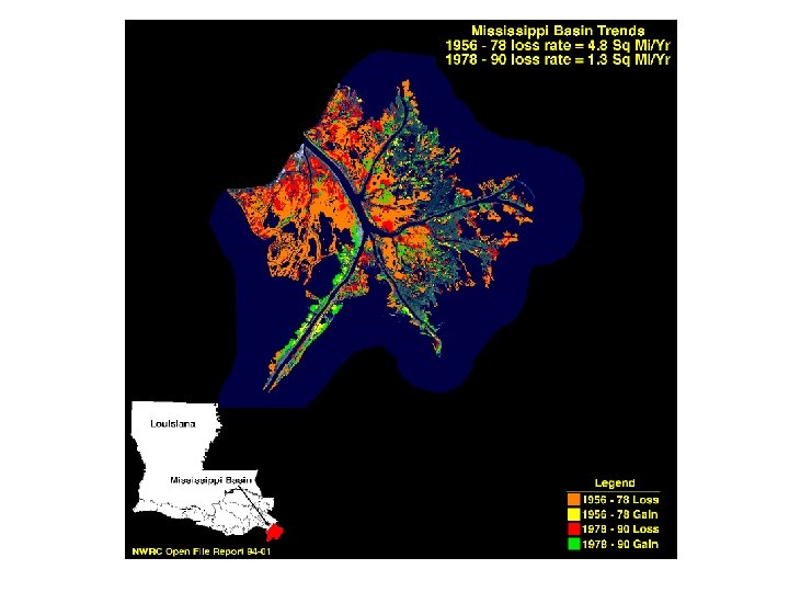
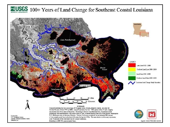
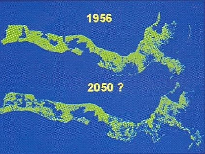
100+ YEARS OF WETLANDS’ LAND LOSS • Past 50 years: Coastal LA has lost and average of 34 square miles of marsh, roughly 1, 700 square miles. • 1932 to 2000: Coastal LA has lost 1, 900 square miles of land-roughly the size of Delaware. • Next 50 years: Coastal LA could lose another 700 square miles of land-area the size of Washington, D. C. /Baltimore.
CON’TD • Coastal LA loses 1 acre of land every 24 minutes, or roughly 70 acres per day; 490 acres per week; 25, 400 acres per year.
PROPOSED SOLUTION • Develop an aqueduct system along the Intracoastal Canal to channel a steady flow of freshwater across the LA wetlandsannually- to stimulate the natural growth of freshwater vegetation landcover.
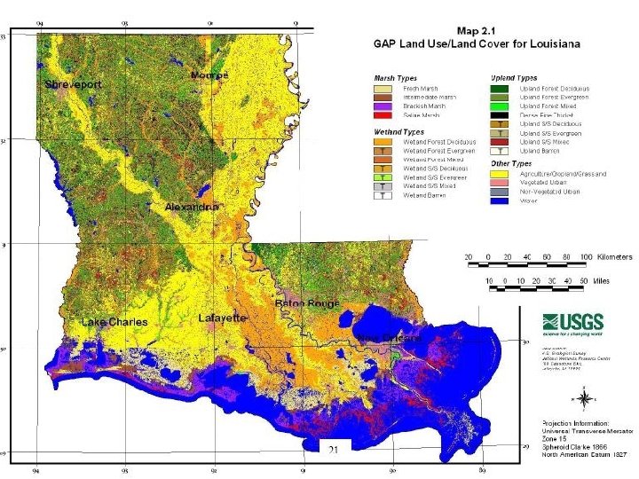
TEACHER REQUIREMENTS • Working knowledge of GIS 3. 2 a. • Go to www. atlas. lsu. edu to obtain oil and gas well shapefile and Digital Orthorectified Quarter Quadrangle ( DOQQ ) data.