Longitude and Latitude Longitude and Latitude The earth


 ►Outline Map of US ►Map")
- Slides: 22
Longitude and Latitude
Longitude and Latitude ►The earth is divided into lots of lines called longitude and latitude.
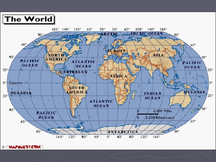
Lines ►Longitude lines run north and south. ►Latitude lines run east and west. ►The lines measure distances in degrees. Latitude Longitude
M E R R I I D M I E A N P 0° Longitude? ► The prime meridian is 0 degrees longitude. This imaginary line runs through the United Kingdom, France, Spain, western Africa, and Antarctica.
0° Latitude? ►The equator is 0° latitude. ►It is an imaginary belt that runs halfway point between the North Pole and the South Pole. Equator
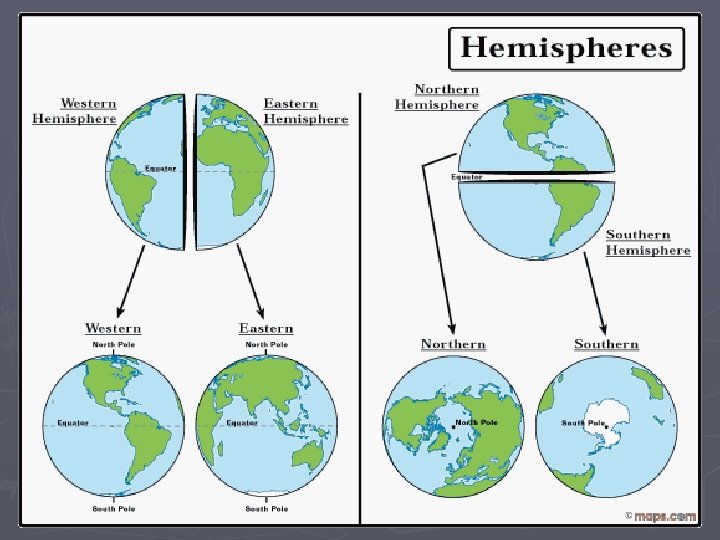
Hemispheres ►By using the equator and prime meridian, we can divide the world into four hemispheres, north, south, east, and west.
Compass ►A compass is a tool that helps the user know what direction one is headed. ►On a map, a compass or a compass rose helps the user locate these directions.
Compass Rose ►The needle on a compass is magnetized to point to the earth's north magnetic pole. Thus with a compass, a person can roughly tell which direction they are headed. ►There are four major or cardinal directions on a compass- north, south, east & west. In between are the directions northeast, northwest, southeast, southwest. ► Direction Quiz Source: http: //aerocompass. larc. nasa. gov
Directions ► The cardinal directions are north, south, east, and west. ► The intermediate directions are northeast, southwest and northwest. ► They help describe the location of places in relation to other places.
Scale ►Maps are made to scale; that is, there is a direct connection between a unit of measurement on the map and the actual distance. ►For example, each inch on the map represents one mile on Earth. So, a map of a town would show a mile-long strip of fast food joints and auto dealers in one inch.
Scale
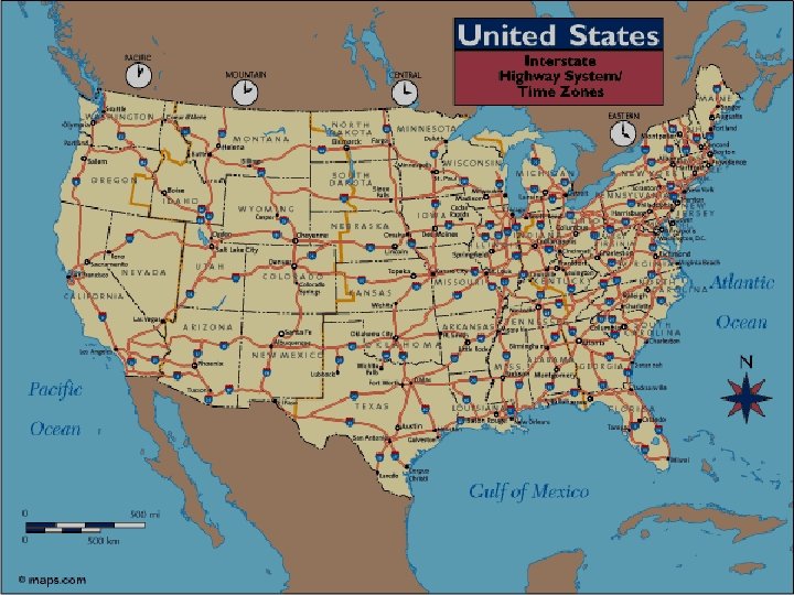
Time Zones ►The Earth is divided into 24 time zones, corresponding to 24 hours in a day. ►As the earth rotates, the sun shines in different areas, moving from east to west during the course of a day. ►Places that have the same longitude will be in the same time zone.
Map Legends ► The legend is the key to unlocking the secrets of a map. Objects or colors in the legend represent something on the map. Religions Legend
Can you understand this legend?
Age Expectancy Legend
Legend Reading Activities ►What You Can Learn From A Map § What do Maps Show Activity § Road Map Legend § Road Map of Salt Lake City Region § Map Worksheet
Sites to visit Look up Latitude and Longitude for US Cities Maps and Map Skills Degrees, Latitude, & Longitude Worksheet ► Latitude and Longitude Map (lesson plan) ► Scale ► Time Zones ► Anchors Aweigh (a map adventure) ► Map Quiz ► Make Your Own Map ► Topography Maps ► U. S. Map Collection ► Geo. Spy Game ► Globe Projector ► Geo. Game ► ►
Additional Sources ►Atlas - World (Holt, Rinehart and Winston) ►Outline Map of US ►Map Packet Download ►Maps. com ►National Geographic Xpeditions ►Maps & Globes