Longitude and Latitude Grid Latitude and Longitude Geographic


 measured clockwise from true")


 Utilize the index in your atlas to answer the")
 Which cities are at the following coordinates? � 1)")

")
- Slides: 17
Longitude and Latitude Grid � Latitude and Longitude � Geographic Grid
Longitude and Latitude Grid
The International date line
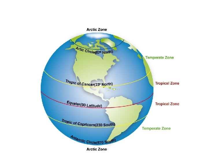
Tropics
Compass points
Compass
Compass � Azimuths The compass bearings in degrees (360 ) measured clockwise from true or magnetic north. � In azimuthal notation, a circle is divided up from 0 to 359 in a clockwise direction. North is 0, east is 90, south is 180, and west is 270.
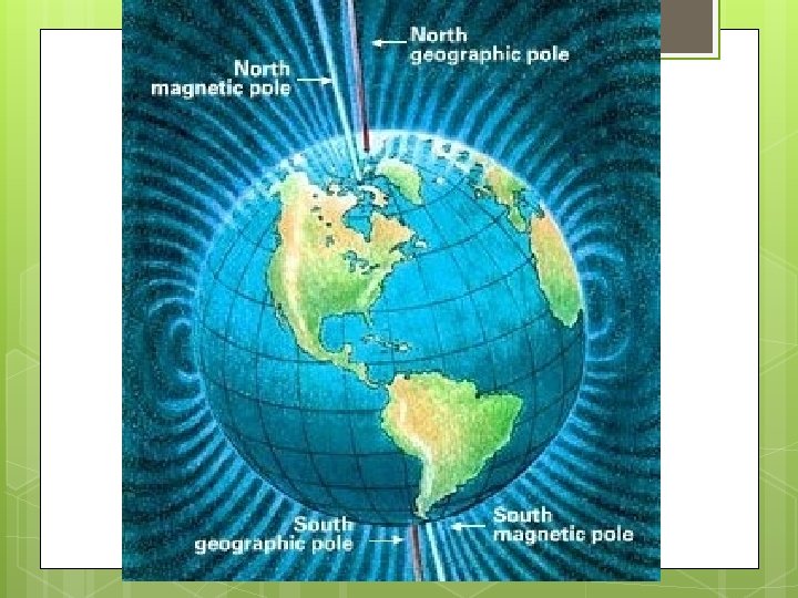
Magnetic North � The Earth is like a giant magnet and has a magnetic field. � On a compass the needle points to Magnetic North Pole � The Magnetic North Pole moves from year to year due to movements in the earths core
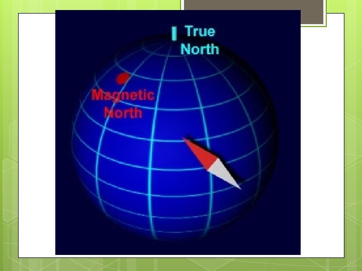
Declination � The angular distance between True North and Magnetic North. � Shown on a Topographic map as
Long and Lat � Finish handouts
Long and Lat � A) Utilize the index in your atlas to answer the following. Latitude Longitude � Spokane, Washington 48ºN 117ºW � Edmonton, Alberta 54ºN 114ºW � Mexico City, Mexico 19ºN 99ºW � Havana, Cuba 23ºN 82ºW
Long and Lat � B) Which cities are at the following coordinates? � 1) 54ºN 130ºW Prince Rupert � 2) 34ºN 118ºW Los Angeles � 3) 30ºN 90ºW New Orleans � 4) 53ºN 60ºW Happy Valley
Long and Lat � Label the 16 compass points
Long and Lat � Label the 8 Main Azimuths (degrees)