Long Range Transportation Plan Kokhanok Village Council Tribal

Long Range Transportation Plan Kokhanok Village Council Tribal Roads Program BY ROY ANDREW Bureau of Indian Affairs 17 th Annual Conference Anchorage, Alaska November, 2017

KOKHANOK VILLAGE COUNCIL LONG RANGE TRANSPORTATION PLAN WRITTEN BY MAPS PRODUCED TRIBAL ROADS ADVISER Kokhanok Village Council Colleen Williams Gary Nielsen Roy Andrew Assistant Tribal Roads Manager Kokhanok, Alaska 99606 SUBMITTED TO Bureau of Indian Affairs – Branch of Transportation Nathan B. Cornilles, PE Civil Engineer 3601 C Street Anchorage, Alaska 99503 COVER PICTURE


TABLE OF CONTENTS 1. INTRODUCTION 2. KOKHANOK TRIBAL INFORMATION 3. EXISTING TRIBAL INFORMATION 4. REVIEW OF PLANS 5. TRANSPORTATION ROADS DATA 6. EQUIPMENT INVENTORY 7. KOKHANOK ROADS MAPS 8. APPENDICES 9. FIGURES PICTURES REFERENCES
 was updated in FY")
1. INTRODUCTION Kokhanok Village Council’s Long Range Transportation Plan (LRTP) was updated in FY 2017 by Roy Andrew, Tribal Roads Manager, with assistance from Nathan B. Cornelius, Bureau of Indian Affairs, Colleen Williams, assistant and Gary Nielsen, Tribal Roads Consultant. This LRTP outlines the tribe’s plans and roads data. There approximately 96 miles currently inventoried roads and 120 miles of existing and proposed roadways for updated inventory. The inventory includes the immediate area extending out towards Cook Inlet, Lake Iliamna region and west towards Bristol Bay. The revised mapping project has been updated and submitted to BIA for an update. To make work planning easier, two separate large wall maps of the village have been produced. A Safety Plan has also been written to complement this LRTP.

2. KOKHANOK TRIBAL INFORMATION POPULATION: 176 BOROUGH: Lake and Peninsula Borough INCORPATION: Unincorporated LOCATION: SE shores of Lake Iliamna TRANSPORTATION: 360 ft runway and boat ramp FACILITIES, UTILITIES, SCHOOL AND HEALTH CARE: Septic systems, running water; tribal owned utility, Kokhanok School is K-12 grades; ANTHC clinic

3. EXISTING TRANSPORTATION SYSTEM BIA GRANT AWARD INFORMATION BIA gives out their monies to the villages according to these factors: - Tribal population, roads mileage and tribal shares - Monies given out according to a particular year or act such as the FAST Act from Congress INVENTORIED TTP ROADS - Inventoried, recorded and approved by BIA - Then known as Route 110, Route 2214, etc. - Range from inside village to outside locations such as Gibralter River, etc. KOKHANOK ROADS CONTRACTS 2 to 4 contracts per year. The main contracts are Maintenance and Planning. The others shift pending on priorities - Maintenance - Planning - Public Transit - Design Street Lights

LONG RANGE TRANSPORTATION PLAN - The last LRTP was done in FY 2014 - This is an update for new tribal roads - Plan shorter and easier to read - 2 sections: the document plan and maps ROADS MAINTENANCE DUTIES Includes snow plowing, grading and sanding the roads and filling in the holes SAFETY PLAN The Safety Plan addressed water, fire, ice and emergency situations STREET LIGHTS PROJECT 16 poles throughout the community now have streetlights ROAD DUST PROJECT - Project is slated for 2018 - Reduce the roads dust to increase visibility and improve the health standards - Less damage and impact on the land the environment

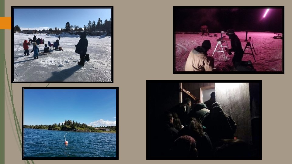
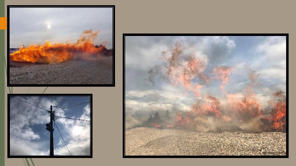
TRAININGS AND CONFERENCES Sample locations for trainings and conferences: - Anchorage for the BIA Provider’s and AFE - BIA supervisor in Anchorage - UAF at Fairbanks - Falmouth Institute at Las Vegas - National Tribal Transportation Conference TREE AND BRUSH REMOVAL - The most time and expense - The work is year round - Have Honda, chainsaws, grasscutters, chainsaw sharpener and supplies - Tree and brush cutters, grasscutters and drivers - They cut, load, haul and burn the wood - Good trees are put aside for people to get

4. REVIEW OF PLANS INBETWEEN – CURRENTLY REVISING THE PLAN CURRENT Transportation Priorities 1. Construction of Old School Road 2. Community Street Light Project 3. Proposed Housing Road 4. Subsistence Trail Improvements 5. Beach and Residential Access Routes 6. Fish Camp Trail Improvements 7. Elderly Public Transit System Maintenance Priorities 1. Community streets road 2. Winter route clearing

FUTURE Transportation Priorities 1. Heavy equipment storage building 2. Purchase heavy equipment 3. Road dust operations 4. KVC creek improvement 5. Improvements of Routes 1006 -30 and 2004 6. Heavy equipment maintenance training 7. Rock boulder quarry pit Maintenance Priorities 1. Road grading and maintenance 2. Heavy equipment maintenance 3. Tree and brush cutting 4. Road dust operations 5. Snow plowing and removal 6. Signs and postings installation

5. TRANSPORTATION ROADS DATA CONSTRUCTION There are 2 pit sites in Kokhanok which are utilized for projects - Airport - Gravel pit CURRENT SURFACING MATERIAL - Main roads are crushed surface material - The smaller trails are crushed materials, mud and gravel PROBLEM SITES These 3 sites create icy road conditions: - Church Hill - Post Office Road - KVC Creek

ROADS MAINTENANCE - To pave the roads, clear snow and ice scraping - Sand the slippery roads - The roads are plowed all year long SNOW REMOVAL - Heavy equipment used along the main roads - Trucks used to clear smaller roads - The icy roads turn into slush with warm weather

6. Heavy Equipment - Front end loader - D 3 dozer - Grader - Skid steer - Backhoe Trucks - Ford 350 - Jeep - Nissan truck - GMC dodge truck - Ford fuel truck EQUIPMENT INVENTORY

7. KOKHANOK ROADS MAPS PREVIOUSLY Last map project in FY 2014 Hired consultants to do our LRTP and mapping 47 pages including maps Finished maps were finalized – no more changes CURRENT Staff created our own LRTP maps Map templates for other programs and projects GIS, maps and computer trainings Outside company prints the maps Save original and make copies for other maps


COMPLETED RESULTS PREVIOUS - Too much other information - 25 pages mostly written material - Very few pictures - Hired outside consultants to write the plans and make maps NEW - Wrote our own LRTP instead of hiring outside consultants - 20 pages including more pictures - Shorter, condensed information - Made our own maps

STEPS TO MAKING OUR OWN MAPS - Started by using Google Earth Searched Kokhanok in Internet Drew by sight for all routes Used different colors for routes Saved in My Places folder PRINTING OUR MAPS - For higher resolution we used a printing company Created large wall size maps MODEL MAPS FOR OTHER PURPOSES - IGAP, Water and Sewer, planning, etc. Create different types of maps Digitally saved in different formats for other projects and grants
- Slides: 20