Location Climate Natural Resources Unit 6 Notes Latin


 the")


- Slides: 37
Location, Climate, & Natural Resources Unit 6 Notes
Latin America • How do location, climate, and natural resources affect where people live and how they trade in Latin America? • Let’s take a closer look at Mexico, Venezuela, Brazil, & Cuba…
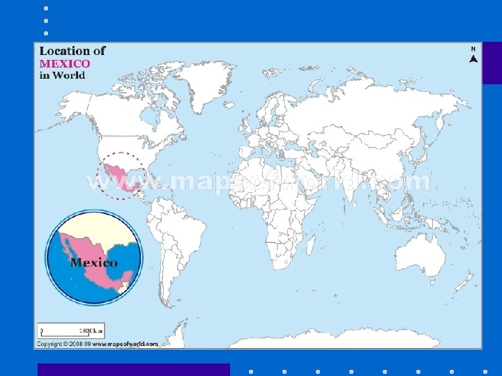
Mexico’s Location • south of the US, east of the Pacific Ocean, and west of the Gulf of Mexico & Caribbean Sea • located between major bodies of water: – great opportunities for trading – can easily ship goods around the world • another advantage: close to US, so trade between two countries is convenient
Mexico’s Climate • Climate varies according to location but tends to be dry and warm
Mexico’s Natural Resources • Oil is one of the top exports: – exports 1. 7 million barrels/day – Money from oil sales provides 1/3 of government’s budget. • It is one of the world’s top producers of silver. • Other resources include natural gas, copper, gold, lead, zinc, and timber (choose any 3) • 12% arable land
Physical Characteristics • Very mountainous with large central plateau • Tropical beaches • Dry deserts
Where People Live in Mexico • Most people live in central Mexico: – Nearly 20% of the people live in the area of Mexico City – 2 nd most populous country in Latin America – Largest Spanish-speaking country in the world • urban: 77% • rural: 23%
Trade in Mexico • mix of new and old industries – recently expanded railroads, airports, and electric generating plants • 7 major seaports • exports: oil, manufactured goods, silver, fruits, vegetables, coffee, & cotton • tourism
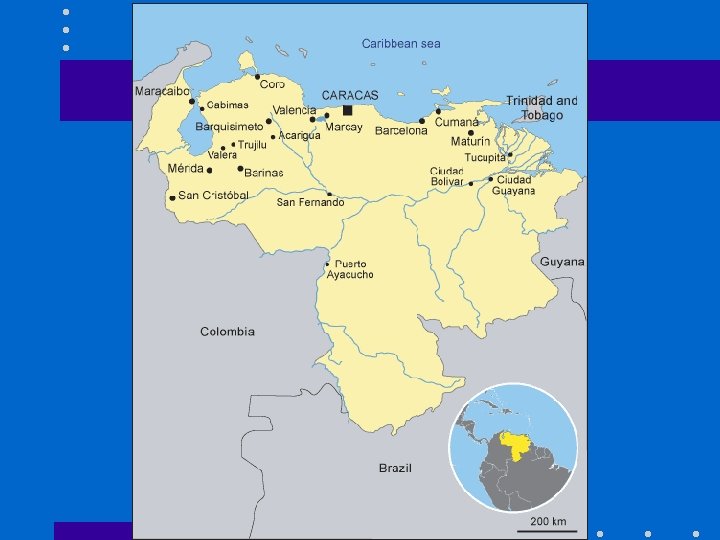
Venezuela’s Location • in northeast part of South America; just north of equator • coasts on Caribbean Sea and Atlantic Ocean – gives it easy access to trade with other countries – nearby Panama Canal provides a shortcut to the Pacific to trade with Asian countries • mountains in the north and south, only about 3% arable land
Venezuela’s Climate • hot, tropical climate • cooler in the mountains • rain varies by region (16 inches on the coast; over 100 inches in the mountains)
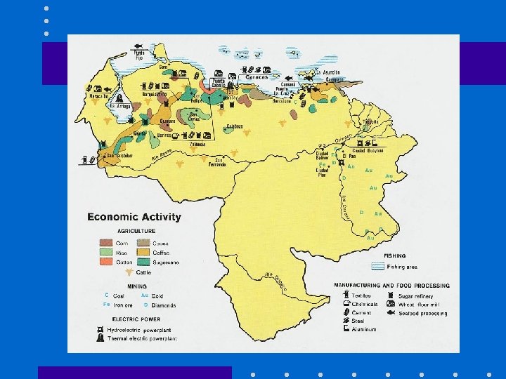
Venezuela’s Natural Resources • Oil • Natural gas, iron ore, gold, bauxite, other minerals, hydropower, diamonds (choose any 3) • 3% arable land – mostly better for pastures than crops
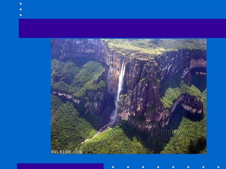
Physical Characteristics • Mountain systems break Venezuela into four distinct areas: • (1) the Maracaibo lowlands • (2) the mountainous region in the north and northwest • (3) the Orinoco basin, with the llanos (vast grasscovered plains) on its northern border and great forest areas in the south and southeast • (4) the Guiana Highlands, south of the Orinoco, accounting for nearly half the national territory. •
Where People Live in Venezuela • urban: 88% • rural: 12% • Caracas is the largest city • Most people live in the northern highlands, along the coast.
Trade in Venezuela • sixth-largest oil exporter in the world – produces 2. 8 million barrels/day – 90% of the money the government makes on trade comes from oil exports • 4 major seaports • other exports: bauxite and aluminum, steel, chemicals, agricultural products, basic manufactures • tourism • Farming provides jobs for 10% of the population.
Problems in Mexico & Venezuela • millions of citizens live in poor conditions – little or no health care, poor education • both countries rely on oil production for a large part of their trade: – When price of oil goes down, it is difficult for the government to pay its bills and help its people. – Pollution caused by oil is also a problem.
Brazil’s Location • eastern side of South America, along the coast of the Atlantic Ocean • shares a border with nearly every country in South America! • Amazon River and other large rivers stretch across Brazil • The equator crosses the northern part of the country • Largest country in Latin America
Brazil’s Climate • Location on the equator gives it the climate needed to support one of the world’s largest rainforests. • Climate is mostly hot and tropical. • In the south, the climate is temperate (mild).
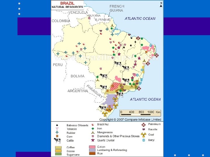
Brazil’s Natural Resources • Only 7% of land is arable, but Brazil makes the most of this resource – Farmers grow 1/3 rd of the world’s coffee, and lead the world in production of oranges, papayas, sugar cane, and soybeans • Only the US exports more farm products that Brazil • Other resources include bauxite, gold, iron ore, manganese, nickel, phosphates, platinum, tin, uranium, oil, hydropower, and timber (choose any 3)
Physical Characteristics • The Amazon rain forest in the north and lowlying mountains and hilly terrain to the south flanks the country.
Where People Live in Brazil • • urban: 84% rural: 16% most populated country in Latin America largest Portuguese-speaking country in the world • most Brazilians live along the coasts; 80% live within 200 miles of the ocean • Nearly all cities and large towns are in the coastal area
Brazil’s Trade • 7 major seaports • exports: transportation equipment, iron ore, soybeans, footwear, coffee, autos, sugar, fruits • tourism – Amazon Rainforest attracts many visitors – beaches are another attraction • USA is Brazil’s largest trading partner
Cuba’s Location • an island 90 miles south of Florida, in the Caribbean Sea • 700 miles long • largest island in the West Indies • location on ocean trading routes has been an important influence on its history and economy
Cuba’s Climate • tropical but moderated by trade winds – It’s warm to hot all year long, but the winds provide relief from the heat • rainy season from May to October and a dry season from November to April • target for hurricanes – Hurricane season runs from June to November.
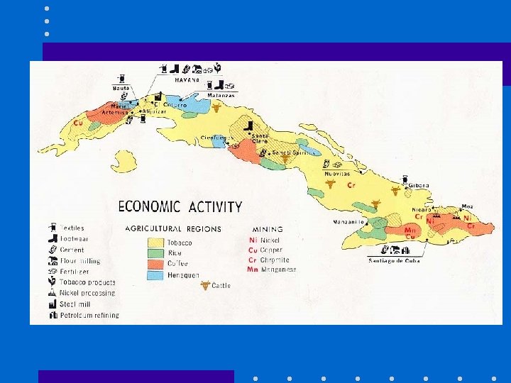
Cuba’s Natural Resources • 28% of Cuba’s land is arable • Other resources include cobalt, nickel, iron ore, chromium, copper, salt, timber, silica, petroleum (choose any 3)
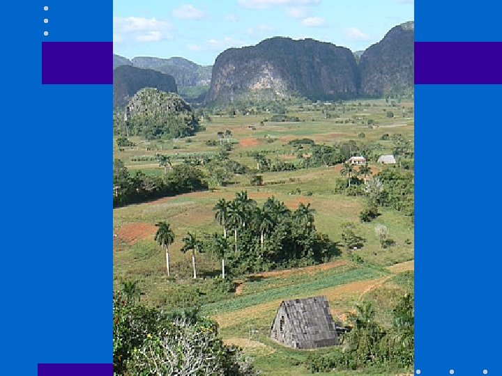
Physical Characteristics • flat to rolling plains and hilly to rugged mountain areas in its southeast. • The highest point in Cuba is Pico Turquino at 6, 578 feet (2, 005 m).
Where People Live in Cuba • urban: 76% • rural: 24% • Havana is the largest city – 20% of Cubans live in Havana
Cuba’s Trade • 3 major seaports • exports: sugar, nickel, tobacco, fish, medical products, citrus, coffee • tourism • Venezuela is Cuba’s largest trading partner; it sells oil to Cuba at a reduced price.
Latin American Mascots! • Create a mascot to represent one of the following countries: Cuba, Mexico, Brazil, and Venezuela. 1. Create an illustration of your country’s mascot. 2. Write at least 3 reasons why the mascot represents your country.
Juan the Taco! 1. Most people live in the center of Mexico; most of the filling of the taco is in the center. 2. The yellow shell of the taco represents the sun in Mexico. 3. Help me think of another!
Credits • Original presentation retrieved from www. Slide. Share. net on February 5, 2012 • Read more: Venezuela: Maps, History, Geography, Government, Culture, Facts, Guide & Travel/Holidays/Cities — Infoplease. com http: //www. infoplease. com/ipa/A 0108140. html#ixzz 1 m 29 uk 0 IH • http: //www. mapsofworld. com/country-profile/brazil. html • http: //geography. about. com/od/cubamaps/a/cubageography. htm • www. google. com/images • Georgia CRCT Test Prep 6 th Grade Social Studies. Clairmont Press, Inc. Lilburn, GA. 2009.