Location Climate Natural Resources Mexico Venezuela Cuba Brazil

Location, Climate, & Natural Resources: Mexico, Venezuela, Cuba, & Brazil Where People Live & How They Trade
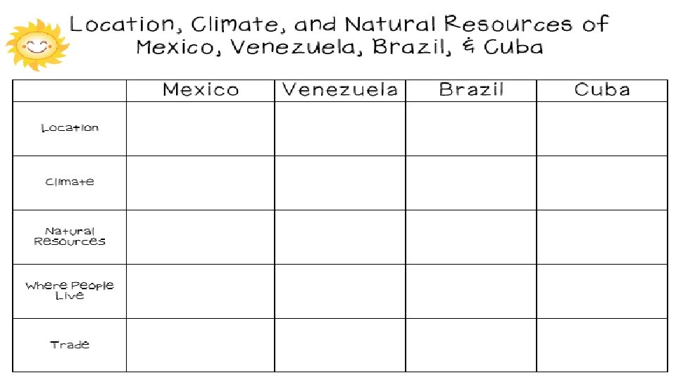

Location, Climate, & Natural Resources: Mexico, Venezuela, Cuba, & Brazil Where People Live & How They Trade

Mexico

Location • It’s south of the US, east of the Pacific Ocean, and west of the Gulf of Mexico & Caribbean Sea. • It’s great that it’s located between major bodies of water because: • great opportunities for trading • can easily ship goods around the world • Another advantage: close to US, so trade between two countries is convenient.
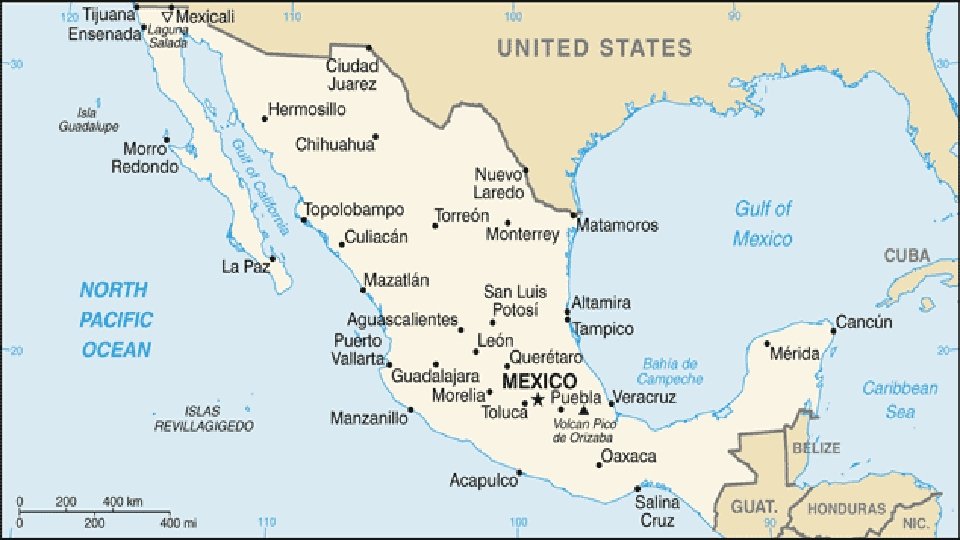

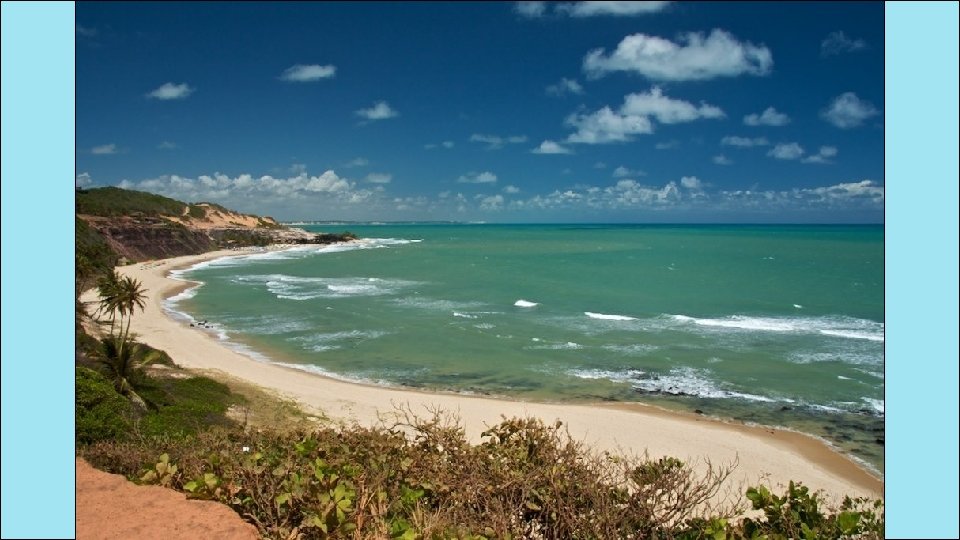
Climate • In Mexico, the climate varies according to location: • The northern part is mostly desert (hot). • The beaches have a tropical climate. • Mountains and plains have a more mild climate.
")
Chihuahua (Mexican state)

Sierra Madre Occidental
")
Chiapas (Mexican state)

Natural Resources • Oil is one of the top exports: • Exports 1. 7 million barrels/day. • Money from oil sales provides 1/3 of government’s budget. • Mexico is one of the world’s top producers of silver. • Other exports include fruits, vegetables, coffee, & cotton. • Tourism is also a major industry.

Where People Live • Most people live in central Mexico: • arable farmland with enough rain to grow crops • many manufacturing centers are located here (provide jobs to 75% of the country’s population) • urban: 77% • rural: 23%

Mexico City

Mexico City

How They Trade • Mexico has a mix of new and old industries. • recently expanded railroads, airports, and electric generating plants • 7 major seaports • exports: oil, manufactured goods, silver, fruits, vegetables, coffee, & cotton • tourism

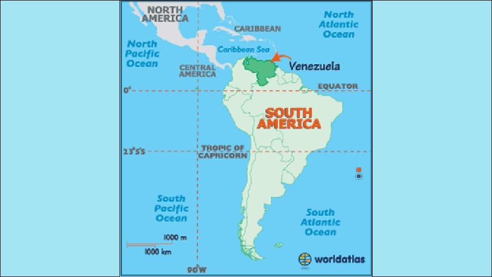
Venezuela

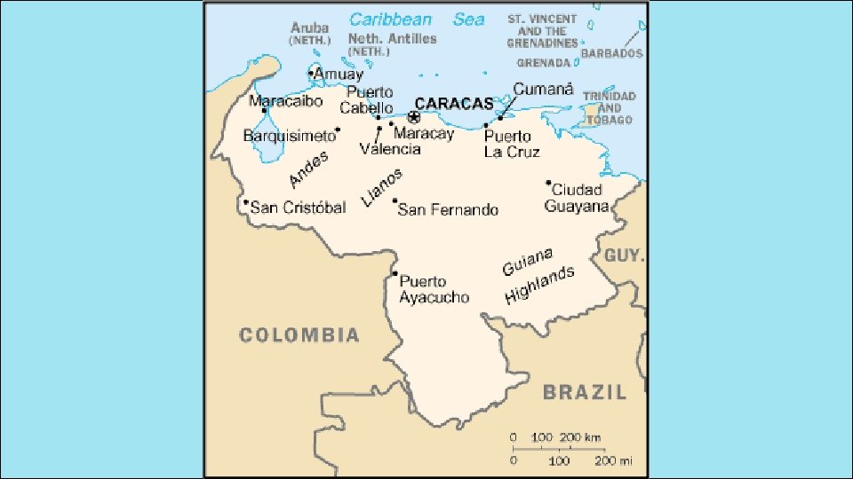
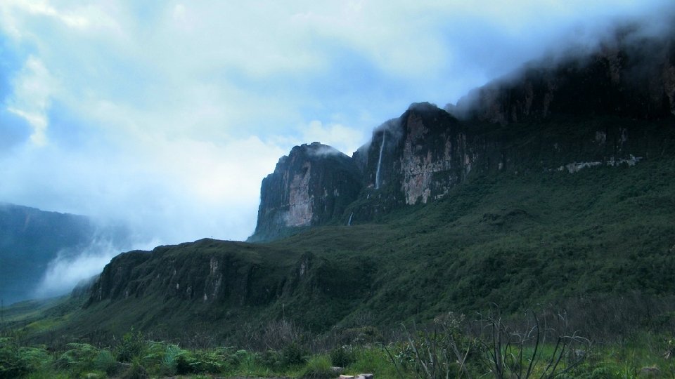
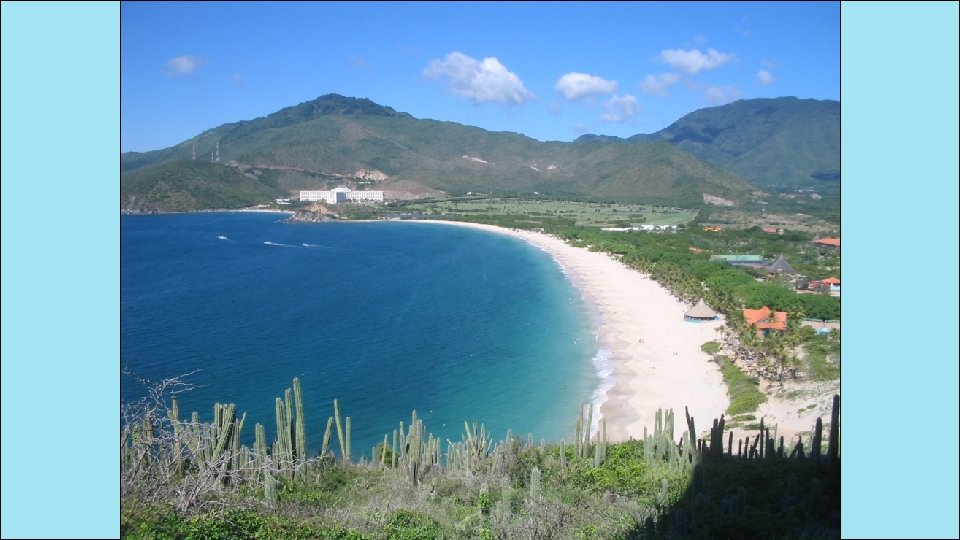
Location • Venezuela is in the northeast part of South America, just north of equator. • It has coasts on Caribbean Sea and Atlantic Ocean. • This gives it easy access to trade with other countries. • The nearby Panama Canal provides a shortcut to the Pacific to trade with Asian countries. • There are mountains in the north and south, so only about 3% of the land is arable.

Climate • Venezuela has a hot, tropical climate. • It’s cooler in the mountains. • Rain varies by region (16 inches on the coast; over 100 inches in the mountains).

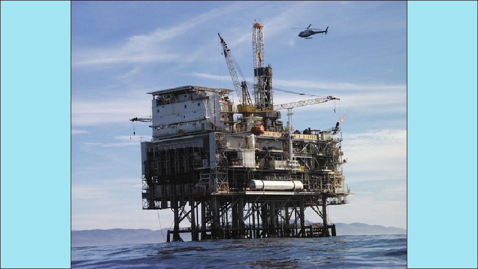
Natural Resources • Venezuela is the sixth-largest oil exporter in the world. • It produces 2. 8 million barrels/day. • 90% of the money the government makes on trade comes from oil exports. • Farming provides jobs for 10% of the population.

Where People Live • urban: 88% • rural: 12% • Caracas is the largest city. • Most people live in the northern highlands, along the coast.

Caracas

Caracas

How They Trade • 90% of money made on exports comes from oil. • 4 major seaports • Other exports: bauxite and aluminum, steel, chemicals, agricultural products, basic manufactures • Tourism

Cuba

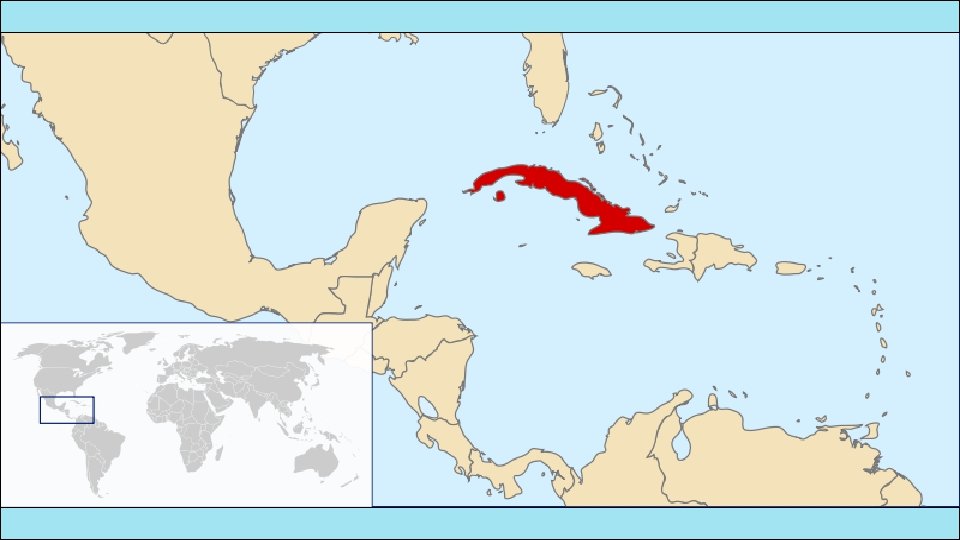
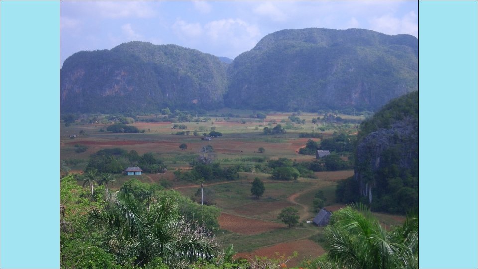
Location • Cuba is an island 90 miles south of Florida, in the Caribbean Sea. • It’s only 700 miles long. • It’ the largest island in the West Indies. • It’s location on ocean trading routes has been an important influence on its history and economy.

Climate • The climate is tropical but moderated by trade winds. • (It’s warm-to-hot all year long, but the winds provide relief from the heat. ) • There’s a rainy season from May to October and a dry season from November to April. • Cuba is a target for hurricanes. • Hurricane season runs from June to November.
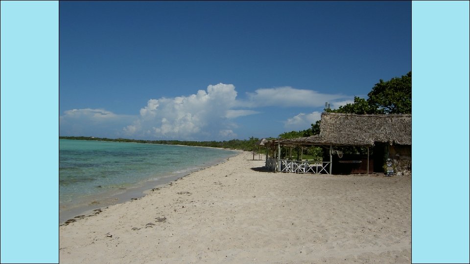
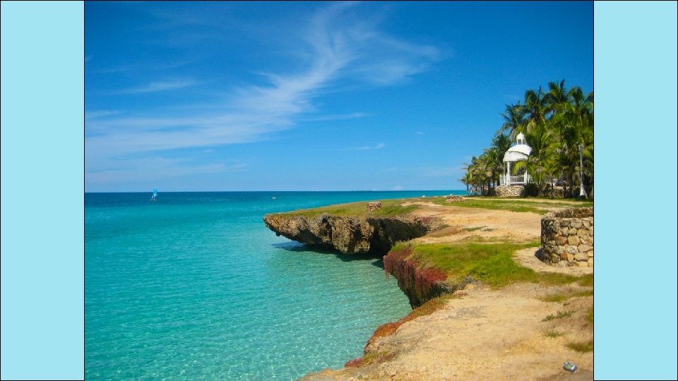

Natural Resources • 28% of Cuba’s land is arable. • It’s most important export is sugar cane. • Other exports include: coffee, fish, fruits, & tobacco. • Tourism is a fast-growing industry.

Sugar cane Farm

Where People Live • urban: 76% • rural: 24% • Havana is the largest city. • 20% of Cubans live in Havana.

Havana

Havana

How They Trade • 3 major seaports • Exports: sugar, nickel, tobacco, fish, medical products, citrus, coffee • Tourism • Venezuela is Cuba’s largest trading partner; it sells oil to Cuba at a reduced price.

How They Trade • The Communist government of the Soviet Union helped support Cuba for many years. • When it collapsed in 1991, Cuba faced difficult times. • Trade from other countries does not bring in enough money to meet needs of Cuba’s people. • Government sometimes orders businesses & factories to close. • Also orders blackouts—times when all electricity is cut off in order to save electricity.

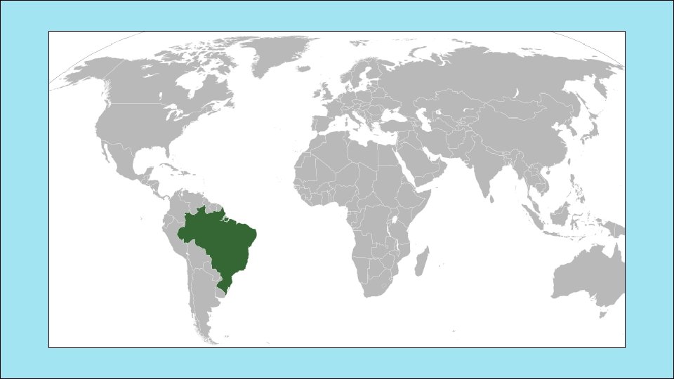
Brazil

Location • Brazil is on the eastern side of South America, along the coast of the Atlantic Ocean. • It shares a border with nearly every country in South America! • Amazon River and other large rivers stretch across Brazil.

Climate • Brazil’s location on the equator gives it the climate needed to support one of the world’s largest rain forests. • Its climate is mostly hot and tropical. • In the south, the climate is temperate (mild).

Natural Resources • Only 7% of land is arable, but Brazil makes the most of this resource. • Farmers grow 1/3 rd of the world’s coffee, and lead the world in production of oranges, papayas, sugar cane, and soybeans. • Only the US exports more farm products than Brazil.

Coffee Plantation

Where People Live • urban: 84% • rural: 16% • It’s the most populated country in Latin America. • It’s the largest Portuguese-speaking country in the world. • Most Brazilians live along the coasts; 80% live within 200 miles of the ocean.

Havana

Havana

How They Trade • 7 major seaports • Exports: transportation equipment, iron ore, soybeans, footwear, coffee, autos, sugar, fruits • tourism • Amazon Rainforest attracts many visitors. • Beaches are another attraction. • USA is Brazil’s largest trading partner.

Copy the following Venn Diagrams in your INB. You will put one Venn Diagram on each page – one on the left and one of the right. Fill them in with information you learned from the Power Point and your notes. Afterwards, you will create a “Pinterest Board” for one of the 4 countries. You should imagine that they are planning a trip to the country, and you are “pinning” things that will come in handy for their trip. Write a summary (underneath the picture) to explain what the significance is to the topic. Example: If my board is about Cuba, I could draw an umbrella/rain jacket. My summary would need to be something about Cuba having a rainy season from May to October.

Terms of Use © 2014 Brain Wrinkles. Your download includes a limited use license from Brain Wrinkles. The purchaser may use the resource for personal classroom use only. The license is not transferable to another person. Other teachers should purchase their own license through my store. This resource is not to be used: • By an entire grade level, school, or district without purchasing the proper number of licenses. For school/district licenses at a discount, please contact me. • As part of a product listed for sale or free by another individual. • On shared databases. • Online in any way other than on password-protected website for student use only. © Copyright 2014. Brain Wrinkles. All rights reserved. Permission is granted to copy pages specifically designed for student or teacher use by the original purchaser or licensee. The reproduction of any other part of this product is strictly prohibited. Copying any part of this product and placing it on the Internet in any form (even a personal/classroom website) is strictly forbidden. Doing so makes it possible for an Internet search to make the document available on the Internet, free of charge, and is a violation of the Digital Millennium Copyright Act (DMCA). Clipart, fonts, & digital papers for this product were purchased from: Thank you, Ansley at Brain Wrinkles © 2014 Brain Wrinkles
- Slides: 60