LOCATING CAVE RESOURCES Aaron Stockton May 12 16


- Slides: 17
LOCATING CAVE RESOURCES Aaron Stockton May 12 -16, 2014 Cody, Wyoming
WHY ? ► To Protect Resources from Theft, Vandalism, and Careless Damage. ► To Eliminate or Reduce Threats from Human Surface Activities. ► Reduce Potential Hazards Caves May Present to Visitors and Surface Users. ► Gain a Better Understanding of the Natural Environment We are Responsible for Managing.
SEARCH YOUR FILES AND RECORDS Cultural Records ► Range and Timber Files ► Recreation Files ► Wildlife Records ► Minerals Records ► Engineering Files ► Law Enforcement Files ►
LOCAL RESEARCH ► Ask Ranchers, Loggers, Well Drillers, Hunters, Local Cavers, Hikers, and Riders. ► Local SAR, Law Enforcement, Fire Department ► Geological, Newspapers, Local History Books, and Articles. ► Library ► Old Timers ► Fly Overs ► Google Earth
GEOLOGIC MAPS VOLCANIC LIMESTONE
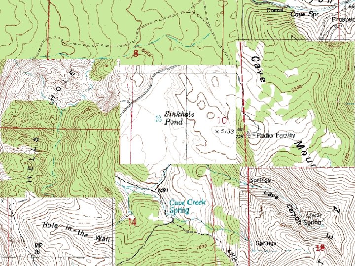
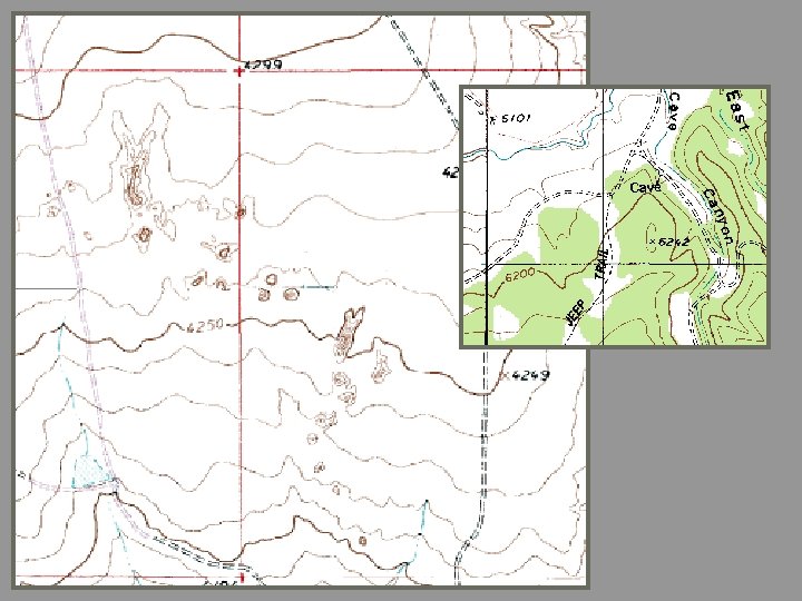
TOPOGRAPHIC MAPS ► ► ► Search for Features with Cave Names Sinkholes Losing/Ephemeral Streams Springs Road Anomalies Vegetation Anomalies
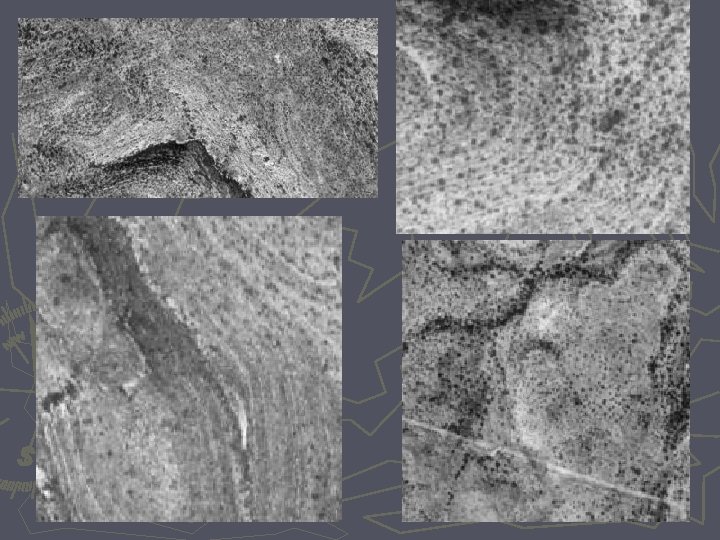
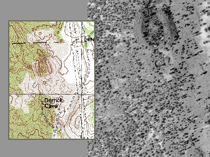
TOPOS and AIR PHOTOS
GEOLOGIC SENSING ► Ground Penetrating Radar ► Seismic Detection ► Acoustic Resonance Detection ► Resistivity – Electric Current Flow ► Magnetometer
FIELD SURVEYS
RESISTIVITY
Digging ► Hot button topic ► Produced entry into incredible cave systems – Lechuguilla ► Can damage valuable information/resources ► Not one size fits all….
Questions ? Which way is north? Modified from 2001 M. Safford, 2004 B. Hummel, 2007 D. Kampwerth, 2011 A. Stockton Presentations Photos by A. Stockton and BLM files