LK 8000 http www bware itLK 8000 Workshops

LK 8000 http: //www. bware. it/LK 8000 Workshops Mateusz Pusz mateusz. pusz@gmail. com 29. 11. 2010
 Links Q&A")
Agenda Introduction Operational modes Interface Map Preparation to flight Usage scenarios (Workshops) Links Q&A

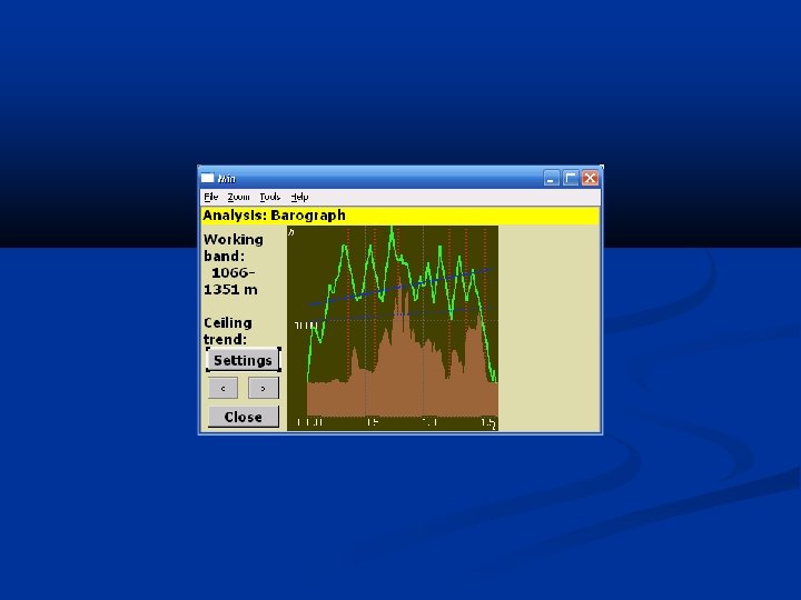
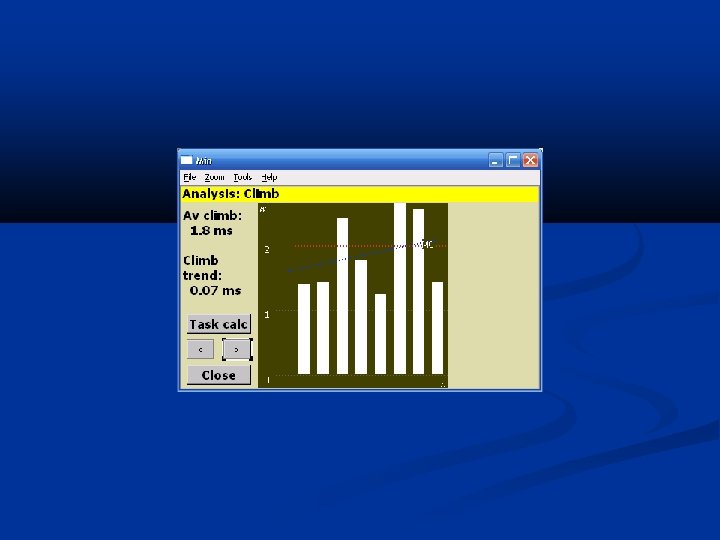
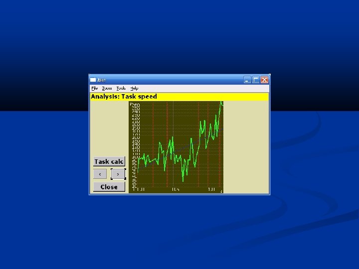
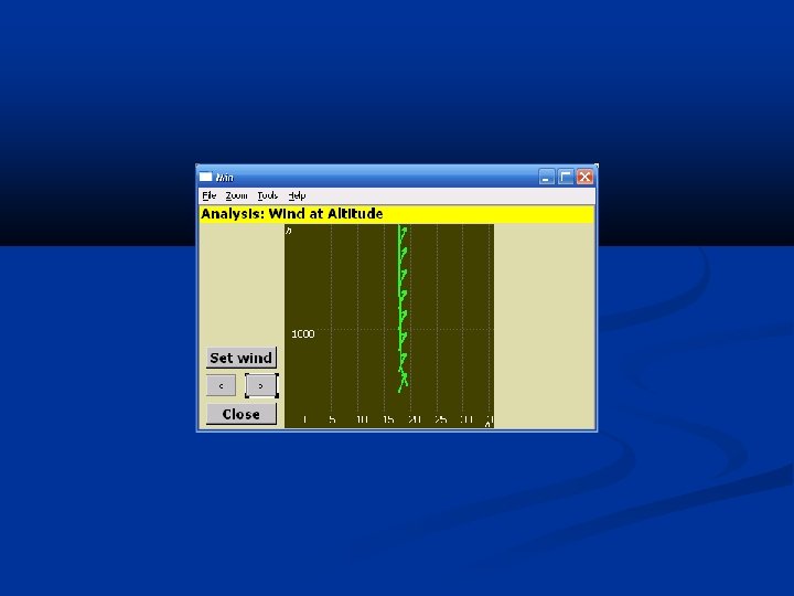
Note Most of the pictures of that presentation were captured on LK 8000 1. 20 b in Mar 2010 The latest version of the software may slightly differ from the presented one

LK 8000 Software written by pilots and for pilots Main developer – Paolo Ventafridda Several Alpha and tens of Beta testers living and flying all over the world Software validation both in real scenarios with different HW configurations and under Condor The Competition Soaring Simulator Free of charge!!! The owner of the FAI Diamond Badge Application is a fork of XCSoar project Software binaries and source code available for download from the project website Real alternative for See. You and Win. Pilot

Operational modes

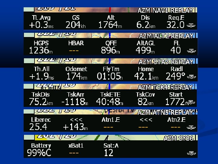
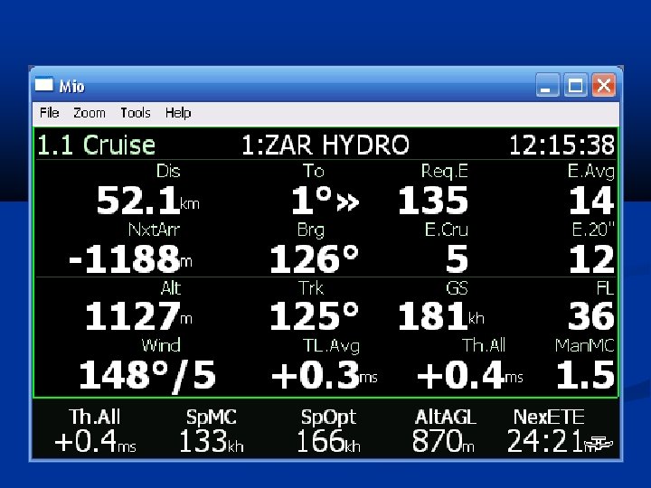
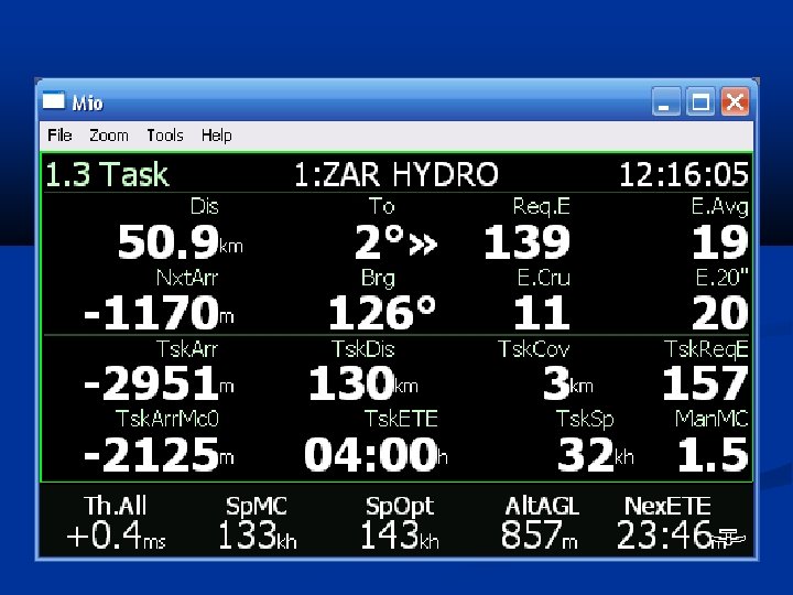
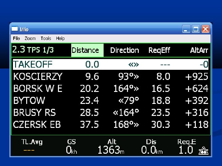
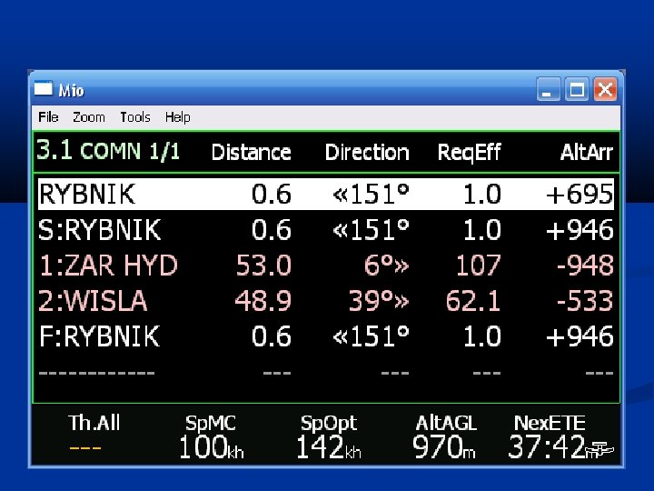
Target Direction to the target Clock from GPS source Compass Distance to the target MC Current Efficiency needed to reach the target Vario Final Glide Bar Expected height above the target Ground speed Scale Status Wind Bottom Bar 10 sets of parameters (4 sets fully configurable) Mode

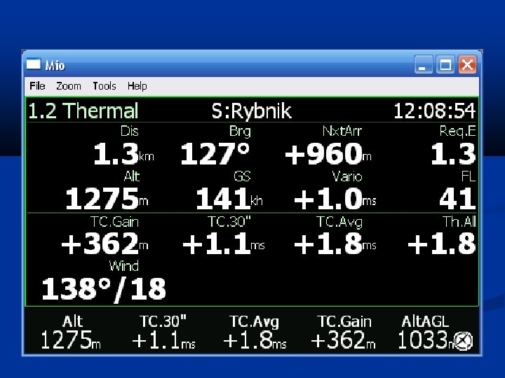
Current height in a thermal and current MC value The center of thermal accounted for wind and height Vertical profile of thermal Scale Status Mode Height AMSL Average vario from last 30 seconds Average vario from the whole thermal Altitude gain in thermal Height AGL
")
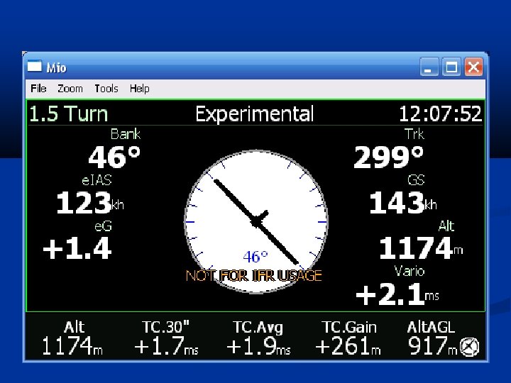
Interface (Turbulence-Proof)

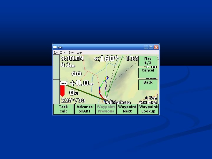
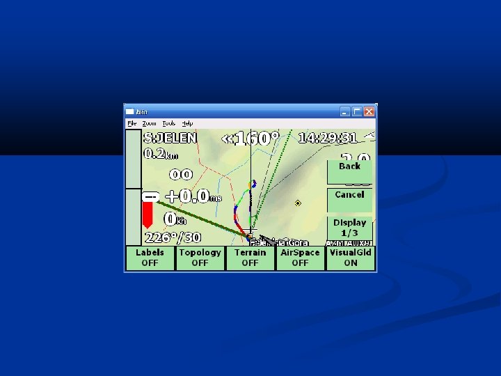
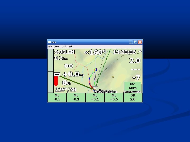
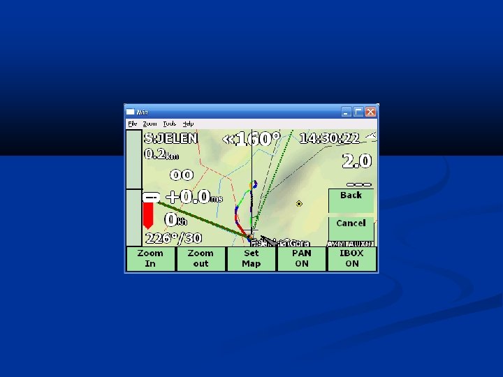
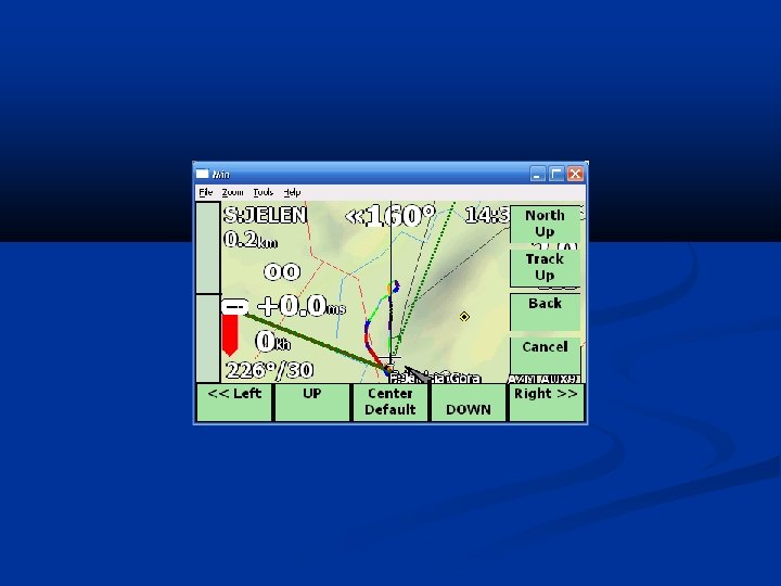
Left UP Right UP Zoom IN Zoom OUT Info. Page Right Menu Left

Up Select Down Info. Page Right Menu Left

Scroll Down/Up Page Next/Prev

AUX Parameters of active operational mode

Map

Flight direction

Safety

Glide range

Terrain obstacles

Circling 1/2

Circling 2/2

Ridge

Final Glide Bar Far away from finish line Altitude needed to reach finish line accounted for MC, water ballast and wind For MC=0 we are nearly there For MC=0 we will reach the finish line, with actual MC we will not make it We will reach finish line even with current MC

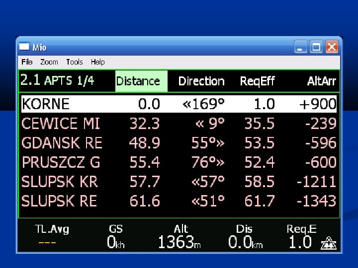
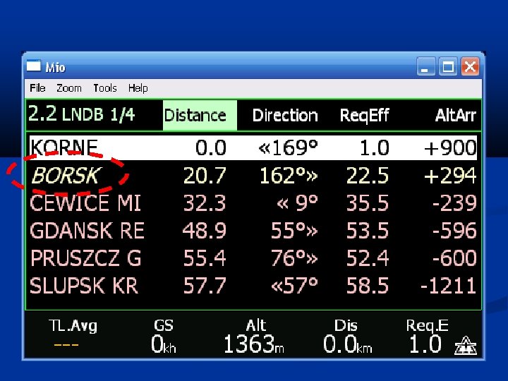
Airfields accessibility Airfield not accessible Airfield accessible

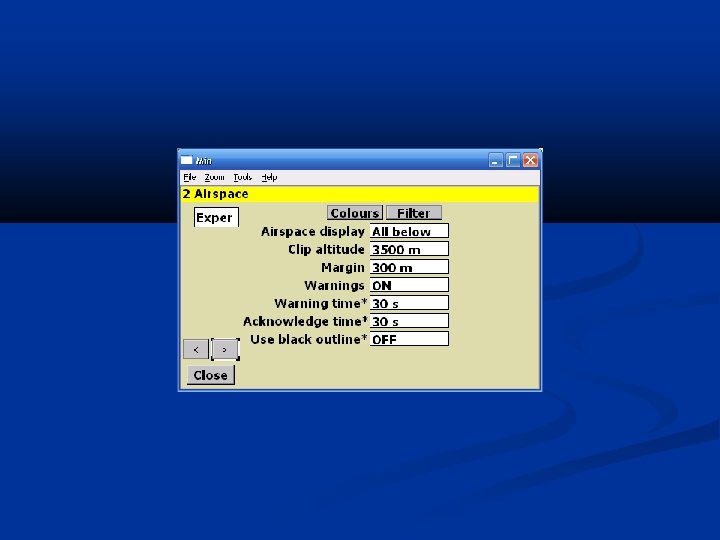
Airspaces All on

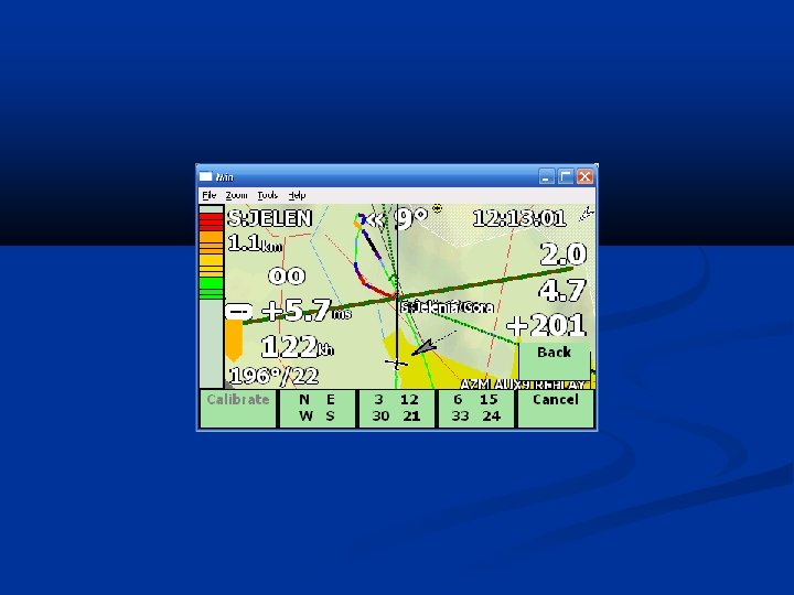
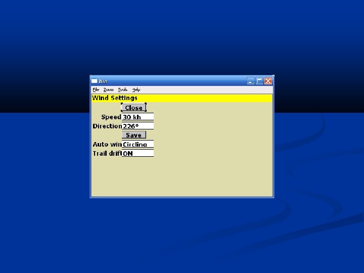
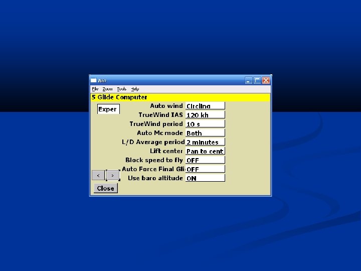
True. Wind Calculates direction and speed of the wind during straight flight Does not need any external devices to work correctly Results accuracy confirmed against: circling wind Zander See. You PC Condor

Preparation to flight

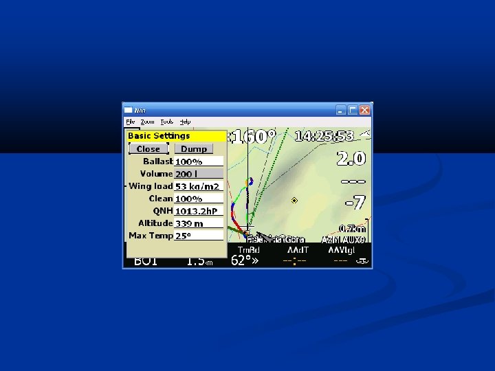
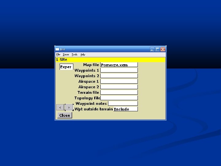
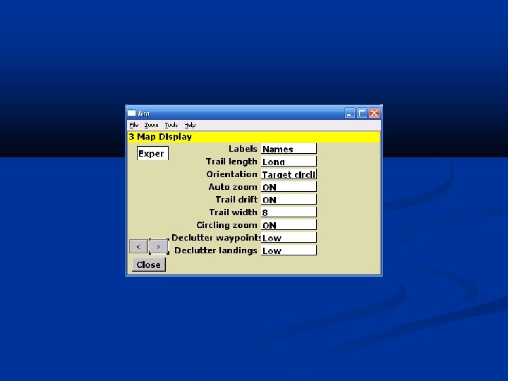
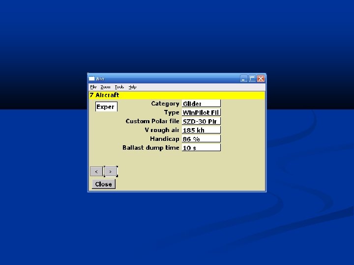
What is needed ahead of flight? LK 8000 with your favorite configuration PLR files with glider polar Waypoints files LKMAPS – LKM and DEM files XCSoar – XCM file Airspaces [optional] Win. Pilot (DAT) or See. You Mobile (CUP) format may be nested inside LKM or XCM files Terrain and topology [optional but strongly suggested] Win. Pilot format + additions Format Open Air = Win. Pilot Review and set correct values in Basic Setup window
![Polar Mass. Dry. Gross[kg] Max. Water. Ballast[liters] Water ballast volume Speed 1[km/h], Sink 1[m/s],](http://slidetodoc.com/presentation_image_h2/925775d206c89e942d656291371708bb/image-38.jpg "Polar Mass. Dry. Gross[kg] Max. Water. Ballast[liters] Water ballast volume Speed 1[km/h], Sink 1[m/s],")
Polar Mass. Dry. Gross[kg] Max. Water. Ballast[liters] Water ballast volume Speed 1[km/h], Sink 1[m/s], Speed 2, Sink 2, Speed 3, Sink 3 Mass for which glider’s polar was measured 3 speed and sink pairs taken from glider’s polar Wing. Area[m 2] LK 8000 Extension (not present in Win. Pilot) Allows setting Wing Loading in Basic Setup

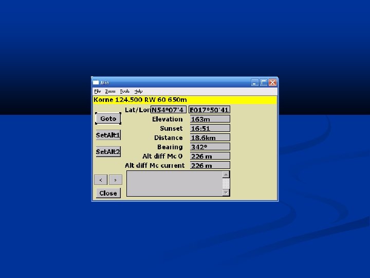
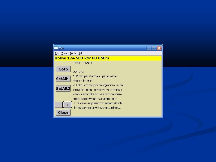
Waypoints Name Latitude and Longitude Height AMSL Waypoint type Airfield Landable TP – Turn Point Direction and length of airfield together with its radio frequency (only in See. You CUP) Comment

Terrain and Topology 1/3 Terrain Ground heights AMSL Used for terrain obstacles calculation drawing of terrain height map when Waypoint does not have a height provided in a waypoints file than the height in that place on map is used Topology Characteristic terrain features (roads, rivers, lakes, etc. )

XCM Files 2/3 XCSoar Format Warning: That format is obsolete and may stop to be supported at some time in the future XCSoar On-Line Generator Allows easy map generation by your own for any area in the world specified by: coordinates waypoints file (Win. Pilot format) http: //xcsoar. dd. com. au/cgi-bin/terrain. pl

LKM and DEM Files 3/3 LKMAPS format New maps format providing Allows customization of the amount of details drawn on the map to the pilot needs Download newer and more accurate terrain data (up to 250 m) more topology details A set of ready to download maps http: //www. lk 8000. it/download/maps. html Requesting If interesting area is not ready for download than a simple form has to be filled and sent to the project’s author
 format Type Name Height http: //www. winpilot. com/Users. Guide/User.")
Airspaces Open Air (Win. Pilot) format Type Name Height http: //www. winpilot. com/Users. Guide/User. Airspace. asp from – to AMSL or AGL Shape Lines Arc

Basic Setup Water ballast Wing loading The ratio of total mass of the glider (that specific example with its equipment, pilot, luggage, chute, etc) to its wing area Bugs factor Moves speed polar

Home Waypoint It should be set after every change of waypoints file Home Waypoint is a place where a map is centered after LK 8000 startup if no GPS signal is present is an airfield to which LK 8000 always shows the radial and distance is a landable with the highest priority on the list of alternate landings is a waypoint that will always be visible on the Info. Page 3. 1 Commons is a height for barometer in a case when the glider is located close to the home
")
Usage scenarios (Workshops)

Flying with airfield reachable Safety altitude = 300 m Bad!!! Good!!!

Flights inside an airspace 1/2 Before the flight we filter only our airspace type Accept the warning with ‘ACK Warn’
 We are inside")
Flights inside an airspace 2/2 We left the airspace (shading present) We are inside the airspace (no shading)
")
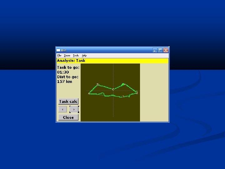
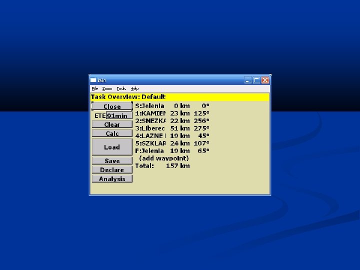
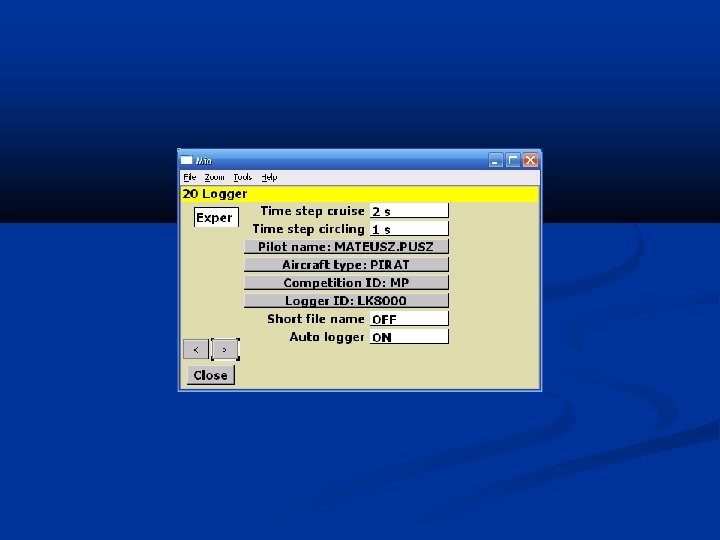
Tasks 1/3 LK 8000 setup Set a map, waypoints and airspaces (Setup System 1) Set glider data (Setup System 7) Set logger data (Setup System 20)

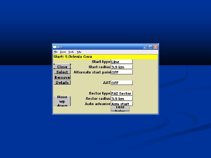
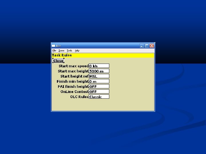
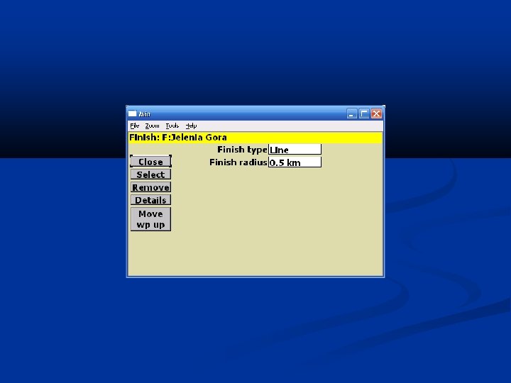
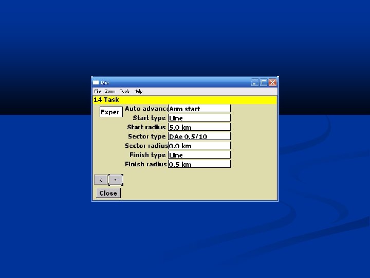
Tasks 2/3 Task setup Nav 2/3 -> Task Edit Add all waypoints For the first waypoint set start observation zone type task observation zones type waypoints advancement type (see next slide) advanced parameters for start and finish (competitions) For the last waypoint set finish observation zone data In case of AAT task set observation zone data for each waypoint

Tasks 3/3 Waypoint advancement type Manual Automated advancement of waypoints right after reaching them May provide problems when we are crossing start line many times (i. e. thermalling or on a tow) Arm Manual advancement of all waypoints NOT recommended Latched advancement of all waypoints Recommended for AAT Arm start Latched advancement of a start waypoint All other waypoints advanced automatically (like Auto) Recommended but a pilot needs to remember about arming it right before starting a task

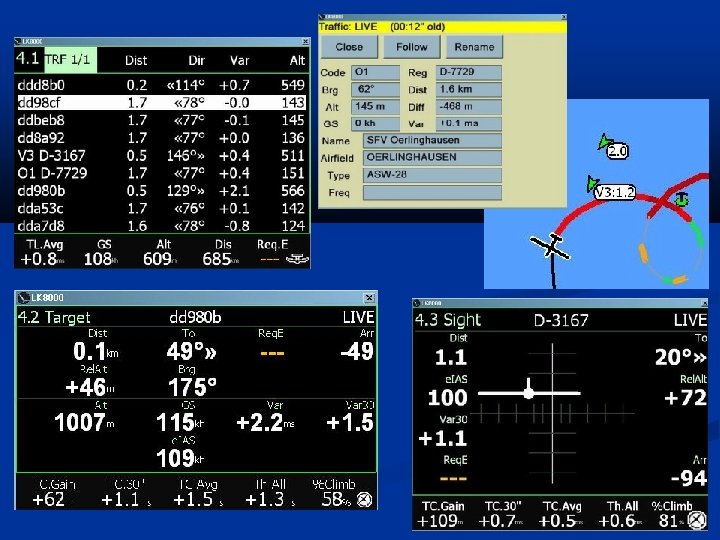
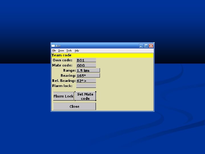
Team flying Friend’s location Our code

Links LK 8000 Forum http: //www. postfrontal. com/forum/default. asp? CAT_ID=11 XCSoar http: //www. bware. it/LK 8000 http: //xcsoar. org Condor 2 Nav http: //sourceforge. net/projects/condor 2 nav

Q&A
")
Menu (Backup)

- Slides: 93