
Lithostratigraphy By Mohammad Nabi Gorgij University of Sistan


Lithostratigraphy By: Mohammad Nabi Gorgij University of Sistan and Baluchestan 2009

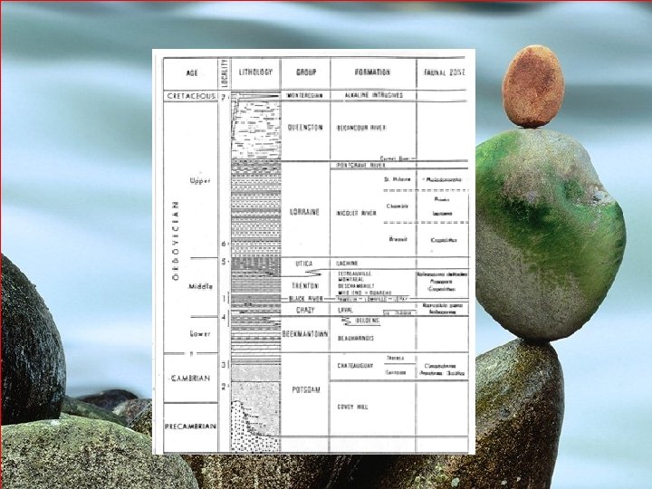
Lithostratigraphy �� Formation �� Fundamental unit of lithostratigraphic classification �� A body of rock identified by lithic characteristics (composition, colour, sedimentary structures, fossils,
Lithostratigraphy �� Formation �� Generally considered to be tabular in geometry �� Large enough to be mappable at the Earth’s surface or traceable in the subsurface �� Existing formations range from a few m to several 1000 s of m thick �� Traceable for a few km or several 1000 km

Lithostratigraphy �� Members �� Subdivisions of formations �� Possess characteristics that distinguish it from other parts of the formation �� Not all formations are subdivided into members

Lithostratigraphy �� Groups �� Two or more formations related lithologically �� Component formations may change laterally (e. g. , due to facies changes) �� Supergroups �� Assemblage of related or superimposed groups �� Sometimes useful for regional synt
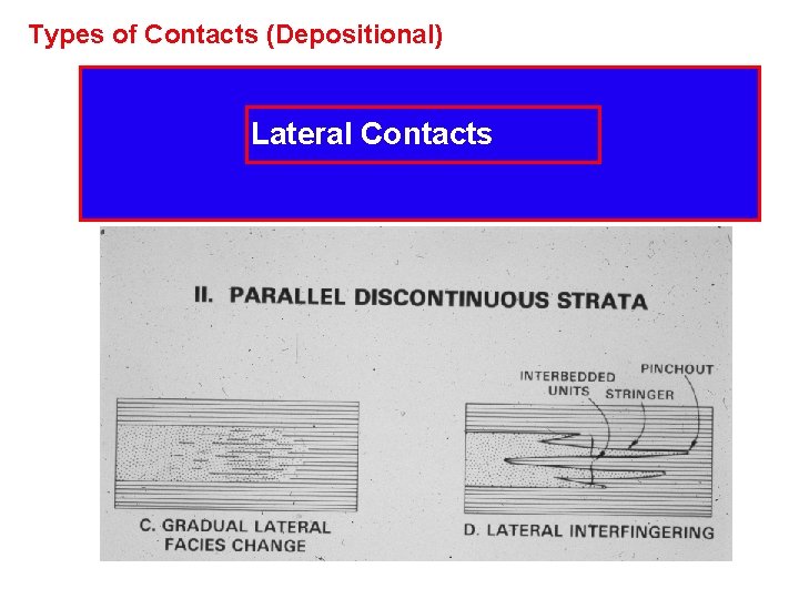
Types of Contacts (Depositional) Lateral Contacts
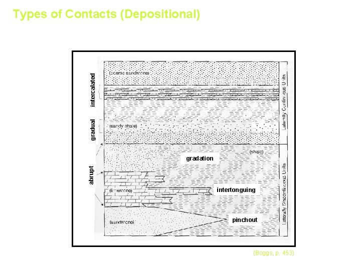
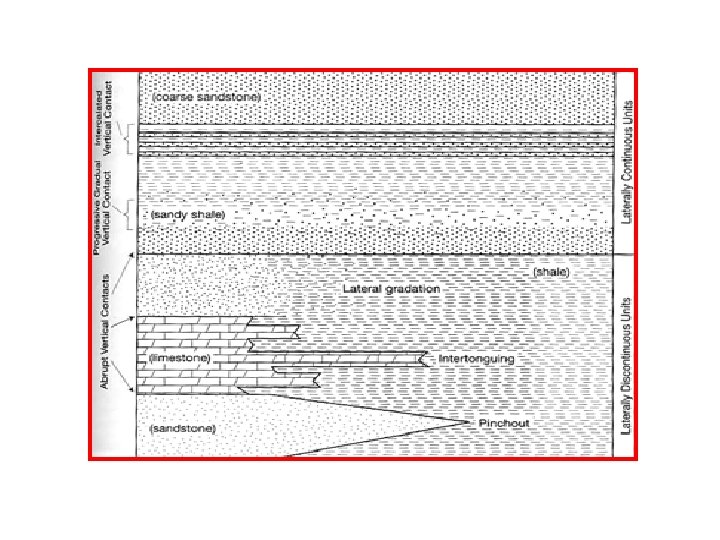
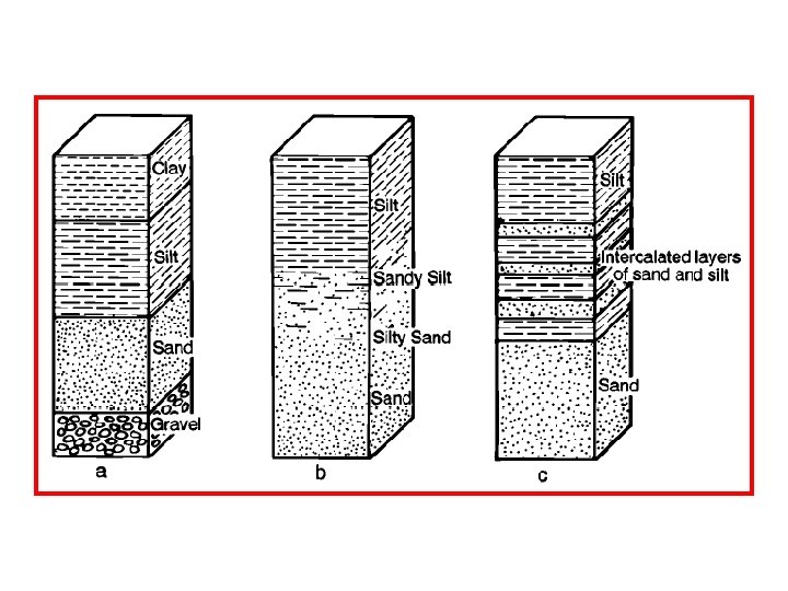
Types of Contacts (Depositional) intercalated gradual gradation abrupt Vertical Contacts Lateral Contacts intertonguing pinchout (Boggs, p. 453)
Types of Contacts • Intrusive • Fault • Depositional - Conformable Contact - Unconformity
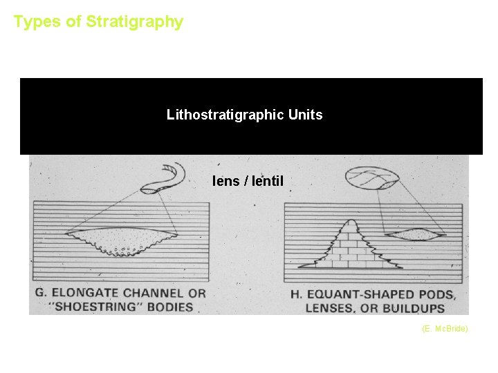
Types of Stratigraphy Lithostratigraphic Units lens / lentil (E. Mc. Bride)
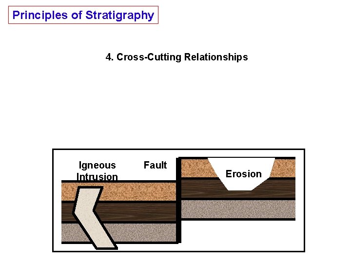
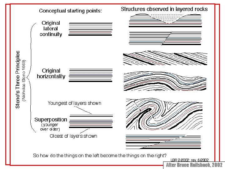
Principles of Stratigraphy 4. Cross-Cutting Relationships Rock that are cut by another geologic feature are older than the feature that cuts them. Igneous Intrusion Fault Erosion
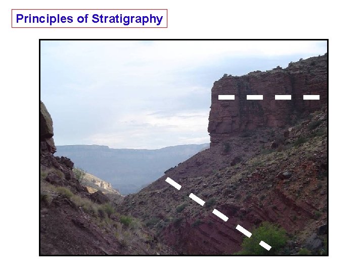
Principles of Stratigraphy
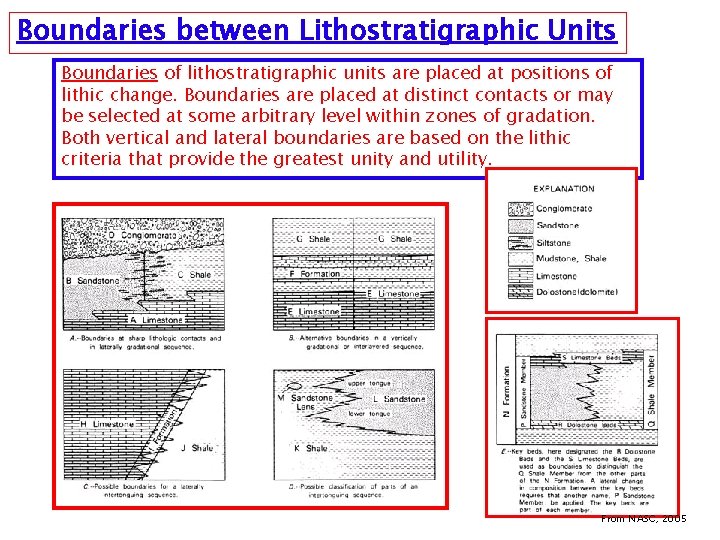
Boundaries between Lithostratigraphic Units Boundaries of lithostratigraphic units are placed at positions of lithic change. Boundaries are placed at distinct contacts or may be selected at some arbitrary level within zones of gradation. Both vertical and lateral boundaries are based on the lithic criteria that provide the greatest unity and utility. From NASC, 2005
Lithostratigraphic Units A lithostratigraphic unit is a defined body of sedimentary, extrusive igneous, metasedimentary, or metavolcanic strata which is distinguished and delimited on the basis of lithic characteristics and stratigraphic position. A lithostratigraphic unit generally conforms to the Law of Superposition and commonly is stratified and tabular in form. Supergroup. A supergroup is a formal assemblage of related or superposed groups, or of groups and formations. Such units have proved useful in regional and provincial syntheses. Supergroups should be named only where their recognition serves a clear purpose. Group. A group is the lithostratigraphic unit next higher in rank to formation; a group may consist entirely of named formations, or alternatively, need not be composed entirely of named formations. Formation. The formation is the fundamental unit in lithostratigraphic classification. A formation is a body of rock identified by lithic characteristics and stratigraphic position; it is prevailingly but not necessarily tabular and is mappable at the Earth's surface or traceable in the subsurface. Member. A member is the formal lithostratigraphic unit next in rank below a formation and is always a part of some formation. It is recognized as a named entity within a formation because it possesses characteristics distinguishing it from adjacent parts of the formation. A formation need not be divided into members unless a useful purpose is served by doing so. Some formations may be divided completely into members; others may have only certain parts designated as members; still others may have no members. Bed(s). A bed, or beds, is the smallest formal lithostratigraphic unit of sedimentary rocks. Flow. A flow is the smallest formal lithostratigraphic unit of volcanic flow rocks. A flow is a discrete, extrusive, volcanic body distinguishable by texture, composition, order of superposition, paleomagnetism, or other objective criteria. From NASC, 2005
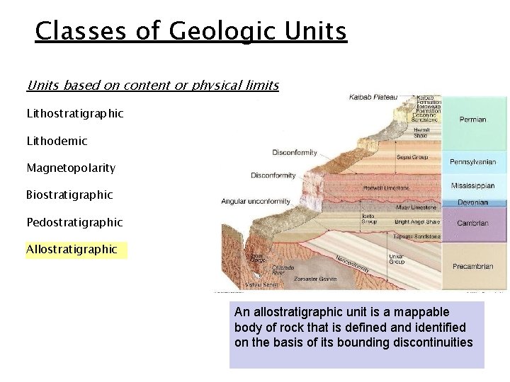
Classes of Geologic Units based on content or physical limits Lithostratigraphic Lithodemic Magnetopolarity Biostratigraphic Pedostratigraphic Allostratigraphic An allostratigraphic unit is a mappable body of rock that is defined and identified on the basis of its bounding discontinuities
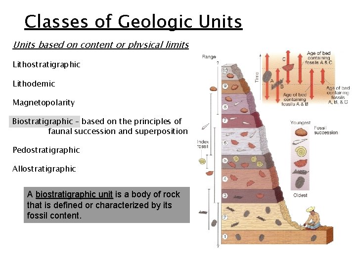
Classes of Geologic Units based on content or physical limits Lithostratigraphic Lithodemic Magnetopolarity Biostratigraphic – based on the principles of faunal succession and superposition Pedostratigraphic Allostratigraphic A biostratigraphic unit is a body of rock that is defined or characterized by its fossil content.
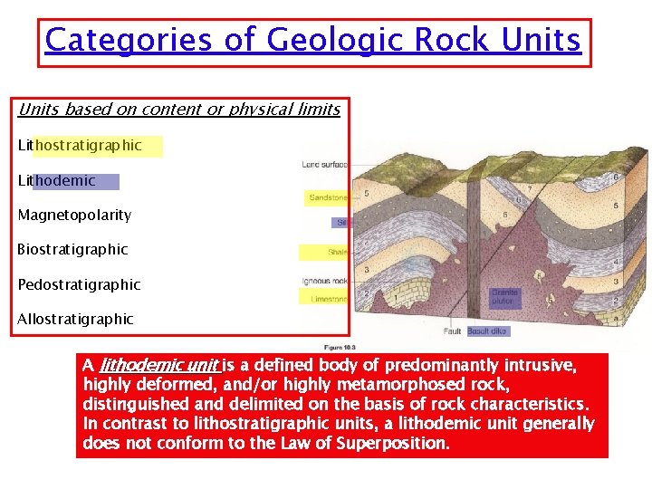
Categories of Geologic Rock Units based on content or physical limits Lithostratigraphic Lithodemic Magnetopolarity Biostratigraphic Pedostratigraphic Allostratigraphic A lithodemic unit is a defined body of predominantly intrusive, highly deformed, and/or highly metamorphosed rock, distinguished and delimited on the basis of rock characteristics. In contrast to lithostratigraphic units, a lithodemic unit generally does not conform to the Law of Superposition.
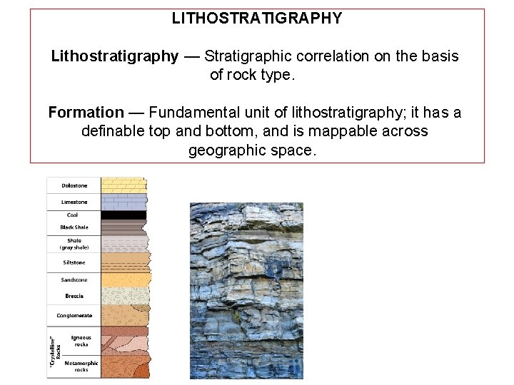
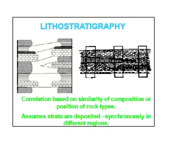
LITHOSTRATIGRAPHY Lithostratigraphy — Stratigraphic correlation on the basis of rock type. Formation — Fundamental unit of lithostratigraphy; it has a definable top and bottom, and is mappable across geographic space.
Types of Depositional Systems Marine ocean, sea Transitional part land, part ocean Terrestrial land
After Bruce Railsback, 2002
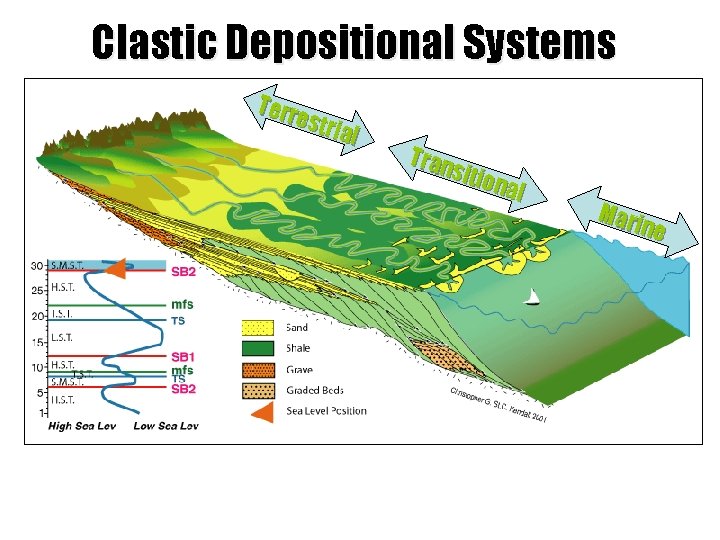
Clastic Depositional Systems Terr estr ial Tran sitio nal Mari ne
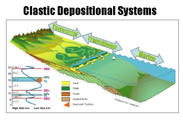
Clastic Depositional Systems Terr estr ial Tran sitio nal Mari ne
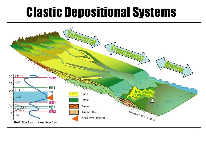
Clastic Depositional Systems Terr estr ial Tran sitio nal Mari ne
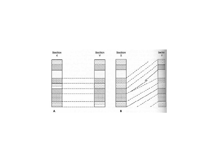
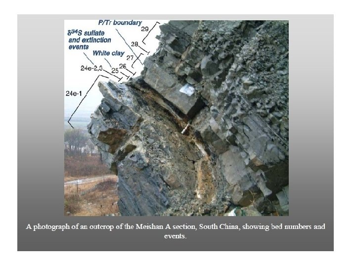
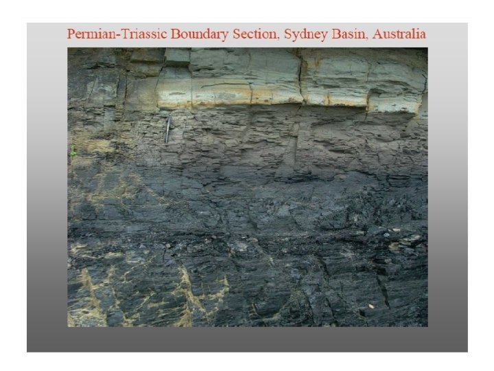
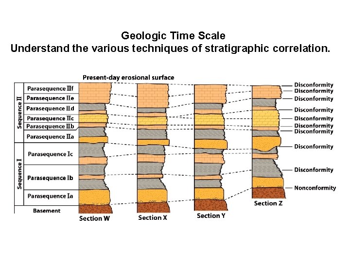
Geologic Time Scale Understand the various techniques of stratigraphic correlation.
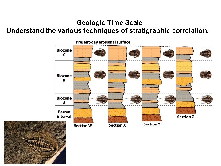
Geologic Time Scale Understand the various techniques of stratigraphic correlation.
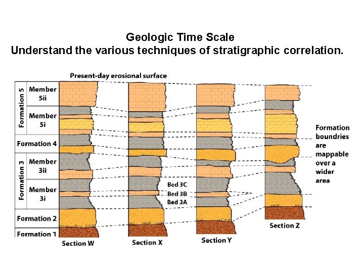
Geologic Time Scale Understand the various techniques of stratigraphic correlation.
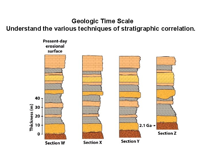
Geologic Time Scale Understand the various techniques of stratigraphic correlation.
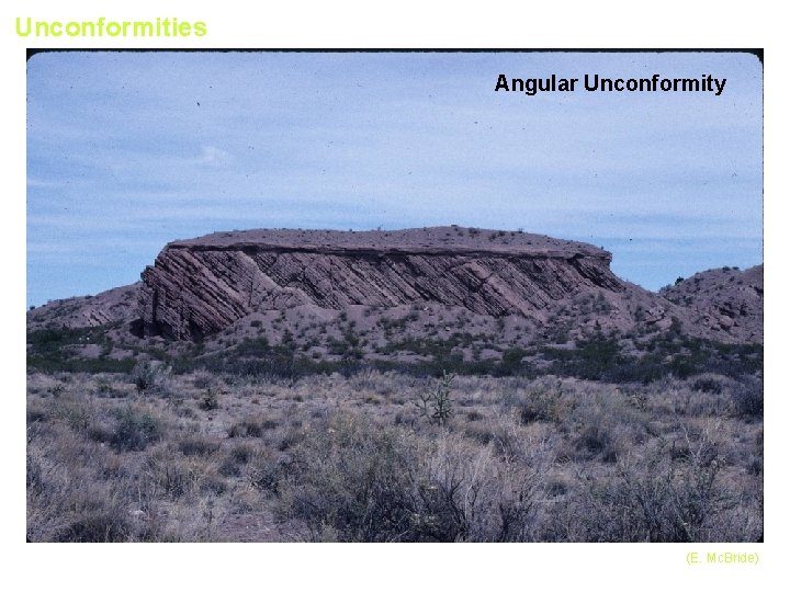
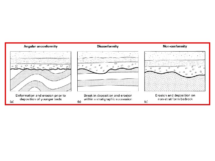
Unconformities Angular Unconformity (E. Mc. Bride)
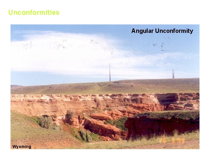
Unconformities Angular Unconformity Wyoming
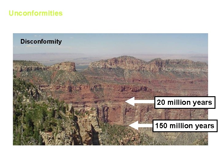
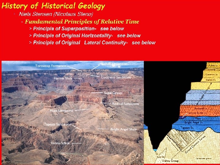
Unconformities Disconformity Supai Group 20 million years Redwall Limestone Muav Limestone 150 million years
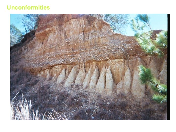
Unconformities Calvert Bluff / Alluvium Contact (Field Trip 1)
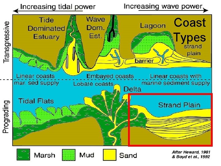
Coast Types
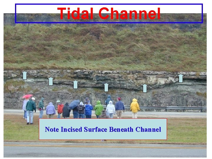
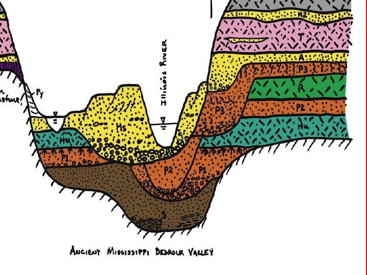
Tidal Channel Note Incised Surface Beneath Channel
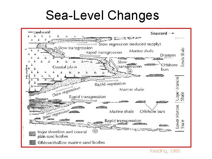
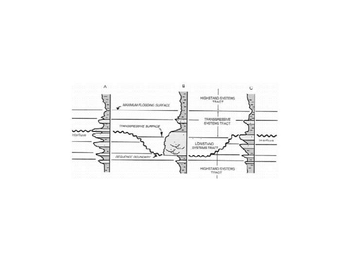
Sea-Level Changes Reading, 1986
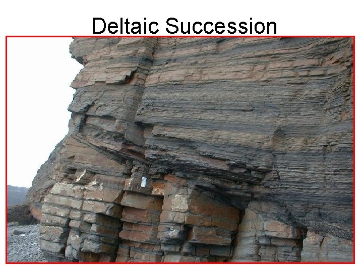
Deltaic Succession
Transgressions and regressions, progradations
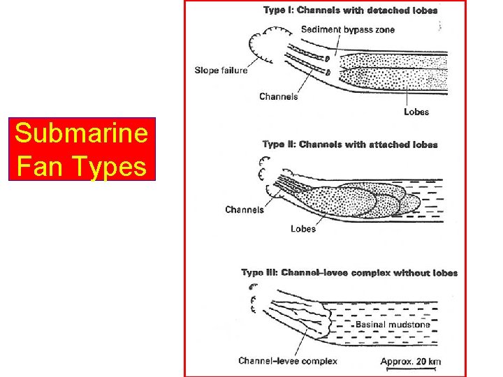
Submarine Fan Types
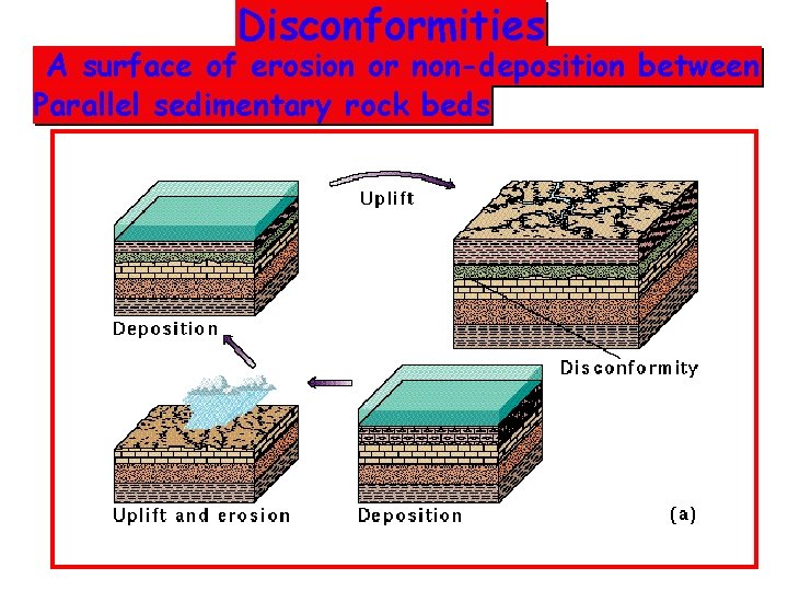
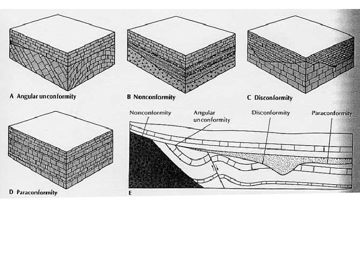
Disconformities A surface of erosion or non-deposition between Parallel sedimentary rock beds of differing ages.
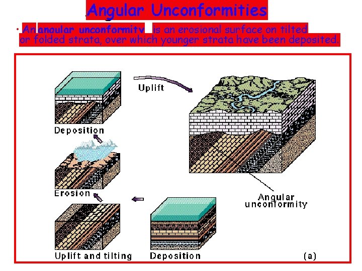
Angular Unconformities • An angular unconformity is an erosional surface on tilted or folded strata, over which younger strata have been deposited.
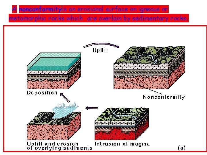
A nonconformity is an erosional surface on igneous or metamorphic rocks which are overlain by sedimentary rocks.
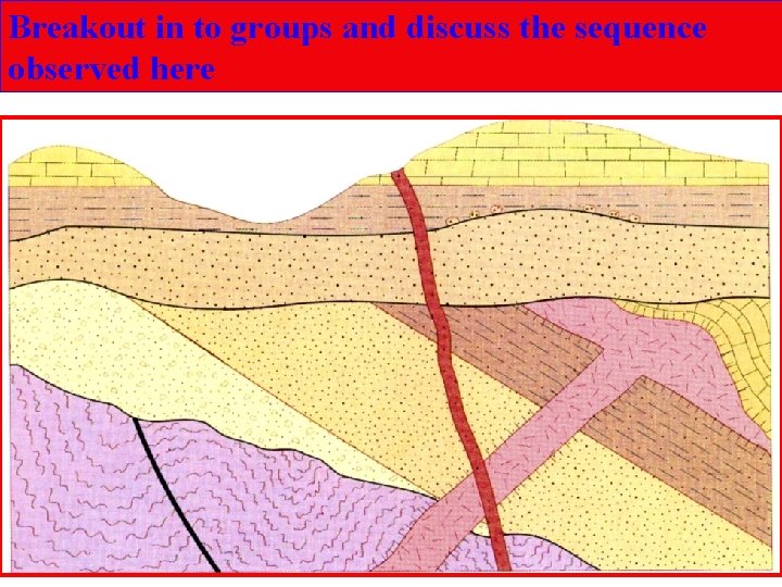
Breakout in to groups and discuss the sequence observed here
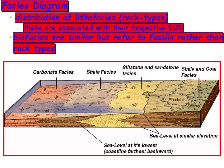
Facies Diagram • distribution of lithofacies (rock-types) - these are associated with their respective EOD • biofacies are similar but refer to fossils rather than rock types
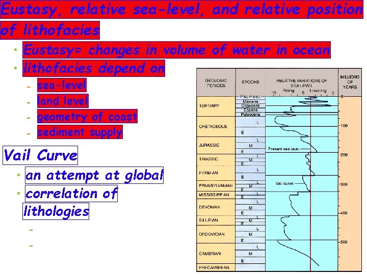
Eustasy, relative sea-level, and relative position of lithofacies • Eustasy= changes in volume of water in ocean • lithofacies depend on - sea-level land level geometry of coast sediment supply Vail Curve • an attempt at global • correlation of lithologies -
Rock designations • Rock units called Lithostratigraphic units - described in terms of Group, Formation, & Member > each term has specific meanings in geological parlance • Formation - a mappable lithostratigraphic unit > has a location for identifying the type-section > has a rock designation describing the lithology - sometimes not all the same lithology > in which case the term "Formation" takes the place of lithologic type • Groups are composed of several formations • Members are distinctive units within a formation - group is largest and contains formations and members - formations are next and contain members
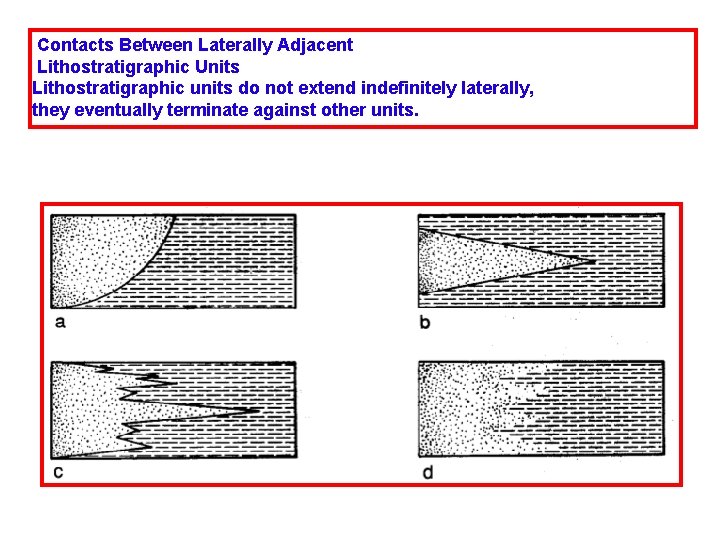
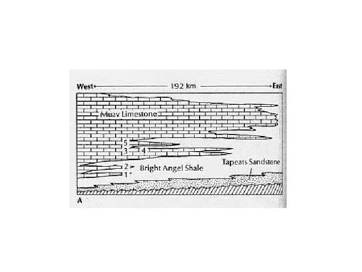
Contacts Between Laterally Adjacent Lithostratigraphic Units Lithostratigraphic units do not extend indefinitely laterally, they eventually terminate against other units.
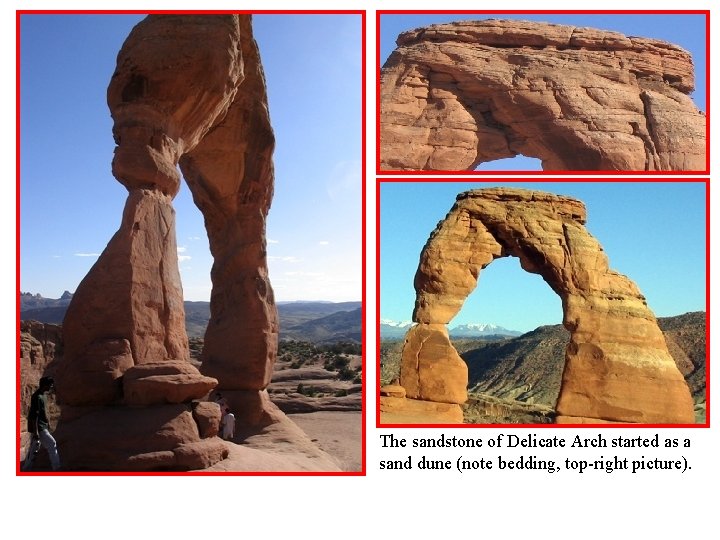
The sandstone of Delicate Arch started as a sand dune (note bedding, top-right picture).
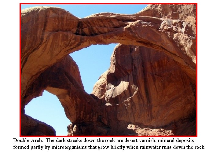
Double Arch. The dark streaks down the rock are desert varnish, mineral deposits formed partly by microorganisms that grow briefly when rainwater runs down the rock.
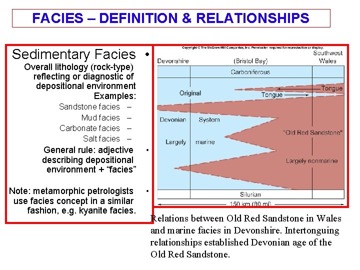
FACIES – DEFINITION & RELATIONSHIPS Sedimentary Facies • Overall lithology (rock-type) reflecting or diagnostic of depositional environment Examples: Sandstone facies Mud facies Carbonate facies Salt facies – – General rule: adjective describing depositional environment + “facies” • Note: metamorphic petrologists use facies concept in a similar fashion, e. g. kyanite facies. • Relations between Old Red Sandstone in Wales and marine facies in Devonshire. Intertonguing relationships established Devonian age of the Old Red Sandstone.
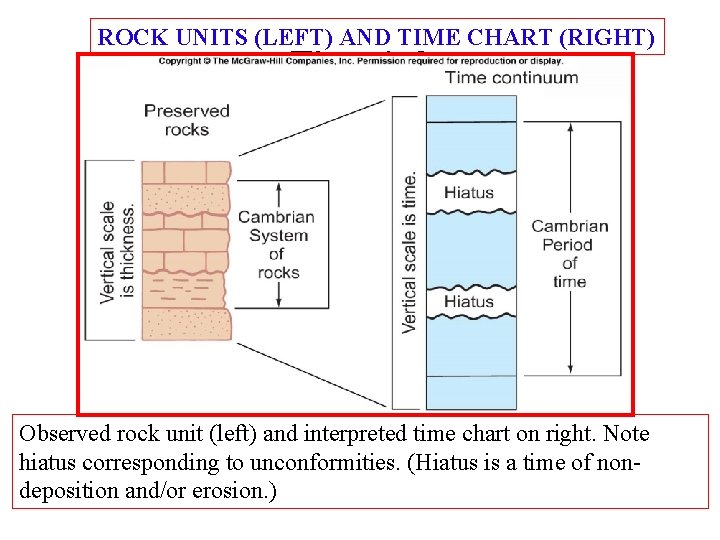
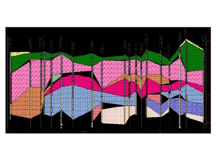
ROCK UNITS (LEFT) AND TIME CHART (RIGHT) Fig. 4. 6 Observed rock unit (left) and interpreted time chart on right. Note hiatus corresponding to unconformities. (Hiatus is a time of nondeposition and/or erosion. )
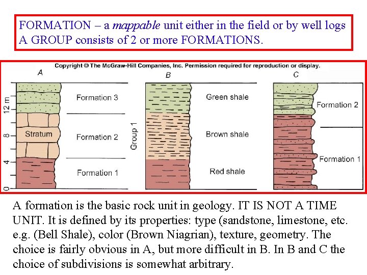
FORMATION – a mappable unit either in the field or by well logs A GROUP consists of 2 or more FORMATIONS. A formation is the basic rock unit in geology. IT IS NOT A TIME UNIT. It is defined by its properties: type (sandstone, limestone, etc. e. g. (Bell Shale), color (Brown Niagrian), texture, geometry. The choice is fairly obvious in A, but more difficult in B. In B and C the choice of subdivisions is somewhat arbitrary.
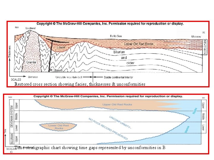
Restored cross section showing facies, thicknesses & unconformities Time-stratigraphic chart showing time gaps represented by unconformities in B
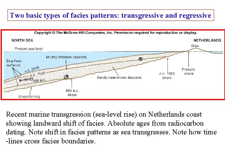
Two basic types of facies patterns: transgressive and regressive Recent marine transgression (sea-level rise) on Netherlands coast showing landward shift of facies. Absolute ages from radiocarbon dating. Note shift in facies patterns as sea transgresses. Note how time -lines cross facies boundaries.
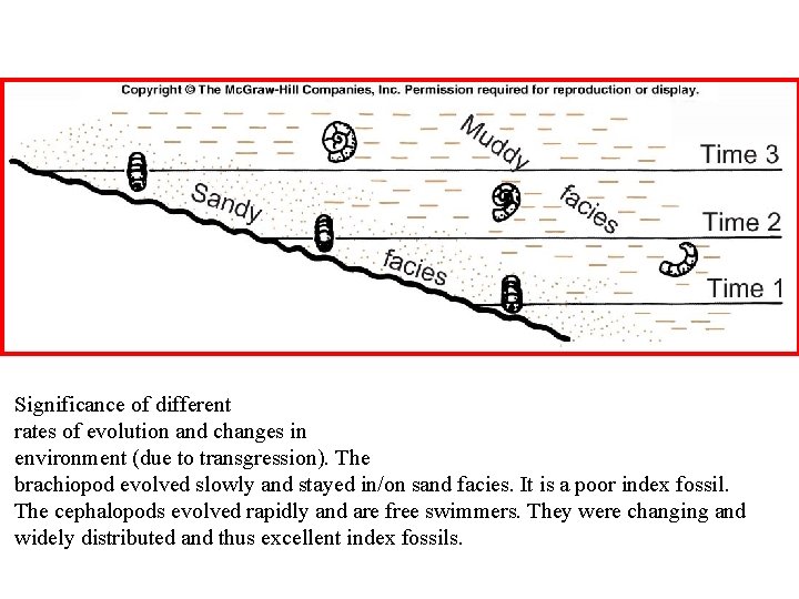
Significance of different rates of evolution and changes in environment (due to transgression). The brachiopod evolved slowly and stayed in/on sand facies. It is a poor index fossil. The cephalopods evolved rapidly and are free swimmers. They were changing and widely distributed and thus excellent index fossils.
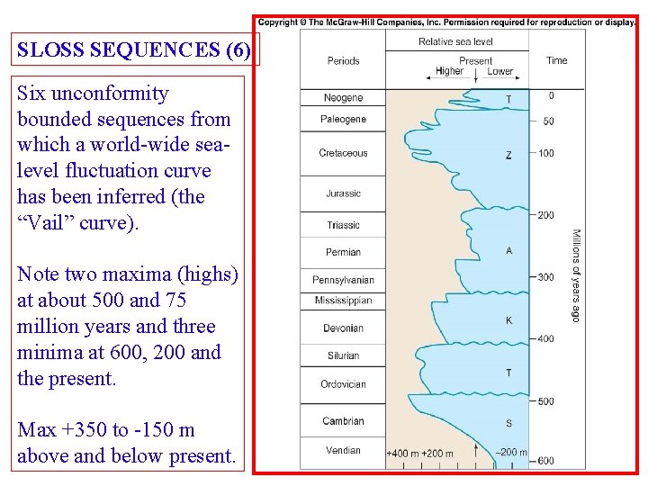
SLOSS SEQUENCES (6) Six unconformity bounded sequences from which a world-wide sealevel fluctuation curve has been inferred (the “Vail” curve). Note two maxima (highs) at about 500 and 75 million years and three minima at 600, 200 and the present. Max +350 to -150 m above and below present.
- Slides: 72