Limestone Map Work Starter Explain the ways in


 For an area that you have studied, and give detailed explanations of")
- Slides: 28
Limestone Map Work Starter Explain the ways in which two different land uses may be in conflict within a upland limestone area. (4).
Learning Intentions • To learn how to spot limestone features on an OS Map.
6 Figure Grid Reference Recap
ALONG THE CORRIDOR AND UP THE STAIRS!!!
What are the 4 figure grid references for A-J?
6 Figure Grid References • 6 figure grid references are more accurate. They are used to identify exact points on a map for example a church, tourist information centre or car park. • We apply the same rules as 4 figure grid references – along the corridor and up the stairs. • You need to think about it as dividing each grid into tens – both up and down.
654725 • 4 FIGURE GRID REFERENCE = 6572 • 654 = 4 along in the 65 square. • 725 = 5 along in the 72 square.
Practice Give the 6 figure grid referenc es for:
What features? Consider
Introduction • It is fairly easy to identify limestone features on an OS map as the names of features are often shown on the map, eg Raven Scar or White Scar Caves.
Limestone Pavement
Intermittent Drainage • Rivers/streams appear to start and stop randomly. • Will reappear as Springs (Spr).
Shake Holes • Shake holes are formed when boulder clay is washed down through cracks or gaps in the underlying limestone.
A scar or scree slope is the name for a minicliff at the edge of the limestone plateau. Scar
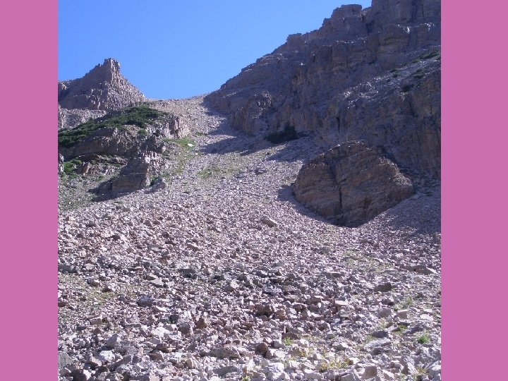
• Scree slopes are tiny bits of rock that form steep cliffs on the limestone. • Formed by freeze thaw action (frost shattering) This is where water collects in the rock fractures, freezes and expands exerting great pressure on rock – breaking rock into tiny pieces. • These break off and are moved downhill by gravity and accumulate at the base of slopes as a scree slope
Scree
Scar
Scar
Cave/Caverns
Pot Hole/Swallow Hole
Gorge
Dry Valley • A dry valley may develop on permeable rock, such as limestone. Such valleys do not hold surface water because it sinks into the permeable bedrock.
Dry Valley
Questions a) For an area that you have studied, and give detailed explanations of a landscape management issue and how public bodies and voluntary organisations are solving these issue (6).