Lightning at NSSL Numerical Modeling and Data Assimilation
![Assimilating Lightning Data o Unambiguous indicator of [electrified] convection o Mixed-phase ice precipitation (graupel) Assimilating Lightning Data o Unambiguous indicator of [electrified] convection o Mixed-phase ice precipitation (graupel)](https://slidetodoc.com/presentation_image_h2/dc4e33411db9ba9ff90b71f632865f50/image-10.jpg)

- Slides: 21

Lightning at NSSL: Numerical Modeling and Data Assimilation Edward Mansell National Severe Storms Laboratory Donald Mac. Gorman and Conrad Ziegler National Severe Storms Laboratory, Norman, OK Funding sources in the Office of Naval Research, NSF, NSSL, the National Research Council, and the Oklahoma State Regents

Modeling Activities/Capabilities • Storm electrification modeling: • Basic understanding of electrification processes • Lightning-storm relationships • Lightning data assimilation (COAMPS) • On mesoscale (>10 km), control convection parameterization scheme. • Storm-scale En. KF radar data assimilation

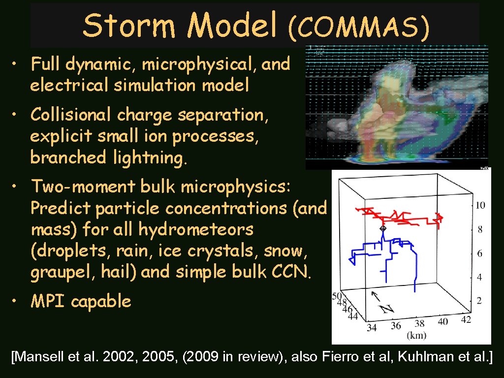
Storm Model (COMMAS) • Full dynamic, microphysical, and electrical simulation model • Collisional charge separation, explicit small ion processes, branched lightning. • Two-moment bulk microphysics: Predict particle concentrations (and mass) for all hydrometeors (droplets, rain, ice crystals, snow, graupel, hail) and simple bulk CCN. • MPI capable [Mansell et al. 2002, 2005, (2009 in review), also Fierro et al, Kuhlman et al. ]

Supercell Simluation

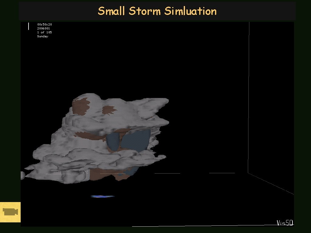
Small Storm Simluation

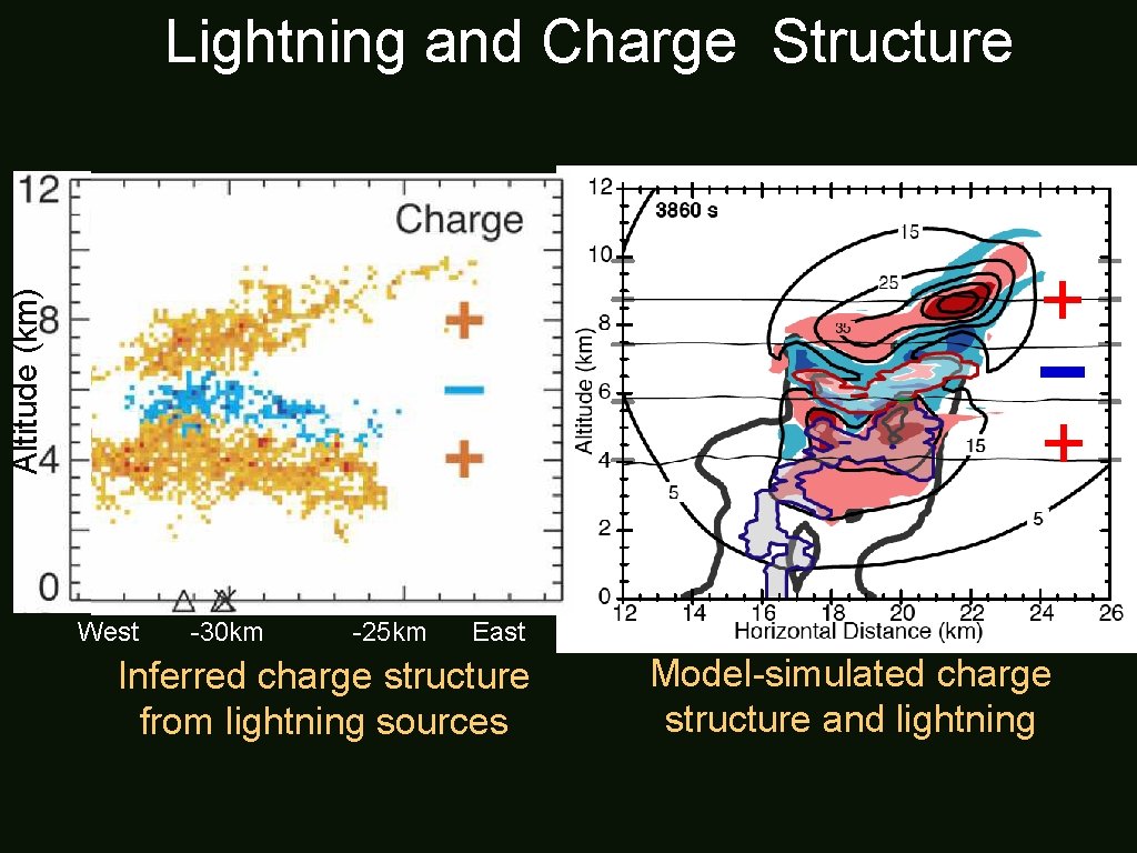
Lightning and Charge Structure Altitude (km) + – + West -30 km -25 km East Inferred charge structure from lightning sources Model-simulated charge structure and lightning

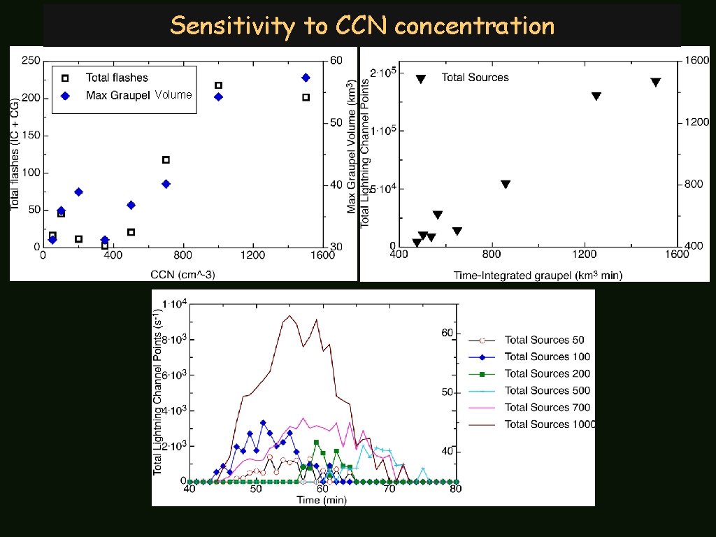
Sensitivity to CCN concentration Volume

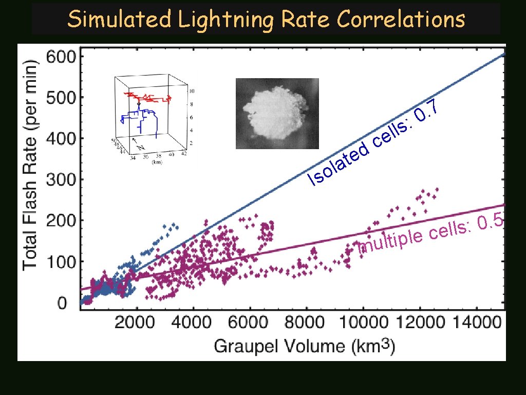
Simulated Lightning Rate Correlations 7. : 0 s l l e c d e at l o Is p i t l u m 5. 0 : s l l e c le

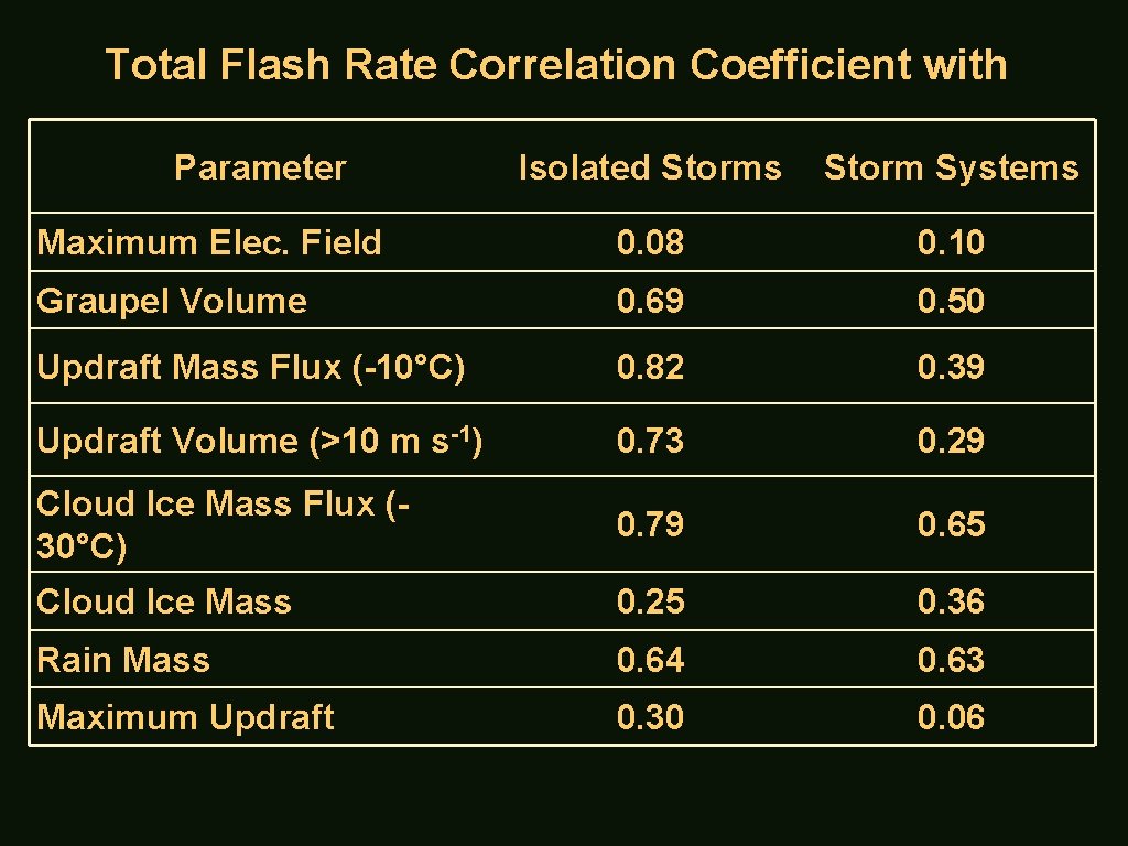
Total Flash Rate Correlation Coefficient with Parameter Isolated Storms Storm Systems Maximum Elec. Field 0. 08 0. 10 Graupel Volume 0. 69 0. 50 Updraft Mass Flux (-10°C) 0. 82 0. 39 Updraft Volume (>10 m s-1) 0. 73 0. 29 Cloud Ice Mass Flux (30°C) 0. 79 0. 65 Cloud Ice Mass 0. 25 0. 36 Rain Mass 0. 64 0. 63 Maximum Updraft 0. 30 0. 06
![Assimilating Lightning Data o Unambiguous indicator of electrified convection o Mixedphase ice precipitation graupel Assimilating Lightning Data o Unambiguous indicator of [electrified] convection o Mixed-phase ice precipitation (graupel)](https://slidetodoc.com/presentation_image_h2/dc4e33411db9ba9ff90b71f632865f50/image-10.jpg)
Assimilating Lightning Data o Unambiguous indicator of [electrified] convection o Mixed-phase ice precipitation (graupel) is present o Can complement radar data assimilation: Fill in radar voids: Mountains, oceans, other countries, radar drop-outs Potential use of flash rate relationships (storm intensity, e. g. , updraft volume/mass flux) and satellite-based (e. g. , GOES) total lightning detection (total flash rate in particular) [Mansell, Ziegler, and Mac. Gorman, 2007]

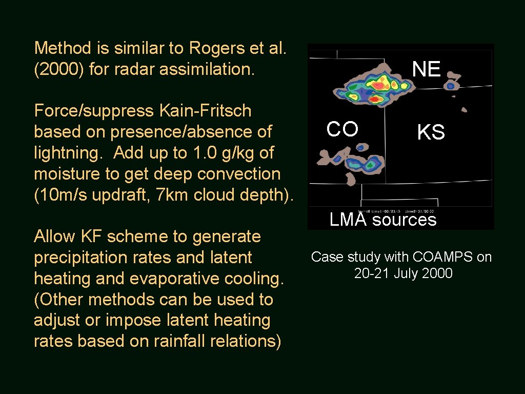
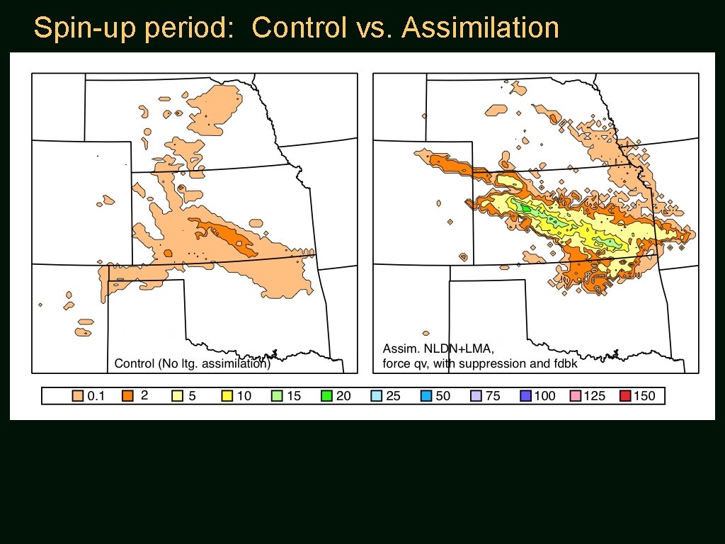
Method is similar to Rogers et al. (2000) for radar assimilation. Force/suppress Kain-Fritsch based on presence/absence of lightning. Add up to 1. 0 g/kg of moisture to get deep convection (10 m/s updraft, 7 km cloud depth). Allow KF scheme to generate precipitation rates and latent heating and evaporative cooling. (Other methods can be used to adjust or impose latent heating rates based on rainfall relations) NE CO KS LMA sources Case study with COAMPS on 20 -21 July 2000

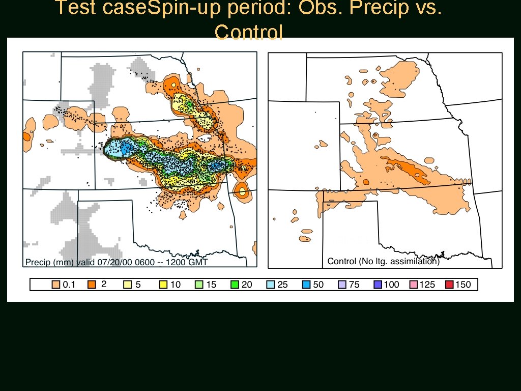
Test case. Spin-up period: Obs. Precip vs. Control

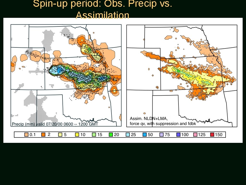
Spin-up period: Obs. Precip vs. Assimilation

Spin-up period: Control vs. Assimilation

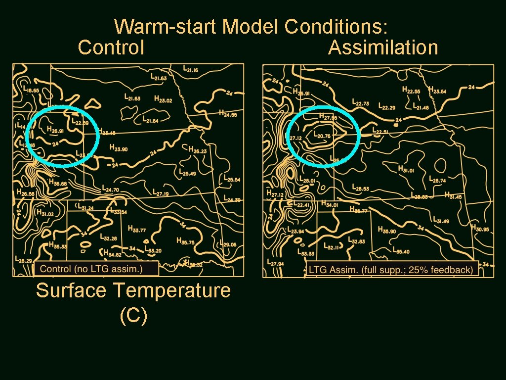
Warm-start Model Conditions: Control Assimilation Surface Temperature (C)

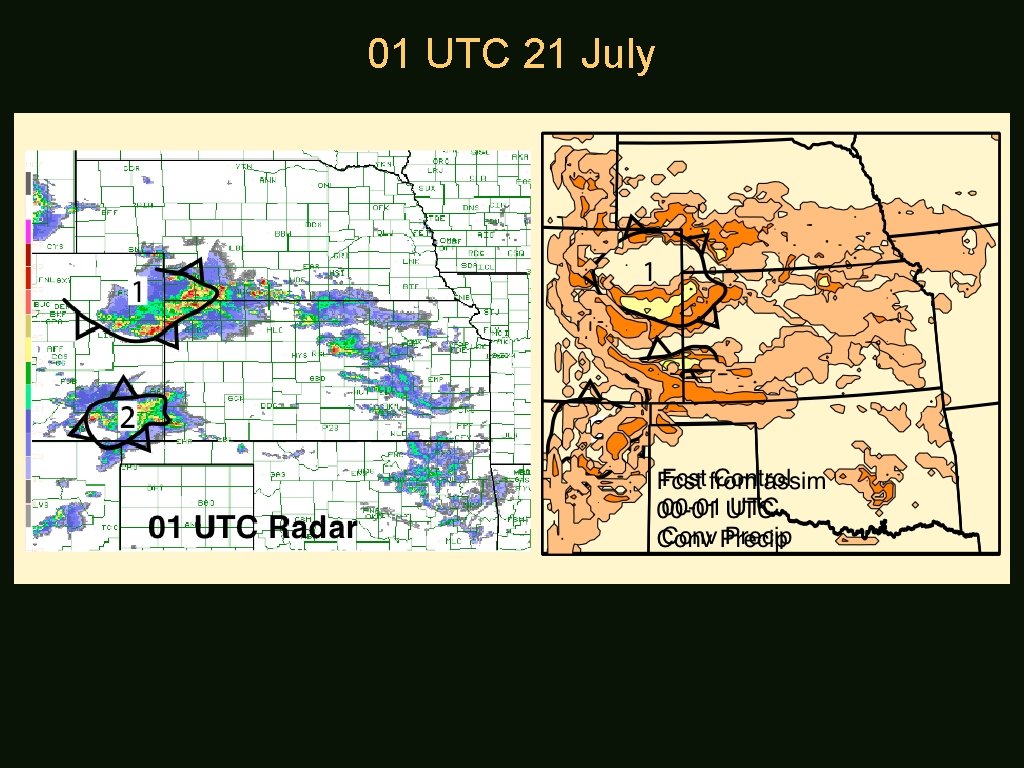
01 UTC 21 July

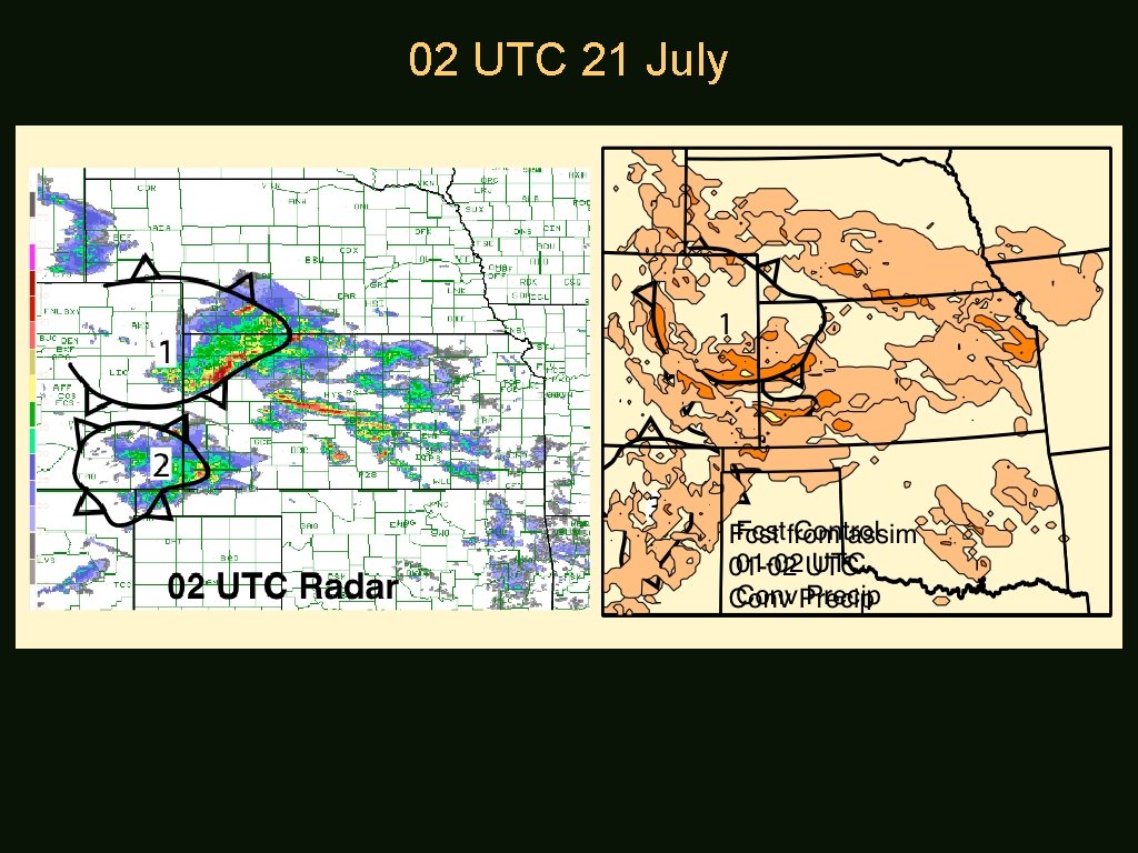
02 UTC 21 July

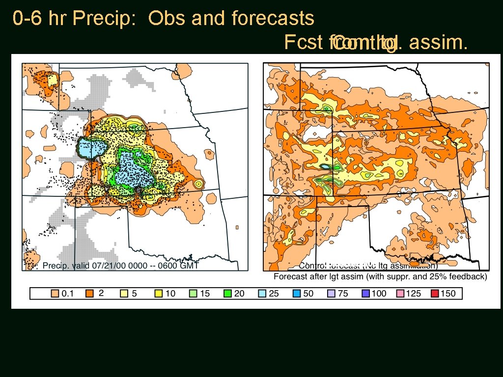
0 -6 hr Precip: Obs and forecasts Fcst from ltg. assim. Control

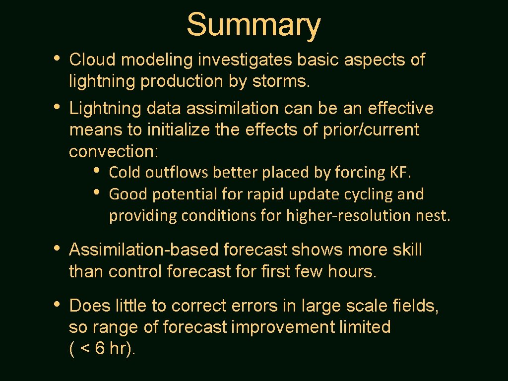
Summary • Cloud modeling investigates basic aspects of lightning production by storms. • Lightning data assimilation can be an effective means to initialize the effects of prior/current convection: • Cold outflows better placed by forcing KF. • Good potential for rapid update cycling and providing conditions for higher-resolution nest. • Assimilation-based forecast shows more skill than control forecast for first few hours. • Does little to correct errors in large scale fields, so range of forecast improvement limited ( < 6 hr).

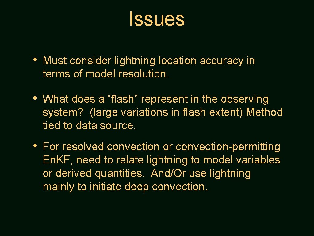
Issues • Must consider lightning location accuracy in terms of model resolution. • What does a “flash” represent in the observing system? (large variations in flash extent) Method tied to data source. • For resolved convection or convection-permitting En. KF, need to relate lightning to model variables or derived quantities. And/Or use lightning mainly to initiate deep convection.
