Leveraging NASA FIRMS webbased active fire mapping and

Leveraging NASA FIRMS web-based active fire mapping and data dissemination activities to optimize USFS upstream data processing framework for active fire mapping Diane Davies, LANCE Operations Manager Brad Quayle, Title, USFS Acknowledgements: Otmar Olsina, Greg Ederer, Robert Wolfe (need to add position / organization)

FIRMS US/Canada A collaboration between NASA and USFS Overview • What is FIRMS? • Intro to NASA LANCE FIRMS • Background to FIRMS and the long standing partnership with USFS • The proposed collaboration between NASA and USFS • USFS Active Fire Mapping is looking to modernize optimize its upstream data processing framework and data processing capabilities. • Level 2 MODIS and VIIRS active fire products from LANCE / FIRMS are already used to compliment the direct readout processing for operational US and Canada active fire mapping activities. • USFS will partner with NASA LANCE / FIRMS to leverage its web based active fire mapping and data dissemination activities. • The output will be a NASA-USFS version of FIRMS tailored to the US/Canada to better support the FS/interagency fire management needs.
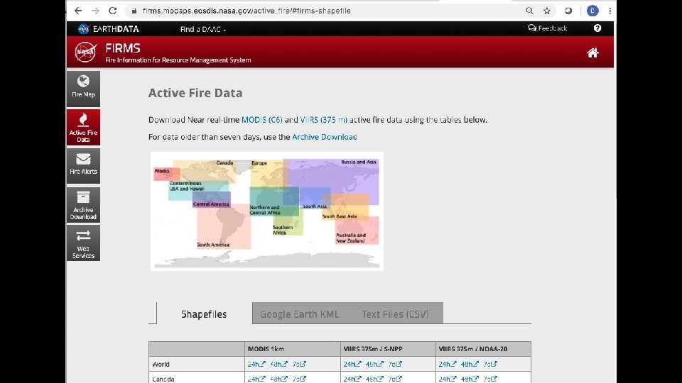
 FIRMS provides global NRT active fire/thermal anomaly")
Fire Information for Resource Management System (FIRMS) FIRMS provides global NRT active fire/thermal anomaly data from MODIS and VIIRS. Originally developed at the University of Maryland in partnership with the United Nations (UN) Food and Agriculture Organization (FAO). FIRMS became part of LANCE in 2012

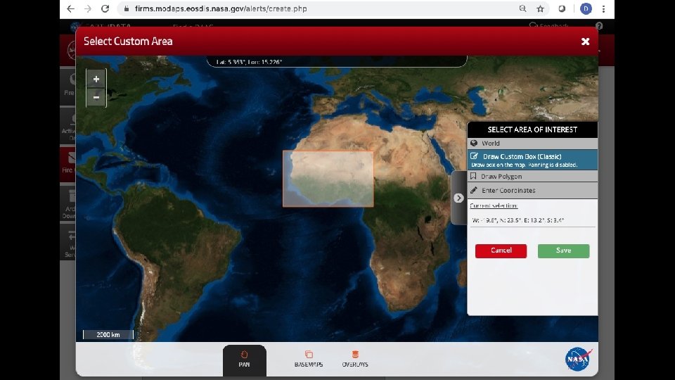

FIRMS Email Notifications of MODIS or VIIRS Hotspot Detections in any Area of Interest FIRMS Fire Alerts: sent to users in over 160 countries. 4, 000 Daily alerts 30, 000 Rapid alerts per day 600 Weekly alerts
 LANCE provides Imagery and Data for near real-time")
Land Atmosphere Near Real-time Capability (LANCE) LANCE provides Imagery and Data for near real-time Applications Air Quality - Dust storms – Fires – Vegetation for agricultural monitoring – Floods – Ash Plumes – Drought – Smoke Plumes – Sea Ice for shipping – Severe Storms 8

LANCE’s Roots: Rapid Response Following the large wildfires in Montana in 2000, the US Forest Service reached out to scientists at NASA and the University of Maryland to request near realtime data and imagery to support wildfire suppression and response. This led to the development of the Moderate Resolution Imaging Spectroradiometer (MODIS) Land Rapid Response System. Photo by John Mc. Colgan, Bureau of Land Management, Alaska Fire Service. Source https: //commons. wikimedia. org/wiki/File: Deerfire_high_res. jpg
 Prompted")
LANCE’s Roots: Expansion of Rapid Response and the Near Real-Time Processing Effort (NRTPE) Prompted by the attack on Sept 11, 2001, there was a sudden need for improved global observational capabilities to support the responding forces in the Middle East that spurred the creation of the NRTPE using the NOAA “bent-pipe” • Initially the near real-time data was used by the USFS for wildfire management in North America but it soon become clear that there were many other applications such as monitoring hurricanes, floods, ash plumes and oil spills and dust storms.
")
GIBS and NASA Worldview NASA EOSDIS developed the LANCE-powered Global Imagery Browse Services (GIBS) in 2011 and the NASA Worldview in 2012. As a result, users can easily download NRT imagery, interactively explore this imagery, and download the underlying data behind this imagery. Left: Screenshot of Worldview showing Corrected Reflectance Imagery (Bands 7, 2, 1) from MODIS Terra. The image shows thick smoke streaming from several fires in southern California
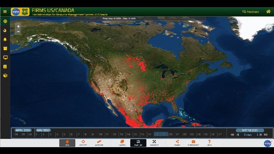

Slide highlighting some of the additional data layers that will go in to the USFS FIRMS

Suggestions for Conclusion? how the concept can be extended to other resource management application areas where the agencies can work together to develop similar tools/applications that leverage NASA NRT data (LANCE, etc. ).

More information on LANCE / FIRMS Hotspot/Active Fire data • Fire Information for Resource Management System (FIRMS): https: //earthdata. nasa. gov/firms Data products • LANCE: https: //earthdata. nasa. gov/lance • Earthdata Search: https: //search. earthdata. nasa. gov/ • Visual search through Worldview https: //earthdata. nasa. gov/worldview Register to download data - Earthdata Login urs. earthdata. nasa. gov/users/new Imagery • Worldview: https: //earthdata. nasa. gov/worldview • Worldview Snapshots: https: //earthdata. nasa. gov/snapshots • Global Imagery Browse Services: https: //earthdata. nasa. gov/gibs Questions: diane. k. davies@nasa. gov or brad. quayle@usda. gov

Back up Slides

Establishment of LANCE was formally established in September 2009. The growing demand for near real-time products and an aging NRTPE system spurred NASA Headquarters to fund a new, more robust system leveraging existing EOSDIS processing facilities and serving NRT data from: • AIRS (Aqua) • MLS (Aura) • MODIS (Aqua and Terra) • OMI (Aura) • AMSR-E (Aqua)

LANCE Approach • Leverage existing science processing expertise to create high quality NRT products • Goal to provide data and imagery within 3 -hours of satellite observation • Provide data products with high reliability using redundant systems • Establish an “umbrella environment” with uniform high-level requirements to ensure consistency and foster coordination and cooperation between the individual elements • LANCE landing page (shown above) to access all LANCE data at lance. nasa. gov • New requirements and enhancements are reviewed and recommended by the LANCE User Working Group chaired by Miguel Roman (USRA)
- Slides: 18