Lecture 6 Part One Total Station Table of

Lecture # 6 Part One Total Station

Table of Contents • What is a Total Station? • Capability of a Total Station • Important Operations of Total Station – – – Distance Measurement Angle Measurements Data Processing Display Electronic Book • Uses of Total Station • Advantages of Using Total Stations • Applications

What is a Total Station? • Total station is a surveying equipment combination of Electromagnetic Distance Measuring Instrument and electronic theodolite. • It is also integrated with microprocessor, electronic data collector and storage system. • The instrument can be used to measure horizontal and vertical angles as well as sloping distance of object to the instrument.

Fig: Total station

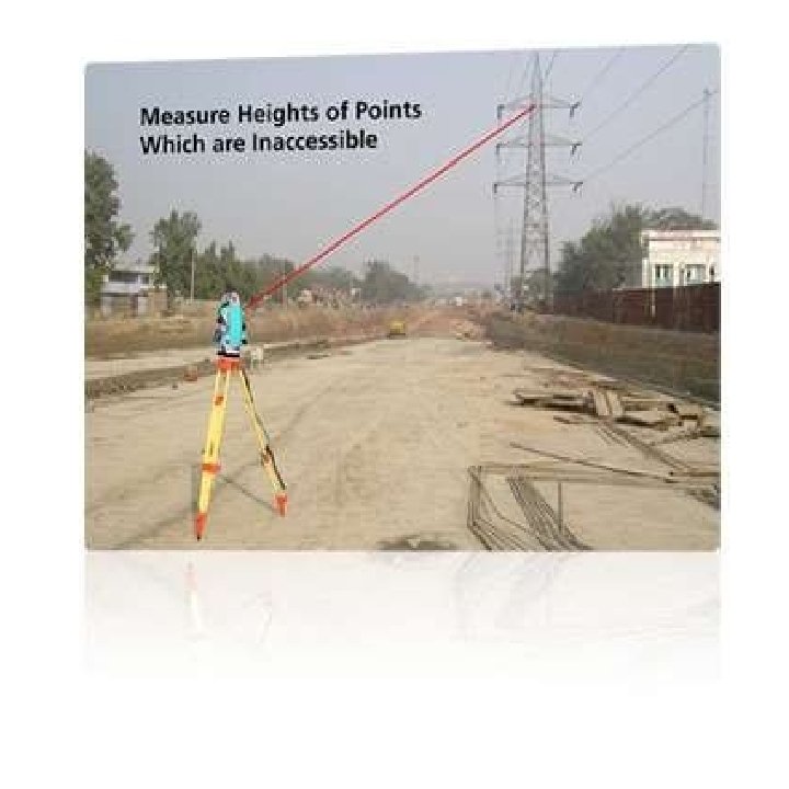
Capability of a Total Station Microprocessor unit in total station processes the data collected to compute: 1. Average of multiple angles measured. 2. Average of multiple distance measured. 3. Horizontal distance. 4. Distance between any two points. 5. Elevation of objects and 6. All the three coordinates of the observed points.

• Data collected and processed in a Total Station can be downloaded to computers for further processing. • Total station is a compact instrument and weighs 50 to 55 N. • A person can easily carry it to the field. • Total stations with different accuracy, in angle measurement and different range of measurements are available in the market. • One such instrument manufactured by SOKKIA Co. Ltd. Tokyo, Japan.

Fig: Parts of total station

Important Operations of Total Station • • Distance Measurement Angle Measurements Data Processing Display
 instrument is a major part of total")
Distance Measurement • Electronic distance measuring (EDM) instrument is a major part of total station. • Its range varies from 2. 8 km to 4. 2 km. • They are used with automatic target recognizer. • The distance measured may be sloping or horizontal or vertical distances from instrument to the object.

Angle Measurements • The electronic theodolite part of total station is used for measuring vertical and horizontal angle. • For measurement of horizontal angles any convenient direction may be taken as reference direction. • For vertical angle measurement vertical upward direction is taken as reference direction. • The accuracy of angle measurement varies from 2 to 6 seconds.

Data Processing • This instrument is provided with an inbuilt microprocessor. The microprocessor averages multiple observations. With the help of slope distance and vertical and horizontal angles measured, when height of axis of instrument and targets are supplied, the microprocessor computes the horizontal distance and X, Y, Z coordinates. • The processor is capable of applying temperature and pressure corrections to the measurements, if atmospheric temperature and pressures are supplied.

Display • Electronic display unit is capable of displaying various values when respective keys are pressed. • The system is capable of displaying horizontal distance, vertical distance, horizontal and vertical angles, difference in elevations of two observed points and all the three coordinates of the observed points.

Uses of Total Station • The total station instrument is mounted on a tripod and is levelled by operating levelling screws. Within a small range instrument is capable of adjusting itself to the level position. Then vertical and horizontal reference directions are taken by focusing telescope of total station with the help of focusing screws. • It is possible to set required units for distance, temperature and pressure (FPS or SI).

• When target is sighted, horizontal and vertical angles as well as sloping distances are measured and by pressing appropriate keys they are recorded along with point number. Then processor computes various information about the point and displays on screen.

Advantages of Using Total Stations • The following are some of the major advantages of using total station over the conventional surveying instruments: • Field work is carried out very fast. • Accuracy of measurement is high. • Manual errors involved in reading and recording are eliminated. • Calculation of coordinates is very fast and accurate. Even corrections for temperature and pressure automatically made.

Applications • Total stations are mainly used by land surveyors and civil engineers, either to record features as in topographic surveying or to set out features (such as roads, houses or boundaries). • They are also used by archaeologists to record excavations etc.

Mining • Total stations are the primary survey instrument used in mining surveying. • A total station is used to record the absolute location of the tunnel walls, ceilings (backs), and floors. • The recorded data are then compared to the designed layout of the tunnel made by CAD program.

Mechanical and electrical construction • Total stations have become the highest standard for most forms of construction layout. • They are most often used in the X and Y axis to lay out the locations of the underground utilities into the foundation, between floors of a structure, as well as roofing. • The coordinates for almost every pipe, conduit, duct and hanger support are available with digital precision.

Meteorology • Meteorologists also use total stations for determining upper- level winds. • With the help of upper level wind the wind speed and direction at different altitudes can be computed. • Additionally, the total station is used to determine the height of cloud layers. • Such upper-level wind data is often used for weather forecasting.
- Slides: 20