LECTURE 4 AERIAL PHOTOGRAPHY Department of City Regional


- Slides: 21
LECTURE # 4 AERIAL PHOTOGRAPHY Department of City & Regional Planning Lahore College for Women University, Lahore Notes by: Saba Islam
AERIAL PHOTOGRAPHY Aerial Photography is the science of obtaining photographs from air using various platforms, mostly aircrafts for studying the surface of earth. It is one of the most common, versatile and economical forms of remote sensing. Remote sensing can be broadly defined as the collection or information about an object or physical phenomenon without being in physical contact with that object.
HISTORY OF AERIAL PHOTOGRAPHY The word “aerial” originated in early 17 th century from Latin aerius , from Greek aerios , from air The term "photography" is derived from two Greek words meaning "light" ( phos ) and "writing“ (graphien). Aerial photography dates to mid 1800, wherein the first photographs were taken using balloons and kites. In 1858, Gasper Felix “ Nadar " took the first aerial photograph from a balloon from an altitude of 1, 200 feet over Paris.
TYPES OF AERIAL PHOTOGRAPHY Aerial photographs are of two types. Vertical Oblique
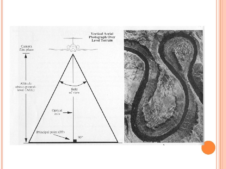
VERTICAL PHOTOGRAPHS These are taken with the camera axis pointing vertically downward Vertical photographs can be truly vertical, or slightly tilted (less than 3 o from the vertical). Most aerial photos are tilted to some degree. Therefore, the use of the term vertical photographs assumes truly vertical photographs, while in reality they might be tilted up to 3 o.
COMPONENTS OF AERIAL PHOTOGRAPHY Field of view – angular dimension covered by the photograph Altitude - Height at which image was collected FOV and Altitude determine ground coverage of the photograph Principal Point - Center of the photograph, the point in the image below the position of the camera
CHARACTERISTICS OF VERTICAL PHOTOGRAPHS Uniform scale throughout the photo, so, making measurements (e. g. , distances and directions) is easier and more accurate. The determination of directions can be performed in the same manner as a map. Easier to interpret than oblique photographs as tall objects (e. g. , buildings, trees, hills, etc. ) will not mask other objects as in oblique photos. Simple to use photogrammetrically as a minimum of mathematical correction is required. To some extent and under certain conditions (e. g. , flat terrain), it may be used as a map if a coordinate grid system and legend information are added.
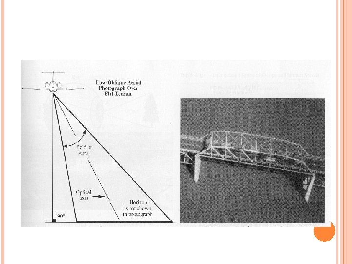
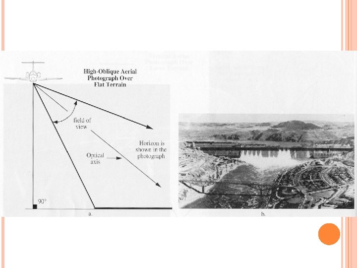
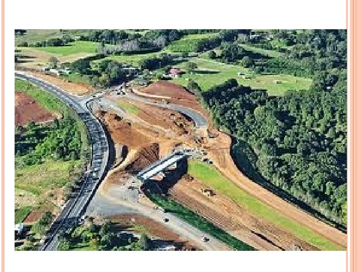
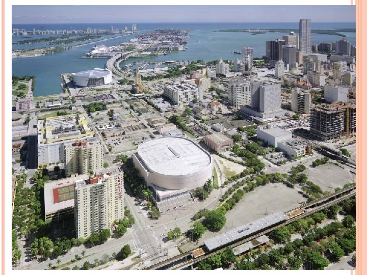
OBLIQUE PHOTOGRAPHS These are taken with the camera axis tilt with an angle between 3 o and 90 o from the vertical. These are of two types. Low oblique (if the horizon is not visible) High oblique (if the horizon is visible)
CHARACTERISTICS OF OBLIQUE PHOTOGRAPHS A more natural view because we are accustomed to seeing the ground features obliquely. Covers much more ground area than a vertical photo taken from the same altitude. Determination of feature elevations is more accurate using oblique photograph than vertical aerial photographs. Tall objects such as bridges, buildings, towers, trees will be more recognizable due to their shadows. Objects that are under trees or under other tall objects are usually visible on oblique photos. Objects, such as cliffs, caves, etc. may not show on a vertical photograph if they are directly beneath the camera.
HIGH OBLIQUE LOW OBLIQUE
HIGH OBLIQUE LOW OBLIQUE
APPLICATIONS OF AERIAL PHOTOGRAPHY Reconnaissance surveys of roads, railways, towns etc. Suitable for the assessment of prohibited areas and inaccessible regions Topographic surveying Urban and/or industrial development Study of Archaeological sites and areas Forestry and geology Show the physical and cultural features of a place have changed over time
APPLICATIONS OF AERIAL PHOTOGRAPHY Flood planning can be based on the aerial surveys made at suitable intervals of time. Capacity of reservoir can be studied in a short time. Excessive damages due to earthquakes can be quickly estimated from aerial photos. For large scale engineering & development projects, preliminary surveys can be undertaken to a large extent from the aerial photos.
PHOTOGRAMMETRY The science of making accurate measurements by means of aerial photography Until the early 1970 s, photogrammetry represented the key method used for the analysis of aerial photographs in order to generate maps – e. g. , it was the foundation for cartography Two types of photogrammetry – Analog and Digital Analogue photogrammetry Visual interpretation using hard copy (photographs or transparencies) Digital or analytical photogrammetry Computer analysis on digitized photography