
Lecture 15 COASTLINES AND BEACH PROCESSES Chapter 12
Lecture 15: COASTLINES AND BEACH PROCESSES Chapter 12
EROSIONAL COASTS • From land – eroded by rivers/streams, abrasion of wind grit, freeze-thaw, plant roots, slumping • From ocean – large waves, transported sediment, marine organisms digging • Rate depends on – hardness/resistance of rocks, wave strength, tidal range • Area of tectonic uplift, lots of cliffs e. g. Pacific coast of U. S. • Erosion more rapid on high energy coasts e. g. Maine
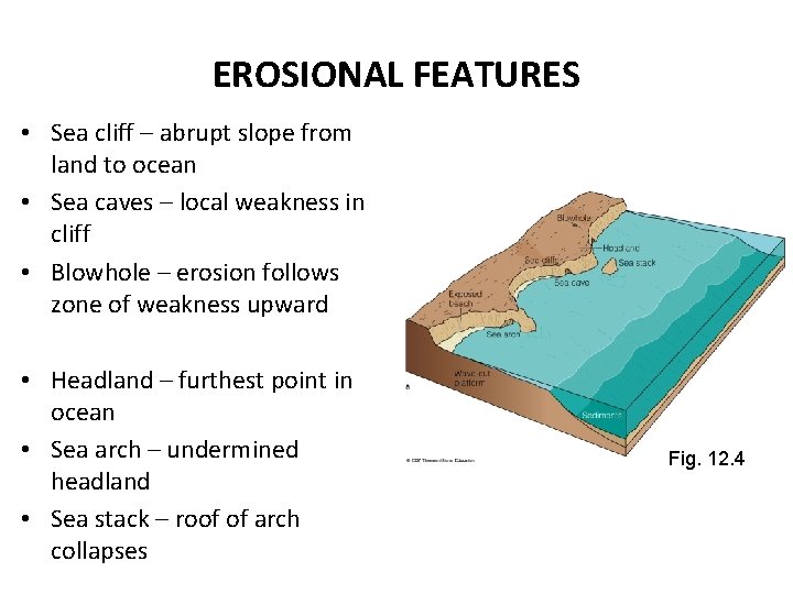
EROSIONAL FEATURES • Sea cliff – abrupt slope from land to ocean • Sea caves – local weakness in cliff • Blowhole – erosion follows zone of weakness upward • Headland – furthest point in ocean • Sea arch – undermined headland • Sea stack – roof of arch collapses Fig. 12. 4
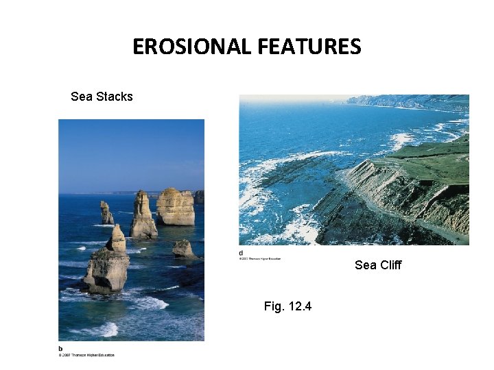
EROSIONAL FEATURES Sea Stacks Sea Cliff Fig. 12. 4

SEA CLIFF FORMATION Fig. 12. 4
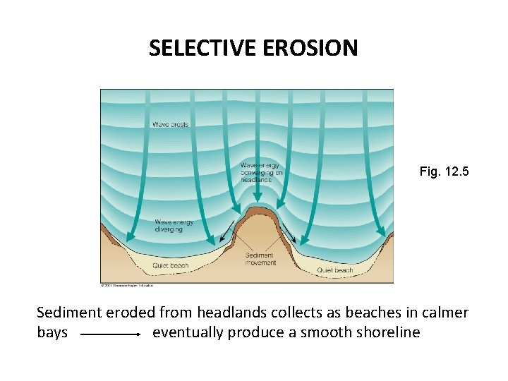
SELECTIVE EROSION Fig. 12. 5 Sediment eroded from headlands collects as beaches in calmer bays eventually produce a smooth shoreline
DEPOSITIONAL COASTS • Dominated by beaches (sediment instead of rock) • Primarily deposited by longshore drift of mobile sediments • Calmer shoreline – beaches, barrier islands, deltas • e. g. Atlantic and Gulf coast of U. S.
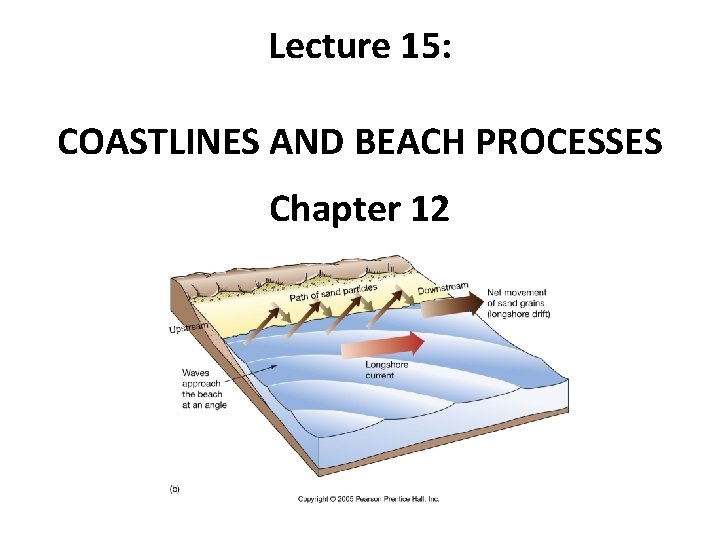
WATER MOVEMENT ALONG BEACH • Perpendicular to shoreline (toward and away) – Swash - water moving up beach – Backwash - returning water (swash – water absorbed in sand) • Parallel to shoreline (up-coast or down-coast) – Longshore current - zigzag pattern of water movement along shore due to waves hitting at slight angle (wave refraction)
LONGSHORE CURRENT • Wave refraction causes water and sand to move parallel to shore • Zigzag motion in surf zone • Longshore current • Longshore transport
SAND MOVEMENT ALONG BEACH • After wave breaks, uprush of water (swash) on beach – Sediment moved toward land • Backwash – Water returns to ocean – Sediment moved away from shore at angle, influenced by longshore currents (zigzag pattern of particle movement)
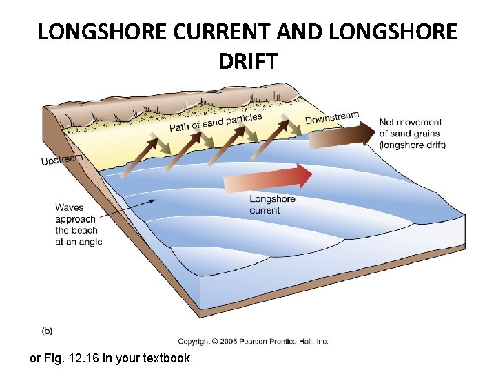
LONGSHORE CURRENT AND LONGSHORE DRIFT or Fig. 12. 16 in your textbook
LONGSHORE TRANSPORT • Millions of tons of sediment moved yearly • Direction of transport changes due to wave approach • In general, sediment transported southward along Atlantic and Pacific coasts of U. S.
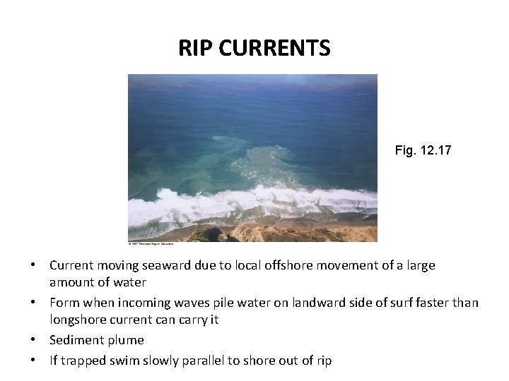
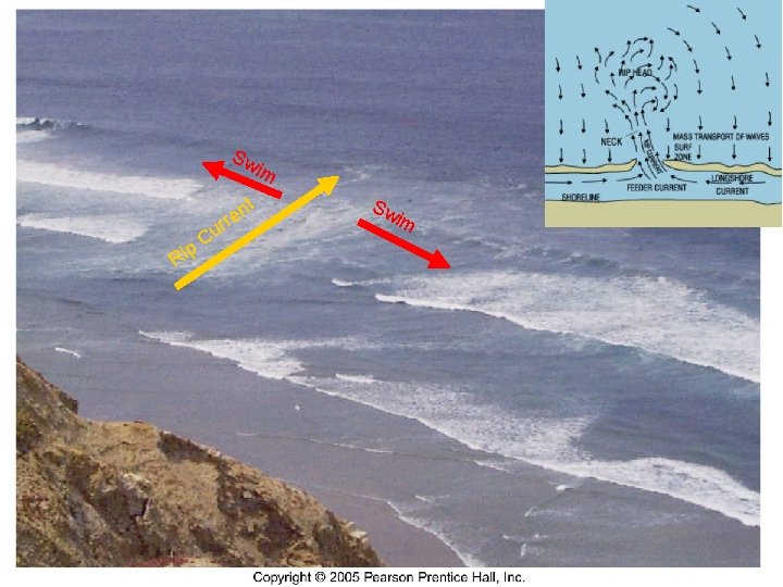
RIP CURRENTS Fig. 12. 17 • Current moving seaward due to local offshore movement of a large amount of water • Form when incoming waves pile water on landward side of surf faster than longshore current can carry it • Sediment plume • If trapped swim slowly parallel to shore out of rip
Sw im nt e rr p Ri Cu Sw im
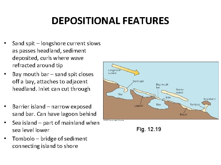
DEPOSITIONAL FEATURES • Sand spit – longshore current slows as passes headland, sediment deposited, curls where wave refracted around tip • Bay mouth bar – sand spit closes off a bay, attaches to adjacent headland. Inlet can cut through • Barrier island – narrow exposed sand bar. Can have lagoon behind • Sea island – part of mainland when sea level lower • Tombolo – bridge of sediment connecting island to shore Fig. 12. 19
BARRIER ISLANDS • Long, narrow offshore deposits parallel to shore • Most developed due to rise of sea level about 18, 000 years ago • Common along East and Gulf coasts of U. S. • Protect mainland from high wave activity
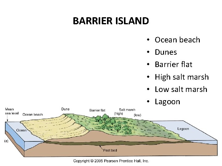
BARRIER ISLAND • • • Ocean beach Dunes Barrier flat High salt marsh Low salt marsh Lagoon
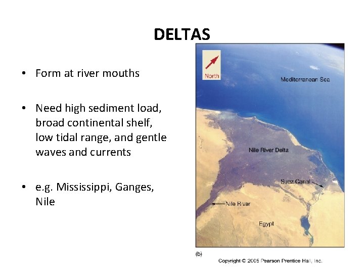
DELTAS • Form at river mouths • Need high sediment load, broad continental shelf, low tidal range, and gentle waves and currents • e. g. Mississippi, Ganges, Nile
ATLANTIC COAST • Most coasts open to wave attack • Barrier islands common • Varied bedrock from resistant rocks to non-resistant sedimentary rocks • Sea level rising about 0. 3 m (1 ft) per century • Drowned river valleys common
GULF COAST • • Low tidal range Generally low wave energy Tectonic subsidence Mississippi delta dominates – Locally sea level rises due to compaction of delta sediments
PACIFIC COAST • • Tectonically rising Rocky headlands, submarine canyons Open exposure to high energy waves Sediment originates from nearby mountains and transported by rivers
- Slides: 21