Latitude What is Latitude Lines of Latitude run


- Slides: 35
Latitude What is Latitude? Lines of Latitude run horizontally Latitude is measured in degrees. The Equator is 0 degrees Latitude. Lines of Latitude locate places North or South of the Equator. § The North Pole is 90 degrees N Latitude, and the South Pole is 90 degrees S Latitude. § §
§ Air generally moves from the poles to the equator, this is because air flows from high pressure to low pressure – High pressure forms when cold air sinks (at the poles) – Low pressure forms when warm air rises (at the equator) § But the air doesn’t flow in a straight line
Does the Earth rotate at the same velocity at all points?
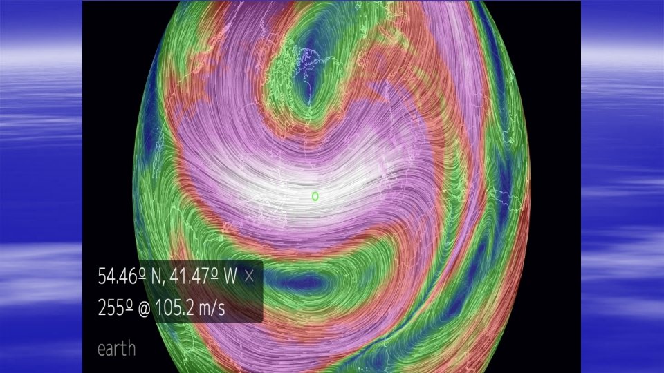
Coriolis Effect § A phenomenon that causes fluids like, water and air, to curve as they travel across and above Earth’s surface. § It is caused by the Earth spinning on its axis § This is the reason hurricanes and tornadoes spin counter clockwise in the Northern hemisphere. https: //youtu. be/dt_XJp 77 -mk https: //youtu. be/i 2 mec 3 vgea. I
§ As warm, moist air rises, it creates a zone of low pressure, clouds, and precipitation along the equator.
Jet Streams • Narrow ‘rivers’ of air that form about 7 miles above the surface of Earth • Typically occur more in the winter when temperatures are more varied • The larger the differences in temperature, the faster the wind speed
Planetary winds § blow across the entire planet § blow at the same speed and direction § Some are high in the atmosphere and you cannot feel them on the ground § Each hemisphere contains 3 wind belts: Trade winds, Westerlies, and Easterlies
• This air flowing back towards the equator produces what are known as the trade winds. • Located between 0 -30º north and south • Called trade winds because many European sailors used these winds for trade • The area near the equator where these winds die out is referred to as the doldrums. • In the Northern hemisphere they are the Northeast Trade Winds and in the Southern hemisphere they are called the Southeast Trade Winds Doldrums
• The air cools and sinks back down to the surface at about 30°north and south of the equator. This sinking air produces areas of higher pressure with drier conditions. 30 degrees- sinking air High Pressure Sahara Desert, New Mexico, Arizona, Southern California, etc.
Horse Latitudes • The Horse Latitudes lie between 30° and 35° • They are known for variable wind mixed with calm
• Winds traveling along the surface of the earth from 30 - 60 degrees north and south of the equator are called WESTERLIES. They flow from the west to the east.
• The air currents moving from the poles at 90°to 60° north and south of the equator, flow from east to west and are referred to as Polar Easterlies. • High pressure over the poles (caused by the sinking cold dense air) causes the air to blow away from the poles toward 60º latitude
Planetary Wind Shift • Because the Earth goes through seasons throughout the year, the wind belts can shift slightly • But the average shift is only about 10º
Local Winds • These winds blow over small areas • Unlike planetary winds, local winds can change speed and direction frequently • These are the winds we feel on the ground • They are influenced by local conditions and local temperature variations
Sea and land breezes are examples of local wind.
Fronts § A boundary between two air masses of different density, moisture, or temperature.
Cold Front – a cold air mass replacing a warm air mass When a cold front passes through, temperatures can drop more than 15 degrees within the first hour. Cold fronts generally move from northwest to southeast. The air behind a cold front is noticeably colder and drier than the air ahead of it.
Warm Front When a warm front passes through, the air becomes noticeably warmer and more humid than it was before. A warm air mass is replacing a cold air mass. Generally move from SE to NW. The air is generally warmer and more moist than the air preceding it.
Stationary Front – a front that is not moving When a warm or cold front stops moving, it becomes a stationary front. Once this boundary resumes its forward motion, it once again becomes a warm front or cold front.
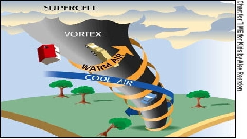
Occluded Front – when a cold front takes over a warm front A cold front essentially wraps around a warm front and typically forms a tornado. The warm, humid air rises while the cold front that has wrapped around moves toward the ground. Symbolically, an occluded front is represented by a solid line with alternating triangles and circles pointing the direction the front is moving. .
Tornado Alley https: //youtu. be/7 KDz 6 d. GQ 5 RE
Fujiti Scale
DAMAGING WINDS Damage from a downburst Damage from a tornado
Jarrell, TX — May 27, 1997
Severe Weather Safety § § § Watches- conditions are favorable Warnings- conditions already exist Examples- Tornadoes, Flooding, Thunderstorms, Blizzards, Winter Mixes and Hurricanes
Severe Weather
Flooding For each foot of rising water, a car weighs 1500 pounds less! As little as 18 inches of water can float a truck! It takes only 12 to 14 inches of water to float a car!
Hurricane https: //youtu. be/k 35 Gwb 0 FFU 0
Hurricane Scale
Hurricane vs Tornado § https: //youtu. be/W 0 Lsk. Be_Qf. A
Dry Line is a moisture boundary. A dry line is a boundary that separates a moist air mass from a dry air mass.
Air Mass Map
Weather Front Worksheet