Landscapes the general shape of the land A

- they build up the Earth")
- they decrease the elevation of the Earth’s surface.")


, distorted bedrock, usually igneous")


- Slides: 16
Landscapes -the general shape of the land
A. Forces that Shape the Earth 1. Uplifting Forces(Constructive)- they build up the Earth and enlarge the surface area of continents. a. Folding/Faulting b. Earthquakes c. Volcanoes
A. Forces Continued 2. Leveling Forces(Destructive)- they decrease the elevation of the Earth’s surface. a. Subsidence or sinking of the land. b. Weathering c. Erosion
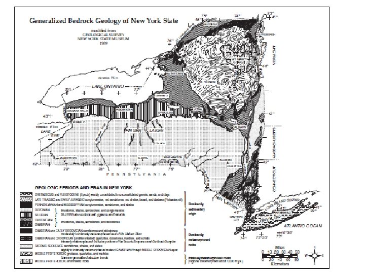
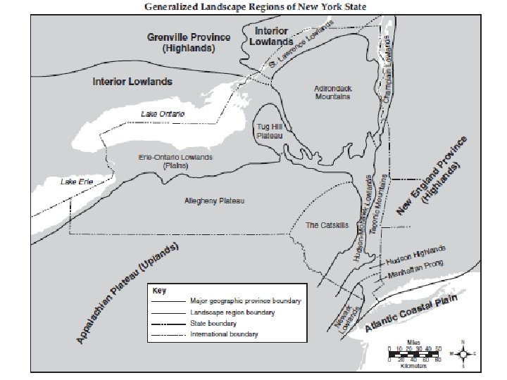
B. Landscape Regions Characterized by: 1. Relief - changes in elevation 2. Internal Rock Structure
I. Types A. Plains-Lowlands 1. Usually composed of horizontal, sedimentary rock, has a low elevation and generally level surface with little change in slope. 2. Streams meander over a broad flood plain.
B. Plateaus-Uplands 1. Medium elevation, steep to gentle slopes, horizontal sedimentary bedrock. 2. Streams have a high velocity with rapids and meanders.
C. Mountains-Highlands 1. High relief(distance from highest to lowest elevation), distorted bedrock, usually igneous or metamorphic. 2. High elevation, streams have a high velocity.
C. Climate Factors 1. Humid regions have rounded hills, more vegetation.
2. Arid regions have angular landforms, very little vegetation. Monument Valley State Park, Utah
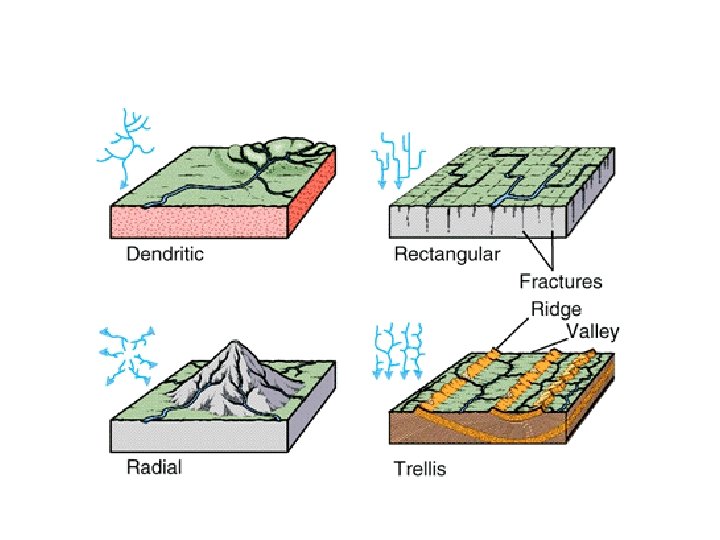
D. Stream Drainage Patterns 1. Dendritic -found on gentle sloping landscapes-PLAINS
2. Radial- streams flow down a mountain side.
3. Trellis -forms in areas that have undergone faulting or folding.
4. Annular- found on domed mountains with resistant bedrock and erosion.