Land Use and Land Cover Change Isaac Gerg


![Visible Wavelength Sensors Sensor Launch Date GSD [m] Orbview 2, 3 Kompsat-1 Ikonos 1997, Visible Wavelength Sensors Sensor Launch Date GSD [m] Orbview 2, 3 Kompsat-1 Ikonos 1997,](https://slidetodoc.com/presentation_image/cc1411b7d6c6d5887dac38b0a3d504d6/image-6.jpg)


- Slides: 23

Land Use and Land Cover Change Isaac Gerg

Land Cover & Usage Timeline n History n Playing Field n Visible n Multispectral n Hyperspectral n SAR n

80 70 S p -X IIR a EM 1 - V En. M n. D ye- S 1 1 3 - T a o E MI w - X 2 20 011 – Ge TE vie R- TR rl d S A A 2 09 S A 2 0 0 8 - W o rra R 2 2 0 0 0 8 - T e D A A R t -2 T 2 07 – RA LS sa SA 2 0 0 7 – P A mp O 3 20 07 – K o RM ew 20 06 - FO bvi 3 08 20 006 - O r S S - O 20 4 – I 2 0 S L M I 20 03 – NE R d 2 0 0 3 - ME A R b i r -4 04 20 02 – AS ick ew 20 02 - Qu bvi S n 20 03 2 0 0 2 – O r R I ri o 20 001 – CH pe 20 y 2 01 – S I H I 02 20 01 – A L D -7 20 000 – MO ISR sat t-1 20 d sa 2 00 – M n 2 0 9 9 – L a mp s 1 01 9 1 99 – K o no R 2 T 20 19 99 – ko TE w A I e S i 9 00 9 – 1 9 A S bv R AR 20 19 99 – O r DA -S 19 99 – RA S R / X 1 9 9 7 – A T -C -1 19 95 – S I R RS 19 95 – JE I at 19 994 – A M as T 1 92 – S e O R 1 19 91 – SP HR sat 19 87 – A V nd 19 986 – La 8 – 90 1 97 72 19 19 19

History n n n 1858: First aerial pictures by French photographer and balloonist Nada over Paris, France. 1959: Explorer 6 takes first satellite image of earth. 1972: Birth of Landsat and birth of spaceborne MSI. 1972: Blue Marble from Apollo 17. 1977: KH-11 series satellites give first near real-time imagery. 2007: Worldview-1 has current lowest commercial GSD @ 0. 5 m for a satellite.

The Playing Field (μm) Sample HSI Sample MSI
![Visible Wavelength Sensors Sensor Launch Date GSD m Orbview 2 3 Kompsat1 Ikonos 1997 Visible Wavelength Sensors Sensor Launch Date GSD [m] Orbview 2, 3 Kompsat-1 Ikonos 1997,](https://slidetodoc.com/presentation_image/cc1411b7d6c6d5887dac38b0a3d504d6/image-6.jpg)
Visible Wavelength Sensors Sensor Launch Date GSD [m] Orbview 2, 3 Kompsat-1 Ikonos 1997, 2003 1999 6 1999 1 USA Korea USA Quickbird FORMOSAT-2 Kompsat-2 Worldview-1 Geo. Eye-1 (Orbview-5) 2001 2004 2006 2007 2008 USA Taiwan Korea USA 0. 6 2 1 0. 5 0. 41 Country

Houston, TX 10/07 via Worldview-1

Houston, TX 10/07 via Worldview-1

Utility of MSI n n n n n NDVI Crop growth stage Fire detection Surface Temperature Landcover usage (NLCD) Deforestation monitoring Mineral mapping Soil Brightness Index (SBI) Green Vegetation Index (GVI)

Multispectral Sensors Sensor Platform Launch Date Country MSS, ETM+ Landsat 1 -7 1972 -99 USA AVHRR NOAA POS 1978 -88 USA 1986 -2002 France SPOT ATSR ERS-2 1995 ESA MODIS Terra, Aqua 1999, 2002 USA ASTER Terra 1999 USA MISR (multi-angle look) Terra 1999 USA ALI EO-1 2000 USA MERIS Envisat 2002 ESA LISS-3, 4 Resource. Sat-1 2003 India VIIRS NPOESS USA 2013

Land Cover Classification

MODIS Fire Map

MODIS NDVI

Landsat Program n Sats launched 1972 -1999 7 satellites (Landsat 6 failed to reach orbit) Only 5 and 7 still functioning Multispectral (MSS) on Landsat 1 -5 Thematic Mapper (TM) sensor on Landsat 4 & 5 ¨ 0. 45 um – 2. 35 um + thermal band (10. 4 -12. 5) n n n Enhanced Thematic Mapper (ETM+) on Landsat 7 Landsat 1: 18 day revisit, RBV, MSS Landsat 2: 18 day revisit, RBV, MSS Landsat 3: 18 day revisit, RBV, MSS, first with thermal band Landsat 4: 16 day revisit, TM, MSS, 30 m max resolution Landsat 5: TM, MSS, 16 day revisit, provide global archive of satellite photos, TM Landsat 7 (ETM+, 16 day revisit, 15 m resolution panchromatic, 60 m thermal resolution, Current, cloud free imagery) ¨ ETM+ has 8 bands including thermal

Utility of HSI Material abundance maps (MAMs) n Subpixel detection n Automatic target recognition (ATR) n Crop health n Crop type n

Hyperspectral Sensors Sensor Platform Launch Date Country Hyperion (220 bands) EO-1 2000 USA CHRIS PROBA-1 2001 ESA 2001 (DNO) USA Orbview-4 ARIES Australia NEMO ARTEMIS (~400 bands) En. Map Tac. Sat-3 Cancelled 2002 USA 2008 USA 2011 Germany

Mineral Maps of Cuprite, NV

MAM from Moffett Field, CA

Utility of SAR Polarization n All weather n DEM n Urban density n Soil moisture n Crop type n

SAR Sensors Sensor Platform Seasat AMI ERS-1, 2 JERS-1 SIR-C/X-SAR Launch Date Country 1987 USA 1991, 1995 ESA 1992 -1998 Japan Endeavor 1994 RADARSAT-1, 2 USA 1995, 2007 Canada ASAR Envisat 2002 ESA PALSAR ALOS 2006 Japan Terra. SAR-X 2007 Germany Tan. DEM-X 2009 Germany

SIR-C/X-SAR Examples

Questions?

References n See slide notes.
 Hirschburg test
 Esophoria
 De 4 kundetyper
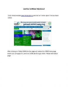
 Hmda dpms citizen search
 Chapter 10 urbanization
 Global land cover facility
 St. marys county land use and zoning lawyer
 Characteristics of a well-prepared upland field
 What is physical changes
 Absolute change and relative change formula
 Difference between chemical and physical property
 Change in supply and change in quantity supplied
 Chemical change and physical change
 Rocks change due to temperature and pressure change
 Physical change and chemical change venn diagram
 First and second order change
 What are landforms
 Grassland landforms
 How do destructive forces change the land's surface
 How you use ict today and how you will use it tomorrow
 Newton childhood
 Isaac has 43 nickels and quarters in his wallet
 Similarities between abraham and isaac
 Isaac and albert were excitedly describing the result


