
Land Navigation Summer Project Unit Introduction Landbased outdoor
Land Navigation Summer Project
Unit Introduction Land-based outdoor and adventurous activities are widely used by many providers of outdoor experiences. The core land-based activities include mountain walking, rock climbing, mountaineering, caving and orienteering. However, there is a variety of different outdoor programmes, dictated by client demand or access to resources, including activities such as downhill skiing, Nordic skiing, snowboarding, mountaineering and trekking. This unit develops and enhances learners’ abilities and understanding of land-based activity skills. It focuses on the concept of the good practitioner in the outdoors, whilst recognising that knowledge and understanding of the nature and ethos of the activity are essential. 2
“ “Navigation is a vital skill that makes outdoor activities more enjoyable and has the potential to save your life” 3
Why is navigation important? Mind Map Task Create a mind map on paper or on computer (e. g. Word, Power. Point) which explores how and why navigation is important. Your mind map should fill an A 4 sheet of paper. You may want to carry out some research by finding articles or watching videos on You. Tube.
Basic Direction You are probably familiar with the mnemonic ‘Never Eat Shredded Wheat’ or ‘Naughty Elephants Squirt Water’? These phrases are used to teach students what are known as the basic cardinal points of a compass. North, East, South, West. Can you think of a modern version of the above mnemonics which may help students in your class remember these important points? 5
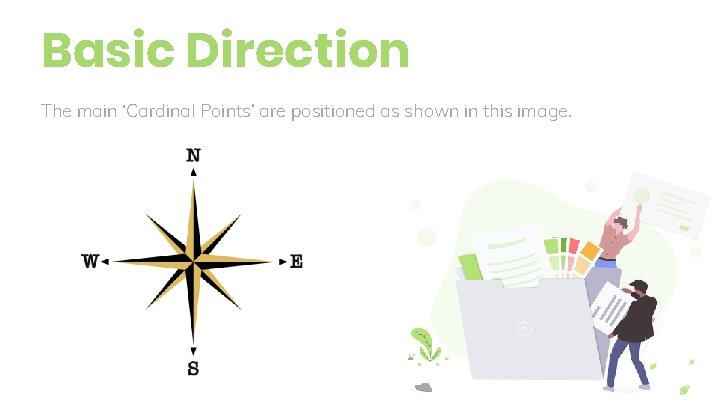
Basic Direction The main ‘Cardinal Points’ are positioned as shown in this image.
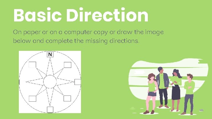
Basic Direction On paper or on a computer copy or draw the image below and complete the missing directions. 7
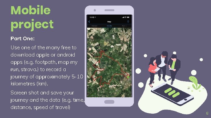
Mobile project Part One: Use one of the many free to download apple or android apps (e. g. footpath, map my run, strava. ) to record a journey of approximately 5 -10 kilometres (km). Screen shot and save your journey and the data (e. g. time, distance, speed of travel) Place your screenshot here 8
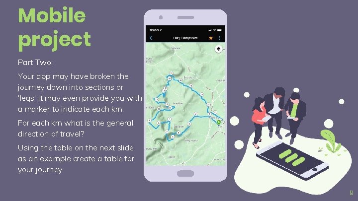
Mobile project Part Two: Your app may have broken the journey down into sections or ‘legs’ it may even provide you with a marker to indicate each km. Place your screenshot here For each km what is the general direction of travel? Using the table on the next slide as an example create a table for your journey 9
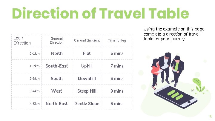
Direction of Travel Table Leg / Direction General Gradient Time for leg 0 -1 km North Flat 5 mins 1 -2 km South-East Uphill 7 mins 2 -3 km South Downhill 6 mins 3 -4 km West Steep Hill 9 mins 4 -5 km North-East Gentle Slope 6 mins Using the example on this page, complete a direction of travel table for your journey. 10
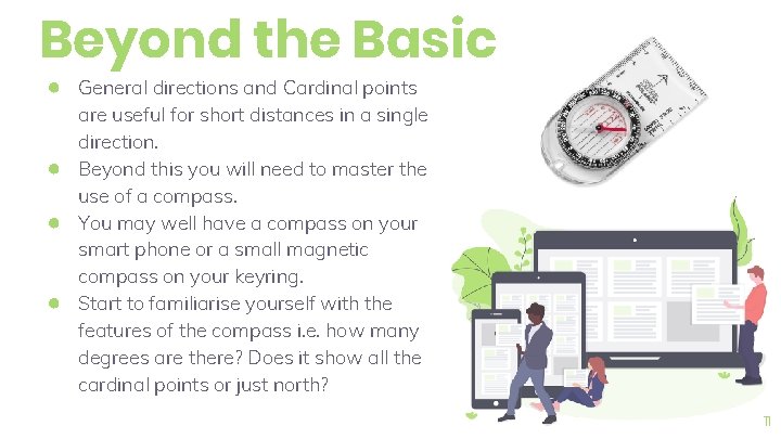
Beyond the Basic ● General directions and Cardinal points ● ● ● are useful for short distances in a single direction. Beyond this you will need to master the use of a compass. You may well have a compass on your smart phone or a small magnetic compass on your keyring. Start to familiarise yourself with the features of the compass i. e. how many degrees are there? Does it show all the cardinal points or just north? 11
Which Activity? For the purpose of this practical activity we will assume that you do not have access to a compass. (If you do have a compass, wait until you have used one of the practical methods and then use the compass the check if you were right!) Choose one of the practical methods shown on the following slides and carry out a video or photo vlog/blog of you attempting to use it: 12
Finding North without a Compass Stars Sun Watch It is possible to use the stars to navigate and this method has been successfully used by navigators for thousands of years. Can you do this? It is possible to use the sun and the shadow which it casts on the ground to establish which direction is North. Can you do this? It is possible to use an analogue watch (one with hands, even digital hands) to establish which direction is North. Can you do this? 13
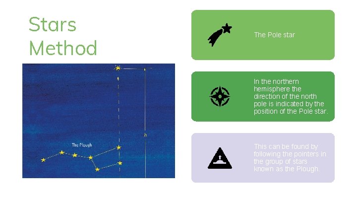
Stars Method The Pole star In the northern hemisphere the direction of the north pole is indicated by the position of the Pole star. Stars This can be found by following the pointers in the group of stars known as the Plough.
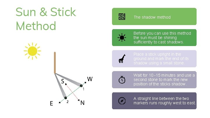
Sun & Stick Method The shadow method Before you can use this method the sun must be shining sufficiently to cast shadows. Place a stick upright in the ground and mark the end of its shadow using a small stone. Sun Wait for 10 -15 minutes and use a second stone to mark the new position of the sticks shadow. A straight line between the two markers runs roughly west to east.
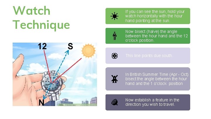
Watch Technique If you can see the sun, hold your watch horizontally with the hour hand pointing at the sun. Now bisect (halve) the angle between the hour hand the 12 o’clock position. This line points due south. In British Summer Time (Apr - Oct) bisect the angle between the hour hand the 1 o’clock position Now establish a feature in the direction you wish to travel.
Video or Photo Task Please make sure that the photos or videos that you create can be seen and heard clearly. Place your screenshot here If you need assistance from family to create your vlog/blog that is fine. 17
Save Your Work ● These Mini-Projects should take some time to complete. Do not rush them. ● Please get into the good habit of saving your work with a title that ensures you can find it again to keep working on it and to upload it. ● Keep it safe. You will be asked to submit or bring your work with you in September so that your lecturers can check and provide feedback. 18
Looking Forward to seeing you in September!
- Slides: 19