Lab 12 Landslides and Shoreline Hazards Geography 1

Lab 12: Landslides and Shoreline Hazards Geography 1 L: Physical Geography Lab

How can you predict what homes are at risk of suffering from a landslide?

After Weathering, rock material is Transported via Mass Movement, this is what endangers homes

What causes the weathered rock to be transported via mass movement? • All mass movements occur on slopes under the influence of gravitational stress • The steepness of the resulting slope depends upon the size and texture of the rock, this steepness is the angle of repose • The angle represents the equilibrium between gravity and the friction of the rock parts

Knowing the different types of mass Movements can help in avoiding building in hazardous areas Gravity will pull on rock debris until a critical shear failure, then the material will move. 1. Fall: Rock Falls and Debris Avalanches 2. Slide: Landslides 3. Flow: Earth Flows and Mud Flows 4. Creep: Soil Creep 5. Human Causes: Scarification Water content of regolith is important in determining what type of mass movement will occur
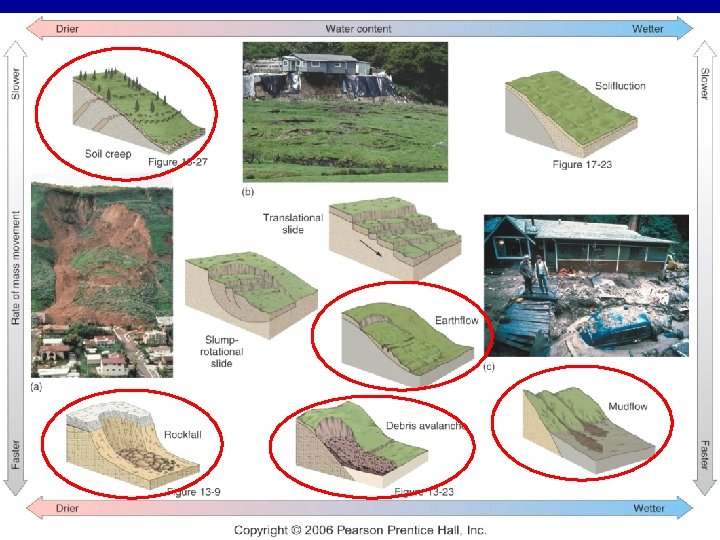

Fall: Rock Falls and Debris Avalanches Rock fall: a volume of rock that falls through the air and hits a surface. Debris Avalanche: a mass of falling and tumbling rock, debris and soil. Tremendous speed and lack of warning

Fall: Rock Falls and Debris Avalanches Debris Avalanche Rock Fall: Note the Talus Slope

Landslides: typically the most dangerous for homes • Landslide: A sudden rapid movement of a cohesive mass of regolith or bedrock that is not saturated with moisture • Common in hilly, mountainous areas where active faulting occurs

La Conchita Landslide

La Jolla Landslide

Earth flows and Mud flows • When moisture content is high the surface flow is used for mass movements. • Earth flows: A flowing mass of soil and rock mixed with water • Mudflows have a higher water content and move faster.

Mudflow Earth flow

Soil Creep: The slowest home destroyer • A persistent, gradual movement of regolith • Soil particles are lifted and disturbed by cycles of moisture, freezing, temperature, grazing livestock, or digging animals • May cause fence posts, utility poles, and trees to lean down slope
: • Every human disturbance of a slope – highway,")
Human Induced Mass Movement (Scarification): • Every human disturbance of a slope – highway, road cut, surface mining, or building of any structure – can hasten mass wasting because of destabilization of the surface

How can you predict what homes are at risk of suffering from a landslide? • Homes at highest risk are built: • Along Steep slopes in hilly or mountainous areas: more gravitational pull: more mass movement to reach angle of repose • On bedrock that is heavily jointed: more rock fall, debris avalanche, and landslide hazard • Where active faulting disturbs rocks • In climates with heavy soil moisture content precipitation: Earth and Mudflows

Coastal Field Trip

Big Sur, CA

Erosional Coast Figure 16. 13

High Wave Energy

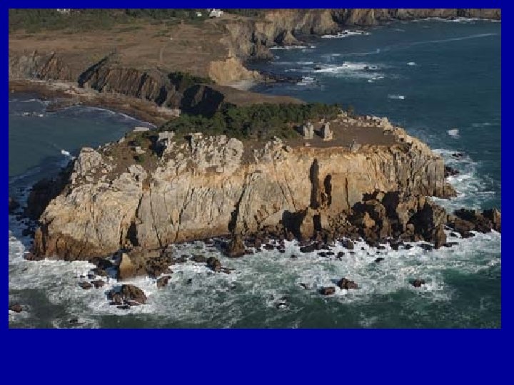
Sea Cliff, Sea Cave, Notched Cliff

Sea Stack, Land Slides

Terraces, Sea Arch, Happy Cows?

Coastal Field Trip

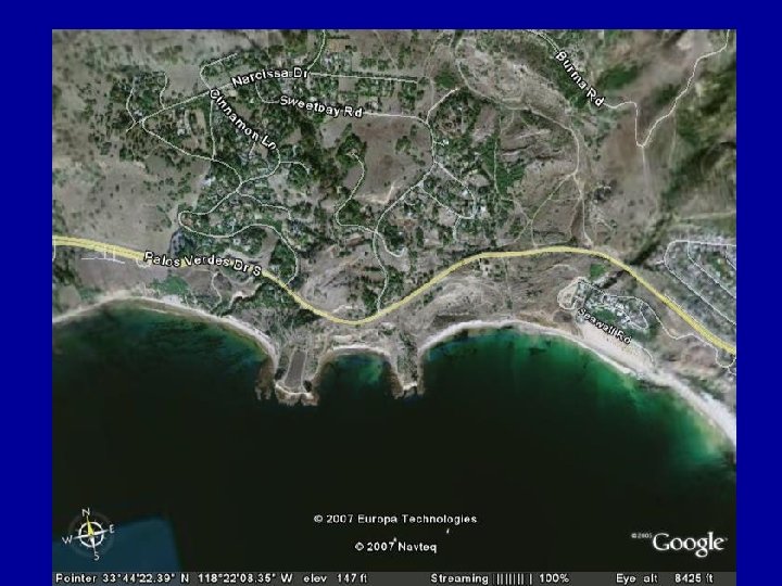
Palos Verdes, CA
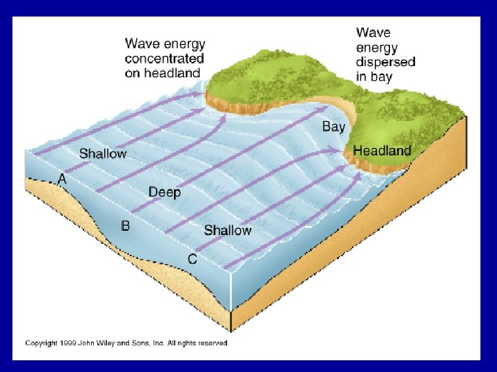

Three Headlands

Where are the waves more intense?

Sea Caves

Headland

Pocket Beach

Tumbolo

Coastal Field Trip

Palos Verdes

Trump National
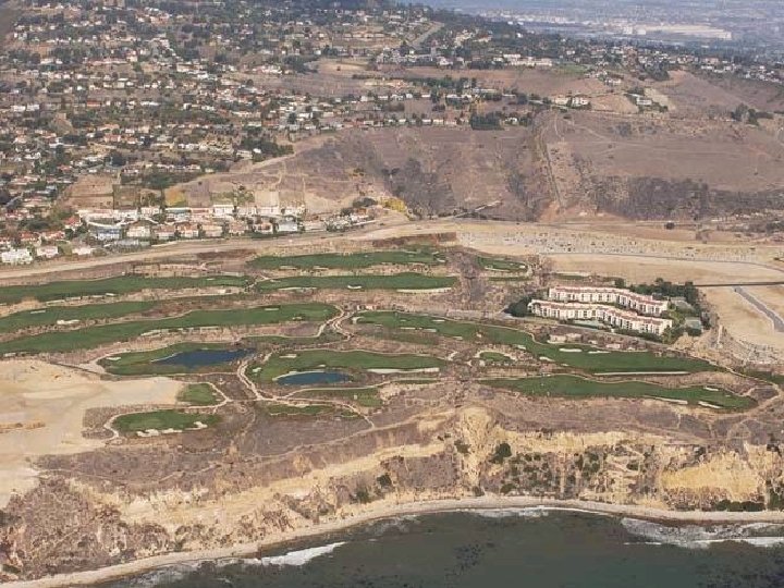

18 th Hole

Juneau, AK

Tracy Arm Fjord, AK

Tracy Arm Fjord, AK

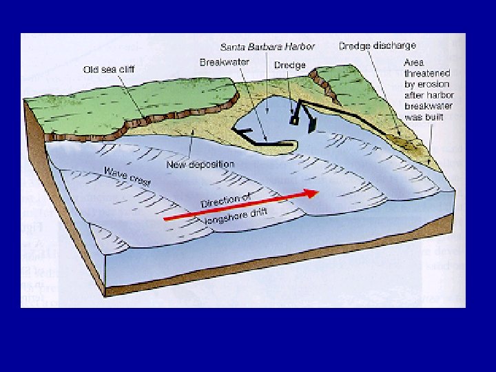
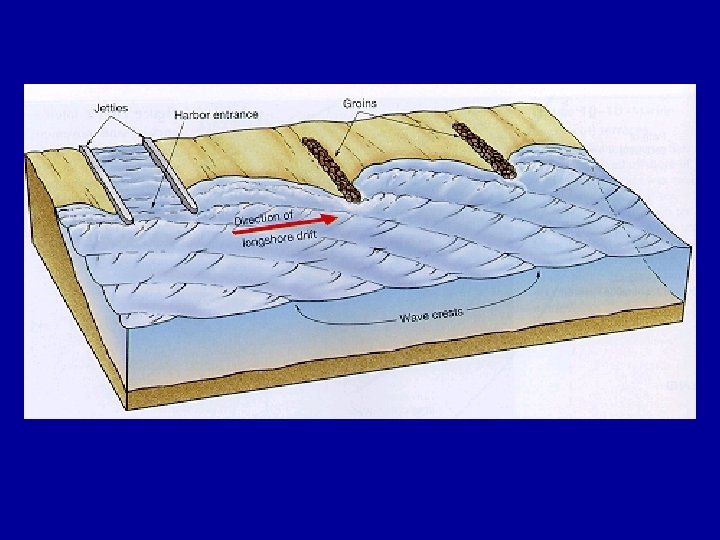
Depositional Coasts • • Beaches Sand bars Long shore drift Rip Currents Sand Spits Mouth bars Barrier Islands, Sea islands Deltas,

Coastal Field Trip

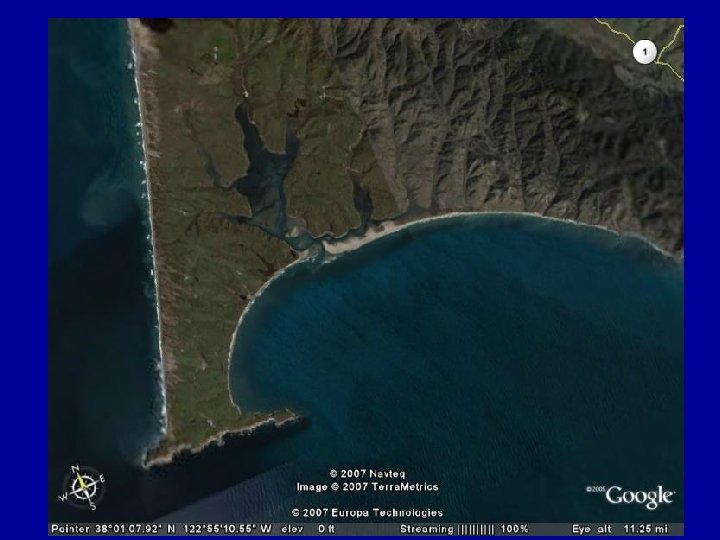
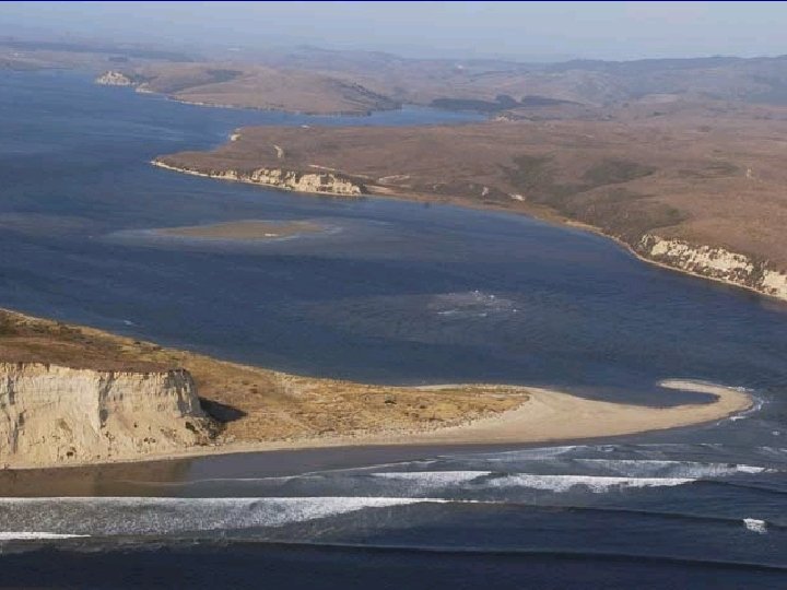
Pt. Reyes
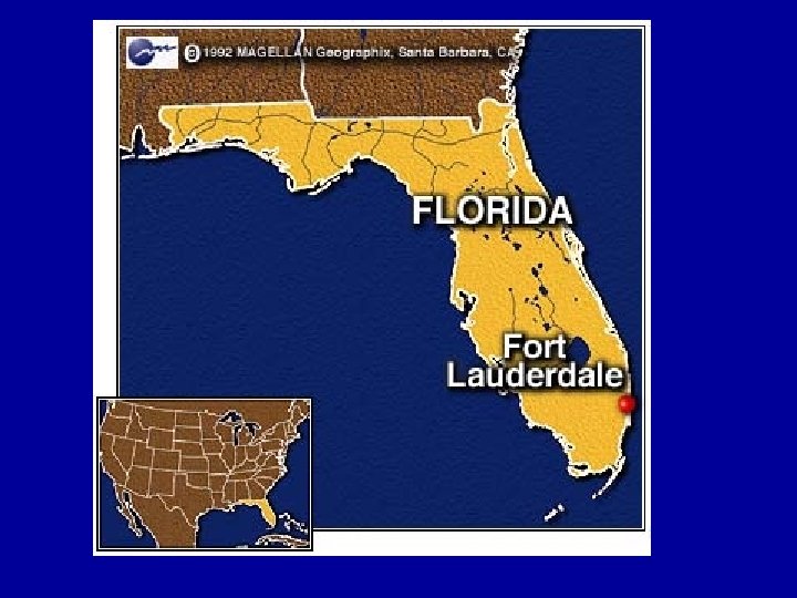

Ft. Lauderdale, FL

Sandy Beaches, Smaller Waves

Sandbar Surf

Sandbar Daytona Beach, FL

Daytona Beach Sandbar at Low Tide

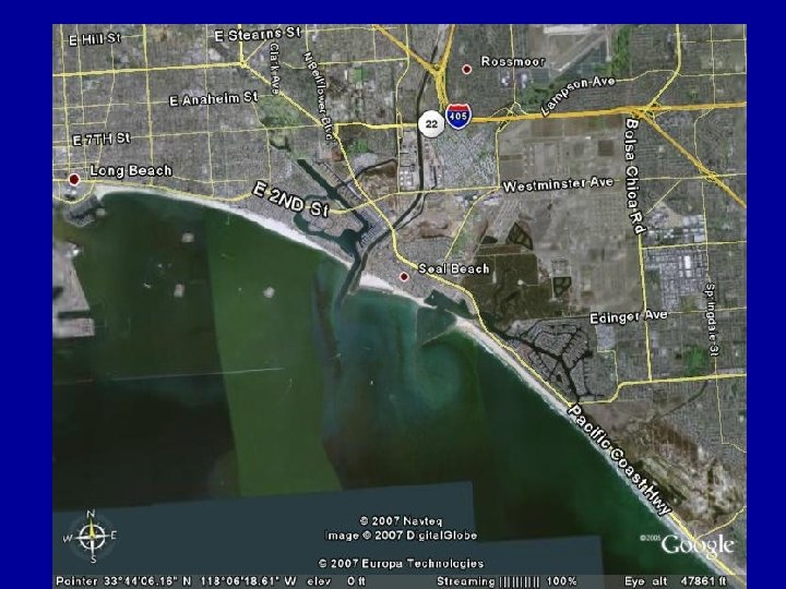
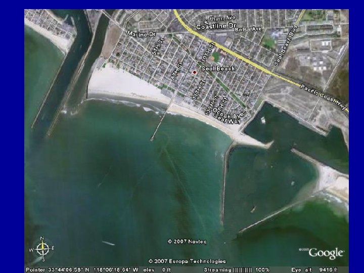
Long Beach

Pt. Reyes

Rip Currents

Rip Currents

Pt. Arena

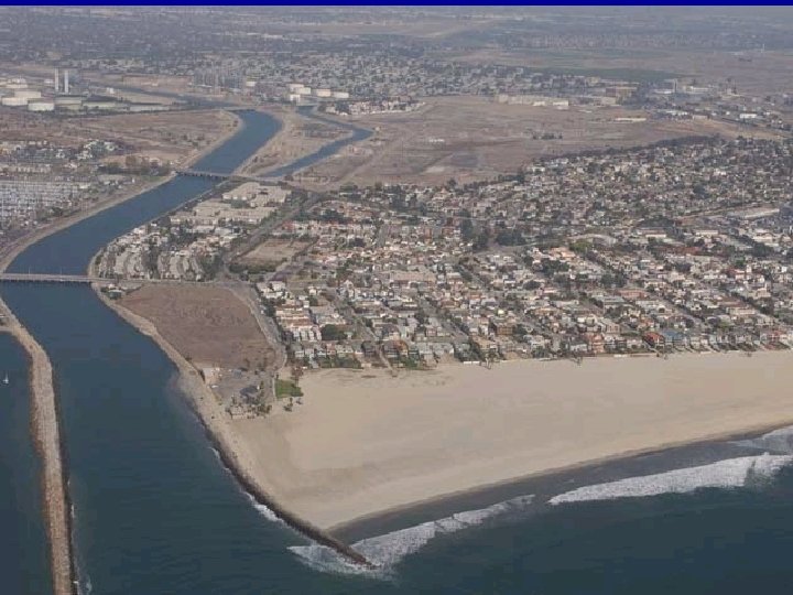
Mouth Bar

Mouth Bar

Mouth Bar

Coastal Field Trip

Mobile, AL

Barrier Island, Bay Mouth Bar

Delta, New Orleans

Depositional Coasts • • Beaches Sand bars Long shore drift Rip Currents Sand Spits Mouth bars Barrier Islands Deltas

Erosional Coasts – High wave energy – Sea Cliffs, Sea Cave, Notched Cliff – Sea Stack, Land Slides – Terraces, Sea Arch – Headlands, Shore straitening – Long shore transport, Pocket Beach – Tumbolo – Rover Mouths – Fjords

Lab 12: Landslides and Shoreline Hazards Geography 1 L: Physical Geography Lab
- Slides: 75