KRISHI ICAR GEOPORTAL Spatial Agricultural Research Information http


 is online Ø http: //krishi. icar. gov. in/geoportal Ø Some")


, ADG(SWM), DIR(IASRI), DIR(IARI), DIR(NBSS) Dr")


- Slides: 32
KRISHI: ICAR GEO-PORTAL Spatial Agricultural Research Information http: //krishi. icar. gov. in/geoportal 4 -Aug-2015, NASC, New Delhi
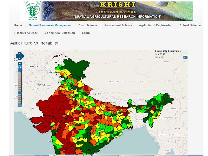
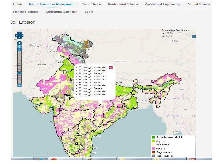
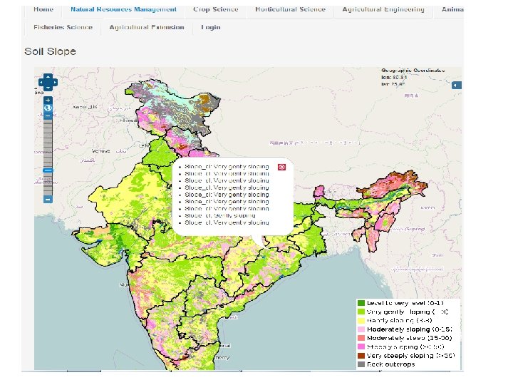
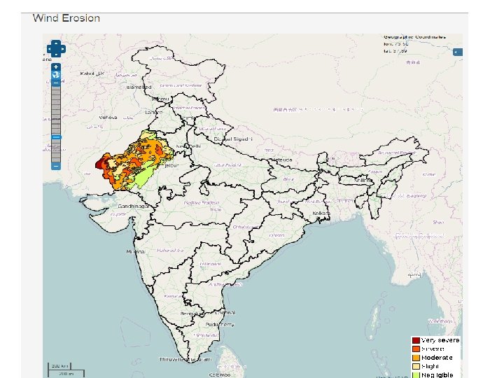
Background • • One of the Six Research Data Repositories of ICAR KRISHI Portal Aims to provide a digital platform in public domain to - to facilitate generation and compilation of data of agriculture having spatial context - to store/host spatial database generated in NARS - to provide visualization of spatial data as maps with contextual attributes - to assimilate existing spatial agricultural data from other sources - to provide tools for analysis of spatial data - to allow spatial data access and sharing to clients across platform and GIS flavours - strengthen in-house technical capabilities
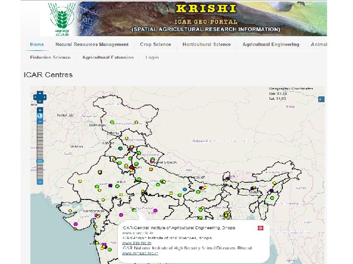
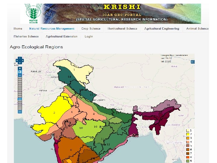
Status ØVersion 1 (beta) is online Ø http: //krishi. icar. gov. in/geoportal Ø Some of the spatial layers finalized and made online Ø Configured on ICAR Data Centre at IASRI ØVersion 2 with enhanced capabilities under development Øhttp: //14. 139. 56. 74: 8080/geoexplorer/ Ø Available on development server at IARI
Technologies Used • Open source technologies • Total in-house development • Server Side • Linux (Redhat ver. 6. x) • Apache http server (ver 2. 4) • Apcahe Tomcat server (ver 7. 0. 6) • Programming Language: PHP (ver 5. 4) • Geoserver (ver 2. 6) : provide WMS service • Database Engine: My. Sql, Post. GIS • Client Side • Java. Script • OSM (Open Street Layer) • Open Layers • HTML, CSS, Jason • CMS: Joomla
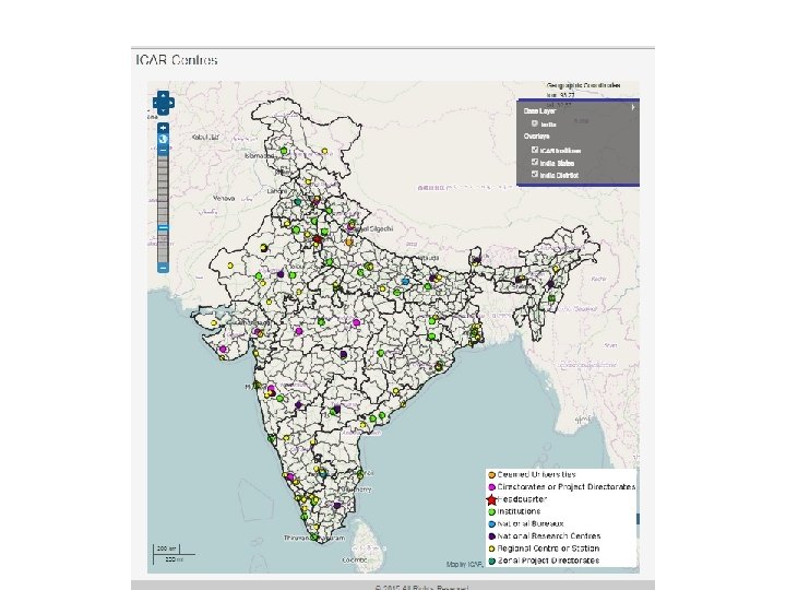
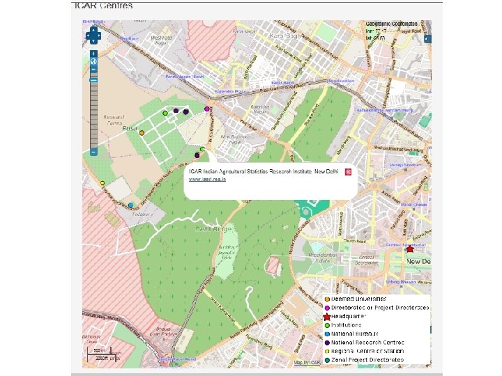
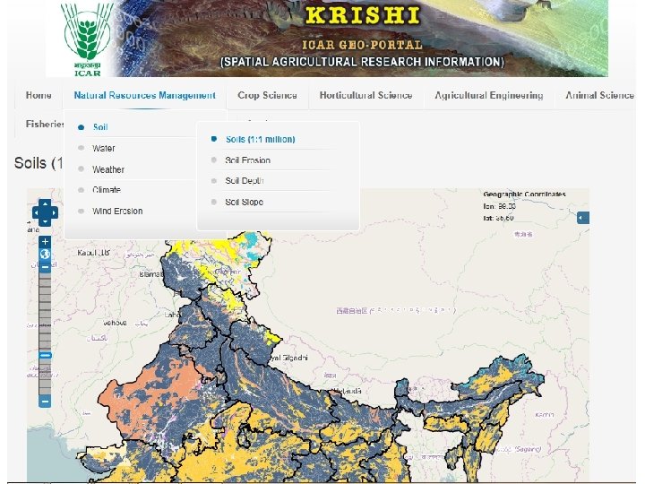
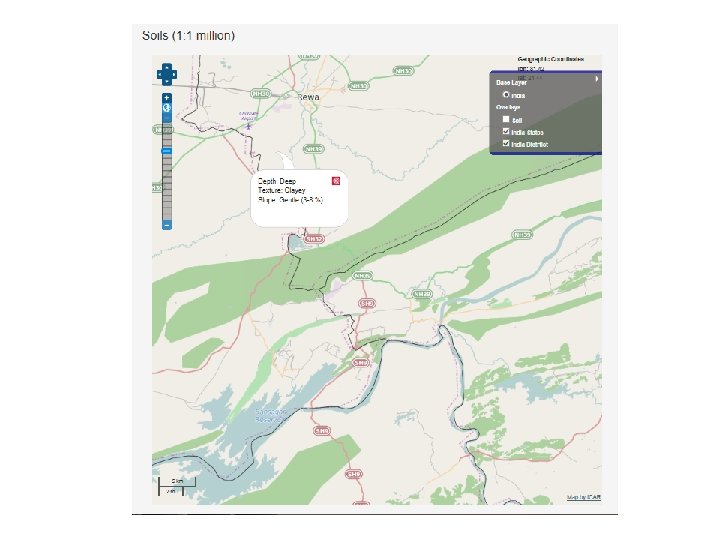
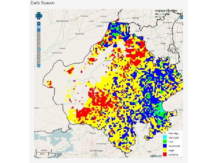
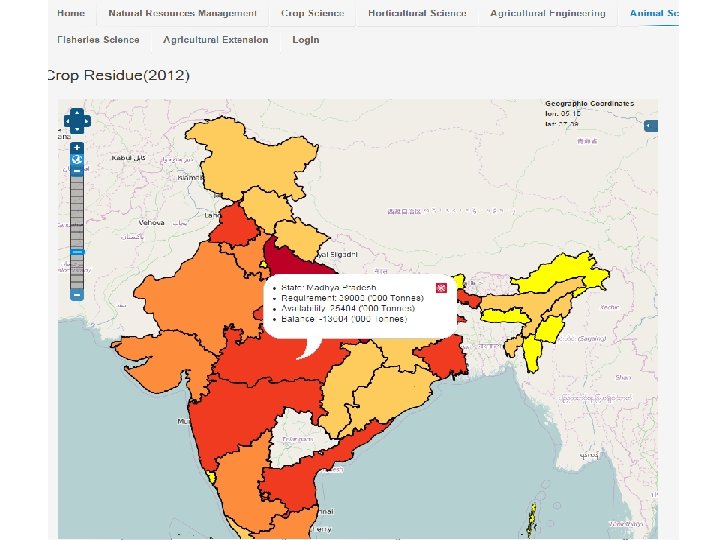
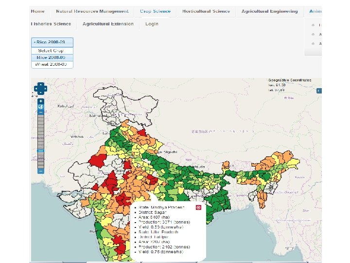
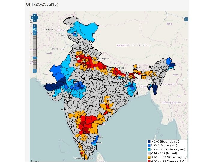
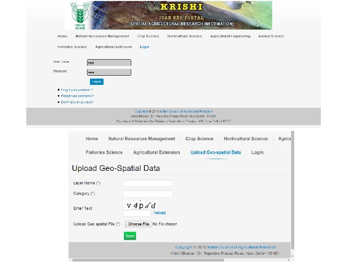
Geo. Portal Features • Handles all type of spatial data – Vector ( point, line, polygon), Raster, Quadtree • Highly configurable due to Open Source technologies • Extended functionalities • Compatibility across platforms • Provides Web Map Services (WMS) • Overlay State and district boundaries on any map • Open Source Base layer till street level details • Provision for users to upload their data directly to Geoportal
Geo-Portal Ver 2. 0 • Live on: http: //14. 139. 56. 74: 8080/geoexplorer/ • An updated interface – Two panels: Map Window panel, Layer panel – Geoportal Toolbar and Map Window Toolbar – Display of Layer Properties, Metadata and Layer Styles – Selection of map scale • Selection of base layers: Open. Street. Maps, Bing, Google • Overlay of Map Layers: Order and Transparency • Enhanced Query: Map extent and Map attributes • Add WMS (Web Map Service) Layers from remote Geoservers
The Interface
Map Toolbar
Geoportal Toolbar
Layer Panel
Layer Properties
Layer Properties
WMS Service
Way Forward • Practice and sensitize “Data Openness”. • Identify Spatial Data of your Subject Matter / Commodity – Generated in your institutes, – Generated in allied institutes – Available in public domain • Identify Tabular Data with spatial context – Current – Historical • Digitization / reformatting of identified data • Be meticulous in generating “Metadata” of spatial data • Now on always generate data with precise “Geolocation” – Experimental, Observational, Survey • Be an active partner of team KRISHI
Thank You sehgal@iari. res. in vksehgal@gmail. com Acknowledgements DDG(NRM), ADG(SWM), DIR(IASRI), DIR(IARI), DIR(NBSS) Dr R. Prasad, Dr O. Reddy, Dr A. Dhandapani, Dr A. K. Choubey Mr R. Verma, Mr Subhash Mr Ashish Tiwari, Ms Priyanka, Ms Malti
Issues • • Procurement of base layer data from Survey of India Open Source vs Commercial Geoserver How many concurrent users to be served? Redundancy of Geoportal Security of Data Availability of Data to ICAR users / General users Disclaimer about boundaries, geolocation, administrative boundaries etc.
http: //bhuvan 5. nrsc. gov. in/bhuvan/wms http: //14. 139. 56. 74: 8080/geoexplorer/