Jet Stream An area of strong winds that
- Slides: 23

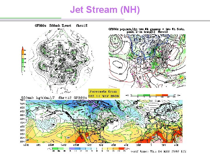
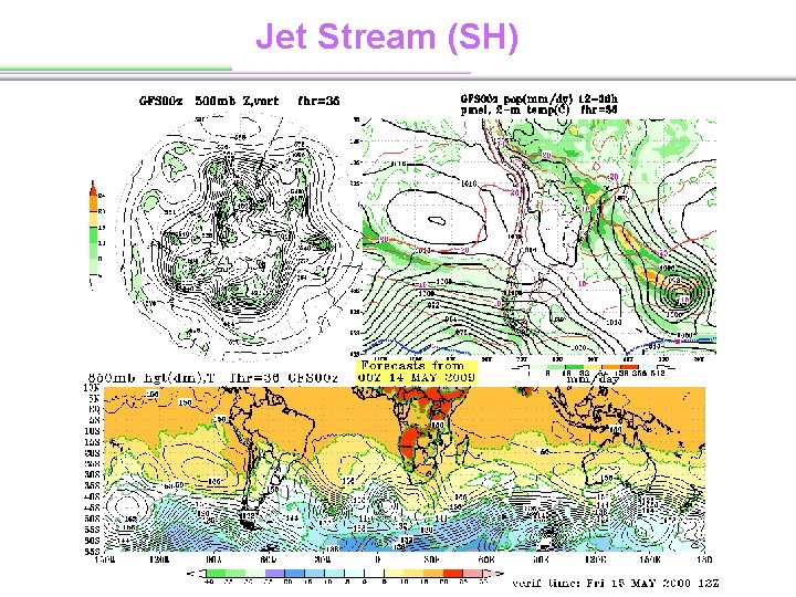
Jet Stream An area of strong winds that are concentrated in a relatively narrow band in the upper troposphere of the middle latitudes and subtropical regions of the Northern and Southern Hemispheres. Flowing in a semi-continuous band around the globe from west to east, it is caused by the changes in air temperature where the cold polar air moving towards the equator meets the warmer equatorial air moving polarward. It is marked by a concentration of isotherms and strong vertical shear. (from AMS)

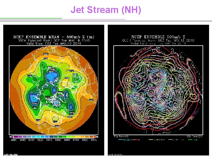
Jet Stream (NH)

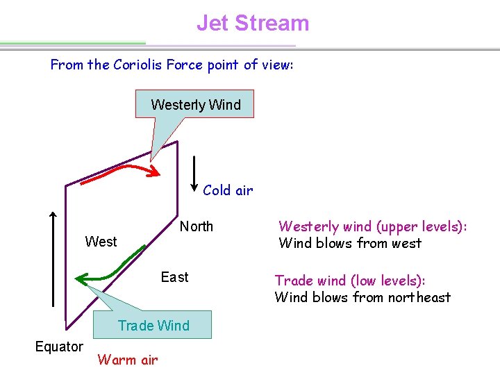
Jet Stream From the Coriolis Force point of view: Westerly Wind Cold air North West East Trade Wind Equator Warm air Westerly wind (upper levels): Wind blows from west Trade wind (low levels): Wind blows from northeast

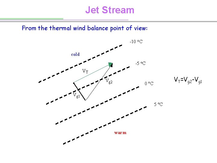
Jet Stream From thermal wind balance point of view: -10 o. C cold -5 o. C VT Vg 2 VT=Vg 2 -Vg 1 0 o. C Vg 1 5 o. C warm

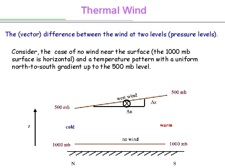
Thermal Wind The (vector) difference between the wind at two levels (pressure levels). Consider, the case of no wind near the surface (the 1000 mb surface is horizontal) and a temperature pattern with a uniform north-to-south gradient up to the 500 mb level. X

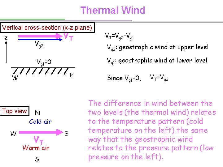
Thermal Wind Vertical cross-section (x-z plane) z Vg 2 VT Vg 2: geostrophic wind at upper level Vg 1: geostrophic wind at lower level Vg 1=0 E W Top view W N Cold air VT Warm air S VT=Vg 2 -Vg 1 E Since Vg 1=0, VT=Vg 2 The difference in wind between the two levels (the thermal wind) relates to the temperature pattern (cold temperature on the left) the same way that the geostrophic wind relates to the pressure pattern (low pressure on the left).

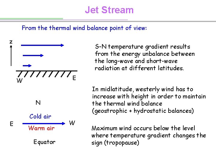
Jet Stream From thermal wind balance point of view: z S-N temperature gradient results from the energy unbalance between the long-wave and short-wave radiation at different latitudes. E W In midlatitude, westerly wind has to increase with height in order to maintain thermal wind balance (geostrophic + hydrostatic balances) N E Cold air Warm air Equator W Maximum wind occurs below the level where temperature gradient changes the sign (tropopause)

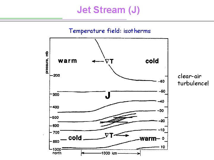
Jet Stream (J) Temperature field: isotherms clear-air turbulence!

Jet Stream (NH)

Jet Stream (SH)

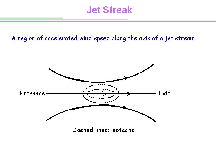
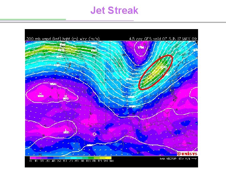
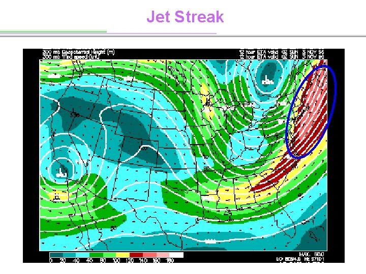
Jet Streak A region of accelerated wind speed along the axis of a jet stream. Entrance Exit Dashed lines: isotachs

Jet Streak

Jet Streak

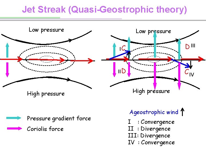
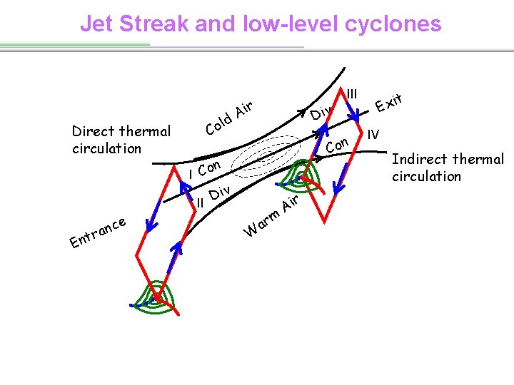
Jet Streak (Quasi-Geostrophic theory) Low pressure High pressure Pressure gradient force Coriolis force Low pressure IC D III II D C IV High pressure Ageostrophic wind I : Convergence II : Divergence III: Divergence IV : Convergence

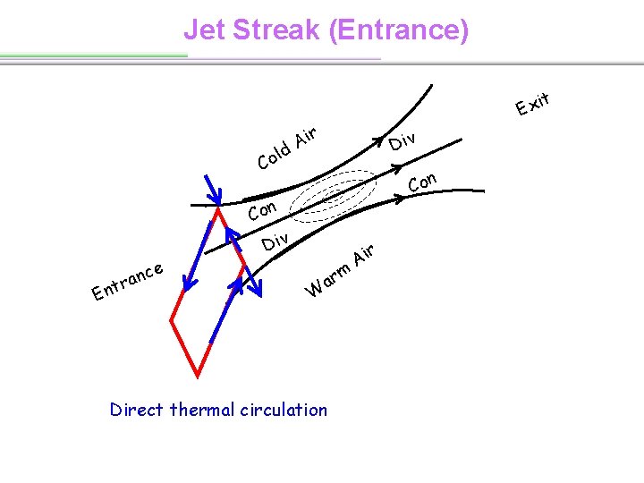
Jet Streak (Entrance) l Co e c n ra t n E t Exi r i A d Div Con Div W m ar Direct thermal circulation r Ai

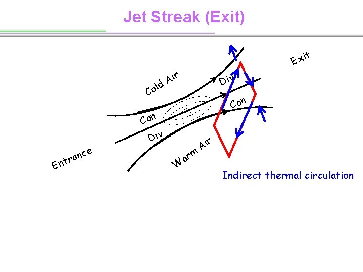
Jet Streak (Exit) l Co e c n ra t n E t Exi r i A d Div Con Div W m ar r Ai Indirect thermal circulation

Jet Streak and low-level cyclones Direct thermal circulation ld Co r Ai Con n I Co Div II r t n E e anc Div III W m ar r Ai t Exi IV Indirect thermal circulation

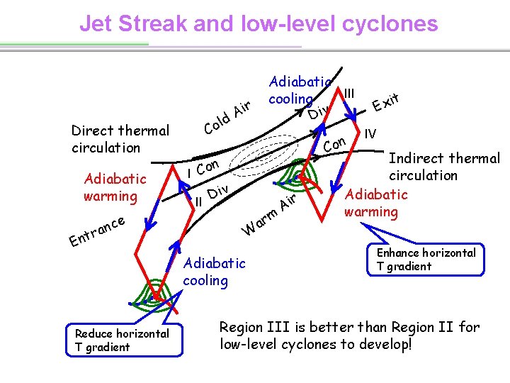
Jet Streak and low-level cyclones Direct thermal circulation Adiabatic warming ld Co r Ai Con n I Co Div II e anc W r t n E Adiabatic cooling Reduce horizontal T gradient Adiabatic III cooling Div m ar r Ai t Exi IV Indirect thermal circulation Adiabatic warming Enhance horizontal T gradient Region III is better than Region II for low-level cyclones to develop!

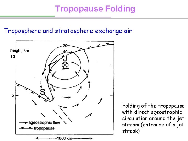
Tropopause Folding Troposphere and stratosphere exchange air Folding of the tropopause with direct ageostrophic circulation around the jet stream (entrance of a jet streak)

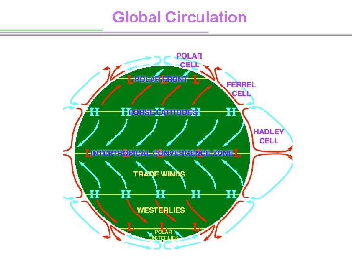
Global Circulation

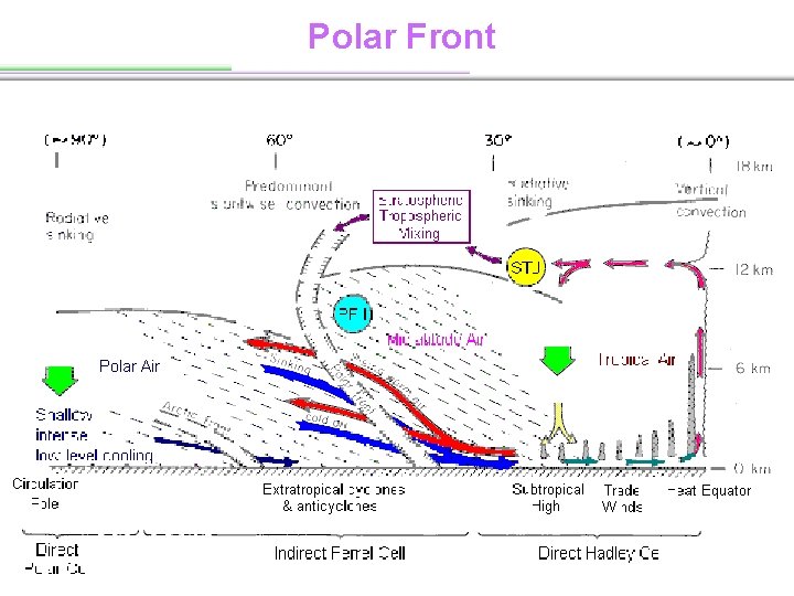
Polar Front

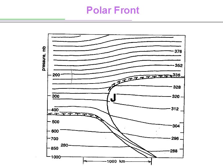
Polar Front

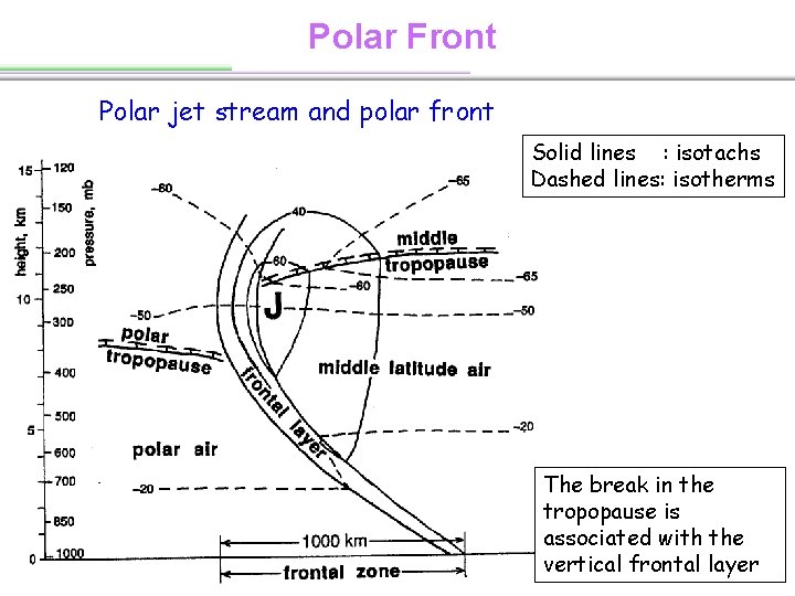
Polar Front Polar jet stream and polar front Solid lines : isotachs Dashed lines: isotherms The break in the tropopause is associated with the vertical frontal layer