
Japan Submitted by Yoshihiko TAHARA RA II WIGOS
Japan Submitted by Yoshihiko TAHARA RA II WIGOS Workshop 6 -8 November 2018, Beijing, China
Outline I. III. IV. Introduction of Japan and JMA National requirements for observations Summary of national observing capabilities Status of national implementation of WIGOS
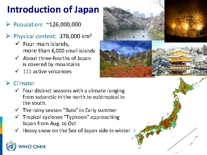
Introduction of Japan Ø Population: ~126, 000 Ø Physical context: 378, 000 km 2 ü Four main islands, more than 6, 000 small islands ü About three-fourths of Japan is covered by mountains ü 111 active volcanoes Ø Climate: ü Four distinct seasons with a climate ranging from subarctic in the north to subtropical in the south. ü The rainy season “Baiu” in Early summer ü Tropical cyclones “Typhoon” approaching Japan from Aug. to Oct ü Heavy snow on the Sea of Japan side in winter
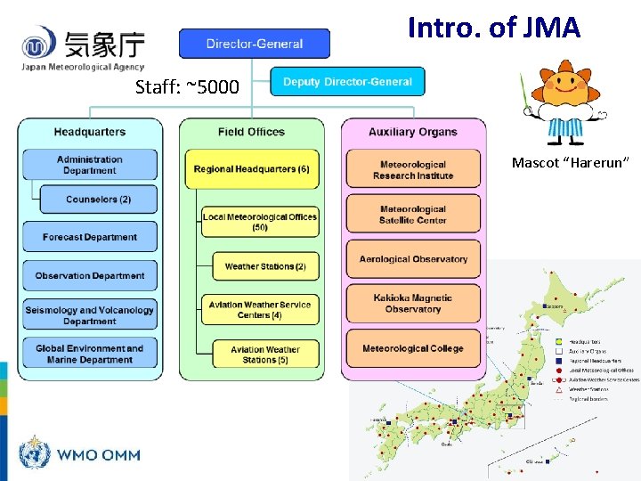
Intro. of JMA Staff: ~5000 Mascot “Harerun”
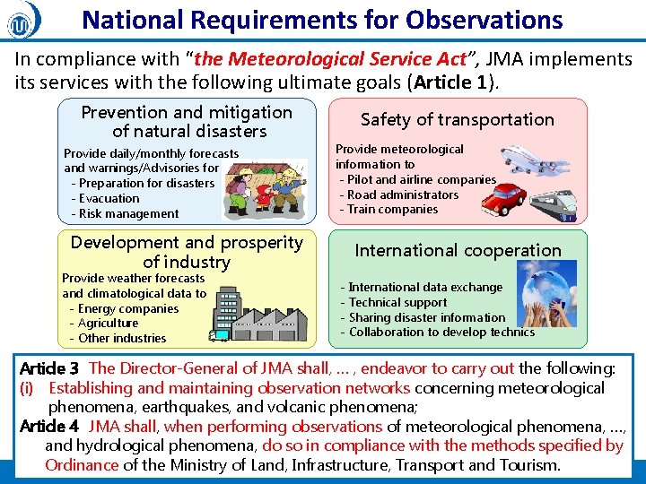
National Requirements for Observations In compliance with “the Meteorological Service Act”, JMA implements its services with the following ultimate goals (Article 1). Prevention and mitigation of natural disasters Provide daily/monthly forecasts and warnings/Advisories for - Preparation for disasters - Evacuation - Risk management Development and prosperity of industry Provide weather forecasts and climatological data to - Energy companies - Agriculture - Other industries Safety of transportation Provide meteorological information to - Pilot and airline companies - Road administrators - Train companies International cooperation - International data exchange - Technical support - Sharing disaster information - Collaboration to develop technics Article 3 The Director-General of JMA shall, … , endeavor to carry out the following: (i) Establishing and maintaining observation networks concerning meteorological phenomena, earthquakes, and volcanic phenomena; Article 4 JMA shall, when performing observations of meteorological phenomena, …, and hydrological phenomena, do so in compliance with the methods specified by Ordinance of the Ministry of Land, Infrastructure, Transport and Tourism. 5
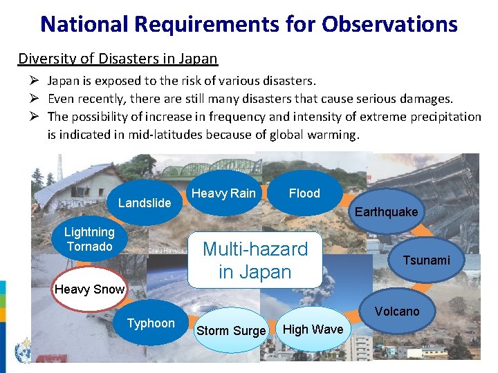
National Requirements for Observations Diversity of Disasters in Japan Ø Japan is exposed to the risk of various disasters. Ø Even recently, there are still many disasters that cause serious damages. Ø The possibility of increase in frequency and intensity of extreme precipitation is indicated in mid-latitudes because of global warming. Landslide Lightning Tornado Heavy Rain Flood Earthquake Multi-hazard in Japan Heavy Snow Typhoon Tsunami Volcano Storm Surge High Wave
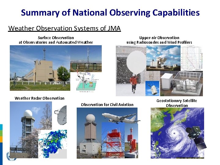
Summary of National Observing Capabilities Weather Observation Systems of JMA Surface Observation at Observatories and Automated Weather Stations Upper-air Observation using Radiosondes and Wind Profilers Weather Radar Observation for Civil Aviation Geostationary Satellite Observation
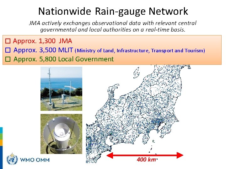
Nationwide Rain-gauge Network JMA actively exchanges observational data with relevant central governmental and local authorities on a real-time basis. □ Approx. 1, 300 JMA □ Approx. 3, 500 MLIT (Ministry of Land, Infrastructure, Transport and Tourism) □ Approx. 5, 800 Local Government 400 km
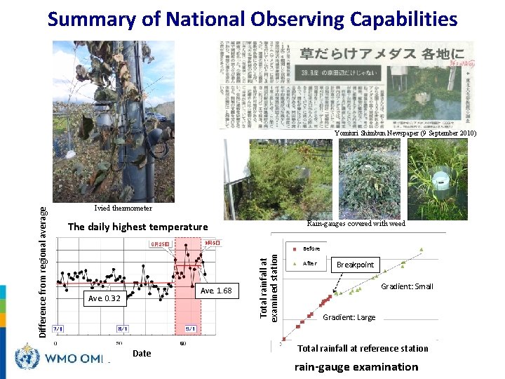
Summary of National Observing Capabilities Ivied thermometer The daily highest temperature Rain-gauges covered with weed Before Ave. 1. 68 Ave. 0. 32 Date Total rainfall at examined station Difference from regional average Yomiuri Shimbun Newspaper (9 September 2010) After Breakpoint Gradient: Small Gradient: Large Total rainfall at reference station rain-gauge examination
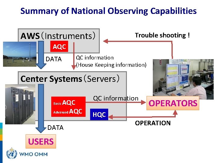
Summary of National Observing Capabilities AWS(Instruments) Trouble shooting ! AQC DATA QC information (House Keeping information) Center Systems(Servers) AQC Advanced AQC Basic DATA USERS QC information HQC OPERATORS OPERATION
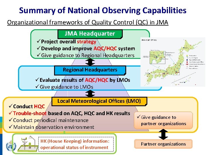
Summary of National Observing Capabilities Organizational frameworks of Quality Control (QC) in JMA Headquarter üProject overall strategy üDevelop and improve AQC/HQC system üGive guidance to Regional Headquarters üEvaluate results of AQC/HQC by LMOs üGive guidance to LMOs Local Meteorological Offices (LMO) üConduct HQC üTrouble-shoot based on AQC, HQC and HK results üConduct periodical maintenance üMaintain observation environment HK (House Keeping) information: operational status of instrument üGive guidance to partner organizations Partner organizations
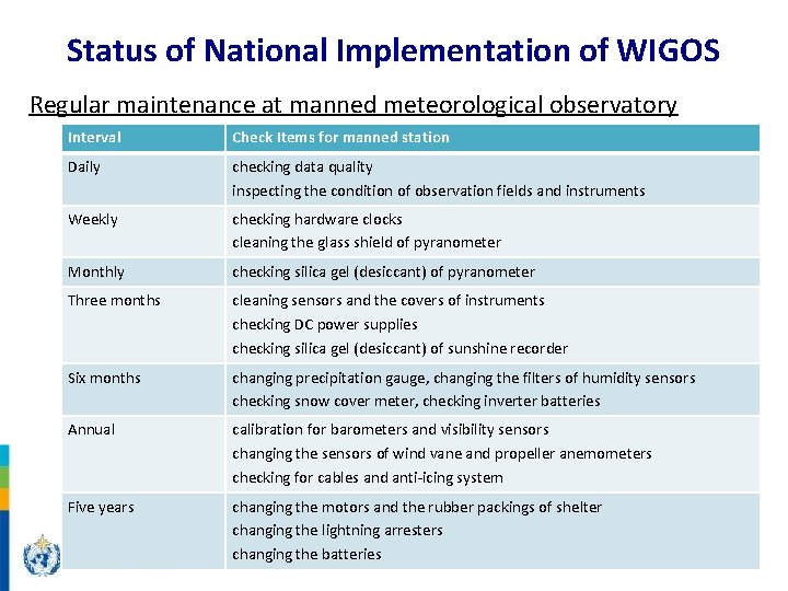
Status of National Implementation of WIGOS Regular maintenance at manned meteorological observatory Interval Check Items for manned station Daily checking data quality inspecting the condition of observation fields and instruments Weekly checking hardware clocks cleaning the glass shield of pyranometer Monthly checking silica gel (desiccant) of pyranometer Three months cleaning sensors and the covers of instruments checking DC power supplies checking silica gel (desiccant) of sunshine recorder Six months changing precipitation gauge, changing the filters of humidity sensors checking snow cover meter, checking inverter batteries Annual calibration for barometers and visibility sensors changing the sensors of wind vane and propeller anemometers checking for cables and anti-icing system Five years changing the motors and the rubber packings of shelter changing the lightning arresters changing the batteries
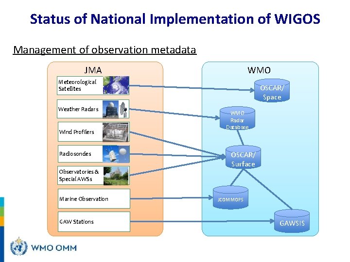
Status of National Implementation of WIGOS Management of observation metadata JMA WMO Meteorological Satellites Weather Radars Wind Profilers Radiosondes Observatories & Special AWSs Marine Observation GAW Stations OSCAR/ Space WMO Radar Database OSCAR/ Surface JCOMMOPS GAWSIS

Thank you y-tahara@met. kishou. go. jp
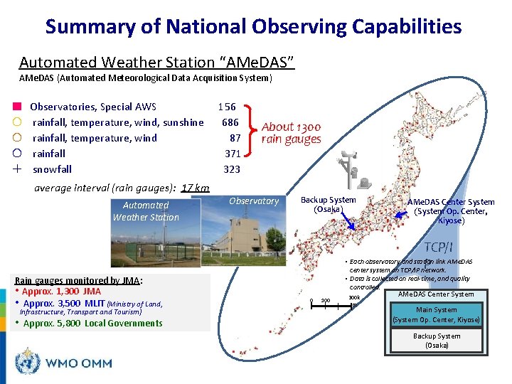
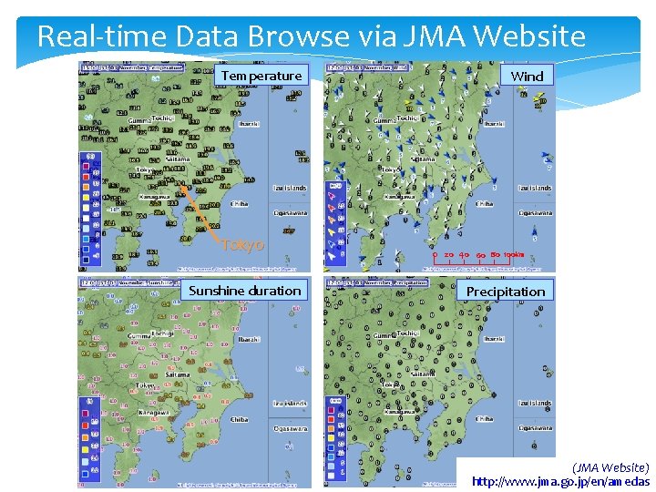
Summary of National Observing Capabilities Automated Weather Station “AMe. DAS” AMe. DAS (Automated Meteorological Data Acquisition System) ■ Observatories, Special AWS 〇 rainfall, temperature, wind, sunshine 〇 rainfall, temperature, wind 〇 rainfall + snowfall 156 686 87 371 323 About 1300 rain gauges average interval (rain gauges): 17 km Automated Weather Station Rain gauges monitored by JMA: • Approx. 1, 300 JMA • Approx. 3, 500 MLIT (Ministry of Land, • Infrastructure, Transport and Tourism) Approx. 5, 800 Local Governments Observatory Backup System (Osaka) AMe. DAS Center System (System Op. Center, Kiyose) TCP/I • Each observatory and station link AMe. DAS P center system on TCP/IP network. 0 100 • Data is collected on real-time, and quality controlled. AMe. DAS Center System 300 k m Main System (System Op. Center, Kiyose) Backup System (Osaka)
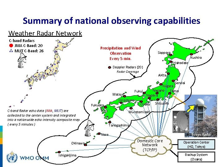
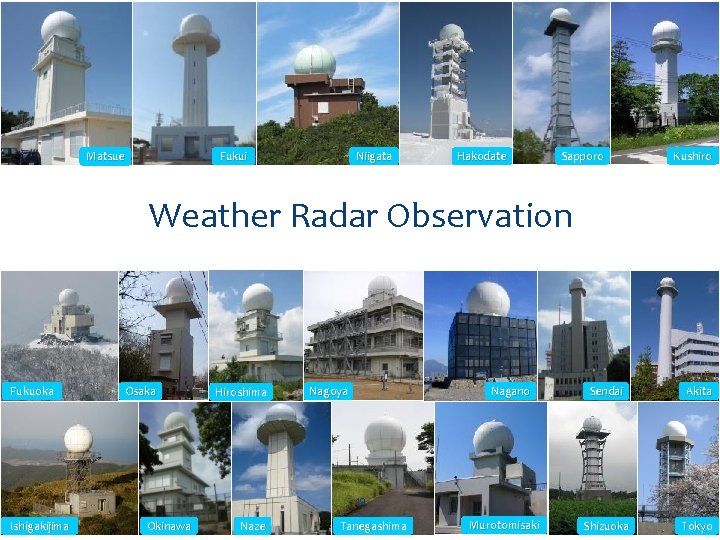
Summary of national observing capabilities Weather Radar Network C-band Radars ● JMA C-Band: 20 △ MLIT C-Band: 26 Precipitation and Wind Observation Every 5 min. Sapporo Kushiro Hakodate Doppler Radars (20) Radar Coverage Sendai Niigata Nagano Tokyo Fukui Nagoya Matsue Hiroshima Fukuoka C-band Radar echo data (JMA, MLIT) are collected to the center system and integrated into a nationwide echo intensity composite map ( every 5 minutes ) Akita Osaka Shizuoka Murotomisaki Tanegashima Tokyo Radar Naze Okinawa Ishigakijima Domestic Core Network (TCP/IP) Operation Center (HQ, Tokyo) Backup System (Osaka)
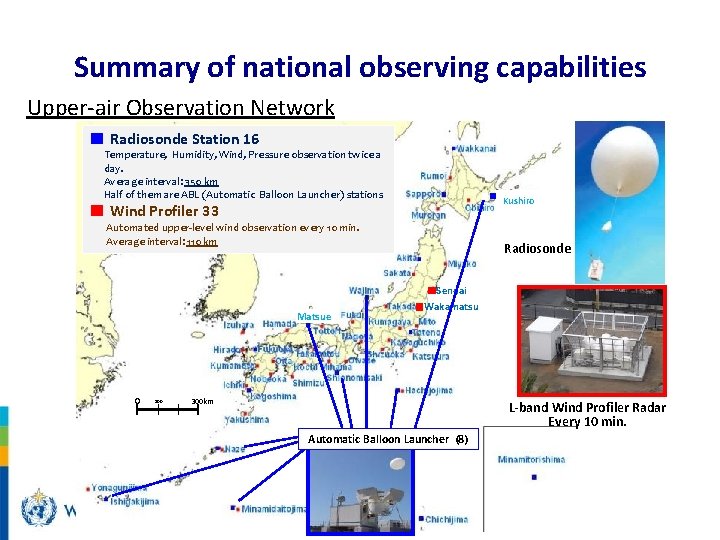
Summary of national observing capabilities Upper-air Observation Network ■ Radiosonde Station 16 Temperature, Humidity, Wind, Pressure observation twice a day. Average interval: 350 km Half of them are ABL (Automatic Balloon Launcher) stations ■ ■ Wind Profiler 33 Automated upper-level wind observation every 10 min. Average interval: 110 km Kushiro Radiosonde ■Sendai Matsue 0 100 ■Wakamatsu 300 km L-band Wind Profiler Radar Every 10 min. Automatic Balloon Launcher (8)
Real-time Data Browse via JMA Website Temperature Tokyo Sunshine duration Wind 0 20 40 60 80 100 km Precipitation (JMA Website) http: //www. jma. go. jp/en/amedas
Fukui Matsue Niigata Hakodate Sapporo Kushiro Weather Radar Observation Fukuoka Osaka Hiroshima Nagoya Nagano Sendai Akita Shizuoka Tokyo 19 Ishigakijima Okinawa Naze Tanegashima Murotomisaki
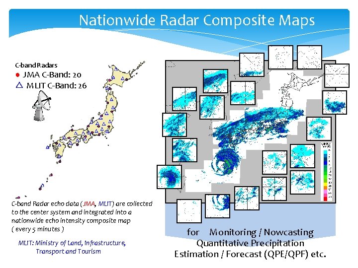
Nationwide Radar Composite Maps C-band Radars ● JMA C-Band: 20 △ MLIT C-Band: 26 C-band Radar echo data (JMA, MLIT) are collected to the center system and integrated into a nationwide echo intensity composite map ( every 5 minutes ) MLIT: Ministry of Land, Infrastructure, Transport and Tourism for Monitoring / Nowcasting Quantitative Precipitation Estimation / Forecast (QPE/QPF) etc.
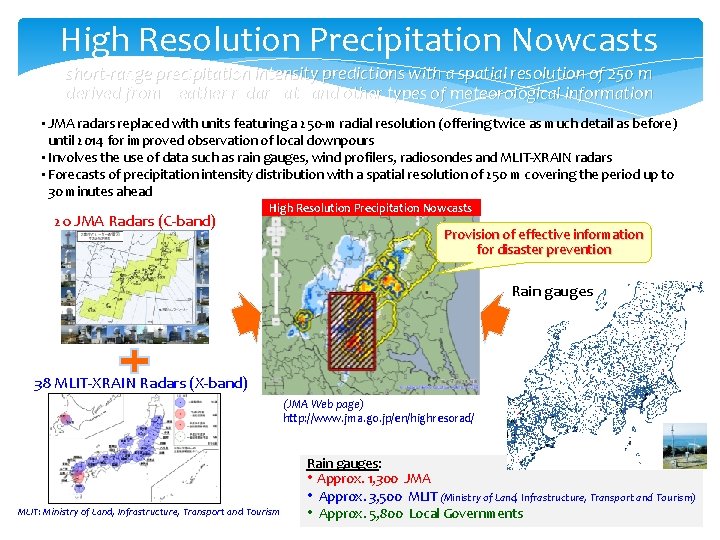
High Resolution Precipitation Nowcasts short-range precipitation intensity predictions with a spatial resolution of 250 m derived from weather radar data and other types of meteorological information • JMA radars replaced with units featuring a 250 -m radial resolution (offering twice as much detail as before) until 2014 for improved observation of local downpours • Involves the use of data such as rain gauges, wind profilers, radiosondes and MLIT-XRAIN radars • Forecasts of precipitation intensity distribution with a spatial resolution of 250 m covering the period up to 30 minutes ahead 20 JMA Radars (C-band) High Resolution Precipitation Nowcasts Provision of effective information for disaster prevention Rain gauges 38 MLIT-XRAIN Radars (X-band) (JMA Web page) http: //www. jma. go. jp/en/highresorad/ MLIT: Ministry of Land, Infrastructure, Transport and Tourism Rain gauges: • Approx. 1, 300 JMA • Approx. 3, 500 MLIT (Ministry of Land, Infrastructure, Transport and Tourism) • Approx. 5, 800 Local Governments
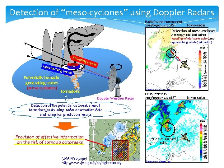
Detection of “meso-cyclones” using Doppler Radars Radial-wind component 2013/09/02 14: 20 JST Tokyo-radar Detection of meso-cyclones A strongly-localized pair of receding winds (warm color) and approaching winds (cold color) Rec edin Appr oachi g wi nds ng wi Potentially tornadogenerating vortex (meso-cyclones) nds tornadoes Doppler Weather Radar Echo intensity 2013/09/02 14: 20 JST Detection of the potential outbreak area of tornadoes/gusts using radar observation data and numerical prediction results Provision of effective information on the risk of tornado outbreaks (JMA Web page) http: //www. jma. go. jp/en/highresorad/ “Hook”-shaped echo Tokyo-radar
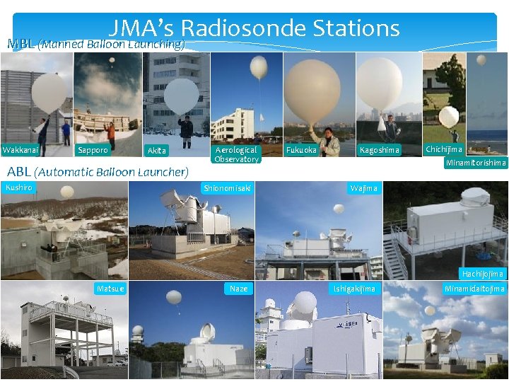
JMA’s Radiosonde Stations MBL (Manned Balloon Launching) Wakkanai Sapporo Akita ABL (Automatic Balloon Launcher) Kushiro Aerological Observatory Shionomisaki Fukuoka Kagoshima Chichijima Minamitorishima Wajima Hachijojima Matsue Naze Ishigakijima Minamidaitojima
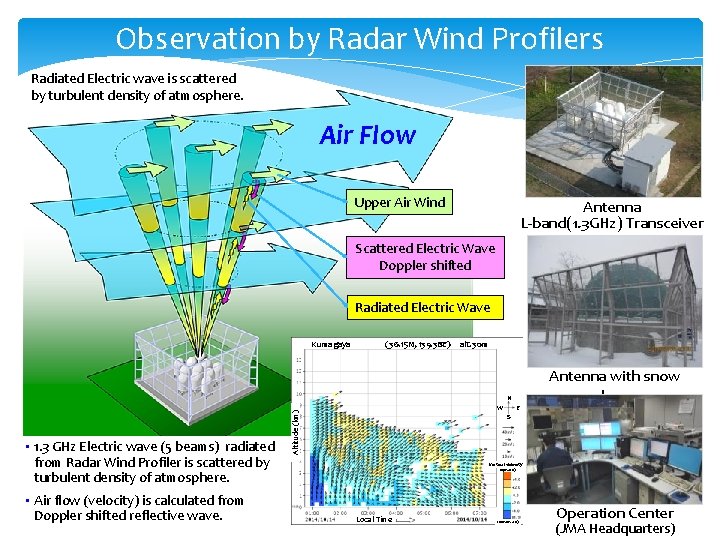
Observation by Radar Wind Profilers Radiated Electric wave is scattered by turbulent density of atmosphere. Air Flow Upper Air Wind Antenna L-band(1. 3 GHz) Transceiver Scattered Electric Wave Doppler shifted Radiated Electric Wave Kumagaya (36. 15 N, 139. 38 E) alt. 30 m N • Air flow (velocity) is calculated from Doppler shifted reflective wave. Altitude (km) • 1. 3 GHz Electric wave (5 beams) radiated from Radar Wind Profiler is scattered by turbulent density of atmosphere. W E Antenna with snow dome S Vertical velocity (upward) Local Time (downward) Operation Center (JMA Headquarters)
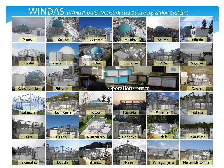
WINDAS (Wind Profiler Network and Data Acquisition System) Rumoi Obihiro Muroran Miyako Sakata Takada Sendai Wakamatsu Fukui Kumagaya Mito Nagoya Kawaguchiko Shizuoka Katsuura Hachijojima Ohita Takamatsu Hirado Kouchi Operation Center Owase Tottori Hamada Mihama Izuhara Kumamoto Nobeoka Ichiki Yakushima Shimizu Naze Yonagunijima Minamidaitojima
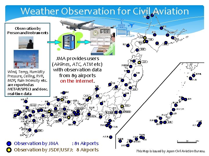
Weather Observation for Civil Aviation Observation by Person and Instruments Wind, Temp, Humidity Pressure, Ceiling, RVR, MOR, Rain Intensity etc. are reported as METAR/SPECI and 6 sec. real-time data JMA provides users (Airlines, ATC, ATM etc) with observation data from 89 airports on the Internet. Observation by JMA : 81 Airports Observation by JSDF/USFJ: 8 Airports This Map is issued by Japan Civil Aviation Bureau.
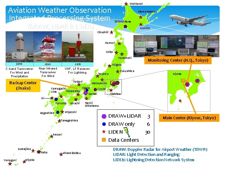
Wakkanai Aviation Weather Observation Integrated Processing System (DRAW, LIDAR & LIDEN) Memanbetsu Shin-Chitose Kushiro Okushiri Aomori Akita Hanamaki Niigata C-band Transceiver For Wind and Precipitation Near Infrared Transceiver For Wind VHF, LF Reciever For Lightning Tottori Backup Center (Osaka) Yamaguchi. Takamatsu Ube Toyama Monitoring Center (H. Q. , Tokyo) Fukushima Matsumoto Osaka Oshima Iki Fukuoka Kouchi Miyazaki Kagoshima Tanegashima Amami Kumejima Yonaguni Miyako Naha Minamidaitou Narita Tokyo Haneda Cyubu Kansai Kiyose Oshima Nanki Shirahama DRAW+LIDAR 3 DRAW only 6 LIDEN 30 Data Centers Main Center (Kiyose, Tokyo) DRAW: Doppler Radar for Airport Weather (TDWR) LIDAR: Light Detection and Ranging LIDEN: Lightning Detection Network System
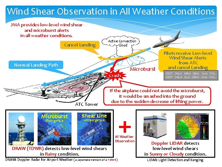
Wind Shear Observation in All Weather Conditions JMA provides low-level wind shear and microburst alerts in all weather conditions. Cancel Landing Active Convection Cloud Normal Landing Path Microburst Crash ATC Tower Microburst divergence Pilots receive Low-level Wind Shear Alerts from ATC and cancel Landing 0837 34 LA MBA 39 kt- 1 nm FNL 0837 34 LA SLA 25 kt+ 3 nm FNL If the airplane could not avoid the microburst, it would be smashed into the ground due to the sudden decrease of lifting power. Shear Line convergence All Weather Observation DRAW (TDWR) detects low-level wind shears in Rainy condition. DRAW: Doppler Radar for Airport Weather (a Japanese version of a TDWR) Doppler LIDAR detects low-level wind shears in Sunny or Cloudy condition. LIDAR: Light Detection and Ranging
- Slides: 28