ISOLINES AND FIELD MAPS Isoline line of equal


 pressure")
 n Contour lines- lines of equal elevation")
")


 Relative risk of damage,")

. Lines far")


- Slides: 39
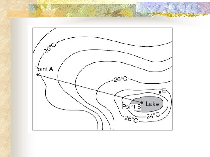
ISOLINES AND FIELD MAPS Isoline –line of equal value Field – area with measurable values
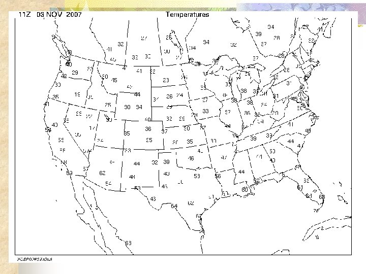
Temperature http: //weather. unisys. com/surface/index. html Isotherm –line of equal temperature
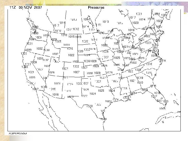
Air Pressure Isobar- Line of equal air (barometric) pressure
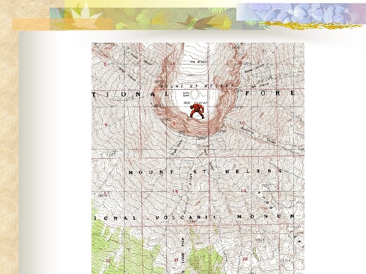
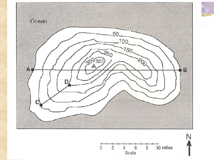
Topographic Maps (Contour maps) n Contour lines- lines of equal elevation
Extra tropical low (remnants of Noel 11 -3 -07)
http: //www. wrcc. dri. edu/pcpn/us_precip. gif
cas. buffalo. edu/commentary/buffalo-weather. html
FIGURE 4. Earthquake risk maps of the United States: (a) Relative risk of damage, based to a large extent on known earthquake history (Algermissen, 1969). (b) Probabilistic risk map showing maximum horizontal ground acceleration with a 90 -percent probability of not being exceeded in 50 years (Algermissen et al. , 1982). w. mgs. md. gov/esic/brochures/earthquake. html
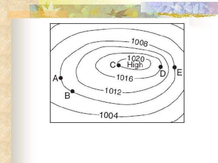
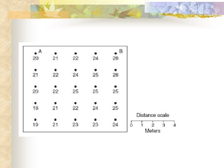
ISOLINE RULES 1. 2. 3. Connect point of equal value Gentle and smooth lines Parallel and form circle ( NEVER cross, exception –cliff))
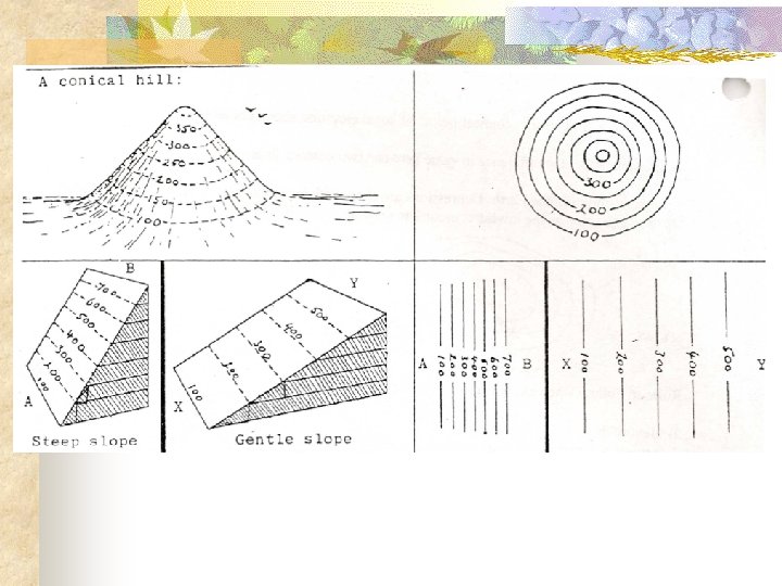
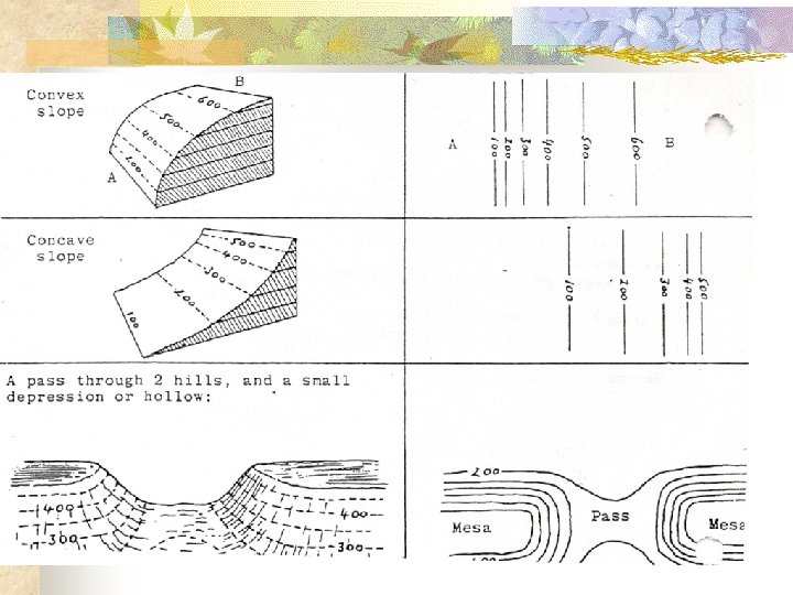
Gradient n n Show fast or slow change occurs Lines close (steep). Lines far apart (gentle) Equation: ESRT
East Styrockaway Mountains
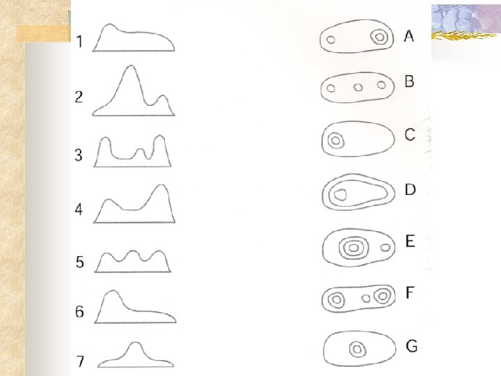
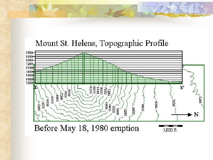
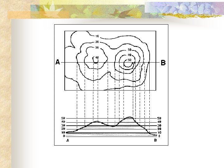
Intro to Topographic Maps n n Contour lines - lines of equal elevation Contour interval- difference between two lines n Slope/Gradient – Show fast or slow change occurs (ESRT) n Profile – Side view
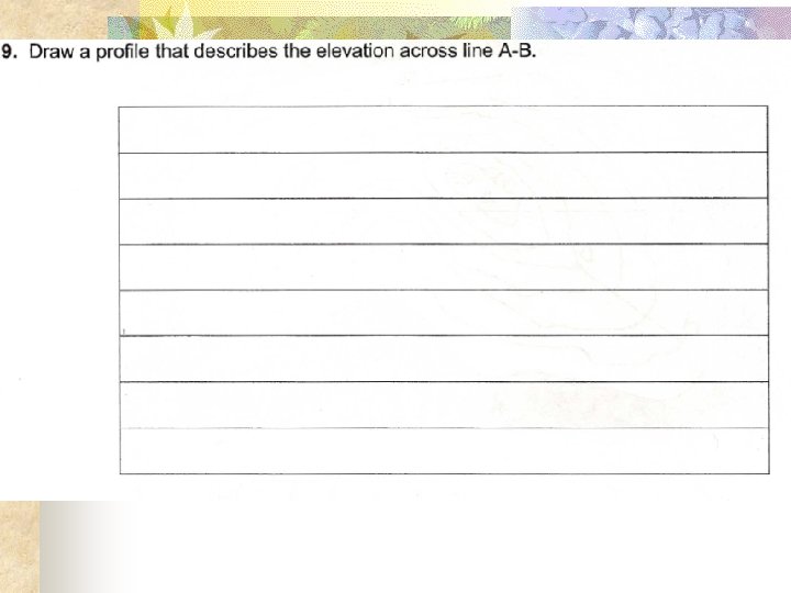
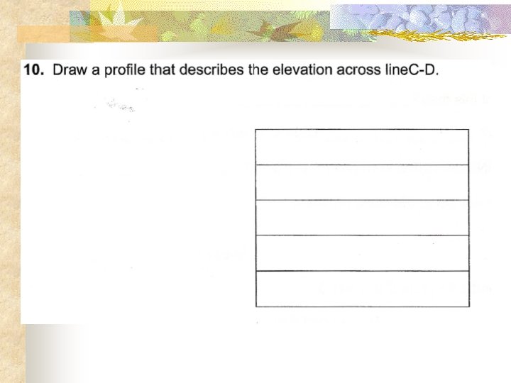
Making a Profile n n n n Put piece of paper along the line (make sure you can see the contour values. If not please label) Put a mark wherever your paper crosses a contour line. Each mark(on your paper) should have a contour value. Take your paper and place at the bottom of graph. Create a vertical axis with numbers on the graph. Graph your marks with the elevations. Connect points with a smooth line.
javascript: ;
http: //hvo. wr. usgs. gov/maunaloa/
http: //volcano. und. edu/vwdocs/vwlessons/activities/l_number 3. html
Mapping http: //www. lib. noaa. gov/#Imaging noaa library – maps and images http: //docs. lib. noaa. gov/rescue/dwm/data_rescue_daily_weather_maps. html old weather maps http: //www. csus. edu/indiv/s/slaymaker/Archives/Geol 10 L/landforms. htm great TOPO EXAMPLES http: //geology. asu. edu/~sreynolds/topo_gallery. htm http: //reynolds. asu. edu/topo_gallery. htm vitual topo stuff http: //geology. asu. edu/~reynolds/topo_gallery/intro_title. htm http: //www. nysgis. state. ny. us/gisdata/quads/drg 24/index. htm has high res scanned in topo maps for the entire state of NY (as far as I can tell). File size is large, but you can save it to your computer, zoom in, crop, print, and so on. The quality is quite impressive. you can also use: www. topozone. com which has printable topo maps. you can choose the scale and size. i would recommend 1: 24000 and "large" setting. quality is not as good, but the files load much quicker. finally, this is a great site that shows landform examples on topo maps. http: //www. csus. edu/indiv/s/slaymaker/Archives/Geol 10 L/landforms. htm
http: //seamless. usgs. gov/ http: //www. nationalatlas. gov/printable. html#reference maps http: //www. lib. utexas. edu/maps/ maps http: //www. geographynetwork. com/ http: //data. geocomm. com/ http: //www. maptech. com/onlinemaps/index. cfm? CFID=807630&CFTOKEN=38445056 printable maps of every state such as this one at. . . http: //www. nationalatlas. gov/printable. html#reference google earth map of NY state http: //www 1. nysgis. state. ny. us/Main. Map. cfm latitude and longitude Degree Confluence Project: http: //www. confluence. org/ You can find resources for your own state at. . . http: //www. usgs. gov/ http: //www. ngdc. noaa. gov/seg/geomag/declination. shtml mag declination pictures This is a great site with topo maps for multiple geomorphic features: http: //www. csus. edu/indiv/s/slaymaker/Archives/Geol 10 L/landforms. htm Here's a simple one that shows photo of feature side by side with topo map: http: //www. uwsp. edu/geo/faculty/lemke/alpine_glacial_glossary/glossary. html http: //www. nysgis. state. ny. us/gisdata/quads/drg 24/index. htm topo maps of ny climate variables http: //www. geo. appstate. edu/ncga/newsletters/Climate%20 Controls. htm