Introduction To Topographical Maps LET II Introduction Topographic


- Slides: 11
Introduction To Topographical Maps LET II
Introduction • Topographic maps show more detail of an area’s natural features. Because of its detail, especially of terrain features, elevation, and relief, the military prefers this type of map. Marginal Information • The marginal information for topographic maps varies significantly from that of road maps. • One major difference is that the marginal information on topographic maps is more standardized than that on other maps.
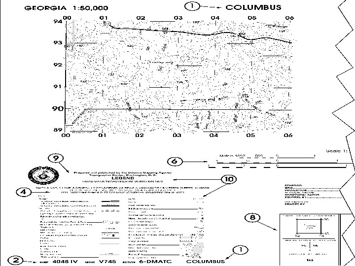
Marginal Information • 1. Sheet Name. You can locate the sheet name at the center of the top margin. • 2. Sheet Number. You can find the sheet number located in either the upper right or the lower left corners. • 3. Adjoining Map Sheets Diagram. Locate the adjoining (or adjacent) map sheets diagram in the right corner of the lower margin.
Marginal Information • 4. Special Notes. Special notes are statements of general information that relate to the mapped area. • 5. Declination Diagram. Another item of information located in the lower right margin is the declination diagram. All you need to know at this time is that it indicates the direction and relationship of true, magnetic, and grid north. • 6. Scales. Locate the graphic (bar) scales in the center of the lower margin of the map.
Marginal Information • We express a map scale as a representative fraction, which gives the ratio of map distance to ground distance. • For example, the scale note 1: 50, 000 indicates that one unit of measure on the map equals 50, 000 units of the same measure on the ground. • The most common units of measurement are miles (statute and nautical), meters/kilometers, and yards.
Marginal Information • 7. Contour Interval Note. The contour interval note also appears in the center of the lower margin. It represents the vertical distance between contour lines on the map. • 8. Grid Reference Box. Located at the bottom center of the lower margin, the grid reference box contains information for identifying the grid zone and the 100, 000 meter square representing the area.
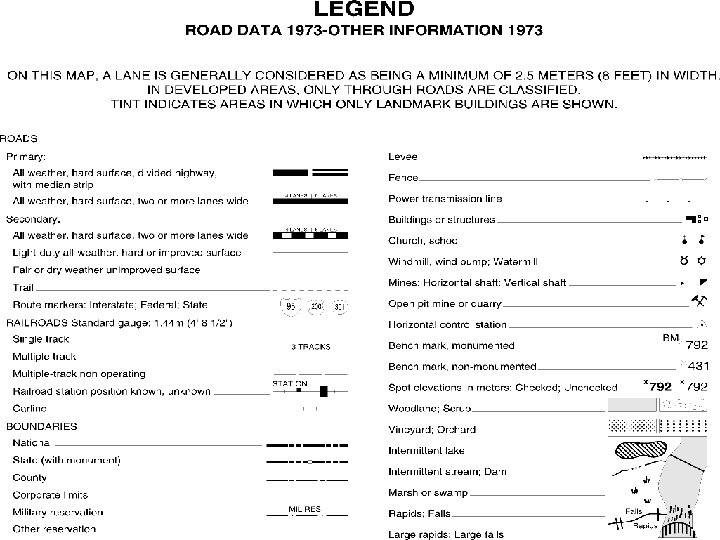
Marginal Information • 9. Unit Imprint. You can find the unit imprint below the left corner of the mapped area. • 10. Legend. The legend appears below the unit imprint. The legend explains the meanings for the symbols used on a topographic map. Map Symbols • The legend explains the meanings for the symbols used on a topographic map.
Map Colors • The five colors described in the previous lesson (black, blue, brown, green, and red) and the features they represent are also used on topographic maps. In addition, topographic maps use two colors that are usually not found on other maps. • White: Identifies an area void of vegetation. • Reddish-brown: Identifies man-made and relief features and elevation (for example, contour lines on red-light readable maps).