Introduction to Spatial Modeling Michael F Goodchild University


")

 (wi, xi, yi) Find (X, Y) to minimize:")


. AND.")

 Initial conditions, parameters, rules GIS")


- Slides: 67
Introduction to Spatial Modeling Michael F. Goodchild University of California Santa Barbara
Spatial modeling • What is it? • Why do it? • Spatial modeling and spatial analysis – an example • Types of modeling • Organizing and thinking about the options
Definitions • A model – a representation of something real – of a real process operating on the Earth's surface • social or physical – a design process conceived by a human • to search for the best alternative • A digital representation – everything reduced to 0 s and 1 s – in software and data – executed on a computer • a computational model
A spatial model • A model of some process operating in space (and time) – there is variation across the space (and through time) – location is important • the results of modeling change when locations change • locations must be known
Models can also be analog • Executed physically • Scaled to practical size – scale factor is critical – scaled in space and time • compressed and accelerated
(X, Y) (wi, xi, yi) Find (X, Y) to minimize:
The Varignon Frame
Scale and digital models • Digital models don't have a scale factor – but they operate at limited spatial resolution • Spatial resolution is a critical factor – it determines: • what is left out of the model • the cost of collecting data and running the model – it contributes to the model's accuracy • the degree of uncertainty about the real world created by the model • Temporal resolution is important for the same reasons
Why do it? • It is better than experimenting on the real thing – surgery students and cadavers • the digital cadaver – highway traffic simulation – global CO 2 • Evaluating "what if" scenarios • Gaining public interest and acceptance
Analyze or model? • Analysis: – – static, one point in time searching for patterns, anomalies generating ideas and hypotheses evaluating • Modeling: – may be dynamic, multiple points in time – implementing ideas and hypotheses • to compare to the real world – experimenting with scenarios
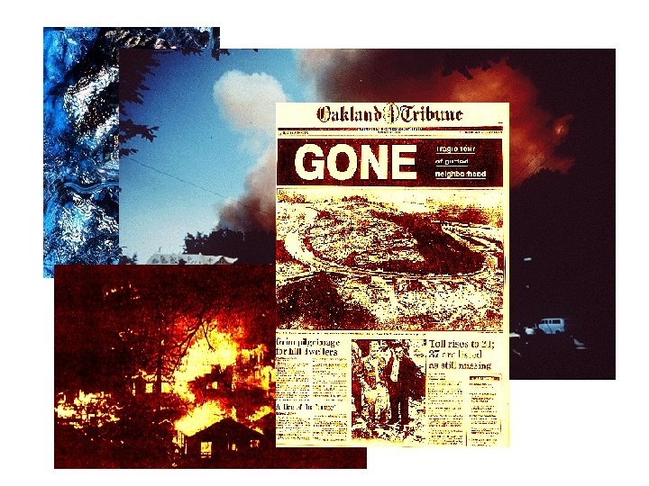
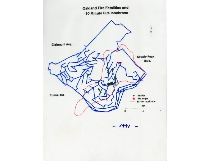
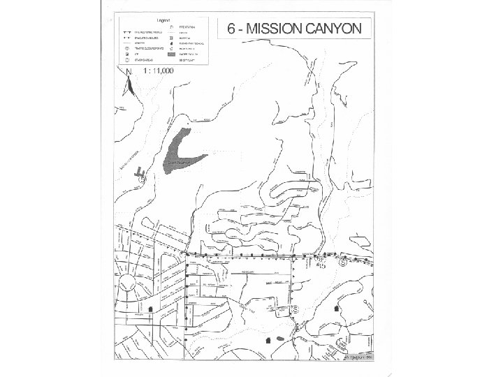
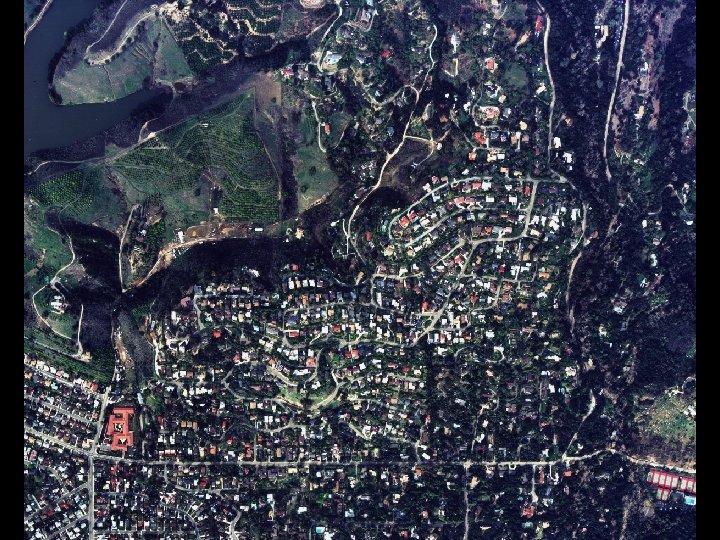
Simulations • 1. 8 vehicles per driveway • Driver behavior influenced by: – – – lane width slope view distances traffic control mechanisms information feedback driver aggressiveness • 770 homes – clearing times > 30 minutes 2 D clip 3 D clip
Policy implications • • • Addition of new outlets Better deployment of traffic control resources Understanding the risk Reduce cars used per household Problems of shut-ins, elderly, latch-key kids
Types of modeling • Static or dynamic? – are there time steps? – are they iterated? • does the model loop? • output of one step becomes the input of the next • how are the initial conditions defined? – is there a real process to emulate?
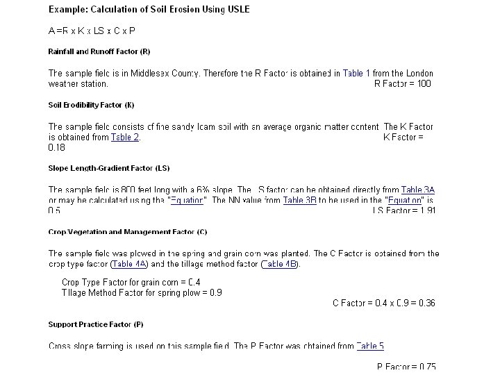
Static model example • The Universal Soil Loss Equation – prediction of soil erosion – from potentially knowable inputs • Five inputs, one output
Is USLE a spatial model? • No, point inputs and point output – it doesn't matter where the points are – this could be done in Excel • downloadable procedure at http: //www. co. dane. wi. us/landconservation/uslepg. htm • So why use a GIS? – calculation of inputs • slope from DEM – inputs in map form – output in map form – integration with other GIS operations
Social, physical, or integrated? • Social: – a model of some process operating among humans • or animals • Physical: – a model of some natural process operating in the environment • Integrated: – a model of the interaction of social and physical processes • land cover change, driven by humans, impacting the environment
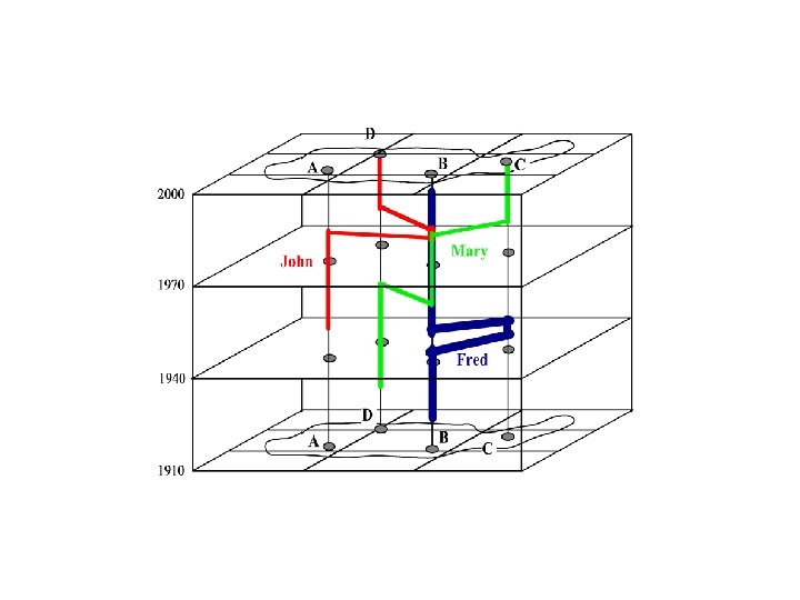
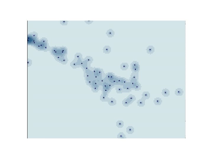
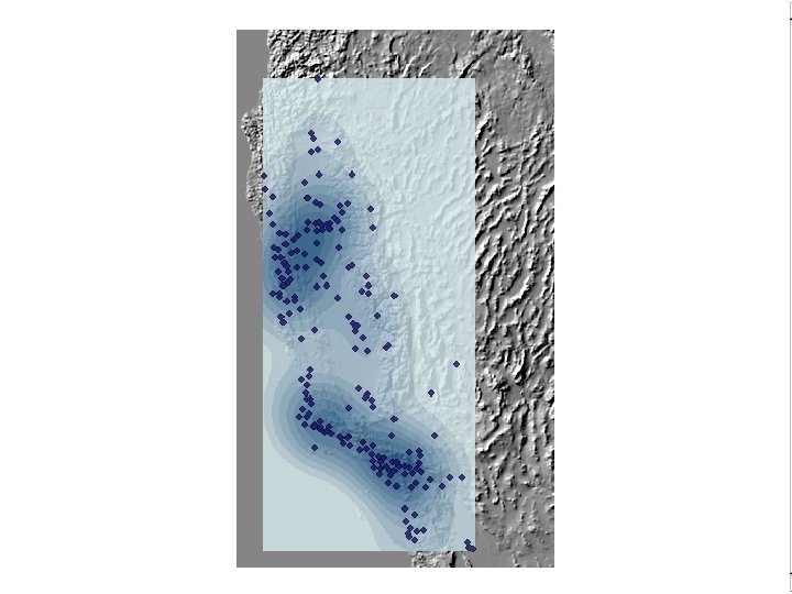
Individual or aggregate? • Modeling each individual separately – data-intensive • impossible for many physical processes – accurate • Modeling the behavior of aggregates – quick, cheap – the only option when individual data are confidential • Illustrations from:
Geovisualization of Human Activity Patterns Using 3 D GIS: A Time. Geographic Approach Mei-Po Kwan and Jiyeong Lee
Identifying Ethnic Neighborhoods with Census Data: Group Concentration and Spatial Clustering: John R. Logan and Wenquan Zhang
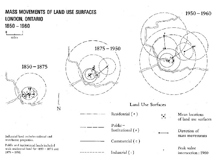
The Steinitz framework • Models at various stages of the decisionmaking or problem-solving process
Landscape Change Model by Carl Steinitz DATA 2. How does the landscape operate? PROCESS MODELS INFORMATION 3. Is the landscape working well? EVALUATION MODELS KNOWLEDGE 4. How might the landscape be altered? CHANGE MODELS DATA 5. What differences might the changes cause? IMPACT MODELS INFORMATION 6. Should the landscape be changed? DECISION MODELS KNOWLEDGE Landscape Assessment REPRESENTATION MODELS Landscape Intervention 1. How should the landscape be described?
How do models manage space? • As a raster – cellular models • As vector objects – possibly moving – object-oriented models
How do models manage time? • As discrete intervals – fixed in time • As a continuum – rates of change and movement
Cellular models • Raster-based – but the raster could be irregular • Each cell has a number of potential states • Rules determine changes in the states of raster cells – based on the states of other (often neighboring) cells – Game of Life
Planning Scenario Visualization and Assessment: A Cellular Automata Based Integrated Spatial Decision Support System Roger White, Bas Straatman, and Guy Engelen
Lots of options and potential • How to organize? – how to think about the alternatives? • Visual – a picture is worth a thousand words – people like to think visually • especially if pictures can be translated directly into models • STELLA – boxes and arrows
Modeling Spatial Information ELEVATION SOILS VEGETATION RAIN FALL SLOPE EROSION POTENTIAL EROSION HAZARD
Overlay and combine values according to the Boolean rule If (A. EQ. 1). AND. (B. GT. 2) then C=1 else C=0
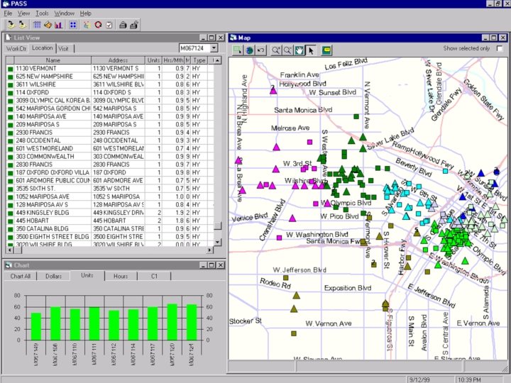
A groundwater example • http: //www. esri. com/news/arcuser/0704/files/ modelbuilder. pdf • Alan Glennon and Rhonda Pfaff • Tutorial
Conceptual Model Visual Representation Script (VBA, Python, AML, Avenue) Initial conditions, parameters, rules GIS execution Maps, tables, charts
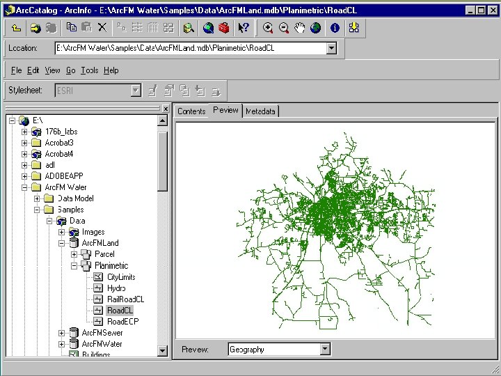
What are the operations/nodes? • Any operation on spatial data – any GIS operation • Many thousands of possibilities – more than 400 entries in Toolbox – plus all the desktop operations
Raster-only options • Map algebra – Dana Tomlin's Cartographic Modeling • Focal – operations on a cell across layers • not strictly spatial • Global – operations on all cells • Local – operations on a cell and its neighbors • Zonal – operations on a cell and contiguous cells of the same attribute value
PCRaster and its language • Developed at the University of Utrecht – by Peter Burrough and colleagues • Simple algebraic language – C=A+B – equivalent to Focal. Add A and B to get C • CA models can be written in the language – along with many other social and physical process models – see http: //pcraster. geog. uu. nl/ for examples etc.
A more comprehensive option • P A Longley, M F Goodchild, D J Maguire, and D W Rhind, 2001. Geographic Information Systems and Science. New York: Wiley.
A six-way conceptual classification • • • Query and reasoning Measurement Transformation Descriptive summary Optimization Hypothesis testing
Queries and reasoning • Real-time answers to geographic questions – Where is…? – What is this? – How do I get from here to here? • Based on alternative views of a database
Measurements • • • Area Distance Length Perimeter Slope, aspect Shape
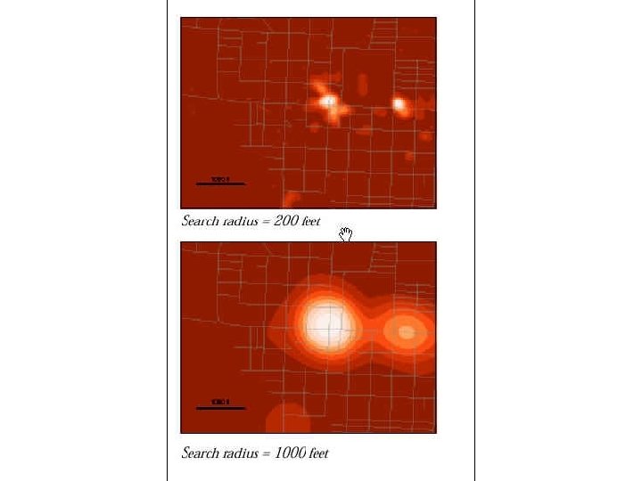
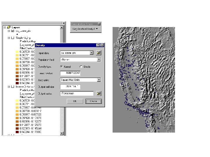
Transformations • • • Buffering Points in polygons Polygon overlay Spatial interpolation Density estimation
City limits Areas reachable in 5 minutes Areas reachable in 10 minutes Other areas
Courtesy of Dick Block
Descriptive summary • • • Centers Measures of spatial dispersion Spatial dependence Fragmentation Fractional dimension
Optimization • Design to achieve specific objectives • Location of central point-like facilities to serve dispersed demand • Location of linear facilities • Design of boundaries for elections
Hypothesis testing • Geographic objects as a sample from a population – what is the population? • The independence assumption – the First Law of Geography – failure to find spatial dependence is always a Type II error – hell is a place with no spatial dependence