INTRODUCTION TO SPATIAL FILE FORMATS AND SPATIAL DATABASES

INTRODUCTION TO SPATIAL FILE FORMATS AND SPATIAL DATABASES The University of Texas at Arlington Neelabh Pant http: //Crystal. uta. edu/mastdb/pant. html 02/06/2017
 • • • WHAT/HOW/WHERE about KML Sample KML")
OUTLINE • Keyhole Markup Language (KML) • • • WHAT/HOW/WHERE about KML Sample KML files Features • KMZ File • Shapefiles (. shp) • • What it is How to create one Technical specification Main file record content Organization of the index file Organization of the Dbase file Spatial Database • Post. GIS SQL
 • KML is an XML-based language schema describing a geographic")
WHAT/HOW/WHERE ABOUT KML? (1) • KML is an XML-based language schema describing a geographic vocabulary used by geobrowser applications on 2/3 dimensional Earth maps. • Developed by Keyhole, Inc. along with Earth Viewer application in 2001. • Acquired by Google in 2004. • KML was converted for use for the Google Earth, Google Maps and Google Mobile applications. • The word Keyhole comes from an American Military reconnaissance satellite program developed in the 1970’s. • The Google Earth program both produces and consumes KML files.
 • KML uses 3 -dimensional geographic reference system of longitude,")
WHAT/HOW/WHERE ABOUT KML? (2) • KML uses 3 -dimensional geographic reference system of longitude, latitude and altitude to describe a basic point of view in space over or on the surface of the Earth. • It also adds more specific control over that view with heading, tilt and roll factors. • Can also add text information, graphic overlays, 3 -D polygons, paths, icons and add embedded files (image or auditory) to enhance the geobrowser experience. • Like all XML, KML must begin with XML header information followed by the KML root element tags.

SAMPLE KML FILE <<? xml version="1. 0" encoding="UTF-8"? > <kml xmlns="http: //www. opengis. net/kml/2. 2"> <Placemark> <Woolf Hall</name> <description>Industrial, Mechanical Engineering Building. </description> <Point> <coordinates> - 97. 11311723710504, 32. 73153178072037, …</coordinates> </Point> </Placemark> </kml> A Placemark object contains the following elements: • Name - the label for the Placemark • Description – about the placemark • Point – the position of the Placemark (latitude, longitude, and optionally altitude)

FEATURES • Coordinates: elements consisting of three floating point values Latitude: is degree of north or south of the Equator (0 degrees). Values range from -90 to 90 degrees. • Longitude: is the angular distance in degrees, relative to the Prime Meridian. Values West range from -180 to 0 degrees and East range from 0 to 180 degrees. • Altitude: is the distance of the camera from the earth’s surface in meters interpreted according to the altitude. Mode element. • altitude. Mode values include: • relative. To. Ground – default in meters above the ground or level of water body. • clamp. To. Ground – exactly terrain or sea level height. • Absolute – meters above sea level • Heading is the direction (azimuth) in degrees from due North 0 to 360 degrees • Tilt is the rotation in degrees around the X axis • Roll is the rotation, in degrees around the Z axis. Values range from -180 to +180 degrees. •

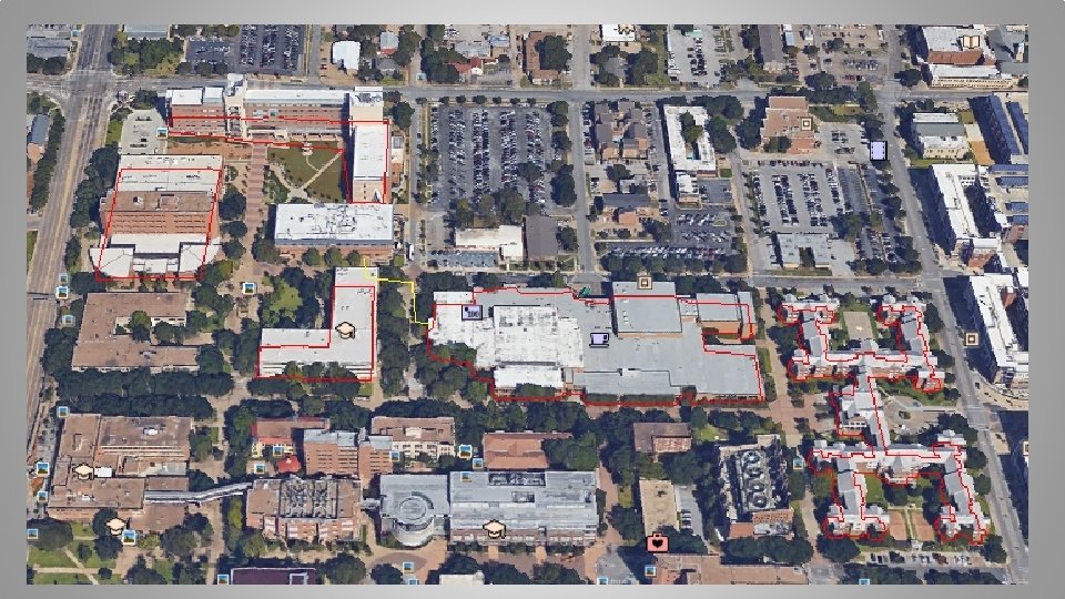
EXAMPLES

KMZ FILE • A KMZ File consists of a main KML file and zero or more supporting files • All the files are compressed within a package in a zipped folder with. kmz suffix. • KMZ files can be stored, emailed and loaded from a web server. • When a KMZ file is unzipped, the main. kml file and its supporting files are separated in to their original formats and directory sturucture, with their original filenames and extentions. • The kml file can be run with Google Earth.

WHAT IS A SHAPEFILE • A shapefile stores geometry and attribute information for the spatial features in a data set. • The geometry for a feature is stored as a shape comprising a set of vector coordinates. • Supports points, lines and area features. Area features are represented as closed loops.

HOW TO CREATE A SHAPEFILE • Export – Export any data source to a shapefile using ARC/INFO, Spatial Database Engine (SDE) or Arc. View GIS. • Digitize – Shapefiles can be created directly by digitizing shapes using Arc. View GIS feature creation tools. • Programming – using ARC Macro Language (AML) you can create shapefiles within your programs. • Converting KML files to Shapefiles can create. shp format files. • My favorite is ogr 2 gui_0. 7.
 •")
TECHNICAL SPECIFICATIONS • An ESRI shapefile consists of A main file (. shp) • An index file (. shx) • A d. Base file (. dbf) • • Main File (. shp) : it is a direct access, variable record length file in which each record describes a shape with a list of its vertices. • Index file (. shx) : Shape index format. It stores indexof the features which consists of positional index of the feature geometry to allow seeking forwards and backwards quickly • d. Base file (. dbf) : d. Base file contains attribute information about the spatial features.
 • Shapefile or (. shp) file consists of a")
MAIN FILE RECORD CONTENT (1) • Shapefile or (. shp) file consists of a shape type followed by the geometric data for the shape. • Length of Record : It depends on the number of parts and vertices in a shape. • For each shape type, first describe the shape and then its mapping to record its content on disk.
 • • SHAPE TYPES IN X, Y SPACE :")
MAIN FILE RECORD CONTENT (2) • • SHAPE TYPES IN X, Y SPACE : 1. Point – A point consists of a pair of double-precision coordinates in the order of X, Y. • { } • Point Double X //X coordinate Double Y //Y coordinate 2. Multi. Point – A multipoint represents a set of points, as follows: • { Multipoint Double[4] Integer Point[Num. Points] box Num. Points //Bounding Box //Number of Points //The Points in the Set } The bounding box is stored in the order of Xmin, Ymin, Xmax, Ymax.
 3. Polygon – A polygon consists of one or")
MAIN FILE RECORD CONTENT (2) 3. Polygon – A polygon consists of one or more rings. A ring is a connected sequence of four or more points that form a closed, non-self intersecting loop. • The order of vertices or orientation for a ring indicates which side of the ring is the interior of the polygon. • • { Polygon Double[4] Integer[Num. Parts] Point[Num. Points] Box Num. Parts Points //Bounding Box //Number of Parts //Index to First Point in Part //Points for All Parts } Box: The Bounding Box for the polygon stored in the order Xmin, Ymin, Xmax, Ymax. Num. Parts: The number of rings in the polygon. Num. Points: The total number of points for all the rings Parts: The array of length Num. Parts. It stores the index of its first point in the points array. Points: An array of length Num. Points. It holds the array index of the starting point of each ring.

ORGANIZATION OF THE INDEX FILE SHX is a file extention for a compiled shape entities file format. • SHX is the compiled machine code version of an SHP ASCII-based entities file. • The SHX file is binary, so one needs a hex editor to look inside. • The index file (. shx) contains a 100 -byte header followed by 8 -byte, fixed-length records which consist of the following two fields. Bytes Types Usage 0 -3 int 32 Record Offset (in 16 -bit words) 4 -7 int 32 Record length (in 16 -bit words) • • Using this index, it is possible to seek backwards in the shapefile by, First, seeking backwards in the shape index (which is possible because it uses fixed-length records) • Second, reading the record offset, and using that offset to seek to the correct position in the. shp file. • • It is also possible to seek forwards an arbitrary number of records using the same method.

ORGANIZATION OF DBASE FILE • DBF is a file format typically used by database software. • DBF stands for Data. Base file. Originally used in d. Base II, and continued through d. Base Version IV. • DBF files can be opened by Microsoft Excel and Microsoft Access. • This file contains the Attribute information, or the descriptive characteristics of the features. • Examples: “Name”, if the feature is a point representing a city, “Road Name”, or “Speed”, if the feature is a line representing a street or “Population” if the feature is a polygon representing a county area or country.

WHAT IS A SPATIAL DATABASE AND DATA • Database that: Stores spatial objects • Manipulates spatial objects just like other objects in the database • • Data which describes either location or shape Example: House or Fire Hydrant Location, Roads, Rivers, Pipelines, Power lines, Forests, Parks, Municipalities, Lakes • In the abstract, reductionist view of the computer, these entities are represented as Points, Lines and Polygons. •

SPATIAL RELATIONSHIPS • Not just interested in location, also interested in “relationships” between objects that are very hard to model outside the spatial domain. • The most common relationships are Proximity : distance • Adjacency : “touching” and “connectivity” • Containment : inside/overlapping •

ADVANTAGES OF SPATIAL DATABASES • Offset complicated tasks to the DB server • • Organization and indexing done for you Do not have to re-implement operators Do not have to re-implement functions Spatial querying using SQL • Use simple SQL expressions to determine spatial relationship • • Distance Adjacency Containment Use simple SQL expressions to perform spatial operations • • • Area Length Intersection Union Buffer
 COMPLAINT FUNCTIONS (1) • Area: Returns the area of the")
OPEN GEOSPATIAL CONSORTIUM (OGC) COMPLAINT FUNCTIONS (1) • Area: Returns the area of the surface if it is a polygon or a multi-polygon • As. Text: Returns the Well Known Text (WKT) representation of the geometry • Geometry: Returns the geometry (Multipoint, Multi-Linestring, Multi-Polygon etc. ) • Geom. From. Text: Returns geometry from text • Length: Returns the length of the geometry if it is a linestring in meters • Perimeter: Returns the length measurement of the boundary • Contains(g 1, g 2): Returns True if g 2 is in g 1 • Crosses(g 1, g 2): Returns true if geometries have some interior points common • Disjoint(g 1, g 2): Returns true if geometries do not share any space together
 COMPLAINT FUNCTIONS (2) • Distance(g 1, g 2): Returns minimum")
OPEN GEOSPATIAL CONSORTIUM (OGC) COMPLAINT FUNCTIONS (2) • Distance(g 1, g 2): Returns minimum distance between two geometries • Dwithin(g 1, g 2, radius): Returns true if geometries are within specified distance (radius) • Equals(g 1, g 2): Returns true if geometries represent the same geometries • Intersect(g 1, g 2): Returns true if geometries spatially intersect each other • Overlap(g 1, g 2): Returns true if geometries share space, but not completely contained by each other • Touches(g 1, g 2): Returns true if geometries have at least one point in common • Within(g 1, g 2): Returns trues if g 1 is completely inside g 2
 •")
DIFFERENT SPATIAL DATABASES • ESRI Arc. SDE (on top of several different DBs) • Oracle Spatial • IBM DB 2 Spatial Extender • Informix Spatial Data. Blade • MS SQL Server (with ESRI SDE) • Geomedia on MS Access • Post. GIS / Postgre. SQL • SQLite / Spatia. Lite
 • Post. GIS is a spatial extention for Postgre.")
POSTGIS SQL – INTRODUCTION (1) • Post. GIS is a spatial extention for Postgre. SQL • Postgre. SQL is the most advanced open source object-relational database management system (ORDBMS). Where My. SQL did not have triggers, Postgre. SQL did. • It is well documented at www. postgresql. org/docs/9. 5 (latest version) • Post. GIS aims to be an “Open. GIS Simple Features for SQL” complaint spatial database/ • The developer of Post. GIS is David Blasby from Refractions Research dblasby@refraction. net • http: //postgis. refractions. net •
 • Post. GIS turns Postgre. SQL Database Management System into a spatial")
INTRODUCTION (2) • Post. GIS turns Postgre. SQL Database Management System into a spatial database • It adds supports for the three functions: Spatial types • Spatial Indexes (R-Trees and Gi. STs – Generalized Search Tree) • Spatial functions • Open. GIS and standards • • There aren’t any good open source spatial databases available (except Spatai. Lite, about which we’ll talk later) • Commercial ones are very expensive

SPATIAL INDEX • An ordinary database provides “access methods” – commonly known as indexes – to allow for fast and random access to subset of data. • It is usually done with B-tree indexes. • Because polygons can overlap, can be contained in one another, and are arrayed in a two-dimensional (or more) space, B-tree cannot be used to efficiently index them. • Real spatial-databases provide a “spatial-index”. • A spatial 0 index can answer queries like, “which objects are within this particular bounding box? ”
 • A bounding box is the smallest rectangle – parallel")
SPATIAL INDEX (BOUNDING BOX) • A bounding box is the smallest rectangle – parallel to the coordinate axis. • It is capable of containing a given figure.
 • Bounding boxes are used because answering")
BOUNDING BOX (WHY ARE THEY USED? ) • Bounding boxes are used because answering questions like • “is A inside B? ” • Is very computationally expensive for polygons but very fast in the case of rectangles. • Even the most complex polygons and line-strings can be represented by a simple bounding box. • So a question like “What lines are inside this polygon? ” will be instead • “What lines have bounding boxes that are contained inside this polygon’s bounding box? ” •
 • Used the Gi. ST (Generalized Search Tree) index")
SPATIAL INDEX (CONTD. . ) • Used the Gi. ST (Generalized Search Tree) index • Fast index creation • Handles compression • Use bounding box of the feature • Can implement R-Trees

R-TREE INDEXING • Generalize all the geometries to the bounding box Small to store • Operations are simple • • Typical search is to find all the objects that overlap a box • Result is an approximation • • Too many features are returned Used to solve overlap and distance problems

D K F L J E I H G M

A D K F L J E I H G M C B D E F A B C G H I J K L M

A D K F E L J X I H G M C B D E F A B C G H I J K L M

A D K F E L J X I H G M C B D E F A B C G H I J K L M

A D K F E L J X I H G M C B D E F A B C G H I J K L M

A D K F E L J X I H G M C B N D E F A B C G H I J K L M

A D K F E L J X I H G M C B N D E F A A B C G H I J K L M

A D K F E L J X I H M G C B N N D D E F A A B C G H I J K L M

A D K F E L J X I H G M C B N A A B C G H I Since N = Leaf, stop and return N D D E F J K L M

A D K F E L J X I H G M C B D E F X A B C G H I J K L M

POSTGIS – LAST WORDS • Post. GIS spatially enables Postgre. SQL by adding spatial objects, functions and indexing • Post. GIS is free software • Post. GIS follows the Open. GIS Simple Features for SQL

SQLITE • SQLite is a software library that implements a self contained, serverless, zero-configuration, transactional SQL Database engine. • No complex client/server architecture • Doesn’t need installation or configuration

SPATIALITE • Spatia. Lite is an open source library intended to extend the SQLite core to support fully fledged Spatial SQL capabilities. • It adds support for the three function: Spatial types • Spatial Indexes (R*-Trees) • Spatial functions • • Spatia. Lite is smoothly integrated into SQLite to provide a complete and powerful Spatial DBMS
- Slides: 43