Introduction to LIDAR Mapping Technology LIDAR Light Detection
 ALSM (Airborne Laser Swath")


- Slides: 40
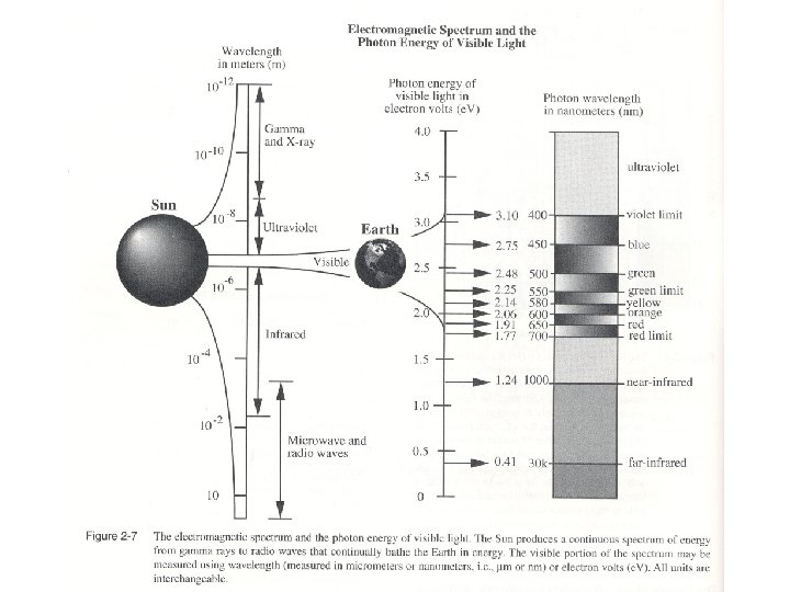
Introduction to LIDAR Mapping Technology LIDAR (Light Detection and Ranging) ALSM (Airborne Laser Swath Mapping) and laser altimetry LASER (Light Amplification by the Stimulated Emission of Radiation) • Amplified electromagnetic radiation of a specific frequency and wavelength generated by stimulated emission. • The radiation emitted by a laser consists of a coherent beam of photons, all in phase and having the same polarization • Commonly generated in the UV-Visible-IR spectral range
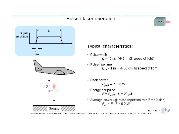
Laser Pulse Generators Airborne topographic mapping lidars - use 1064 nm diode-pumped YAG lasers Bathymetric systems generally use 532 nm diode-pumped YAG lasers Scanner and optics Photodetector and receiver electronics Position and navigation systems Computer System, Memory Management and Data Processing Software
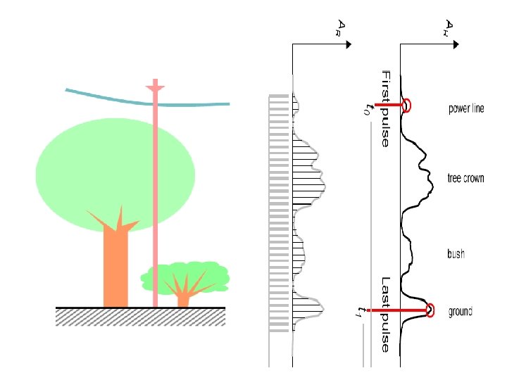
Laser Pulse Reflection T= Two-way Travel time D = distance c = D / (T/2)
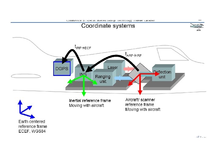
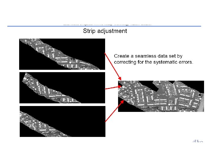
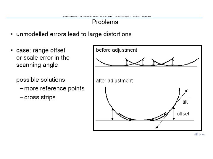
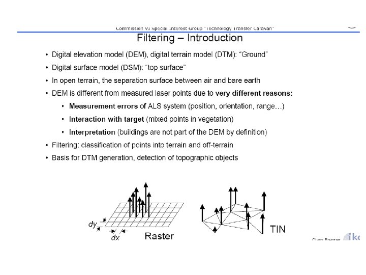
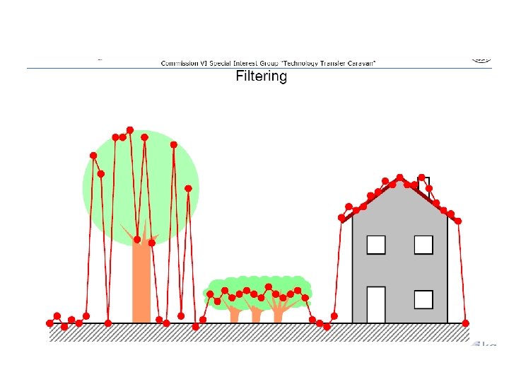
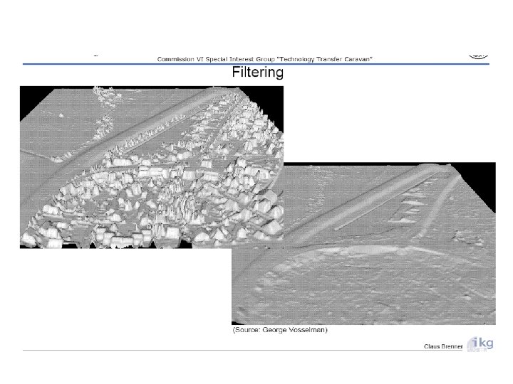
• Airborne Laser Swaths / Flight Operations • Data Management System • Laser Pulse Generation • Laser Pulse Detection • Post-Processing / Error Corrections • Post-Processing / Data Filtering • Digital Modeling • Image Production
laser scanning systems are capable of emitting up to 100, 000 pulses per second
Bainbridge Island, WA Example – 7. 5 -Min DRG
Bainbridge Island, WA Example – 10 m DEM
Bainbridge Island, WA Example – LIDAR 3. 6 m DEM 3. 6 m