INTRODUCTION TO Latitude and Longitude Hemispheres CardinalIntermediate directions


- Slides: 19
INTRODUCTION TO: -Latitude and Longitude -Hemispheres -Cardinal/Intermediate directions -Scale -Time Zones -Legend
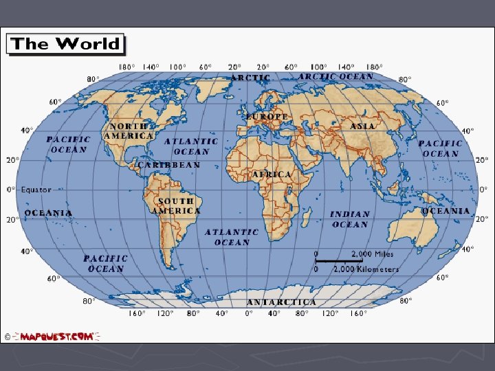
Latitude and Longitude ►The earth is divided into lots of lines called latitude and longitude.
Lines ►LATITUDE lines measure how far north and south of the equator. ►LONGITUDE lines measure how far east and west of the prime meridian. ►The lines measure distances in degrees. Latitude Longitude
Where is the Equator? ►The equator is 0 degrees latitude. ►It is an imaginary belt that runs halfway point between the North Pole and the South Pole. Equator
Where is 0 degree? ► The prime meridian is 0 degrees longitude. It runs from pole to pole. This imaginary line runs through the United Kingdom, France, Spain, western Africa, and Antarctica. Prime Meridian
How do we write it? ► Latitude is always measured and written first and longitude is always measured and written second. ► For example: § Vancouver BC is ► 49 N and 124 W
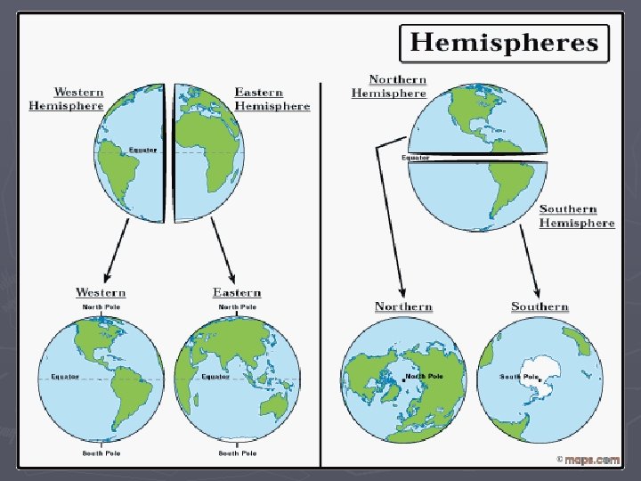
Hemispheres ►By using the equator and prime meridian, we can divide the world into four hemispheres, north, south, east, and west.
Compass ►A compass is a tool that helps the user know what direction one is headed. A compass has a magnetized needle. The needle moves to help the user.
Compass Rose ►A Compass Rose appears on a map and displays the four major directions. ►There are four major or cardinal directions on a compass- north, south, east & west. In between are the directions northeast, northwest, southeast, southwest. Source: http: //aerocompass. larc. nasa. gov
Directions ► The CARDINAL DIRECTIONS are north, south, east, and west. ► The INTERMEDIATE DIRECTIONS are northeast, southwest and northwest. ► They help describe the location of places in relation to other places.
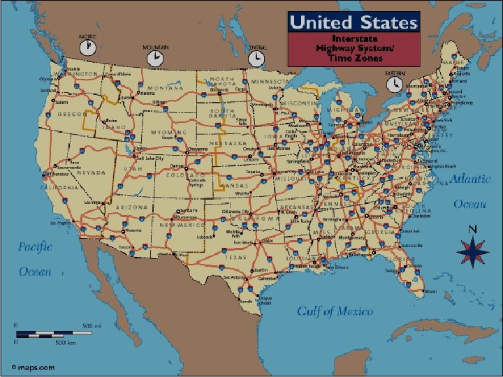
Scale ►Maps are made to scale; that is, there is a direct connection between a unit of measurement on the map and the actual distance. ►For example, each inch on the map represents one mile on Earth. So, a map of a town would show a mile-long strip of fast food joints and auto dealers in one inch.
Scale
Time Zones ►The Earth is divided into 24 time zones, corresponding to 24 hours in a day. ►As the earth rotates, the sun shines in different areas, moving from east to west during the course of a day. ►Places that have the same longitude will be in the same time zone.
Map Legends ► The legend is the key to unlocking the secrets of a map. Objects or colors in the legend represent something on the map. Religions Legend
Can you understand this legend?
Age Expectancy Legend