
Introduction to Hydrologic Processes Rainfall Streamflow 2004 Dr







- Slides: 47
Introduction to Hydrologic Processes Rainfall & Streamflow - 2004 Dr. Philip B. Bedient Civil and Environmental Eng Rice University
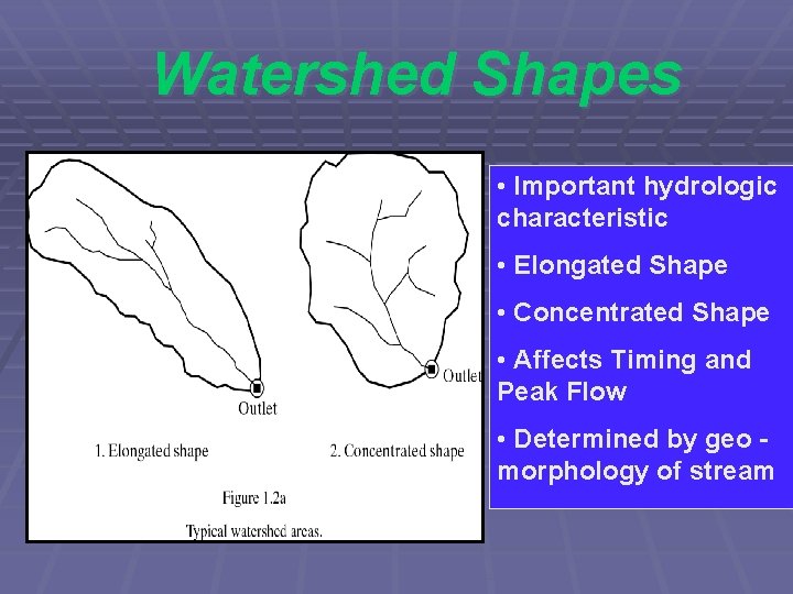
Watershed Shapes • Important hydrologic characteristic • Elongated Shape • Concentrated Shape • Affects Timing and Peak Flow • Determined by geo - morphology of stream
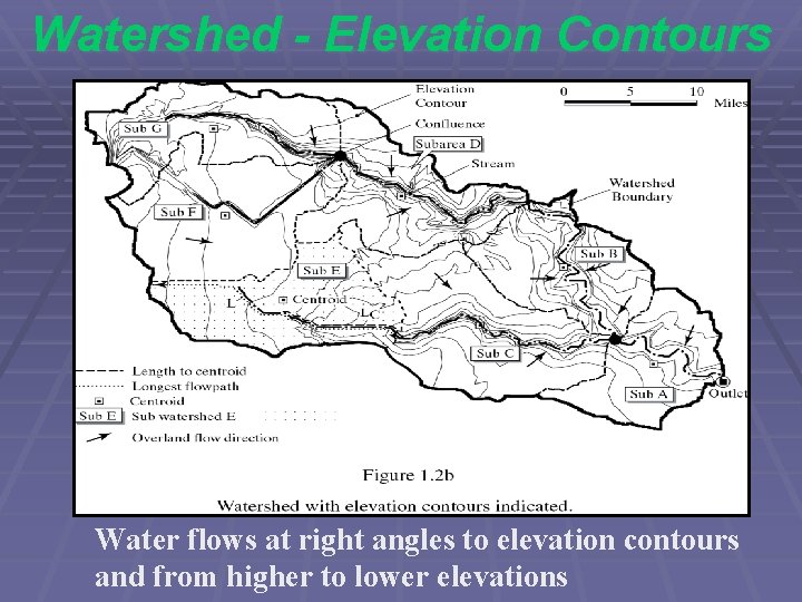
Watershed - Elevation Contours Water flows at right angles to elevation contours and from higher to lower elevations
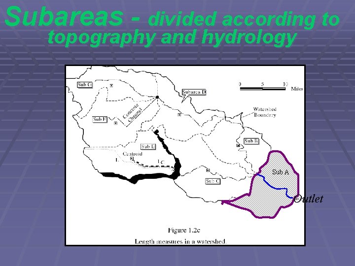
Subareas - divided according to topography and hydrology Sub A Outlet
Texas River Basins Red Trinity Colorado Brazos Rio Grande San Jacinto Hydrologic features with several different types of flow processes
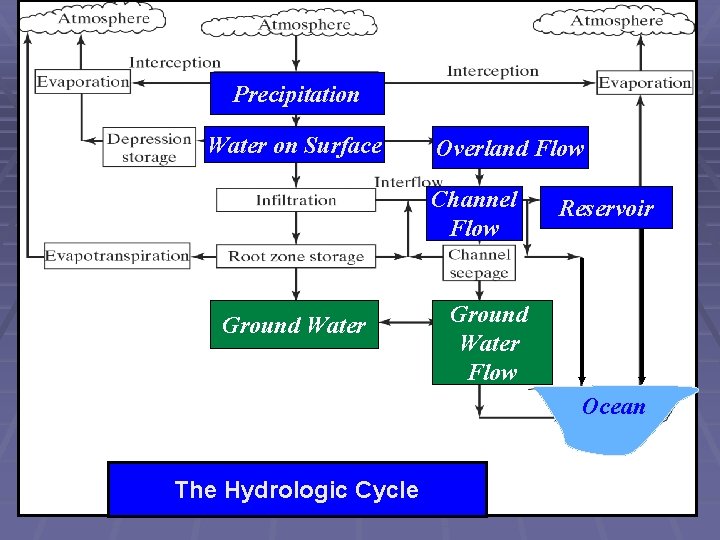
Precipitation Water on Surface Overland Flow Channel Flow Ground Water Reservoir Ground Water Flow Ocean The Hydrologic Cycle
Sources of Rainfall • Severe Storms - Convective Cells • Low Pressure Systems - Hurricanes • Frontal Systems - Cold or Warm • Dew and Fog • Hail and Ice Storms • Condensation
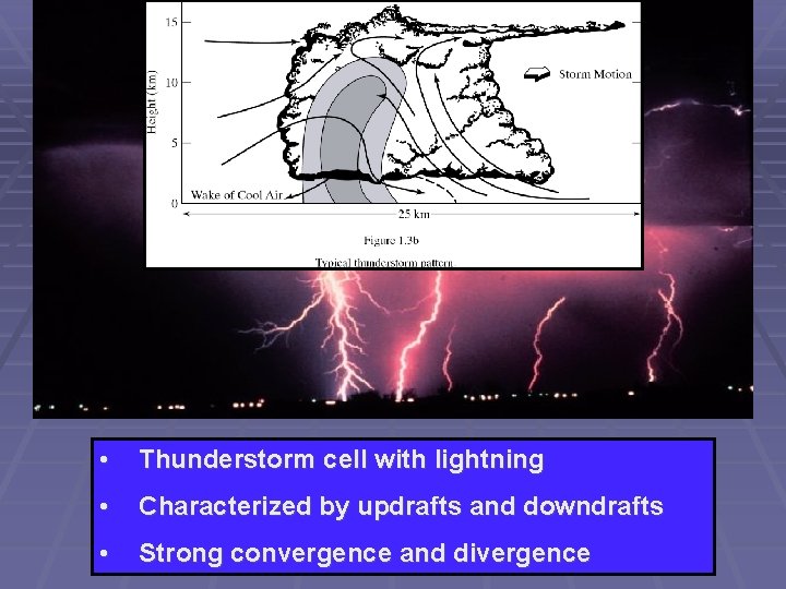
• Thunderstorm cell with lightning • Characterized by updrafts and downdrafts • Strong convergence and divergence
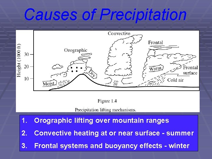
Causes of Precipitation 1. Orographic lifting over mountain ranges 2. Convective heating at or near surface - summer 3. Frontal systems and buoyancy effects - winter
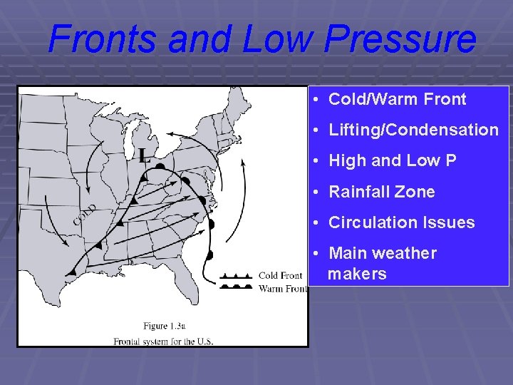
Fronts and Low Pressure • Cold/Warm Front • Lifting/Condensation • High and Low P • Rainfall Zone • Circulation Issues • Main weather makers
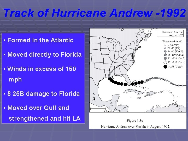
Track of Hurricane Andrew -1992 • Formed in the Atlantic • Moved directly to Florida • Winds in excess of 150 mph • $ 25 B damage to Florida • Moved over Gulf and strengthened and hit LA
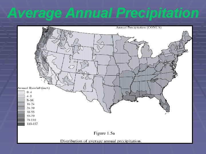
Average Annual Precipitation
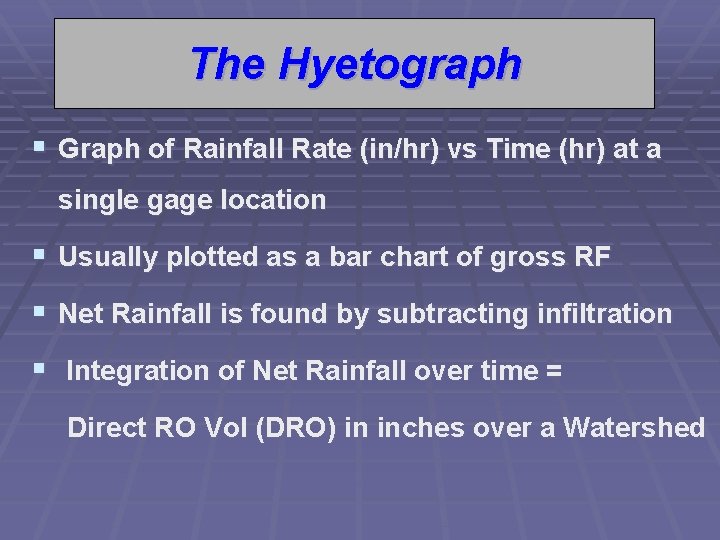
The Hyetograph § Graph of Rainfall Rate (in/hr) vs Time (hr) at a single gage location § Usually plotted as a bar chart of gross RF § Net Rainfall is found by subtracting infiltration § Integration of Net Rainfall over time = Direct RO Vol (DRO) in inches over a Watershed
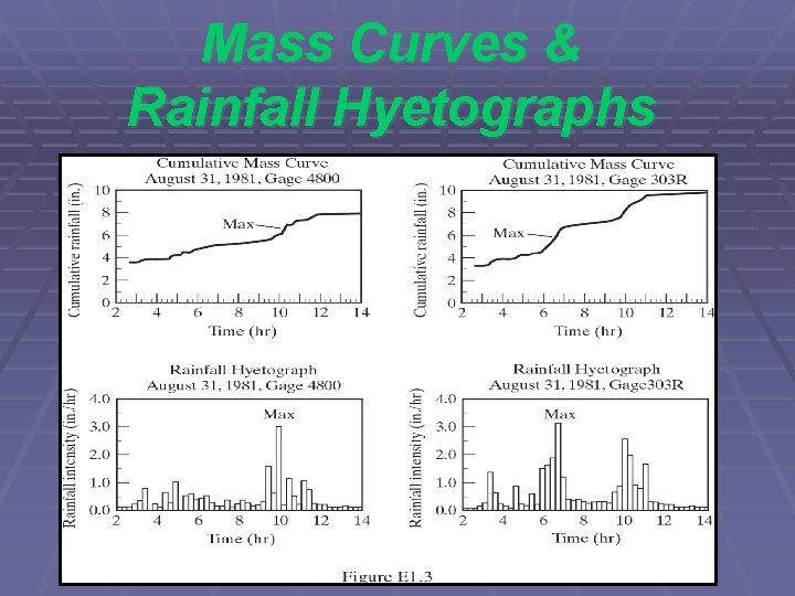
Mass Curves & Rainfall Hyetographs
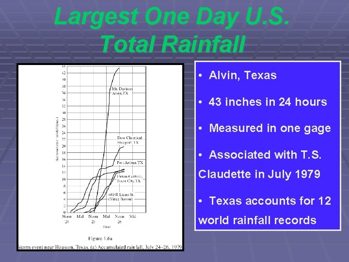
Largest One Day U. S. Total Rainfall • Alvin, Texas • 43 inches in 24 hours • Measured in one gage • Associated with T. S. Claudette in July 1979 • Texas accounts for 12 world rainfall records
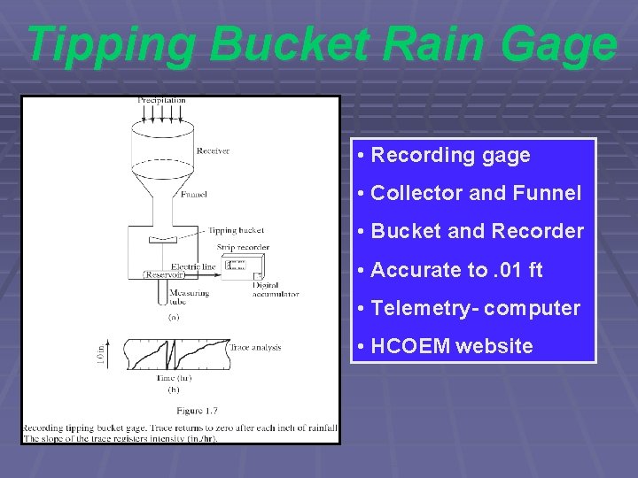
Tipping Bucket Rain Gage • Recording gage • Collector and Funnel • Bucket and Recorder • Accurate to. 01 ft • Telemetry- computer • HCOEM website
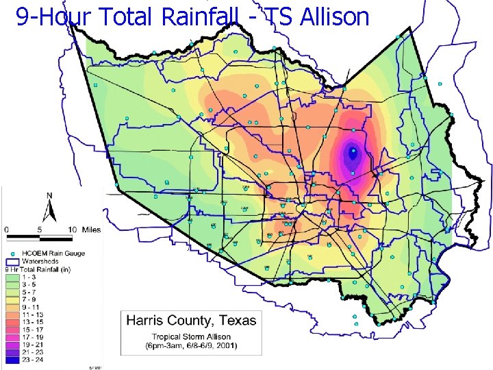
9 -Hour Total Rainfall - TS Allison
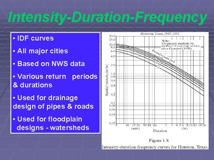
Intensity-Duration-Frequency • IDF curves • All major cities • Based on NWS data • Various return periods & durations • Used for drainage design of pipes & roads • Used for floodplain designs - watersheds
Design Rainfalls § Design Storm from �HCFCD and NWS § Based on Statistical Analysis of Data § 5, 10, 25, 50, 100 Year Events § Various Durations of 6 to 24 hours Six Hour Rainfall
T. S. Allison – Radar Data NEXRAD data is measured every 5 min over each grid cell as storm advances (4 km x 4 km cells) The radar data can be summed over an area to provide total rainfall depths 1 a. m.
T. S. ALLISON RADAR RAINFALL OVER BRAYS BAYOU WATERSHED 12 HOUR TOTALS BY SUBAREA
T. S. Allison Storm Total June 8 -9, 2001 26. 6 in
Thiessen Polygons - Avg P • Connect gages with lines • Form triangles as shown • Create perpendicular bisectors of the triangles • Each polygon is formed by lines and WS boundary • P = S (Ai*Pi) / A
Gage Averaging Methods • Arithmetic • Thiessen Polygon • Isohyetal Contours
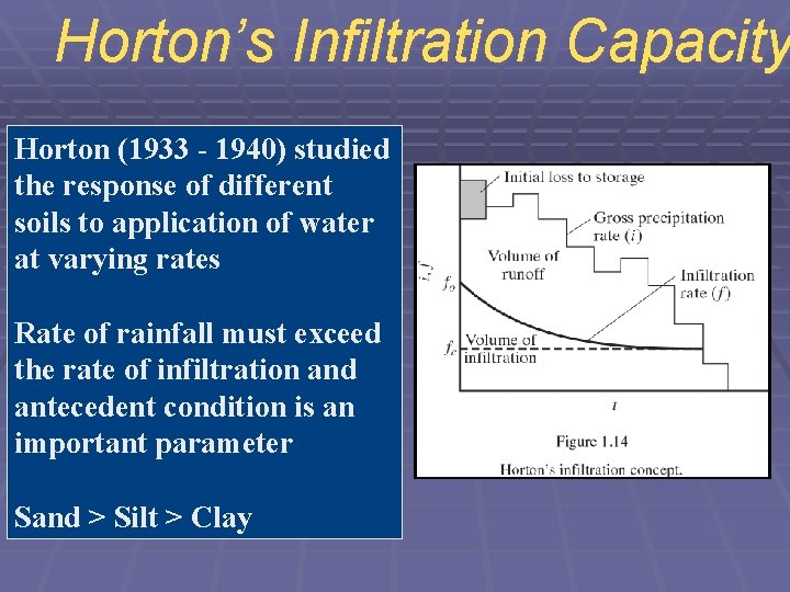
Horton’s Infiltration Capacity Horton (1933 - 1940) studied the response of different soils to application of water at varying rates Rate of rainfall must exceed the rate of infiltration and antecedent condition is an important parameter Sand > Silt > Clay
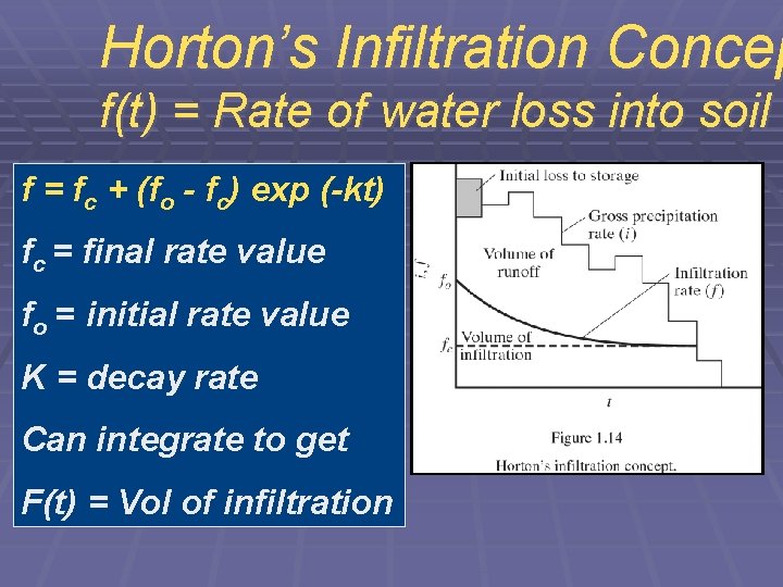
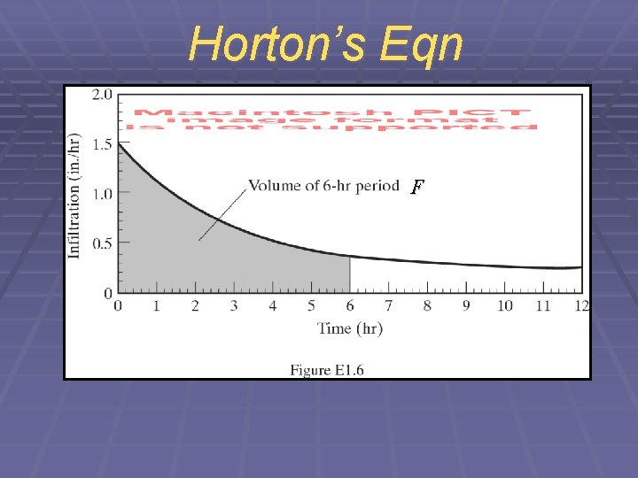
Horton’s Infiltration Concep f(t) = Rate of water loss into soil f = fc + (fo - fc) exp (-kt) fc = final rate value fo = initial rate value K = decay rate Can integrate to get F(t) = Vol of infiltration
Horton’s Eqn F
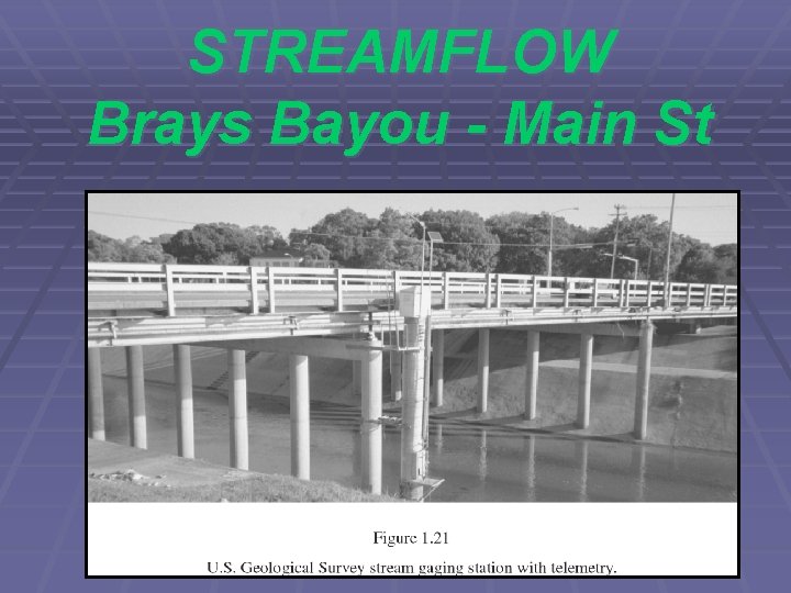
STREAMFLOW Brays Bayou - Main St
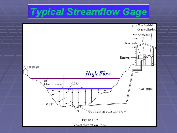
Typical Streamflow Gage High Flow
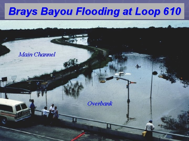
Brays Bayou Flooding at Loop 610 Main Channel Overbank
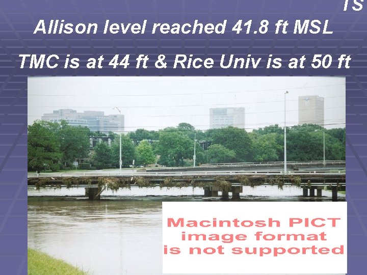
Brays Bayou - T. S. Allison in June, TS TS Allison level reached 41. 8 ft MSL TMC is at 44 ft & Rice Univ is at 50 ft
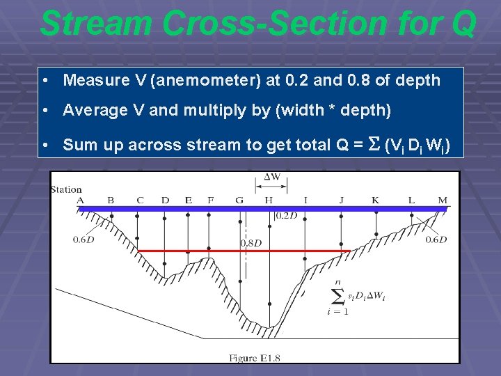
Stream Cross-Section for Q • Measure V (anemometer) at 0. 2 and 0. 8 of depth • Average V and multiply by (width * depth) • Sum up across stream to get total Q = S (Vi Di Wi)
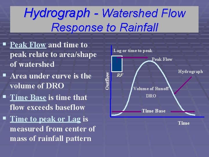
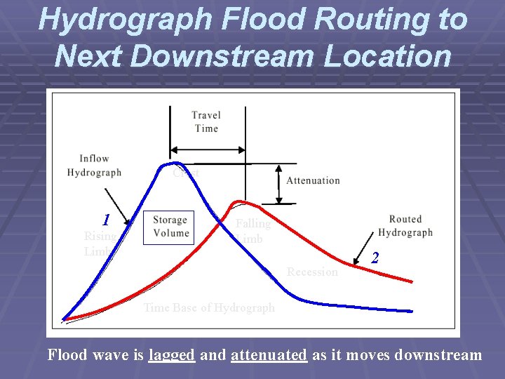
The Hydrograph § Graph of discharge vs. time at a single location § Rising Limb, Crest Segment, Falling Limb, and Recession § Base Flow is usually subtracted to yield DRO § Peak gives the maximum flow rate for the event § Area under curve yields volume of runoff (inches)
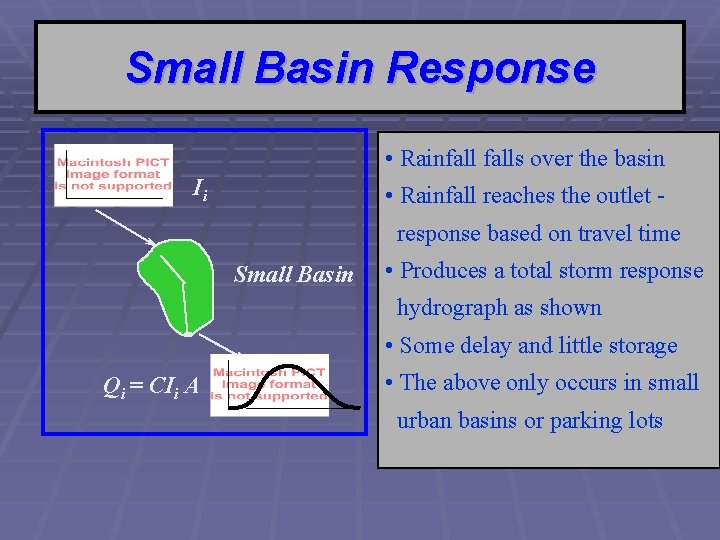
Small Basin Response • Rainfalls over the basin Ii • Rainfall reaches the outlet - response based on travel time Small Basin • Produces a total storm response hydrograph as shown • Some delay and little storage Qi = CIi A • The above only occurs in small urban basins or parking lots
Rainfall and Runoff Response Flow Measured from USGS Gage 403 Inside Harris Gully Rainfall Measured from USGS Gage 400 at Harris Gully Outlet February 12, 1997 on Harris Gully Net Rainfall * Area = integration of direct runoff hydrograph Vol under blue bars * Area = Volume under red line (hydrograph)
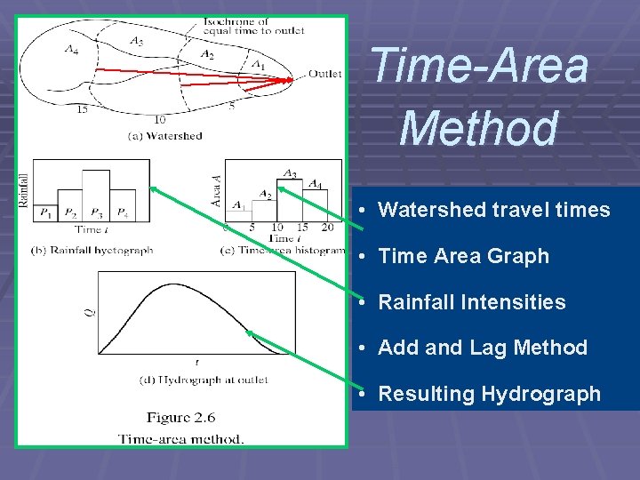
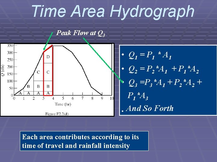
Time-Area Method • Watershed travel times • Time Area Graph • Rainfall Intensities • Add and Lag Method • Resulting Hydrograph
Time Area Hydrograph Peak Flow at Q 3 • Q 1 = P 1 * A 1 • Q 2 = P 2*A 1 + P 1*A 2 • Q 3 =P 3*A 1 + P 2*A 2 + P 1*A 3 • And So Forth Each area contributes according to its time of travel and rainfall intensity
Hydrograph - Watershed Flow Response to Rainfall § Peak Flow and time to Peak Flow Outflow peak relate to area/shape of watershed § Area under curve is the volume of DRO § Time Base is time that flow exceeds baseflow § Time to peak or Lag is measured from center of mass of rainfall pattern Lag or time to peak Hydrograph RF Volume of Runoff DRO Time Base Time
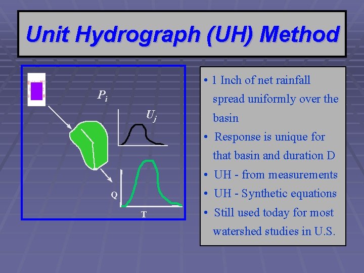
Unit Hydrograph (UH) Method • 1 Inch of net rainfall Pi spread uniformly over the Uj basin • Response is unique for that basin and duration D • UH - from measurements • UH - Synthetic equations Q T • Still used today for most watershed studies in U. S.
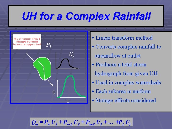
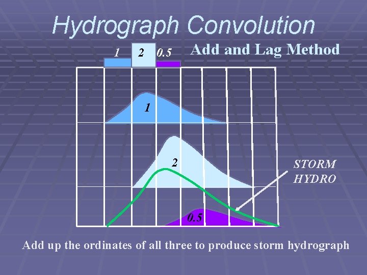
UH for a Complex Rainfall • Linear transform method Pi • Converts complex rainfall to Uj streamflow at outlet • Produces a total storm hydrograph from given UH • Used in complex watersheds • Each subarea is uniform Q T • Storage effects considered Qn = Pn U 1 + Pn-1 U 2 + Pn-2 U 3 + … +P 1 Uj
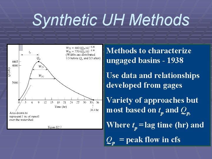
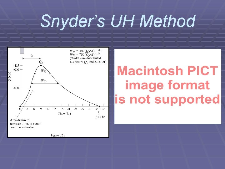
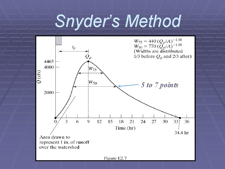
Synthetic UH Methods to characterize ungaged basins - 1938 Use data and relationships developed from gages Variety of approaches but most based on tp and Qp, Where tp = lag time (hr) and Qp = peak flow in cfs
Snyder’s UH Method
Snyder’s Method 5 to 7 points
Hydrograph Convolution 1 2 Add and Lag Method 0. 5 1 2 STORM HYDRO 0. 5 Add up the ordinates of all three to produce storm hydrograph
Hydrograph Flood Routing to Next Downstream Location Crest 1 Rising Limb Falling Limb Recession 2 Time Base of Hydrograph Flood wave is lagged and attenuated as it moves downstream
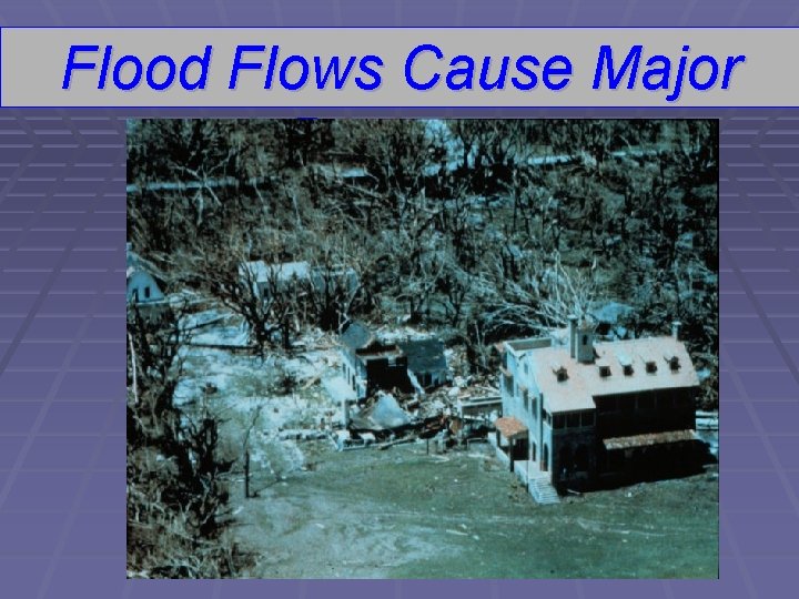
Flood Flows Cause Major Damage
The End