Introduction to GIS Curt Emanuel Clinton County Extension


- Slides: 31

Introduction to GIS Curt Emanuel Clinton County Extension Service

What is GIS? • Geographic Information Systems – Geographically referenced Information – Includes hardware, software and data • Uses Geographic Coordinates • Can be displayed on a Map

What Good is it? • Saves money – Reduce transportation/shipping costs – Targeted advertising/media • Improves decision-making – Natural resource management – Urban planning – Transportation planning and development – Health and Safety

What Good is it? • Improved communication – Provides visual representation of data – Easier to communicate information, particularly across cultures • Manage geographically – Limited natural resources, including geographic space

GPS • Global Positioning Systems – Component of GIS • Space-based – Satellite system – Requires line-of-sight to receiver • Provides time and location information

How does GPS Work? GIS Satellites

How does GPS Work? Satellites Communicate with a receiver Determines where receiver is on Earth

How does GPS Work? • Receiver must communicate with at least three satellites, preferably more – Trilateration (triangulation in 3 dimensions) – Requires line-of-sight (sort of) • Need an earth-based controller – Correct for minor variations – Orbit – Speed

Geographic Coordinates • Latitude & Longitude – Begin by dividing Earth into hemispheres

Geographic Coordinates • Use of decimal degrees – How many degrees? • Where are zeros? – East/West and North/South • Can divide Earth into quadrants – Makes use of negative numbers

Uses in Agriculture • Precision Agriculture – Planting – Fertilizer – Pesticide Applications

Uses in Agriculture Farm Planning

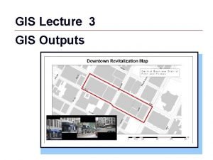
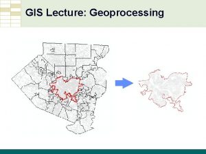
Uses in Mapping • Can be used in almost any type of mapping • If it can be displayed as a map, we can use GIS with it – Geographic features – Transportation routes – Demographics – Weather patterns – Historical developments

Uses in Mapping Geographic Features

Uses in Mapping Transportation Routes

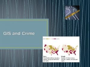
Uses in Mapping Demographics

Uses in Mapping Weather Patterns

GIS Mapping Three main feature types Point: Line: Polygon:

GIS Mapping Uses Layers

Geocaching Definitions • An outdoor recreational activity, in which the participants use a Global Positioning System (GPS) receiver or mobile device and other navigational techniques to hide and seek containers, called "geocaches" or "caches", anywhere in the world. • A sport where one uses billions of dollars worth of government equipment to locate useless dollar store items in remote locations on planet earth.

Geocaching Terms • Geocache - A hidden object or location that is posted by its coordinates for others to find • Geocacher - An individual who tries to locate a geocache after being given the coordinates and maybe some hints • Waypoint - defined coordinates representing points on the surface of the Earth, expressed by latitude and longitude

Geocaching – Caches are hidden and located based on geographic coordinates – Many websites for this such as geocaching. com – 32 geocaches within 5 miles of Frankfort – 18 within 5 miles of Delphi

Geocaching Why Geocache? – Exercise – Good way to plan trips – Scenic Areas – Historical Areas – SWAG!

Geocaching What’s in a Geocache? • Log Book (with or without pencil) • Trackables • SWAG – Stuff We All Get • Prize for FTF (First to Find)

Geocaching • Virtual Geocache – Information search – Common in urban areas – Avoids public safety concerns

Geocaching • Other types of Geocaches – Mystery/Puzzle – Multicaches – Event Caches • Geo. Woodstock – Cache-in, trash-out

Geocaching • Rules of Geocaching – Always leave cache in as good or better shape than you found it – Something out, something in of equal/greater value – Notify cache owner if there’s a problem – Only take trackables if you plan to place them elsewhere – No food!!!

Geocaching • Tips to use with Youth – Insect repellant – Poison Ivy identification lesson – Adult supervision – age dependent – Remember rule about “something in, something out” – Safety first – can even appoint a safety officer

Geocaching http: //www. geocaching. com/

Geocaching Questions?

Geocaching 40’ 32. 894, 86’ 30. 862 1. 40’ 32. 908, 086’ 30. 866 2. 40’ 32. 908, 086’ 30. 866 3. 40’ 32. 917, 086’ 30. 821 4. 40’ 32. 929, 086’ 30. 847 5. 40’ 32. 940, 86’ 30. 825 6. 40’ 32. 925, 86’ 30. 802 7. 40’ 32. 887, 86’ 30. 811
 Clinton county gis
 Clinton gis
 Reconstruction clinton county
 Flanker brand strategy
 Circuit curt
 Curt jones
 Curt pederson
 Chapter 2 sentence check 2 answers curt
 Curtis p. langlotz
 Novel·la cavalleresca
 Como se resuelve
 Curt with requester
 Curt hinton
 Polk county gis florida
 Navajo county tax assessor
 Polk county property appraisers
 Travis county texas gis
 Kentico infor integration
 Kanawha county gis
 Hancock county indiana gis
 Ashland county gis
 Lancaster county gis
 Jim isbell
 Polk county gis
 Kootenai county gis
 Polovodiče typu n a p
 Emanuel kanti
 Liceul teologic baptist emanuel
 Emanuel socaciu
 Elektro emanuel
 Emanuel dohi
 Rebekah emanuel
