Introduction to GIS CS 112 What is GIS


- Slides: 16
Introduction to GIS CS 112
What is GIS? “Geographical Information Systems” Incorporates data with geography (This necessitates decision making. )
GIS Software Most obvious task is mapping. Many options available Arc. GIS QGIS etc.
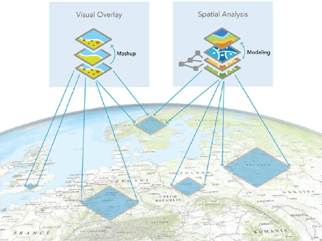
GIS Abilities Analyzing geographic data overlay data sets, spatial relationships, correlations… Visualizing geographic results maps, but also much more…
GIS Decisions Where are you looking? • Is it a place or a space? What are you looking for? • Is it a needle or a haystack? How are they connected?
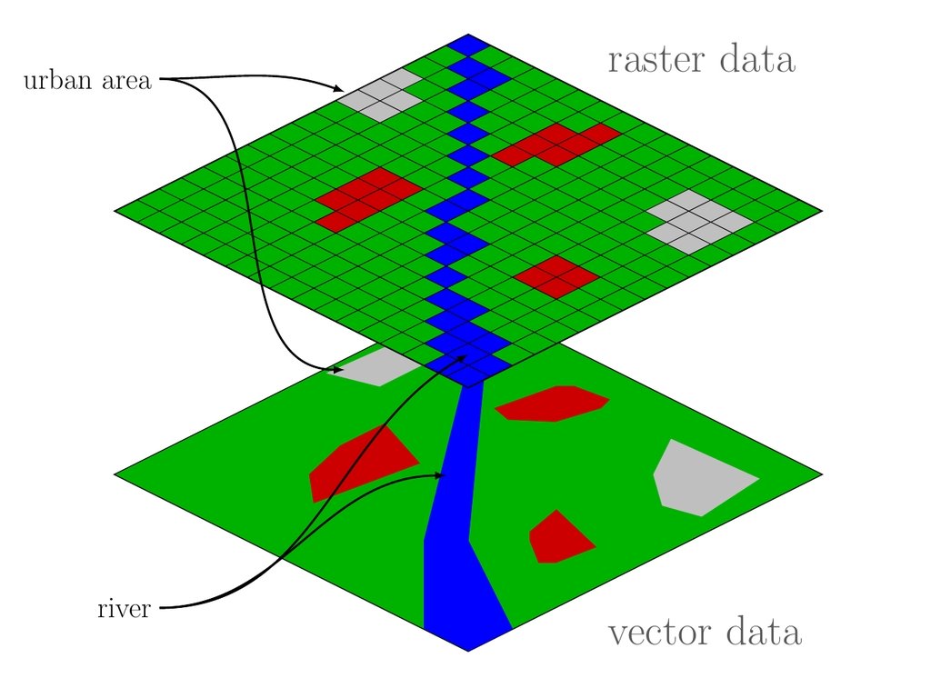
GIS data includes… Non-Geographic Data numbers, values, years, names, etc. geolocation and shape two different types…
Where should an electric company build an industrial power plant that is safe from flooding, earthquakes, fires, and high winds, but is also centered near enough to population centers to be able to serve them without also being so close that its noise becomes annoying for too many of the people who live there, all while optimizing the cost of real estate? Where should a city plan new bus stops or routes? Where should Tim Hortons open its first Louisiana franchise? Is there a correlation between childhood cancer rates and water quality?
Building GIS Analysis Layers … Base map
https: //www. youtube. com/watch? v=Us. Jf 29_Mujw
www. arcgis. com/
I’m afraid of forest fires. Find me someplace safe! I don’t like earthquakes. I’m worried about flooding. I’m not keen on tornadoes. I can’t drive in the snow.