
Introduction to Geomorphology Dr ATUL M JETHE Department

- Slides: 14
Introduction to Geomorphology Dr. ATUL M. JETHE Department of Geography C. T. Bora college, Shirur, Dist. Pune – 412210
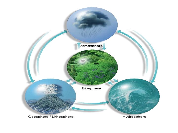
Introduction to Geomorphology The word “geomorphology" comes from the Greek roots"geo, ” “morph, ” and “logos, ” meaning “earth, ” “form, ” and “study, ” respectively. Therefore, geomorphology is literally “the study of earth forms. ” � Geomorphologists are concerned primarily with earth’s surficial features, including their origin, history, composition, and impact on human activity. � Geomorphology concentrates primarily on Quaternary(Pleistocene and Holocene) features. � Earth’s landforms reflect the local and regional balance between hydrologic, tectonic, aeolian, glacial, atmospheric, and marine processes.
Geomorphology defines the processes and conditions that influence landform development, and the physical, morphological, and structural characteristics of landforms. Geomorphologist who study landforms often seek to answer fundamental questions that help them study landforms, such as: § What is the physical form or shape of the landform? • What is the elevation and topographic relief of the landform? • How did the landform originate? • What is the distribution of the landform and where else does itoccur? • Are their any patterns associated with the landform or topography? • What is the significance of the landform in relation to other elementsof the landscape or environment? • Has the landform or geomorphology been altered by humans? • Does the landform or geomorphology affect humans? •
Basic Definitions Topography refers to the elevation and relief of the Earth’s surface. Landforms are the topographic features on the Earth’s surface. Geomorphology is the study of earth surface processes and landforms.
Topography • Topography is a term used to describe the Earth’s surface. Topography includes a variety of different features, collectively referred to as landforms. • Topography is measured by the differences in elevation across the earth’s surface. • Differences between high and low elevation are referred to as changes in relief.
Landforms are the individual topographic features exposed on the Earth’s • surface. • Landforms vary in size and shape and include features such as small creeks or sand dunes, or large features. • Landforms develop over a range of different time-scales. Some landforms develop rather quickly (over a few seconds, minutes, or hours), such as a landslide, while others may involve many millions of years toform, such as a mountain range. • Landform development can be relatively simple and involve only a few processes, or very complex and involve a combination of multiple processes and agents. • Landforms are dynamic features that are continually affected by a variety of earth-surface processes including weathering, erosion, and deposition.
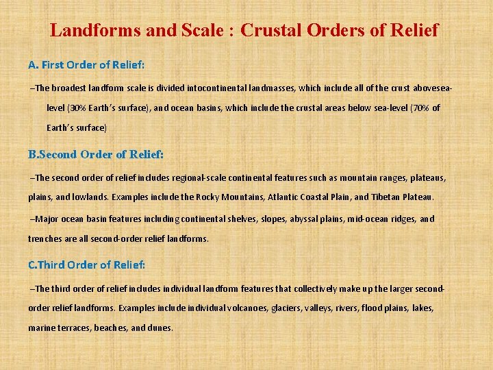
Landforms and Scale : Crustal Orders of Relief A. First Order of Relief: –The broadest landform scale is divided intocontinental landmasses, which include all of the crust abovesea- level (30% Earth’s surface), and ocean basins, which include the crustal areas below sea-level (70% of Earth’s surface) B. Second Order of Relief: –The second order of relief includes regional-scale continental features such as mountain ranges, plateaus, plains, and lowlands. Examples include the Rocky Mountains, Atlantic Coastal Plain, and Tibetan Plateau. –Major ocean basin features including continental shelves, slopes, abyssal plains, mid-ocean ridges, and trenches are all second-order relief landforms. C. Third Order of Relief: –The third order of relief includes individual landform features that collectively make up the larger secondorder relief landforms. Examples include individual volcanoes, glaciers, valleys, rivers, flood plains, lakes, marine terraces, beaches, and dunes.
Uniformitarianism –Uniformitarianism is a common theory held by earth scientists that states “the present is the key to the past”. Uniformitarianism implies that the processes currently shaping the Earth’s topography and landforms are the same processes as those which occurred in the past. –By studying geomorphology, we are better able to interpret the origin of landforms and infer their future evolution within the landscape. –Such applications are especially important for predicting, preventing, and mitigating natural hazards impact to humans, and managing our natural resources for future generations
IMPORTANCE OF GEOMORPHOLOGY To understand geomorphological processes of various environment. • • To detect natural and environmental hazards efficiently, e. g. earthquake, flooding, landslide, tsunami, volcanism etc. • To identify various landform features and landscapes • To identify various landform features from satellite images • Coastal and river research • Vulnerability studies • Used in Geology, Geography, Archeology, Engineering, Planning, Mining, Construction, Urbanization …
Thanks