Introduction to ACCESS NWP Chris Tingwell Bureau of
Introduction to ACCESS NWP Chris Tingwell Bureau of Meteorology R&D Branch Earth Systems Modelling Program Data Assimilation Team ACCESS Users Training Workshop March 23 rd 2016
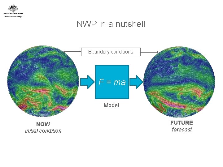
NWP in a nutshell Boundary conditions F = ma Model NOW initial condition FUTURE forecast
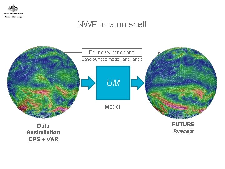
NWP in a nutshell Boundary conditions Land surface model, ancillaries UM Model Data Assimilation OPS + VAR FUTURE forecast
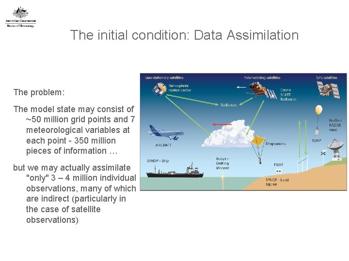
The initial condition: Data Assimilation The problem: The model state may consist of ~50 million grid points and 7 meteorological variables at each point - 350 million pieces of information … but we may actually assimilate "only" 3 – 4 million individual observations, many of which are indirect (particularly in the case of satellite observations)
What a data assimilation system has to do Create initial condition for the model • Also an accurate analysis of the atmosphere • Only include features that are supported by the model • Filter out small scale imbalances that lead to spurious gravity waves (initialisation). Use vast amount of data • Account for differences in time, space, variable, scale and accuracy • Data can be indirect and most data are indirect: satellite radiances, GPS signals, radar etc. • Account for complex & non-linear relationship between observed and basic variables Use the previous forecast as "background" • Represents previous observations projected forward in time • Important source of data, independent of current observations • Necessary as number of grid values >> number of observations
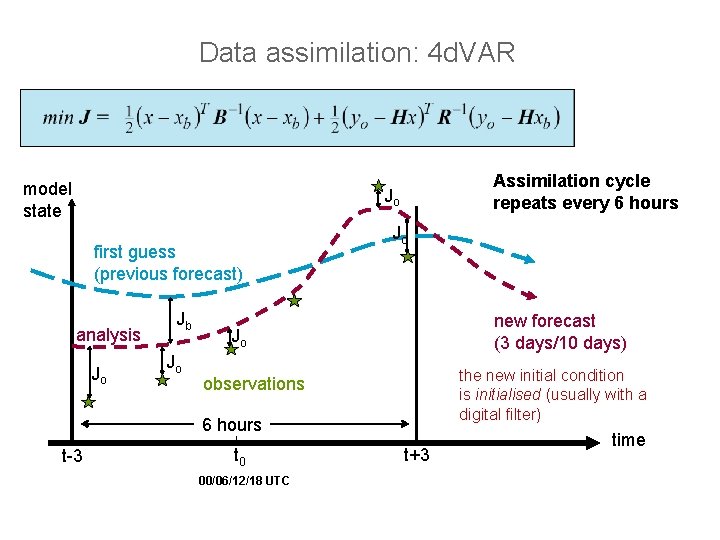
Data assimilation: 4 d. VAR model state Assimilation cycle repeats every 6 hours Jo first guess (previous forecast) analysis Jo Jb Jo Jo new forecast (3 days/10 days) Jo the new initial condition is initialised (usually with a digital filter) observations 6 hours t-3 t 0 00/06/12/18 UTC t+3 time
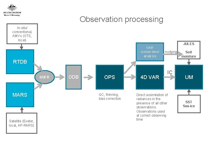
Observation processing In-situ/ conventional, AMVs (GTS, local) JULES VAR screen-level analysis nudging Soil moisture RTDB BUFR MARS Satellite (Exeter, local, AP-RARS) ODB OPS QC, thinning, bias correction 4 D VAR IC Direct assimilation of radiances in the presence of all other observations. Observations used at correct observing time UM SST Sea-ice
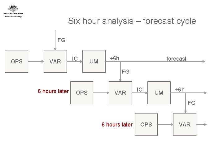
Six hour analysis – forecast cycle FG OPS VAR IC UM +6 h forecast FG 6 hours later OPS VAR IC UM +6 h FG 6 hours later OPS VAR
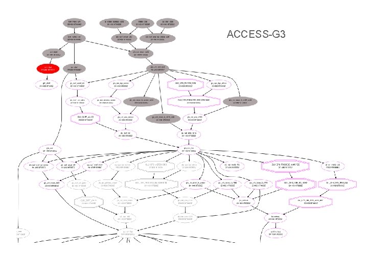
ACCESS-G 3
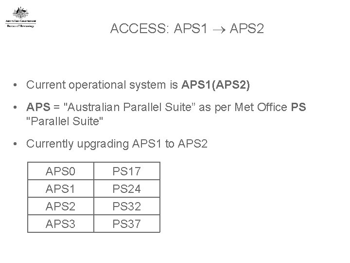
ACCESS: APS 1 APS 2 • Current operational system is APS 1(APS 2) • APS = "Australian Parallel Suite” as per Met Office PS "Parallel Suite" • Currently upgrading APS 1 to APS 2 APS 0 APS 1 APS 2 APS 3 PS 17 PS 24 PS 32 PS 37
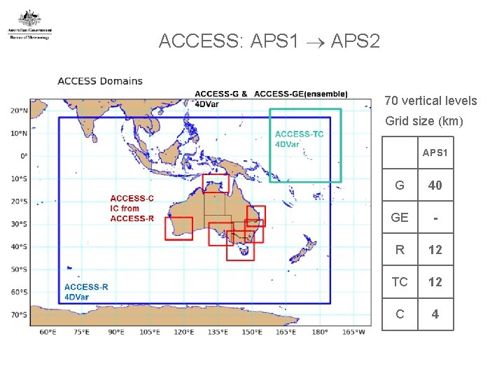
ACCESS: APS 1 APS 2 70 vertical levels Grid size (km) APS 1 11 G 40 GE - R 12 TC 12 C 4
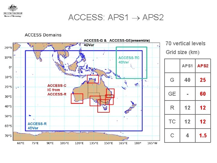
ACCESS: APS 1 APS 2 70 vertical levels Grid size (km) 12 APS 1 APS 2 G 40 25 GE - 60 R 12 12 TC 12 12 C 4 1. 5
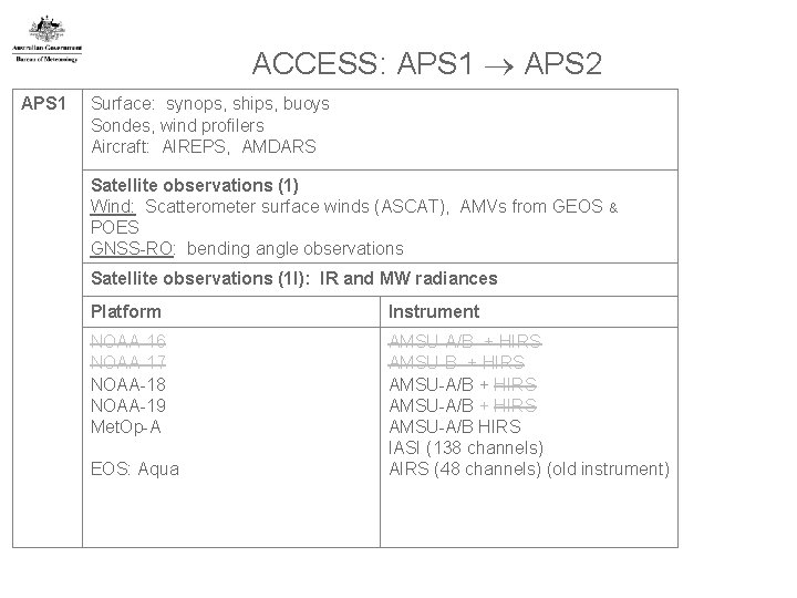
ACCESS: APS 1 APS 2 APS 1 Surface: synops, ships, buoys Sondes, wind profilers Aircraft: AIREPS, AMDARS Satellite observations (1) Wind: Scatterometer surface winds (ASCAT), AMVs from GEOS POES GNSS-RO: bending angle observations & Satellite observations (1 I): IR and MW radiances Platform Instrument NOAA-16 NOAA-17 NOAA-18 NOAA-19 Met. Op-A AMSU-A/B + HIRS AMSU-A/B HIRS IASI (138 channels) AIRS (48 channels) (old instrument) EOS: Aqua
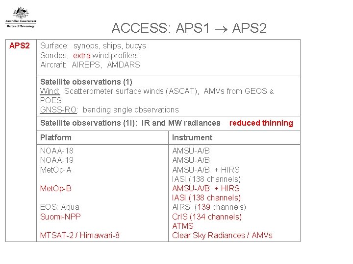
ACCESS: APS 1 APS 2 Surface: synops, ships, buoys Sondes, extra wind profilers Aircraft: AIREPS, AMDARS Satellite observations (1) Wind: Scatterometer surface winds (ASCAT), AMVs from GEOS POES GNSS-RO: bending angle observations Satellite observations (1 I): IR and MW radiances & reduced thinning Platform Instrument NOAA-18 NOAA-19 Met. Op-A AMSU-A/B + HIRS IASI (138 channels) AIRS (139 channels) Cr. IS (134 channels) ATMS Clear Sky Radiances / AMVs Met. Op-B EOS: Aqua Suomi-NPP MTSAT-2 / Himawari-8
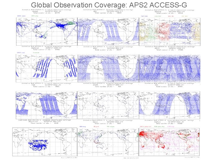
Global Observation Coverage: APS 2 ACCESS-G
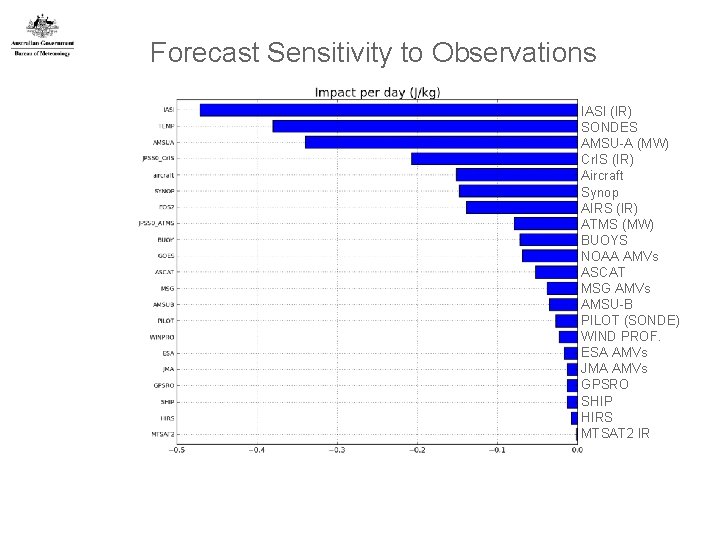
Forecast Sensitivity to Observations IASI (IR) SONDES AMSU-A (MW) Cr. IS (IR) Aircraft Synop AIRS (IR) ATMS (MW) BUOYS NOAA AMVs ASCAT MSG AMVs AMSU-B PILOT (SONDE) WIND PROF. ESA AMVs JMA AMVs GPSRO SHIP HIRS MTSAT 2 IR
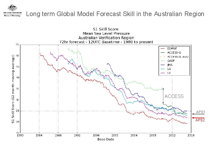
Long term Global Model Forecast Skill in the Australian Region ACCESS APS 1 APS 2
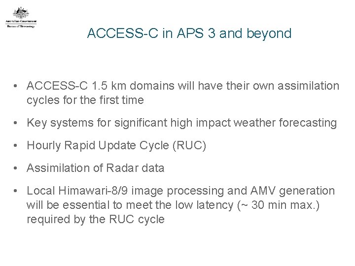
ACCESS-C in APS 3 and beyond • ACCESS-C 1. 5 km domains will have their own assimilation cycles for the first time • Key systems for significant high impact weather forecasting • Hourly Rapid Update Cycle (RUC) • Assimilation of Radar data • Local Himawari-8/9 image processing and AMV generation will be essential to meet the low latency (~ 30 min max. ) required by the RUC cycle
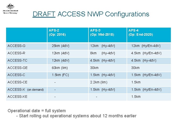
DRAFT ACCESS NWP Configurations APS-2 (Op: 2016) APS-3 (Op: Mid-2018) APS-4 (Op: End-2020) ACCESS-G 25 km {4 d. V} 12 km {Hy-4 d. V} 12 km {Hy/En-4 d. V} ACCESS-R 12 km {4 d. V} 8 km 4. 5 km {Hy/En-4 d. V} ACCESS-TC 12 km {4 d. V} 4. 5 km {Hy-4 d. V} ACCESS-GE 60 km (lim) 30 km ACCESS-C 1. 5 km {FC} 1. 5 km {Hy-4 d. V} 1. 5 km {Hy/En-4 d. V} {Hy-4 d. V} ACCESS-CE - 2. 2 km (lim) 1. 5 km ACCESS-X (on demand) - 1. 5 km {Hy-4 d. V} 1. 5 km {Hy/En-4 d. V} ACCESS-XE - - 1. 5 km Operational date = full system - Start rolling out operational systems about 12 months earlier
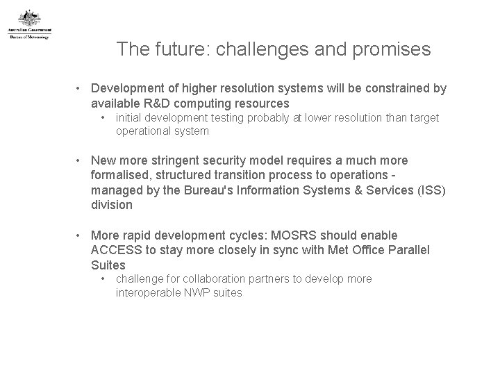
The future: challenges and promises • Development of higher resolution systems will be constrained by available R&D computing resources • initial development testing probably at lower resolution than target operational system • New more stringent security model requires a much more formalised, structured transition process to operations managed by the Bureau's Information Systems & Services (ISS) division • More rapid development cycles: MOSRS should enable ACCESS to stay more closely in sync with Met Office Parallel Suites • challenge for collaboration partners to develop more interoperable NWP suites

Thank you … Chris Tingwell c. tingwell@bom. gov. au

Extra slides
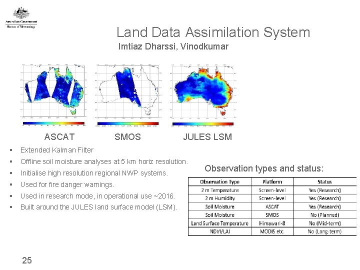
Land Data Assimilation System Imtiaz Dharssi, Vinodkumar ASCAT SMOS JULES LSM § Extended Kalman Filter § Offline soil moisture analyses at 5 km horiz resolution. § Initialise high resolution regional NWP systems. § Used for fire danger warnings. § Used in research mode, in operational use ~2016. § Built around the JULES land surface model (LSM). 25 Observation types and status:
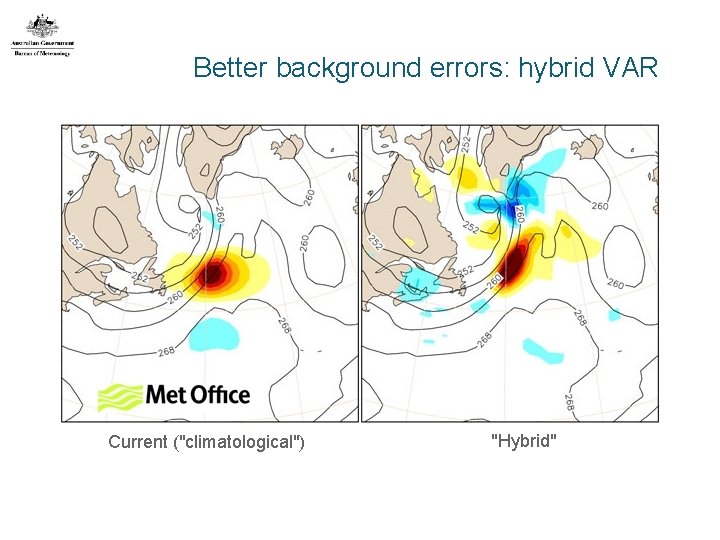
Better background errors: hybrid VAR Current ("climatological") "Hybrid"
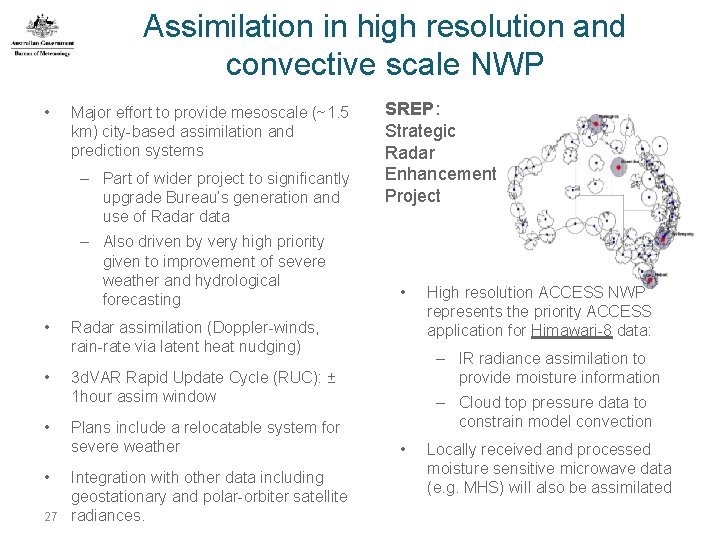
Assimilation in high resolution and convective scale NWP • Major effort to provide mesoscale (~1. 5 km) city-based assimilation and prediction systems – Part of wider project to significantly upgrade Bureau’s generation and use of Radar data – Also driven by very high priority given to improvement of severe weather and hydrological forecasting • • 27 SREP: Strategic Radar Enhancement Project • Radar assimilation (Doppler-winds, rain-rate via latent heat nudging) – IR radiance assimilation to provide moisture information 3 d. VAR Rapid Update Cycle (RUC): ± 1 hour assim window Plans include a relocatable system for severe weather Integration with other data including geostationary and polar-orbiter satellite radiances. High resolution ACCESS NWP represents the priority ACCESS application for Himawari-8 data: – Cloud top pressure data to constrain model convection • Locally received and processed moisture sensitive microwave data (e. g. MHS) will also be assimilated
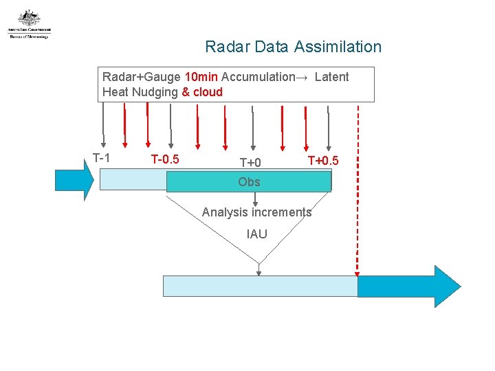
Radar Data Assimilation Radar+Gauge 10 min Accumulation→ Latent Heat Nudging & cloud T-1 T-0. 5 T+0. 5 Obs Analysis increments IAU
- Slides: 26