Intro to Geomorphology Key Concepts Geomorphology Literally means


 • Two end members - 1. Evolutionary Geomorphology > championed")

 • Process Geomorphology > Originally proposed by G. K. Gilbert")


 x distance (s) Fs = Potential Energy (PE) F=mass (m)")


- Slides: 32
Intro to Geomorphology Key Concepts
Geomorphology • Literally means the study of earth landforms - Geo = Earth - Morph=Form - Logos= Study of • Involves understanding of - Mineralogy - Structure - Tectonics - Stratigraphy - Chemistry - Physics - Meteorology & Climatology
Why Bother? • Critical toward understanding - Climate change > systems respond differently to changes in rainfall, temperature changes, and changes in storm strength - Past tectonic activity > distinctive stratigraphic and landform features form in response to tectonics - Engineering problems > Construction of bridges, highways, houses, etc depend on past, current and future understanding of potentially destructive events - Hazard assessment > map out locations that have good have high risk of potential changes - Stratigraphy > all of the sedimentary stratigraphic record is the end product of geomorphic activity/ processes
Agents of Change. . . Rivers & Oceans Gravity Glaciers Wind
And human beings. . . • Significant agents of Geomorphic change - causes changes themselves > remove or oversteepening slopes causes mass wasting > improperly operated dams and levee management cause catastrophic failures - Accelerate processes already occurring > Build buildings along cliffs that are poised to fail > construct jettis along coastlines that are experiencing erosion problems
Why we areagents significant agents of change Significant of change - Accelerate processes already occurring > Build buildings along cliffs that are poised to fail > construct jettis along coastlines that are experiencing erosion problems > construct dams, often where they shouldn't be
Paradigms (1 of 2) • Two end members - 1. Evolutionary Geomorphology > championed by William Morris Davis > part of trend toward seeing everything in light of Darwinian Evolutionary Theory > landscapes evolve throughout time, > stage of evolution can be determined by examining the characteristics of the landscape > implies that TIME is the critical factor in determining what the landscape looks like
Davis' Landscape evolution model (most notably identified for streams and mountains as in this example from an intro geology textbook)
Paradigms (2 of 2) • Process Geomorphology > Originally proposed by G. K. Gilbert > Drew upon his Engineering background > landforms are a balance between resisting framework and the forces acting to alter the landscape > Implies that time is one component of many that affect the appearance of the Earth > Inferred that the landscape was in equilibrium Between driving forces and resisting forces
Landscape in equilibrium- slope example from Gilbert Time = 0 Time = 1 Time = 2
Dynamic Equilibrium • Davisian Geomorphology & TIME as dominant factor dominated the scientific literature until the 1960's • John Hack proposed landscape development occurred similarly to the way Gilbert had espoused - Hack recognized, however, that there was considerable variability in most geomorphic systems > most were in dynamic equilibrium i. e. , There is a balance between opposing forces that has considerable variation. Once overcome, balance must be re-established under the new conditions
Equilibrium & Time • Steady - no changes over short time • Graded Time - small changes over longer time - due to fluctuations in boundary conditions • Cyclic time - the same changes occur over time - as conditions dictate - Average conditions change with time
Driving Forces in geomorphology • Climate - Originally recognized as an agent of change by Walther Penck - Ultimately driven by the Sun and incoming solar radiation (insolation) interacting with Earth’s major systems - Variable at a number of temporal and spatial scales - includes temperature, moisture, and pressure/wind systems • Gravity - acts in conjunction with other driving forces - determines how much work will operate on all systems • Internal Heat - drives plate motion and tectonic activity - Ultimately controls potential energy for work
Work = Force (F) x distance (s) Fs = Potential Energy (PE) F=mass (m) x acceleration (a) • on earth F=mg Weight (W) = m x gravity (g) In simplified terms work is related to the amount of potential energy and the mass of the stuff being transported
Resisting Framework • Rocks! - Strength of the rocks/sediments affects the potential processes that might act upon the materials - e. g. , some lithologies behave as a brittle solid, some behave as a plastic solid - controls processes at a variety of temporal and spatial scales • Structure (Tectonics) - causes zones of weakness - causes redistribution of lithologies - causes climatic variability
Basin and Range- Structure and geomorphology
Ridge and Valley - structure and geomorphology
San Andreas Fault on the Carrizo Plain in California Structure, climate and geomorphology
Thresholds of Change • Implied within dynamic equilibrium - some variability is absorbed by the systems without discernable changes - some variability forces the system to change creating permanent changes • two kinds of thresholds - Extrinsic= external thresholds > e. g. , climate changes - Intrinsic=internal to the system > e. g. , gullying of streams? Difficult to identify when and what controls the intrinsic thresholds.
Complex response • can occur at a variety of scales - common in larger systems • different areas in the systems respond differently depending on a variety of factors • some may respond in exactly the opposite way to the same event Stream gradient profiles adjusting to climatically driven change
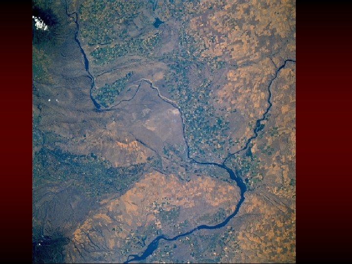
Process Linkage • Operates on domino principle • one part of a system changes, which triggers changes in another part • Complicates what is known as “complex response” • Example the Post Creek Cut-off of the Cache River in Southern Illinois
Internal Influences • Endogenic changes - keep the world from progressing to a featureless ball - In theory this could occur - idea proposed by William Morris Davis called peneplanation - doesn't happen on earth (in most areas) because internal forces cause uplift > increases potential energy > usually initiates change
Categories of Endogenic influence • Epeirogeny - regional uplift with minimal deformation of strata > Geomorphic responses are less than with other categories - influenced by GEOID > equipotential surface of the Oceans > has considerable distortions that appear as topography > hypothetical equipotential surface called the SPHEROID > all the minor perturbations in the surface due to interaction of all the gravitational forces are removed - Isostasy > adjustment of crust due to mass of rocks, sediments, & water > elevation of continents and other crust is a function of density of crustal materials and the forces acting inside the earth
Geoid / Spheroid
Why worry about this? • Motion dictates geomorphic reaction - Upward vertical motion > increases potential energy- can be used by exogenic processes to act on the surface- see slide 13 of this set - Downward vertical motion > decreases potential energy Isostatic equilibrium • continents are in some balance with the internal materials
Exogenic Forces- Climate change Primary influence on surface processes Has its own subcategory called climatic geomorphology relates climate to why certain landforms form under a given set of climate conditions • Glacial and periglacial landforms • Aeolian and arid region landforms • Mass wasting landforms • River response and form • Coastal processes
Major climatic zones influencing Earth’s surface processes What are the dominant agents and processes likely to influence surface processes in each zone?
Climatic implications…? Langbein and Schumm, 1958
Moisture distribution- where are worlds largest rivers? Maximum precipitation
Climate-related geomorphology August 2004 Flood Event in Death Valley, CA scour line aggradation degradation aggradation Remnant debris flow deposit(s), indicating significant aggradation and then in later stages degradation during the event. Note the high water scour line above the deposit.
Eustasy- Changes in the volume of water in ocean basins relative to the size of the basins Strong influence on climate AND geomorphic processes in coastal and fluvial settings