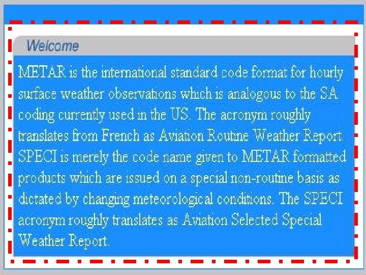
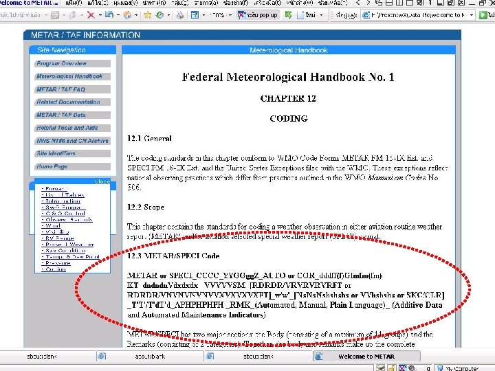
INTERPRETING WEATHER DATA Volume 1 METAR or SPECI


 2. Location Identifier – ICAO")
 or vertical visibility 9.")
 2. Location Identifier – ICAO")

")


 - Upper Air Temperature (flight level) - SIGMET")


- Slides: 51
“ INTERPRETING WEATHER DATA ” Volume. 1
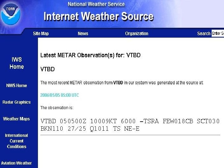
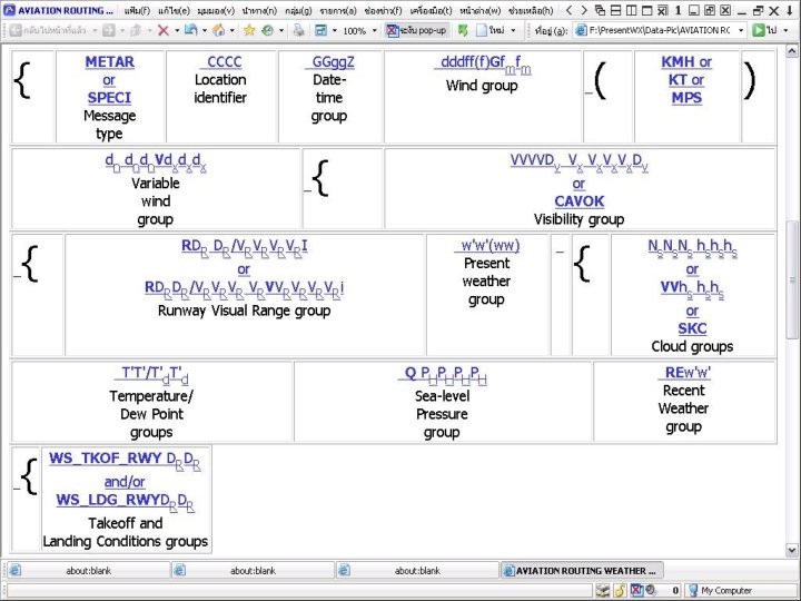
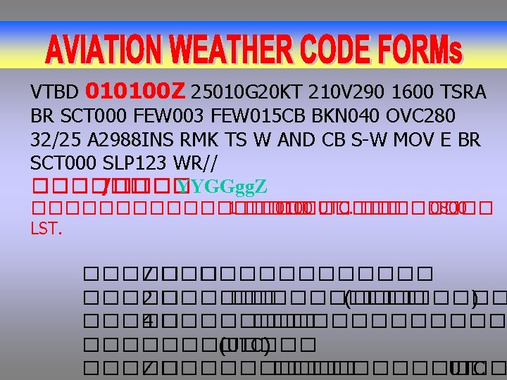
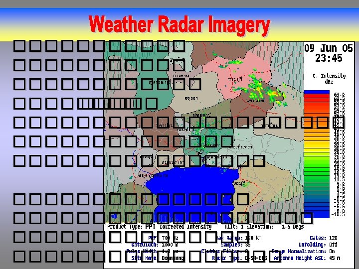
METAR or SPECI CCCC YYGGgg. Z AUTO or COR dddff. Gfmfm. KT dndndn. Vdxdxdx VVVV RDRDR/VRVRFT or RDRDR/VNVNVVXVX w’w’ NSNSNSh. Sh. S [or VVh. Sh. S or SKC] T’T’/T’d. T’d APHPH RMK Encode ���� VTBD 010100 25010 G 20 KT 210 V 290 1600 TSRA BR SCT 000 FEW 003 FEW 015 CB BKN 040 OVC 280 32/25 A 2988 INS RMK TS W AND CB S-W MOV E BR SCT 000 SLP 123 WR//
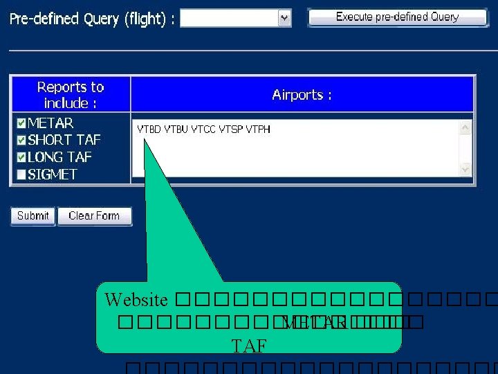
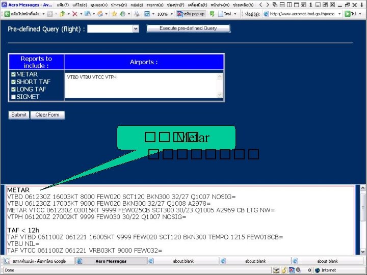
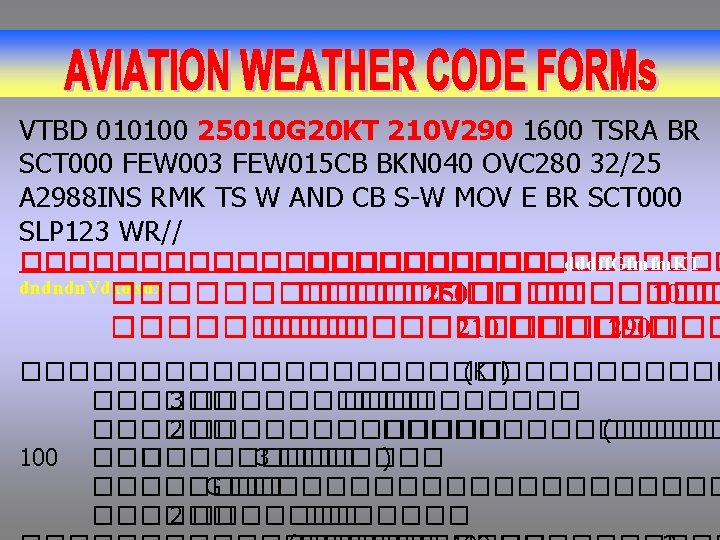
VTBD 010100 25010 G 20 KT 210 V 290 1600 TSRA BR SCT 000 FEW 003 FEW 015 CB BKN 040 OVC 280 32/25 A 2988 INS RMK TS W AND CB S-W MOV E BR SCT 000 SLP 123 WR// ����������� CCCC ����� 4 ����������������� VTMD ���� VTNI ������VTNC ������
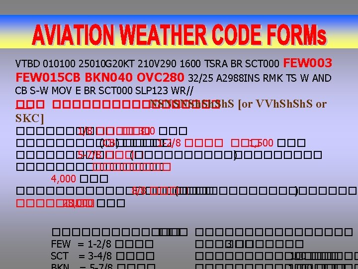
VTBD 010100 25010 G 20 KT 210 V 290 1600 TSRA BR SCT 000 FEW 003 FEW 015 CB BKN 040 OVC 280 32/25 A 2988 INS RMK TS W AND CB S-W MOV E BR SCT 000 SLP 123 WR// ����� ����������� VVVV กลมรหสรายงานคา ทศน วสยทวไป 1, 600 เมตร หรอ 1 ไมล 1/ 16 1/ 4 ½ มคาเทากบ 1 5 Miles Meter Miles Meter 0 0 0100 0200 0300 0400 0500 0600 3/ 8 0600 0800 1000 1200 1400 1600 1800 2000 2400 2600 2800 3000 3200 2 2 ¼ 2 ½ 3200 3600 4000 2 ½ 3 4000 4800 3 4 5 6 7 8 9 10 11 12 13 14 15 4800 6000 8000 9999 9999 9999 15 20 25 30 35 40 etc. 9999 9999 1/ 16 1/ 8 3/ 16 ¼ 1/ 8 5/ 16 3/ 8 ½ 5/ 8 ¾ 7/ 8 1 1 1/8 1 ¼ 1 ½ 1 5/8 1 ¾ 1 7/8 2
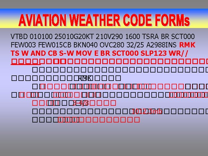
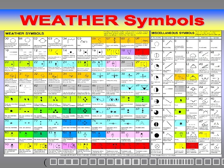
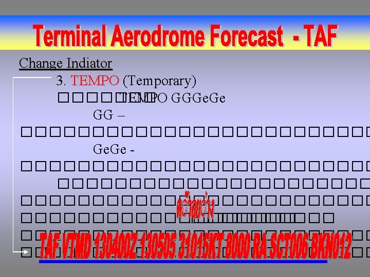
VTBD 010100 25010 G 20 KT 210 V 290 1600 TSRA BR SCT 000 FEW 003 FEW 015 CB BKN 040 OVC 280 32/25 A 2988 INS RMK TS W AND CB S-W MOV E BR SCT 000 SLP 123 WR// ����� �� ������� W’W’ PRESENT WEATHER (w’w’) GROUP CODE QUALIFIER INTENSITY OR PROXIMITY 1 - LIGHT MODERATE + HEAVY VC IN THE VICINITY WEATHER PHENOMENA DESCRIPTOR 2 MI SHALLOW PR PARTIAL BC PATCHES DR LOW DRIFTING BL BLOWING SH SHOWER(S) TS THUNDERSTORM FZ FREEZING PRECIPITATION 3 DZ DRIZZLE RA RAIN SN SNOW SG SNOW GRAINS IC ICE CRYSTALS (DIAMOND DUST) PL ICE PELLETS GR HAIL GS SMALL HAIL AND/OR SNOW PELLETS UP UNKNOWN PRECIPITATION OBSCURATION 4 BR MIST(>5/8 Miles) FG FOG (<5/8 Miles) FU SMOKE VA VOLCANIC ASH DU WIDESPREAD DUST SA SAND HZ HAZE PY SPRAY OTHER 5 PO WELL DEVELOPED DUST/SAND WHIRLS SQ SQUALLS FC FUNNEL CLOUD(S) (TORNADO, OR WATERSPOUT) SS SANDSTORM DS DUSTSTORM VTBD 010100 25010 G 20 KT 210 V 290 1600 TSRA BR SCT 000 FEW 003 FEW 015 CB BKN 040 OVC 280 32/25 A 2988 INS RMK TS W AND CB S-W MOV E BR SCT 000 SLP 123 WR// ���������������������������� 1600 �������
VTBD 010100 25010 G 20 KT 210 V 290 1600 TSRA BR SCT 000 FEW 003 FEW 015 CB BKN 040 OVC 280 32/25 A 2988 INS RMK TS W AND CB S-W MOV E BR SCT 000 SLP 123 WR// ������������������ T’T’/T’d. T’d �������������� 32 ��������������� 25 ������ VTBD 010100 25010 G 20 KT 210 V 290 1600 TSRA BR SCT 000 FEW 003 FEW 015 CB BKN 040 OVC 280 32/25 A 2988 INS RMK TS W AND CB S-W MOV E BR SCT 000 SLP 123 WR// ������ APHPH ���������������� 29. 88 �������������� 1012. 3 ��������
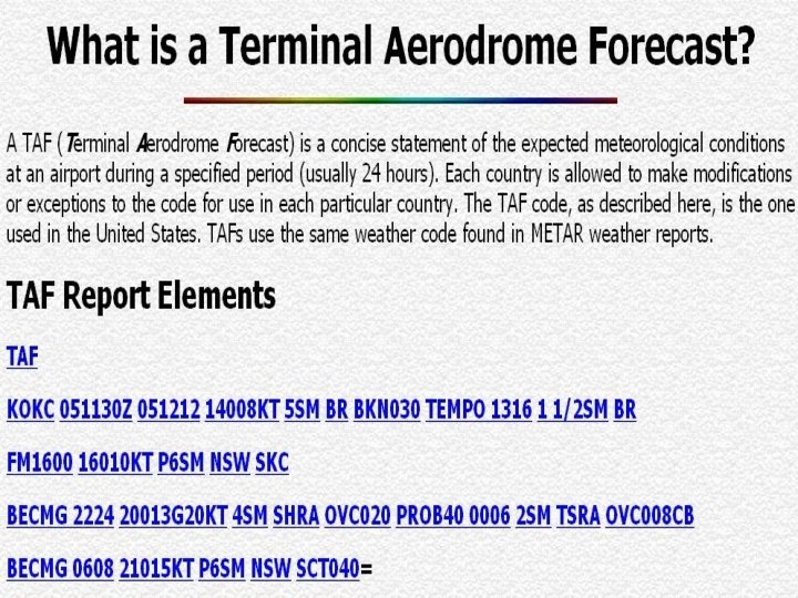
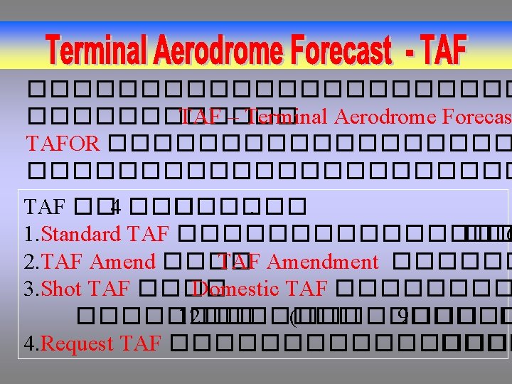
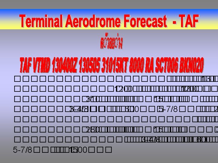
Code Forms TAF CCCC YYGGgg. Z Y 1 Y 1 G 1 G 1 G 2 G 2 dddff. Gfmfm. KT VVVV w’w’ NSNSNSh. Sh. S [or VVh. Sh. S or SKC] ������������ METAR NSW – No Significant Weather
1. Type of Report – Routine terminal aerodrome forecast(TAF) 2. Location Identifier – ICAO four-letter identifier 3. Data and Time – Two-digit day of the month and the time in Zulu(Z) 4. Valid Period – TAF valid time, beginning and ending hours in Zulu(Z) Forecast Elements: Wind/Visibility/Weather/Sky Condition 5. Wind – Three-digit direction, two-or three-digit speed in knots(KT) 6. Visibility – Expected prevailing visibility in statute miles. Forecast visibility greater than 6 miles is coded as P 6 SM(plus 6 SM) 7. Weather – Significant weather and Obstructions to visibility
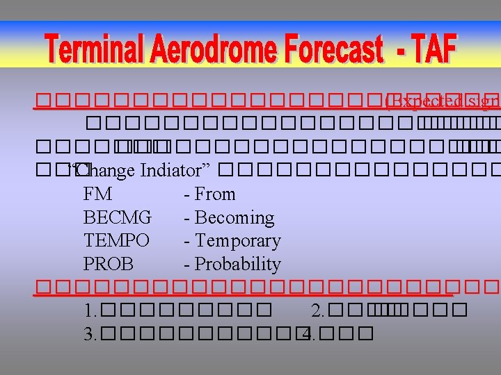
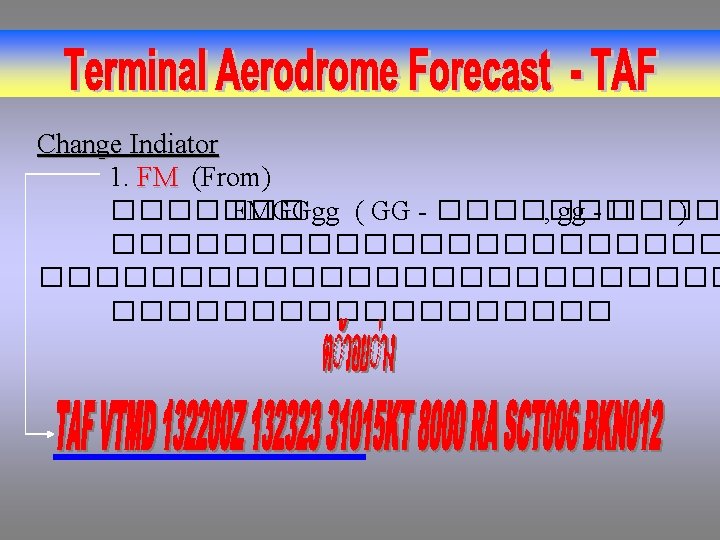
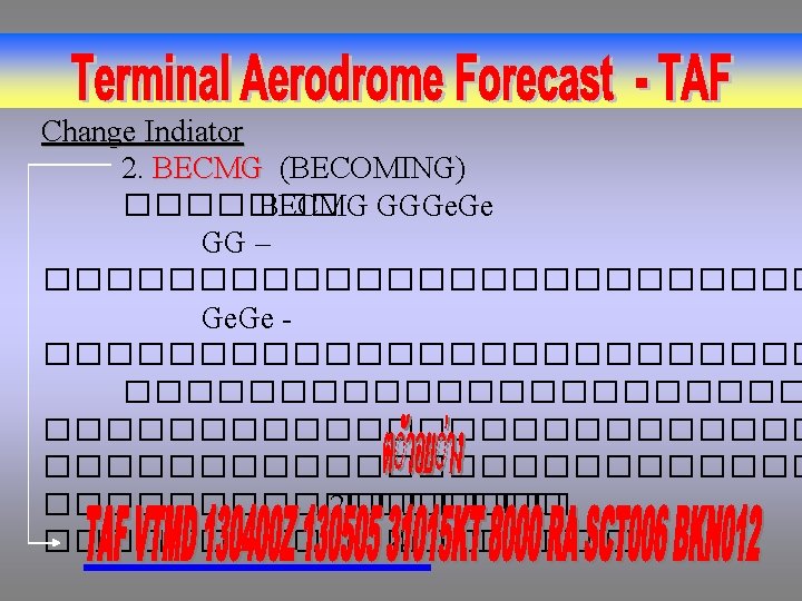
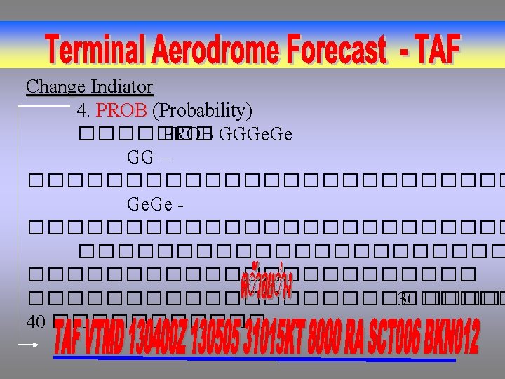
8. Sky Condition – Amount, height, type, (CB or TCU) or vertical visibility 9. Probability Forecast – Probability of thunderstorms or precipitation (in percent), beginning and ending times, and expected conditions 10. Forecast Change Group – Significant, permanent changes in conditions; from(FM), hour; or becoming(BECMG) with beginning and ending times 11. Temporary Conditions – (TEMPO) Conditions expected to last less than an hour at a time, with beginning and ending times
1. Type of Report – Routine terminal aerodrome forecast(TAF) 2. Location Identifier – ICAO four-letter identifier TAF CCCC
3. Data and Time – Two-digit day of the month and the time in Zulu(Z) 4. Valid Period – TAF valid time, beginning and ending hours in Zulu(Z) YYGGgg. Z Y 1 Y 1 G 1 G 1 G 2 G 2
Forecast Elements: Wind/Visibility/Weather/Sky Condition 5. Wind – Three-digit direction, two-or three-digit speed in knots(KT) 6. Visibility – Expected prevailing visibility in statute miles. Forecast visibility greater than 6 miles is coded as P 6 SM(plus 6 SM) 7. Weather – Significant weather and Obstructions to visibility 8. Sky Condition – Amount, height, type, (CB or TCU) or vertical visibility dddff. Gfmfm. KT VVVV w’w’ NSNSNSh. Sh. S [or VVh. Sh. S or SKC]
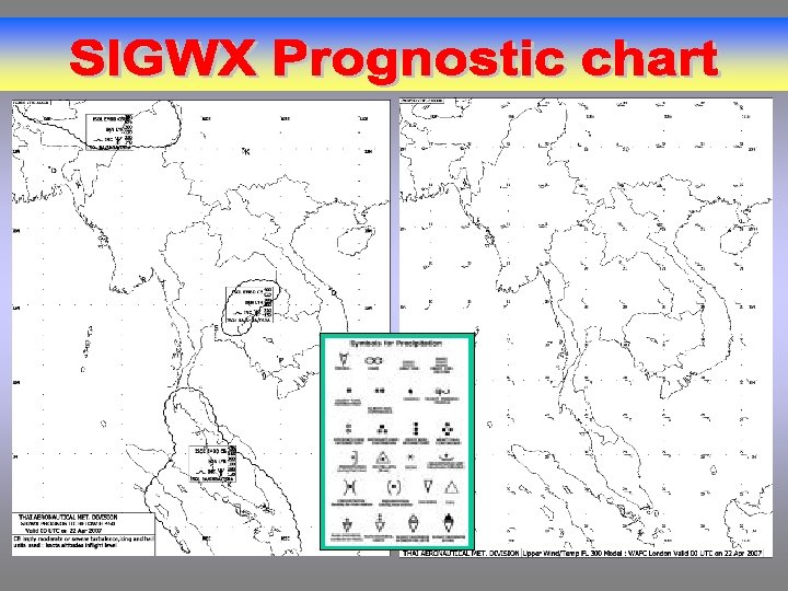
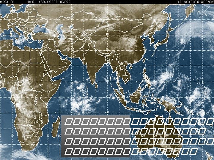
The occurrence of specified En-route Weather Phenomena, Which may Affect the Safety of Aircraft operations Period of validity of a Sigwx Not more than 6 hours
Volume. 1
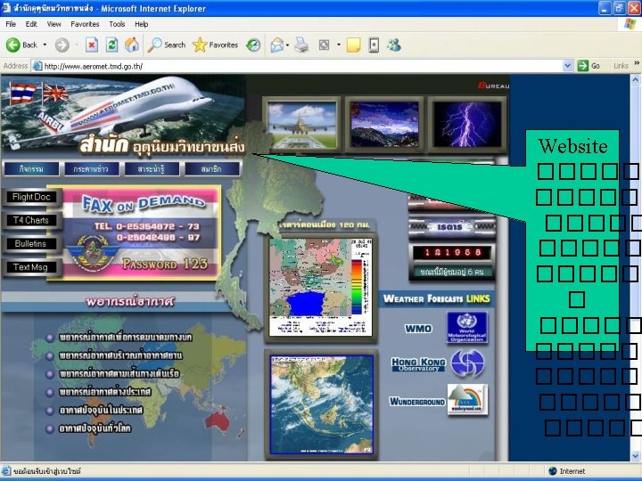
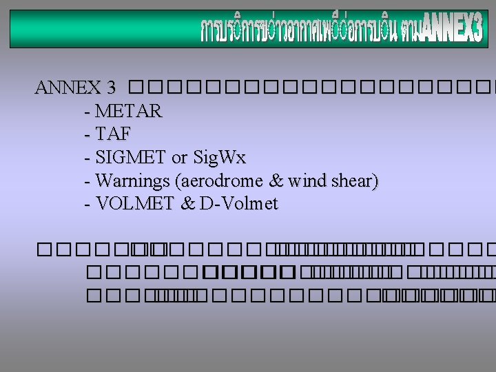
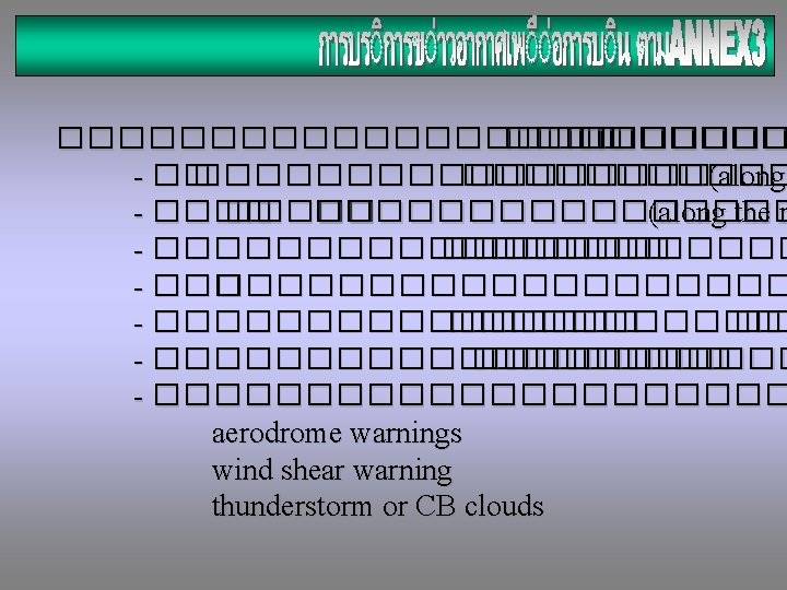
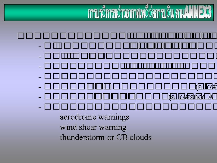
������������ -Upper Wind (along the route) - Upper Air Temperature (flight level) - SIGMET - AIRMET (local area) - VOLMET & D-VOLMET ATIS (local area) & D-ATIS - WX Printable chart (if possible)
Finish ANNEX 3 Meteorological Service for International Air Navigation Thanks Chethawut Channgam FS. 1 Weather Division DOAC RTAF