International Cartographic Association ICA workshop on Geospatial Analysis


- Slides: 48

International Cartographic Association (ICA) workshop on Geospatial Analysis and Modeling - 8 July 2006, Vienna, Austria The use of Rough Set in Geographical Information Systems Beniamino Murgante, Giuseppe Las Casas, Anna Sansone Dipartimento di Architettura, Pianificazione ed Infrastrutture di Trasporto, Università degli Studi della Basilicata, murgante@unibas. it, lascasas@unibas. it, asansone@unibas. it

Introduction Increase of costs Economists Increase of real estate economic value Ecologists Loss environmental value Agronomists Agricultural loss of productivity B. Murgante, G. Las Casas, A. Sansone - The use of Rough Set in Geografical Information Systems International Cartographic Association (ICA) workshop on Geospatial Analysis and Modeling - 8 July 2006, Vienna, Austria

Introduction Municipality Urban planners Urban area Urban core Peri-urban area Rural core Rural area An area with its own intrinsic organic rules B. Murgante, G. Las Casas, A. Sansone - The use of Rough Set in Geografical Information Systems International Cartographic Association (ICA) workshop on Geospatial Analysis and Modeling - 8 July 2006, Vienna, Austria

Techniques of spatial statistic Bailey and Gatrell classification (1995) Point Pattern Analysis B. Murgante, G. Las Casas, A. Sansone - The use of Rough Set in Geografical Information Systems Spatially Continuous Analysis Area Data Analysis International Cartographic Association (ICA) workshop on Geospatial Analysis and Modeling - 8 July 2006, Vienna, Austria

Point Pattern Analysis Tobler's First Law of Geography “All things are related, but nearby things are more related than distant things” Point Pattern Analysis First order effects (Absolute location) B. Murgante, G. Las Casas, A. Sansone - The use of Rough Set in Geografical Information Systems Second order effects (Relative location) International Cartographic Association (ICA) workshop on Geospatial Analysis and Modeling - 8 July 2006, Vienna, Austria

Point Pattern Analysis Density function B. Murgante, G. Las Casas, A. Sansone - The use of Rough Set in Geografical Information Systems International Cartographic Association (ICA) workshop on Geospatial Analysis and Modeling - 8 July 2006, Vienna, Austria

Point Pattern Analysis kernel density B. Murgante, G. Las Casas, A. Sansone - The use of Rough Set in Geografical Information Systems International Cartographic Association (ICA) workshop on Geospatial Analysis and Modeling - 8 July 2006, Vienna, Austria

Point Pattern Analysis Relation between the bandwidth dimension and the study area B. Murgante, G. Las Casas, A. Sansone - The use of Rough Set in Geografical Information Systems International Cartographic Association (ICA) workshop on Geospatial Analysis and Modeling - 8 July 2006, Vienna, Austria

Point Pattern Analysis Nearest neighbor distance B. Murgante, G. Las Casas, A. Sansone - The use of Rough Set in Geografical Information Systems International Cartographic Association (ICA) workshop on Geospatial Analysis and Modeling - 8 July 2006, Vienna, Austria

Rough set An Ontology of Uncertainty in Spatial information B. Murgante, G. Las Casas, A. Sansone - The use of Rough Set in Geografical Information Systems International Cartographic Association (ICA) workshop on Geospatial Analysis and Modeling - 8 July 2006, Vienna, Austria

Rough set Information System o Let U be a nonempty finite set of objects called the universe o Let A be a nonempty finite set of attributes Decision System A decision system is an information system in which the values of a special decision attribute classify the cases d≠A (decision attribute) B. Murgante, G. Las Casas, A. Sansone - The use of Rough Set in Geografical Information Systems International Cartographic Association (ICA) workshop on Geospatial Analysis and Modeling - 8 July 2006, Vienna, Austria

Rough set Indiscernibility o Let R be an equivalence relation on U, called an INDISCERNIBILITY RELATION o For any element x of U, the EQUIVALENCE CLASS of R containing x will be denoted by [ x ] R o Equivalence classes of R [ x ] R are called ELEMENTARY SETS in A B. Murgante, G. Las Casas, A. Sansone - The use of Rough Set in Geografical Information Systems International Cartographic Association (ICA) workshop on Geospatial Analysis and Modeling - 8 July 2006, Vienna, Austria

Rough set o If BX = then the set X is Crisp o If BX ≠ then the set X is Rough B. Murgante, G. Las Casas, A. Sansone - The use of Rough Set in Geografical Information Systems International Cartographic Association (ICA) workshop on Geospatial Analysis and Modeling - 8 July 2006, Vienna, Austria

Rough set Egenhofer M. J. and Herring J. 1991 B. Murgante, G. Las Casas, A. Sansone - The use of Rough Set in Geografical Information Systems International Cartographic Association (ICA) workshop on Geospatial Analysis and Modeling - 8 July 2006, Vienna, Austria

Rough set broad boundary ∆A ∆A = A 2 − A 1 Disjoint and meet B. Murgante, G. Las Casas, A. Sansone - The use of Rough Set in Geografical Information Systems Clementini E. and Di Felice P. 1996 International Cartographic Association (ICA) workshop on Geospatial Analysis and Modeling - 8 July 2006, Vienna, Austria

Rough set Positive region Pos(X)= LX Negative region Neg(X) = U – UX Boundary region Bnd(X) =UX – LX (Wang et al, 2002) B. Murgante, G. Las Casas, A. Sansone - The use of Rough Set in Geografical Information Systems International Cartographic Association (ICA) workshop on Geospatial Analysis and Modeling - 8 July 2006, Vienna, Austria

Case Study B. Murgante, G. Las Casas, A. Sansone - The use of Rough Set in Geografical Information Systems International Cartographic Association (ICA) workshop on Geospatial Analysis and Modeling - 8 July 2006, Vienna, Austria

Case Study B. Murgante, G. Las Casas, A. Sansone - The use of Rough Set in Geografical Information Systems International Cartographic Association (ICA) workshop on Geospatial Analysis and Modeling - 8 July 2006, Vienna, Austria

Case Study B. Murgante, G. Las Casas, A. Sansone - The use of Rough Set in Geografical Information Systems International Cartographic Association (ICA) workshop on Geospatial Analysis and Modeling - 8 July 2006, Vienna, Austria

Case Study 1 < d <5 (ab/h) B. Murgante, G. Las Casas, A. Sansone - The use of Rough Set in Geografical Information Systems International Cartographic Association (ICA) workshop on Geospatial Analysis and Modeling - 8 July 2006, Vienna, Austria

Case Study B. Murgante, G. Las Casas, A. Sansone - The use of Rough Set in Geografical Information Systems International Cartographic Association (ICA) workshop on Geospatial Analysis and Modeling - 8 July 2006, Vienna, Austria

Case Study B. Murgante, G. Las Casas, A. Sansone - The use of Rough Set in Geografical Information Systems International Cartographic Association (ICA) workshop on Geospatial Analysis and Modeling - 8 July 2006, Vienna, Austria

Case Study B. Murgante, G. Las Casas, A. Sansone - The use of Rough Set in Geografical Information Systems International Cartographic Association (ICA) workshop on Geospatial Analysis and Modeling - 8 July 2006, Vienna, Austria

Case Study B. Murgante, G. Las Casas, A. Sansone - The use of Rough Set in Geografical Information Systems International Cartographic Association (ICA) workshop on Geospatial Analysis and Modeling - 8 July 2006, Vienna, Austria

Case Study B. Murgante, G. Las Casas, A. Sansone - The use of Rough Set in Geografical Information Systems International Cartographic Association (ICA) workshop on Geospatial Analysis and Modeling - 8 July 2006, Vienna, Austria

Case Study B. Murgante, G. Las Casas, A. Sansone - The use of Rough Set in Geografical Information Systems International Cartographic Association (ICA) workshop on Geospatial Analysis and Modeling - 8 July 2006, Vienna, Austria

Compactness rate Index value Good compactness Medium compactness Poor compactness B. Murgante, G. Las Casas, A. Sansone - The use of Rough Set in Geografical Information Systems Number of Centres 1 -1, 6 12 1, 61 -2, 4 68 2, 41 -4, 81 20 International Cartographic Association (ICA) workshop on Geospatial Analysis and Modeling - 8 July 2006, Vienna, Austria

Compactness rate shape index B. Murgante, G. Las Casas, A. Sansone - The use of Rough Set in Geografical Information Systems International Cartographic Association (ICA) workshop on Geospatial Analysis and Modeling - 8 July 2006, Vienna, Austria

Compactness rate B. Murgante, G. Las Casas, A. Sansone - The use of Rough Set in Geografical Information Systems International Cartographic Association (ICA) workshop on Geospatial Analysis and Modeling - 8 July 2006, Vienna, Austria

Case Study B. Murgante, G. Las Casas, A. Sansone - The use of Rough Set in Geografical Information Systems International Cartographic Association (ICA) workshop on Geospatial Analysis and Modeling - 8 July 2006, Vienna, Austria

Changes in area/perimeter ratio B. Murgante, G. Las Casas, A. Sansone - The use of Rough Set in Geografical Information Systems International Cartographic Association (ICA) workshop on Geospatial Analysis and Modeling - 8 July 2006, Vienna, Austria

Case Study B. Murgante, G. Las Casas, A. Sansone - The use of Rough Set in Geografical Information Systems International Cartographic Association (ICA) workshop on Geospatial Analysis and Modeling - 8 July 2006, Vienna, Austria

Case Study R 3, R 4 >35% B. Murgante, G. Las Casas, A. Sansone - The use of Rough Set in Geografical Information Systems International Cartographic Association (ICA) workshop on Geospatial Analysis and Modeling - 8 July 2006, Vienna, Austria

Case Study <150 m B. Murgante, G. Las Casas, A. Sansone - The use of Rough Set in Geografical Information Systems International Cartographic Association (ICA) workshop on Geospatial Analysis and Modeling - 8 July 2006, Vienna, Austria

Case Study Real contiguity < Ideal contiguity < Without contiguity Pignola B. Murgante, G. Las Casas, A. Sansone - The use of Rough Set in Geografical Information Systems International Cartographic Association (ICA) workshop on Geospatial Analysis and Modeling - 8 July 2006, Vienna, Austria

Case Study Real contiguity < Ideal contiguity < Without contiguity Avigliano B. Murgante, G. Las Casas, A. Sansone - The use of Rough Set in Geografical Information Systems Lauria International Cartographic Association (ICA) workshop on Geospatial Analysis and Modeling - 8 July 2006, Vienna, Austria

Case Study Without contiguity < Real contiguity < Ideal contiguity Potenza B. Murgante, G. Las Casas, A. Sansone - The use of Rough Set in Geografical Information Systems International Cartographic Association (ICA) workshop on Geospatial Analysis and Modeling - 8 July 2006, Vienna, Austria

Case Study Potenza B. Murgante, G. Las Casas, A. Sansone - The use of Rough Set in Geografical Information Systems International Cartographic Association (ICA) workshop on Geospatial Analysis and Modeling - 8 July 2006, Vienna, Austria

Case Study Potenza B. Murgante, G. Las Casas, A. Sansone - The use of Rough Set in Geografical Information Systems International Cartographic Association (ICA) workshop on Geospatial Analysis and Modeling - 8 July 2006, Vienna, Austria

Case Study Attributes and decision variable B= Nature 2000 sites Values 0 Nature 2000 sites, 1 different from Nature 2000 sites 1 if the distance is less than 150 m. Fi= Hydrography 2 if the distance is included between 150 m. and 800 m. 3 if the distance is bigger than 800 m. Fr= Hydro-geological risk zones 0 classes R 3 ed R 4, 1 different from classes R 3 ed R 4 1 if the slope is less than 23, 6% P= Slope 2 if the slope is included between 23, 6% and 35% 3 if the slope is bigger than 35% 1 if the density is less than 1 flats per hectare D= Density 2 if the density is included between 1 and 5 flats per hectare 3 if the density is bigger than 5 flats per hectare 1 if the distance is less than 200 m. V= Road Network 2 if the distance is included between 200 and 700 m. 3 if the distance is less than 700 m. C 1= Real Contiguity 0, 1 C 2= Ideal Contiguity 0, 1 Nei= Nearest neighbor distance (Decision Variable) 1 if the minumum distance is less than 100 m 2 if the minumum distance is included between 100 and 200 m 3 if the minumum distance is bigger than 200 m B. Murgante, G. Las Casas, A. Sansone - The use of Rough Set in Geografical Information Systems International Cartographic Association (ICA) workshop on Geospatial Analysis and Modeling - 8 July 2006, Vienna, Austria

Case Study Rough classification Attributes and decision variable B= Nature 2000 sites Fi= Hydrography Fr= Hydro-geological risk zones P= Slope D= Density V= Road Network C 1= Real Contiguity C 2= Ideal Contiguity Nei= Nearest neighbor distance (Decision Variable) Values 1 different from Nature 2000 sites 2 if the distance is included between 150 m. and 800 m. 3 if the distance is bigger than 800 m. 1 different from classes R 3 ed R 4 1 if the slope is less than 23, 6% 2 if the slope is included between 23, 6% and 35% 2 if the density is included between 1 and 5 inhabitants per hectare; 1 if the distance is less than 200 m. ; 1 1 1 if the minumum distance less than 100 m 2 if the minumum distance included between 100 and 200 m B. Murgante, G. Las Casas, A. Sansone - The use of Rough Set in Geografical Information Systems International Cartographic Association (ICA) workshop on Geospatial Analysis and Modeling - 8 July 2006, Vienna, Austria

Case Study B. Murgante, G. Las Casas, A. Sansone - The use of Rough Set in Geografical Information Systems International Cartographic Association (ICA) workshop on Geospatial Analysis and Modeling - 8 July 2006, Vienna, Austria

Case Study B. Murgante, G. Las Casas, A. Sansone - The use of Rough Set in Geografical Information Systems International Cartographic Association (ICA) workshop on Geospatial Analysis and Modeling - 8 July 2006, Vienna, Austria

Case Study Map Algebra Rough set Lower Upper Accuracy Without Contiguity 1721768 72857 928856 7, 84% Real Contiguity 766864 138056 435856 31, 67% Ideal Contiguity 1208171 44214 523862 8, 44% Number of cells B. Murgante, G. Las Casas, A. Sansone - The use of Rough Set in Geografical Information Systems International Cartographic Association (ICA) workshop on Geospatial Analysis and Modeling - 8 July 2006, Vienna, Austria

Case Study Lauria B. Murgante, G. Las Casas, A. Sansone - The use of Rough Set in Geografical Information Systems Without contiguity International Cartographic Association (ICA) workshop on Geospatial Analysis and Modeling - 8 July 2006, Vienna, Austria

Case Study Real contiguity < Ideal contiguity B. Murgante, G. Las Casas, A. Sansone - The use of Rough Set in Geografical Information Systems Lauria International Cartographic Association (ICA) workshop on Geospatial Analysis and Modeling - 8 July 2006, Vienna, Austria

Case Study Without contiguity B. Murgante, G. Las Casas, A. Sansone - The use of Rough Set in Geografical Information Systems Picerno International Cartographic Association (ICA) workshop on Geospatial Analysis and Modeling - 8 July 2006, Vienna, Austria

Case Study Real contiguity < Ideal contiguity Picerno B. Murgante, G. Las Casas, A. Sansone - The use of Rough Set in Geografical Information Systems International Cartographic Association (ICA) workshop on Geospatial Analysis and Modeling - 8 July 2006, Vienna, Austria
 Cartographic process
 Qualitative typographic visual variables
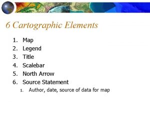
 Cartographic elements
 Cartographic paradox
 Sism9
Sism9 Angular artery
 Ica vs rdp
 Indice ica
 Pca lda
 Pca vs ica
 Ica hörnan enhörna
 Paul merolla
 Independent component analysis vs pca
 Hotel de turistas ica
 Ica-nsf
 Pca vs ica
 Pcom aneurysm presentation
 Sjns
Sjns ενδοθήλιο
 Organisasi ica
 Cocktail party problem ica
 Ica puspita dewi anggraini
 Ica puspita dewi anggraini
 Ica puspita dewi anggraini
 Ica
Ica Validador medios ica cali
 Ica
Ica Teff ica
 Ica
Ica Pendekatan ekologi
 Natalia vassilieva
 Ica
Ica Kagra international workshop
 Millennium geospatial
 Open geospatial consortium standards
 Asprs accuracy standards
 Oregon spatial data library
 Geo business intelligence
 Geospatial world forum amsterdam
 Geospatial positioning accuracy standards
 Geospatial data definition ap human geography
 Geospatial commons
 Minnesota geospatial commons
 Faa nasr
 Bcc geospatial center of the cuny crest institute
 Mit geospatial data center
 Mn geospatial commons
 Canadian geospatial data infrastructure
 Minnesota geospatial commons
