Integration of Earth Observing Systems and the U

Integration of Earth Observing Systems and the U. S. Geological Survey

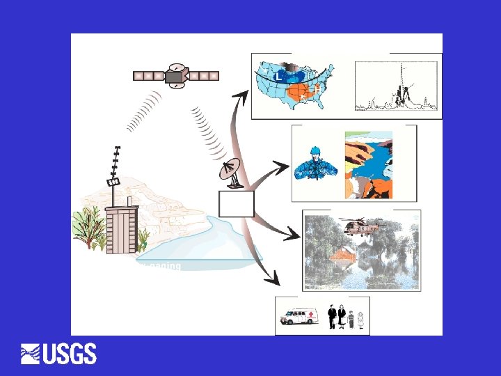
Integration of environmental monitoring networks: • Comprehensive, multi-dimensional study of environmental problems and their linkages • Broader dissemination of monitoring technologies • Greater operational efficiency

Elements of a “back-bone” network: • Consistent core variables • Standard sampling and calibration protocols • Integrated data management driven by internet distribution and GPS systems

Elements of a “back-bone” network: • EPA Estuarine Reserves • NOAA Estuarine Status and Trends network • NOAA ocean current and weather buoys • USGS Streamgaging stations

Streamgaging Gage Network • 7, 100 gages • 85 % real-time Network Costs • $120 M per year • About $12, 500/gage Network Funding State / Local agencies USGS Coop program OFA Mixed USGS NSIP 35% 25% 18% 15% 7%

Partners Flood-related Uses Corps of Engineers Bureau of Reclamation Federal Highways Admin. National Weather Service Reservoir Operations Engineering Design Federal Emergency Management Agency Floodplain mapping, Evacuation planning 800 State and local agencies All of the above Flood Forecasting and Inundation Mapping
= Ave Velocity*Area=Depth*Width")
Traditional Methods Q=VA Discharge (Q)= Ave Velocity*Area=Depth*Width

Measurement Methods Vary

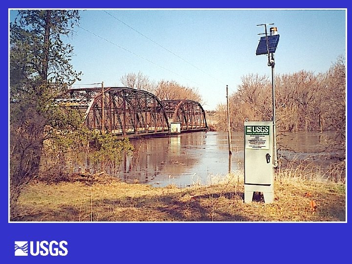
USGS Stream Gage

Peak Flow, CFS Gages Monitor River Stage New 100 -year flood 1997 Flood Old 100 -year flood 1900 2000
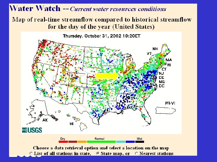

Water. usgs. gov/waterwatch
")
Water. Watch • • Real-time streamflow Flood and High flow Monthly Conditions (and historic) Comparison of today and POR Comparison of 7 -Day Average and POR Below normal Drought Watch

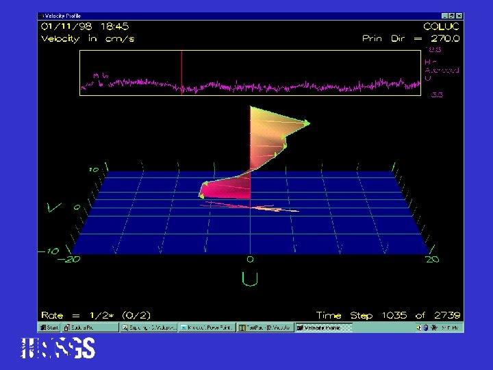
Modernizing Flow Measurement Hydro. Acoustics Radars

Hydro. Acoustics • • • Doppler principle Fast and accurate Not effective in shallow water • Used with boats or tethered from bridges • Can be used as sidelooking, velocity index meters

Mississippi River at St. Louis

Side-Looking Doppler, Index-Velocity Discharge vs Traditional Discharge

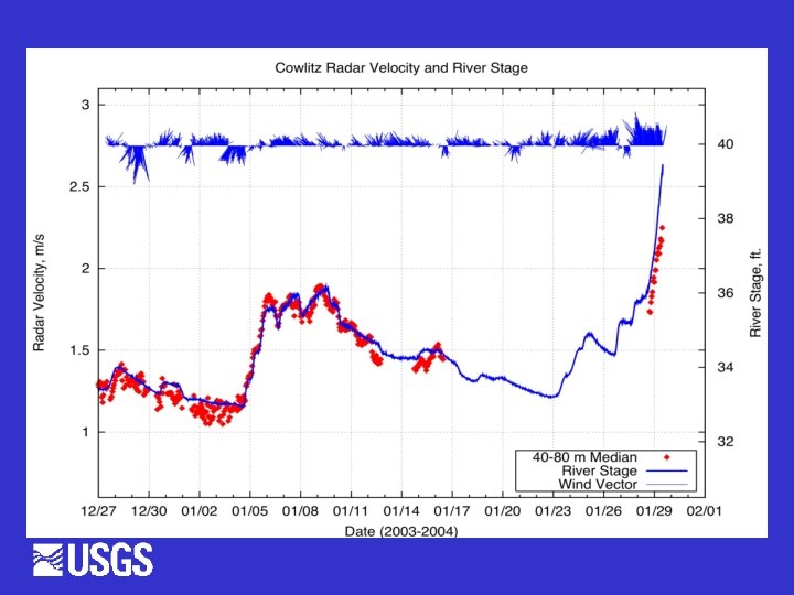
Radars Q=V A • Microwave radar for surface velocity only • Ground-penetrating radar for channel area • GPR doesn’t work well in high conductivity or great depth
- Slides: 23