Information Extraction Visual Quantitative Interpretation Interpretation Aims Geomorphometric


 • Used")


i Interpolation Z at (X, Y)i")
- Slides: 21
Information Extraction • Visual • Quantitative: Interpretation
Interpretation: Aims • Geomorphometric analysis – General geomorphometry – Specific geomorphometry • Quality assessment – Error detection – DTM quality control
Geomorphometric Analysis • Derivation of geomorphometric parameters – General • Landform characteristics applicable to any continuous surface – Specific • Can be separated from adjacent parts using a clear criteria of delineation
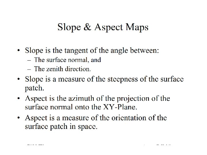
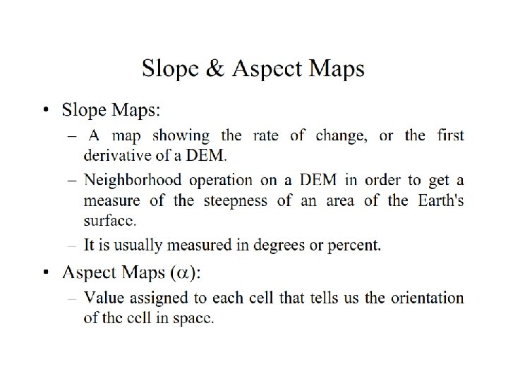
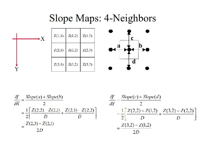
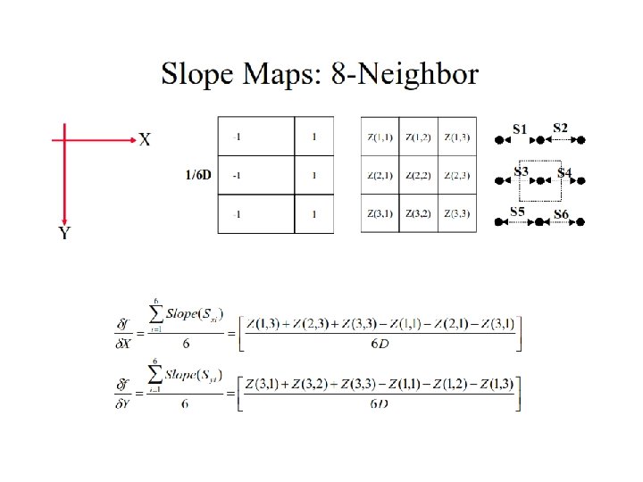
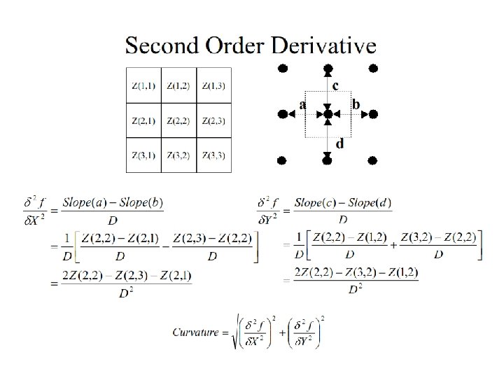
General Geomorphometry • Defined at point and DTM facets (grids or triangles) • Used in classification, etc. • Types: – Slope and aspect – Convexity • Profile convexity: rate of change in gradient • Plan convexity: convexity of contours – Other: Local relief, drainage density, statistics of slope and aspect
Specific Geometry • Mainly features regarding hydrology – Point features: pits, peaks, etc. – Linear features: drainage channels, ridges – Areal features: drainage basins, hills, …
Procedure • Main steps – Topologically connect the parts into continuous network – Obtain descriptive attributes • Point features: comparing local elevation differences • Linear and areal features: using variant and recursive DTM climbing to find points belonging to specific channels or ridge links.
Drainage network
Extracting Drainage Network • • Flow direction determination Coding Accumulation Thresholding
Flow direction estimation • Single flow • Multiple flow
Coding Flow direction coding based on Arc/Info
Flow Accumulation and Thresholding
Quality Assessment • Error detection – Blunders – Systematic errors: in geometry and attribute • Quality control – Compare with reference data (control points, another DTM)
Error detection • Mainly visual with interactive editing – Perspective views – Slope maps – Superimposition • Today: towards automation • Conclusion: defining error and correcting them is a vital stage, without which data obtained from a DTM can not be trusted or used.
Error Check by Superimposition
Accuracy Empirical Approach DTM Check Points (X, Y, Z)i Interpolation Z at (X, Y)i Properties: • simple concept • convincing quality control • extra measuring effort • no generalization • no theoretical insight • not for planning Statistical Analysis