Influential factors in childrens school travel Safe Routes


, health care &")


 $ 30, 029")
 Cesar Chavez Bell Gardens % African. American (school) 0.")


 Before 95. 42%")


 Policy/regulation Model language")


 Comprehensive, continuous and")
 Education/awareness the public,")
- Slides: 62
Influential factors in children’s school travel: Safe Routes to School and beyond Tracy E. Mc. Millan, Ph. D, MPH University of Texas at Austin tmcmillan@mail. utexas. edu
Elementary School property • The paradox of transportation in the late twentieth century is that while it became possible to travel to the moon, it also became impossible, in many cases, to walk across the street. – Joell Vanderwagen, 1995. “Coming down to earth, ” in Zielinski, S. and Laird, G. (eds), Beyond the car, Steel Rail Press, Toronto, pp. 137 -139.
Children’s travel behavior and health • Transportation Issues – Significant mode shift in school travel over the past few decades • 1969: 87% of school trips < 1 mi. walk/bike, 7% private auto • 2001: 55% of school trips < 1 mi. walk/bike, 36% private auto – Localized congestion/hazardous travel in school zone • Ped/bike highest rate of injury/fatality on per mile basis compared to other modes of school travel – Burden on household • Mothers are five times more likely to be transporting children than fathers • Trip chaining
• Health issues – Low rates of overall physical activity – Increase in age-adjusted prevalence of overweight • From 4% in 1963 -65 to ~15% in 1999 youth aged 6 -11 • Mexican-Americans and non-Hispanic blacks disproportionately represented in 12 -19 age group – School trip important contributor to overall daily physical activity – Pedestrian injuries 2 nd leading cause of unintentional injury death for youth aged 5 -14 • 20, 000 non-fatal pedestrian injuries for this age group in 2001
Cost to the nation • Heart disease: $193. 8 billion (2001), health care & lost productivity • Cancer: $189. 5 billion (2003) • Diabetes: $132 billion (2002)
Is the built environment to blame for changes in travel and health behavior/outcomes? • What some research shows: guilty by “association” – Two broad characteristics of the pedestrian infrastructure associated with walking behavior • Presence – Accessibility • Quality – Safety – Security • However, there are limitations to this research – Focus on adult behavior: their activities & destinations—does this transfer over to children? – Little understanding of the structural relationship between variables of influence—no causal path
The reality of influencing behavior • It’s not as simple as we would like! – Not just tell them what’s best and they’ll do it – Not just build it and they’ll come – Dealing with multiple factors that we can affect directly and indirectly
Relative influence of built environment on children’s school travel • Built environment does influence the probability of walk/bike to school – Two significant variables: mixed use & windows facing street – What wasn’t significant? Sidewalks • Magnitude of influence of individual built environment variables was small • However, the overall effect of built environment did help in the prediction of the walking trip to school
More influential factors on caregiver’s decision – Perceptions of neighborhood & traffic safety – Reported distance – Social/cultural norms – Parent’s attitudes & perceptions toward travel – Sociodemographics
Policy implications for SR 2 S • Highlights the complexity of travel behavior • Emphasizes the importance of correctly identifying problems before creating solutions • Most cost-effective and equitable solutions for changing travel behavior may involve a multi-pronged approach (education, enforcement and engineering)
Policy implications for SR 2 S • The “experience of place, ” not just the structure of space, affects behavior • Built environment may still have significant impact on cost of development if outcomes of inactivity are quantified
The California Safe Routes to School Program – Background and Evaluation Marlon G. Boarnet 1, Kristen Day 1, Craig Anderson 1, Tracy Mc. Millan 2, Mariela Alfonzo 1 1 University of California, Irvine 2 University of Texas, Austin Funding: UC Transportation Center and Caltrans
SR 2 S Background • Authorized by California AB 1475, 1999 • Renewed by SB 10, 2001 • Renewed again by SB 1087, 2004
SR 2 S Background • AB 1475 authorized setting aside 1/3 of California’s federal Surface Transportation Program safety funds for two years for the SR 2 S program • Motivation – high profile pedestrian accidents • Coalition of safety, school, non-motorized transportation advocates
SR 2 S Funding • Projects funded at 90% / 10% state/local participation • Projects capped at $450, 000 of state (federal) funds • Five cycles of projects funded so far – 455 projects – $111. 7 million in federal funds – $124. 1 million total funds • Average project funding: $273, 000
SR 2 S Program • Administered by the Division of Local Assistance within Caltrans • Authorizing legislation required an evaluation by December, 2003, with funds for evaluation • Legislative goals: – Increased pedestrian/bicycling safety near schools – Increased viability/frequency of walking/bicycling to schools • SR 2 S was, first, a safety program
SR 2 S application Recent Caltrans brochure states that successful local applications highlight: • How the proposal supports an existing traffic safety or health promotion plan. • How the application has been developed through problem identification using a "walkability checklist" or other audit tool. • Demonstrated understanding about how proposed engineering solutions interrelate to enforcement, education and other strategies. • Evidence-based estimates regarding the impact of the proposed project – both risk reduction and health promotion.
SR 2 S evaluation • Caltrans contract, pursuant to Streets and Highways Code 2333. 5: $118, 500 • University of California Transportation Center: $162, 614
Research Design • Multiple Case Study Approach, 10 school sites • Before/After evaluation – Traffic characteristics • Vehicle counts, vehicle speed, yield to nonmotorized traffic, walk/bicycling counts and on sidewalk/street – Urban Design – Survey of parents of 3 rd-5 th grade children • Did child walk more after SR 2 S construction?
School Sites • 16 Schools chosen, 10 completed SR 2 S construction by Fall, 2003 • Schools chosen based on: – – – Elementary school (70% of Cycle I schools elementary) Variation in urban/rural/suburban setting Represent six SR 2 S work types Willingness to be included in study Fit with research window, April 2002 through Fall, 2003
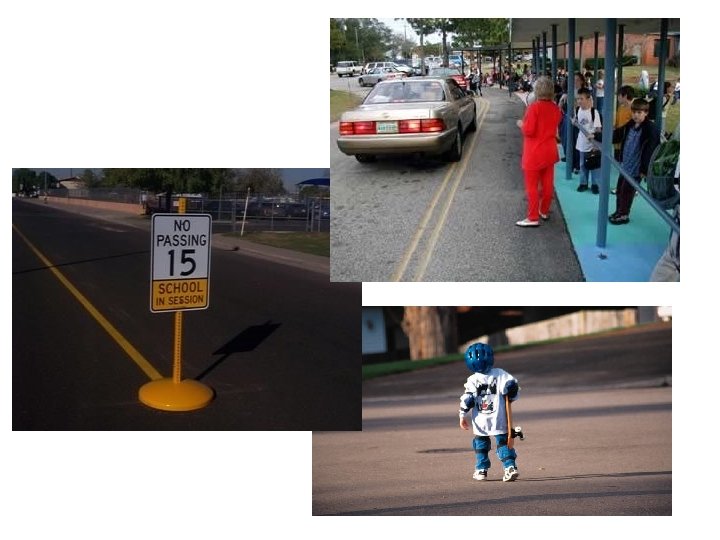
Busy street proximate to Cesar Chavez Elementary School New traffic signal at Loveland Avenue and Jaboneria Road Cesar Chavez Elementary School
Glenoaks Boulevard before installation of crosswalk lighting system New pedestrian-activated, in-pavement crosswalk lighting system on Glenoaks Boulevard Glenoaks Elementary School
Northwest view of Morning View Drive from Juan Cabrillo Elementary School New decomposed granite pathway near school Decomposed granite pathway southeast from school along Morning View Drive Juan Cabrillo Elementary School
Adams Avenue before improvement Murrieta Elementary School Adams Avenue after sidewalk installation
New sidewalk at the San Pablo Dam Road and May Road intersection
School City Cesar Chavez Bell Gardens Med HH income (zip code) $ 30, 029 % blocks w/ complete sidewalk 94% Glenoaks Jasper Juan Cabrillo Mt Vernon $ 41, 674 $ 66, 668 $100, 857 $ 23, 498 36% 57% 17% 63% Murrieta Glendale Alta Loma Malibu San Bernardino Murrieta $ 61, 494 8% Newman Sheldon Valley West Randall Chino El Sobrante Yucaipa Fontana $ 55, 185 $ 61, 494 $ 39, 286 $ 35, 008 86% 53% 22% 36%
School City % Hispanic (school) Cesar Chavez Bell Gardens % African. American (school) 0. 2% Glenoaks Jasper Juan Cabrillo Mt Vernon 1. 7 % 7. 3 % 0. 6 % 9. 3 % 18. 5 % 22. 6 % 17 % 84. 9 % Murrieta Glendale Alta Loma Malibu San Bernardino Murrieta 7. 6% 22. 9 % Newman Sheldon Valley West Randall Chino El Sobrante Yucaipa Fontana 3. 1 % 26. 3 % 1. 8 % 1. 7 % 56. 4 % 22. 1 % 24. 1 % 92. 1 % 99 %
Evaluation: Compare Outcomes to Expected Effects SR 2 S Project Type Number of Schools Sidewalk Improvements 5 Traffic Signal Improvements 2 Crosswalk / Crosswalk Signal 4 Bicycle Facilities 1 Traffic Diversion 0 Traffic Calming 0 Note: Some school projects are more than one type.
Study Methods • Before/After Construction Data Collection at Each School • Observations/Data Collection: – Traffic Characteristics – Survey of Parents of 3 rd through 5 th Graders – Observe Urban Design within ¼ Mile of School
Traffic Observations • Observations for two days before and after SR 2 S construction – 30 minutes before start of school to 15 minutes after start of school – 15 minutes before end of school to 30 minutes after end of school • Teams of 3 -4 observers
Traffic Observations • Vehicle Counts • Vehicle Speed (via stopwatch to time travel of car for pre-marked distance between landmarks – human error estimated in analysis) • Yielding of Vehicles to Pedestrians/Bicyclists • Pedestrian Counts and Locations (on street/path or shoulder/sidewalk) • All data for 2 -minute intervals – assess total and “peak/off-peak”
Parent Survey • Distributed to parents of 3 rd-5 th grade children at all schools • Before Construction Survey response rate ranged from 36% to 72% -- 51% response in full sample • After Construction Survey response rate ranged from 23% to 57% -- 40% response rate in full sample • 1, 562 “before” surveys; 1, 244 “after” surveys
Parent Survey • • How child normally travels to school Perceptions of safety Perceptions of urban design and child travel Attitudes Demographic characteristics Perceptions of traffic near school Perceptions of social/cultural norms about walking/bicycling • Assessment of SR 2 S project
Urban Design • Block by block assessment for ¼ mile around school • Gives information on, e. g. , – – – – % of blocks with complete sidewalk % of blocks with bike lanes Average block length Number of lanes in street Paving treatments Cul-de-sacs Street trees
Evaluation • Detailed data collection and analysis • Project impact assessed by comparing “before” and “after” data • Impact assessed relative to expected impact for each project • Example: traffic light expected to improve yielding; sidewalk expected to change location and amount of walking
How to Assess SR 2 S project effectiveness • • Amount of walking Yielding of cars to non-motorized travelers Location of walking (on or off sidewalk) Vehicle speeds For all of above, consider expected and measured impact of the project – a traffic light would have different expected effects than a sidewalk
Sidewalk Gap Closure Results School # Walk % on Before After Street Before Sheldon 138 152 66% % on Street After T-stat 35% 5. 55 Valley 64 West 692 Randall 89 42% 4% 6. 79 1146 75% 5% 39. 23
Sheldon: Average Vehicle Speeds on San Pablo Dam Road
Sheldon: Safety Advantage from Shift of Walking to Sidewalk San Pablo Dam Road before sidewalk improvement San Pablo Dam Road after sidewalk improvement
Traffic Control Device Results School Cesar Chavez Newman % Yield (number) Before 95. 42% (584) % Yield (number) After 100% (205) T-stat 94. 86% (277) 99. 62% (265) 3. 44 5. 42
Another Looking at Walk/Bike Travel and SR 2 S • “After Construction” survey asked Would you say that your child now walks or bicycles to school: a. Less than before the project described above was built. b. The same amount as before the project was built. c. More than before the project was built.
Sort by Whether SR 2 S Project Along Route to School • Survey asked if project was along child’s usual route to school • 52% of parents said “yes”; 48% said “no” Star indicates location of elementary school; Circle represents portion of neighborhood included in the study (approx. ¼ mile radius from the elementary school)
After Construction Data • 1244 returned “after construction” surveys from 10 schools • School response rates varied from 23% to 54% • Full Sample Response Rate: 40%
Results, by School % Walk More Along Route Not Along Route Diff tstatistic n Cesar Chavez 20. 59% 6. 15% 14. 43% 2. 52 151 Glenoaks 12. 00% 7. 69% 4. 31% 0. 76 126 Jasper 3. 13% 0. 00% 3. 13% 1. 02 57 Juan Cabrillo 6. 67% 0. 00% 6. 67% 1. 04 32 Mt. Vernon 19. 05% 5. 71% 13. 33% 1. 85 87 Murrietta 13. 73% 2. 38% 11. 34% 2. 12 101 Newman 10. 94% 0. 00% 10. 94% 2. 80 101 Sheldon 15. 63% 0. 00% 15. 63% 2. 43 62 Valley 11. 59% 0. 00% 11. 59% 3. 01 97 West Randall 28. 57% 7. 41% 21. 16% 3. 15 139
Summary • Evidence that Outcomes Corresponded to Expectations for 5 of 10 schools – Consistent evidence – Exceeds standard error or human error range – Magnitude large (excludes Murrieta) • Criterion is measurable, near-term impact, and so excludes: – Increases in awareness/caution – Long-term infrastructure program progress
Summary, Patterns from Evaluation • Among 5 sidewalk gap closure projects, 3 had evidence of success – Primary success was moving walking off street/curb • The two traffic signal projects increased vehicle yielding • Crosswalk and crosswalk signal projects – no evidence, likely because success is more caution, which is difficult to measure
Characteristic of Successful Projects • In areas with pre-existing non-motorized travel to school in unsafe conditions • Closing sidewalk gaps in areas where students walk is a good example • Controlling vehicle speed or increasing driver awareness / caution • Some projects were initial investment in infrastructure (e. g. 8% of blocks around Murrieta Elementary had complete sidewalk before SR 2 S. )
Federal SRTS program • Passed in August 2005 • Dedicates $612 million to SRTS from 2005 -2009 • Distribution of funds to states based on student enrollment – Each state will receive at least $ 1 million/yr – http: //safety. fhwa. dot. gov/saferoutes/
• Creates SRTS program in every state DOT – Requires hiring of a full-time SRTS coordinator • Kristie Billiar, MN DOT • Targets grades K-8
• Legislation also required development of clearinghouse/repository for SRTS activities • National Center for SRTS – Based at Highway Safety Research Center at UNCChapel Hill – Collaboration of many partners – www. saferoutesinfo. org • Federal SRTS Task Force also required & currently being formed
Focus on 5 E’s • • • Engineering Education Enforcement Encouragement Evaluation – Each state must allocate at least 10% of total funds (but no more than 30%) to non -infrastructure activities
Intervention point Mediating factors Moderating factors - Neighborhood - Social/cultural safety - Traffic Safety X norms - Attitudes - Household transportation options - Socio-demographics Distal evaluation point Proximal evaluation point Urban Form Intervention point Parental decisionmaking Children’s travel behavior (trip to school) Change in health outcomes Intermediate evaluation point
Increasing the focus on children’s school travel in our communities 1) Policy/regulation Model language in comprehensive/general plans, ordinances, etc
General Plan Language • Real Examples: – City of Los Angeles has a bicycle plan as part of the transportation element of their general plan – for establishing a bicycle network – Minneapolis Bicycle Plans – Minneapolis General Plan “Minneapolis will continue to build, maintain and require a pedestrian system which recognizes the importance a network of private and public sidewalks which achieve the highest standards of connectivity and amenity. ”
Minneapolis General Plan • Require the most generous sidewalk width possible for public sidewalks located in high pedestrian volume areas, such as existing growth centers, neighborhood commercial areas, transit corridors and mixed use areas. • Ensure that all sidewalk standards meet ADA requirements as mandated by law. • Promote the development of design standards that produce high quality sidewalks for public and private sector development, with supporting street furniture (including street trees), ample widths for pedestrian traffic and transit loading, and the use of materials thatrequire acceptable levels of maintenance. • Encourage all new developments to situate their front
What is Missing? • Schools • Hypothetical Examples: – Mention of school siting and pedestrian / bicycle transportation network near schools in community plans
Increasing the focus on children’s school travel in our communities 2) Comprehensive, continuous and coordinated planning – between the school district, the local municipalities and other stakeholders (e. g. , local health department) – addressing school siting, changing demographics in the community, externalities of school location, etc.
Increasing the focus on children’s school travel in our communities 3) Education/awareness the public, stakeholders in the community, etc.