INDICATORS OF DESERTIFICATION IN SERBIA Kostadinov Stanimir 1
 Faculty")
INDICATORS OF DESERTIFICATION IN SERBIA Kostadinov Stanimir 1 and Spasov Petar 2 (1) Faculty of Forestry, Belgrade University Kneza Višeslava 1, 11030 Belgrade (2) Republic Hydrometeorological Service of Serbia Kneza Višeslava 61, 11030 Belgrade SERBIA AND MONTENEGRO

Figure 1. Study area

The study of the “indicators of desertification“ covers the territory of the Republic of Serbia without Kosovo and Metohija. The reason is that, due to the well known events after 1998, the relevant data on the territory of AP Kosovo and Metohija are not available. Based on the above facts, the total area of the study territory is 77, 474. 0 km 2, i. e. : – central Serbia without AP – AP Vojvodina Total: 55, 968. 0 km 2 21, 506. 0 km 2 77, 474. 0 km 2

In the aim of a more complete analysis, the study territory of Serbia is divided into five regions, i. e. : Vojvodina, West Serbia, Central Serbia, East Serbia and South Serbia. The analysis of the pluviometric regime and the assessment of the potential evapotranspi rationand standardised precipitation index was based on the data from the observatories and the weather stations in the network of the Republic Hydro meteorological Services of Serbia in the study area.

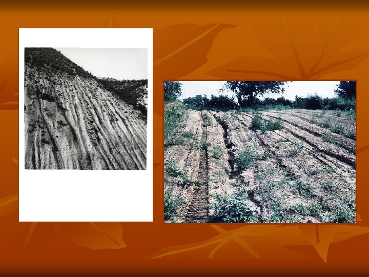
Depending on the severity, water erosion is classified into five categories – from excessive to very weak erosion. According to Gavrilović, the watersheds have been classified into five categories with the following coefficients of erosion (Gavrilović, S. , 1972) : I cat. Excessive erosion, 1. 01 < Z < 1. 5, average 1. 25; II cat. Intensive erosion, 0. 71<Z < 1. 0, average 0. 85; III cat Medium erosion, 0. 41 < Z < 0. 70, average 0. 55; IV cat. Weak (low) erosion, 0. 20 < Z < 0. 40, average 0. 30; V cat. Very weak (low) erosion, 0. 01 < Z < 0. 19, average 0. 10.

METHODS OF MEASUREMENT The measurements related to this indicator initially require the assessment of land degradation in arid, semiarid and subhumid areas. In the case of Serbia, they are semiarid and subhumid regions. To calculate the corresponding indices of incidence, the following measurements were made: area affected by extreme degradation – X km 2 (UNEP stated two categories: extreme and very extreme degradation); areas affected by moderate degradation – Y km 2; areas affected by weak degradation – Z km 2; area of national territory (without aquatic area) – N km 2; area of arid lands subject to desertification, which consists of arid, semiarid and subhumid areas – D km 2.

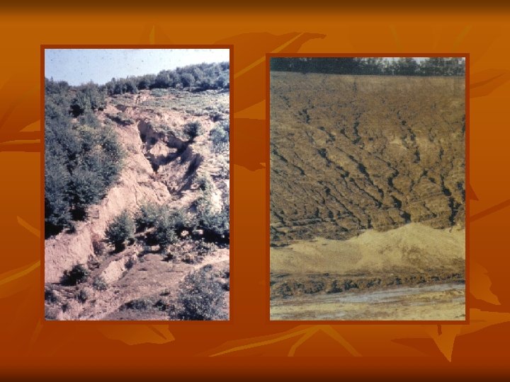
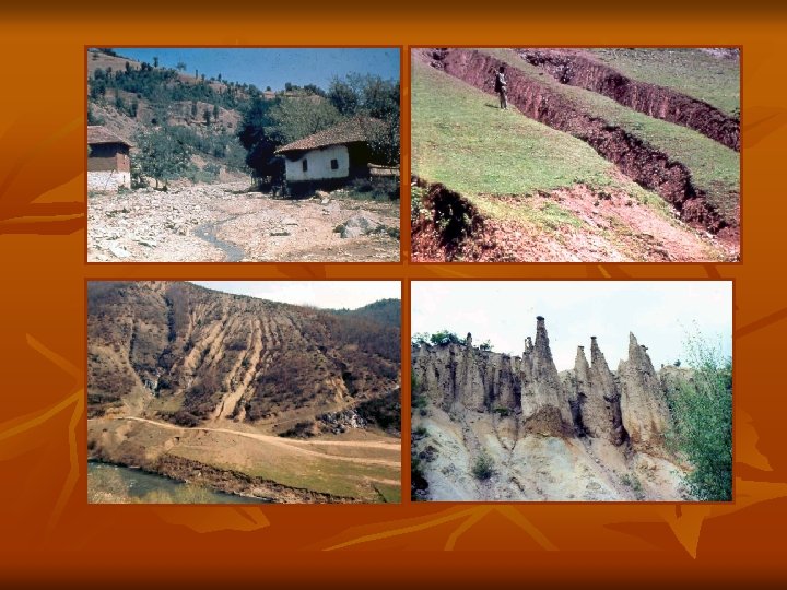
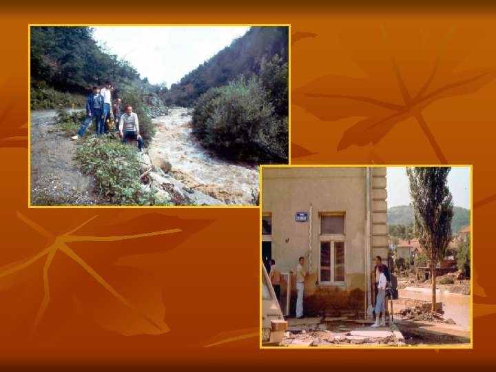
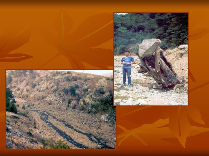
THE MAIN CAUSES OF LAND DEGRADATION IN SERBIA 1. Soil erosion by water and wind, ◊ water erosion ◊ wind erosion 2. Heavy metals and pesticides, and other chemical problems 3. Salinization of soils 4. Surface mining 5. Construction of hydro power plants and their reservoirs 6. Urban and industrial expansion On average, the agricultural land in Serbia are reduced annually by 117 km 2 (11 700 ha) 7. Flooding 8. Waterlogging 9. Compaction 10. NATO bombardment in 1999

RESULTS AND DISCUSSION Trends of temperatures and precipitations A statistical analysis of long term data series of annual air temperature (for period 1951 2000) showed that the territory of Serbia can be divided into two parts: in one of them, northwards of the line Kragujevac Zaječar, the positive temperature trend is gained, and in the other one, southwards of this line, there is a negative temperature trend (Fig. 2). But, in despite of global trend lines, the last two decades of 20 th century should be taken because of extremely high rising of annual air temperature which is registered throughout the entire territory of Serbia. The average increasing of 10 year running mean for period 1990 2000, regarding to the period (1976 1985) of the lowest mean values, was most often 0, 6 0, 8 o. C (or 0, 4 0, 5 o. C/10 year) with maximum rising of 1, 0 o. C (0, 6 o. C/10 year) in Eastern Serbia (Timočka Krajina). ( Spasov, P. , et all, 2002).
 in Serbia,")
Figure 2. 10 -year running mean of the annual temperatures (0 C) in Serbia, 1950 -2000.
 in Serbia, 1950")
Figure 3. 10 -year running mean of the annual precipitations (mm) in Serbia, 1950 -2000.

OTHER FACTORS OF LAND DEGRADATION AND DESERTIFICATION Table 3 presents land use in Serbia without AP Kosovo and Metohija in the period 1999– 2002. If the entire territory of Serbia (88, 361 km 2) is analysed, the land use percentage is as follows: – cropland – forests – pastures about 53%; about 27%; about 11%. In Serbia without AP Kosovo and Metohija, the situation is as follows: cropland forests pastures about 55% about 24% about 11%

Water Erosion map of Serbia

Wind erosion in the Northern Vojvodina

Table 6. Average ratio of annual precipitation-R to annual potential evapotranspiration- PET, for the regions of Serbia in the period 1992– 2002 Year Vojvodina West Serbia Central Serbia East Serbia South Serbia 1992 0. 60 1. 05 0. 83 0. 46 0. 65 1993 0. 48 0. 85 0. 57 0. 49 0. 47 1994 0. 55 0. 91 0. 63 0. 53 0. 49 1995 0. 75 1. 11 0. 82 0. 64 0. 75 1996 0. 77 1. 24 0. 91 0. 67 0. 74 1997 0. 75 1. 15 0. 84 0. 73 0. 64 1998 0. 67 1. 09 0. 86 0. 74 0. 77 1999 0. 97 1. 26 1. 05 0. 73 0. 72 2000 0. 31 0. 61 0. 56 0. 38 0. 41 2001 0. 88 1. 27 1. 00 0. 59 0. 74 2002 0. 50 1. 12 0. 91 0. 85

Table 8. Occurrence of arid areas and desertification per regions Year Region 1992 1993 1994 1995 1996 1997 1998 1999 2000 2001 Vojvodina + + + – – – + West Serbia – – – – + – – Central Serbia – + + – – – + – – East Serbia + + – – + + – South Serbia + + + – – + Incidence of arid areas and desertification – Absence of arid areas

CONCLUSION Indicators of desertification, primarily soil erosion and the ratio R/PET, were analysed for the period 1992 2002, while the trends of the causes of this process, air temperature and precipitation, were analysed for the period 1950 2000. The trends of air temperature which increased by the end of the 20 th century and the annual precipitation which decreased, especially during the period 1986 2000, point to the existence of all the conditions for the development of intensive processes of desertification in Serbia. These trends of climate changes combined with inadequate land use in Serbia condition the development of severe degradation processes in the form of water and wind erosion, which affect (with different intensities) practically the entire territory of Serbia.
 is relatively short for this type of research. Still,")
The study period (1992 2002) is relatively short for this type of research. Still, some conclusions can be drawn: 1. The study period can be divided into three periods, i. e. : period 1992– 1994 when the territory of Serbia, without West Serbia, was threatened by desertification; period 1995– 1999, when only individual regions were threatened by desertification (1995 and 1997), and during 1996, 1998 and 1999, the whole territory of Serbia was classified in the group of humid areas, without the desertification risk; period 2000– 2002, when the entire Serbia was threatened by desertification (2000), and in 2001 and 2002 only individual regions were affected;

2. The region which is the most threatened by desertification is East Serbia (six years), followed by Vojvodina and South Serbia (five years each), Central Serbia (three years) and the least affected area is West Serbia (one year); 3. Although this is a short period of research, it can be concluded that practically the whole territory of Serbia, except West Serbia, was threatened by desertification

THANK YOU !
- Slides: 24