Improving the Vortex Initialization of Hurricane Karl 2010

- Slides: 14

Improving the Vortex Initialization of Hurricane Karl (2010) Through the Assimilation of Tropical Cyclone Vitals Quadrant Wind Radii Estimates Robert Nystrom, Fuqing Zhang, and Jason Sippel

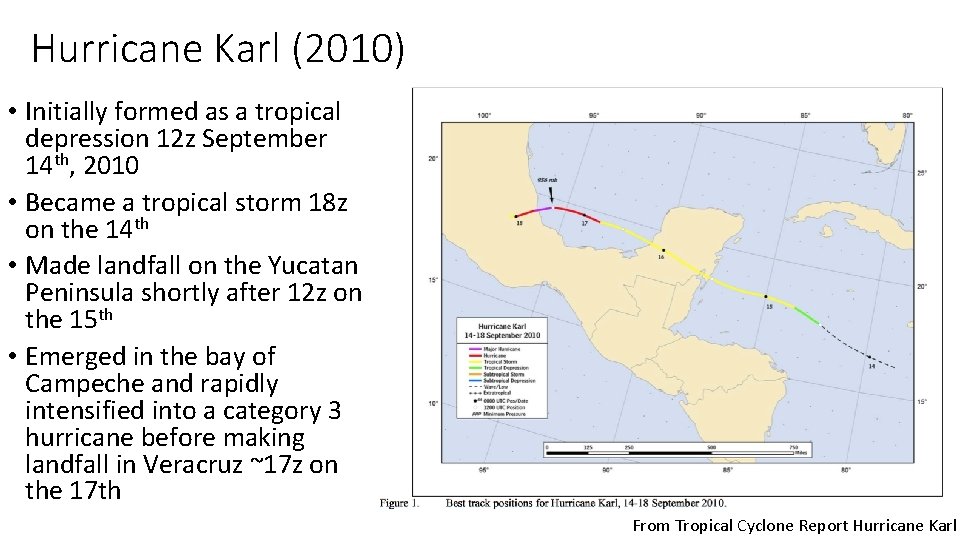
Hurricane Karl (2010) • Initially formed as a tropical depression 12 z September 14 th, 2010 • Became a tropical storm 18 z on the 14 th • Made landfall on the Yucatan Peninsula shortly after 12 z on the 15 th • Emerged in the bay of Campeche and rapidly intensified into a category 3 hurricane before making landfall in Veracruz ~17 z on the 17 th From Tropical Cyclone Report Hurricane Karl

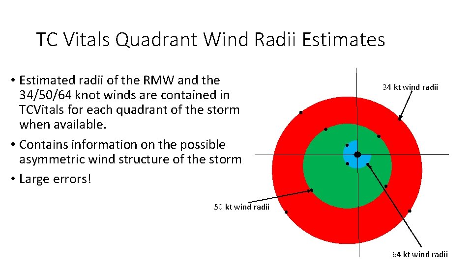
TC Vitals Quadrant Wind Radii Estimates • Estimated radii of the RMW and the 34/50/64 knot winds are contained in TCVitals for each quadrant of the storm when available. • Contains information on the possible asymmetric wind structure of the storm • Large errors! 34 kt wind radii 50 kt wind radii 64 kt wind radii

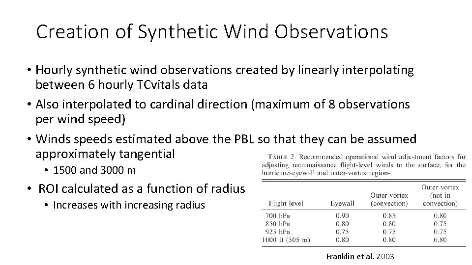
Creation of Synthetic Wind Observations • Hourly synthetic wind observations created by linearly interpolating between 6 hourly TCvitals data • Also interpolated to cardinal direction (maximum of 8 observations per wind speed) • Winds speeds estimated above the PBL so that they can be assumed approximately tangential • 1500 and 3000 m • ROI calculated as a function of radius • Increases with increasing radius Franklin et al. 2003

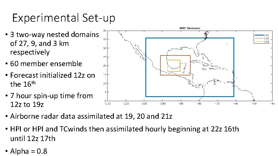
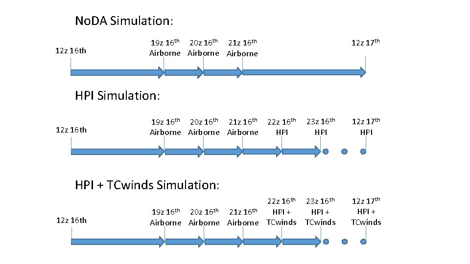
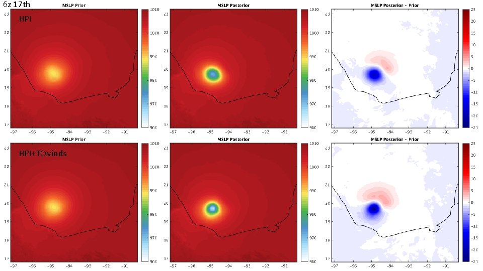
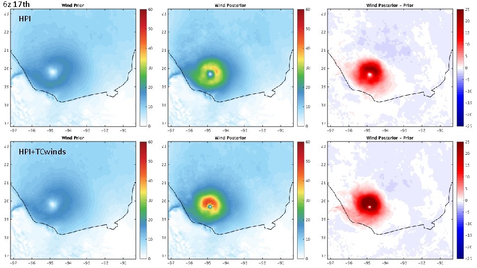
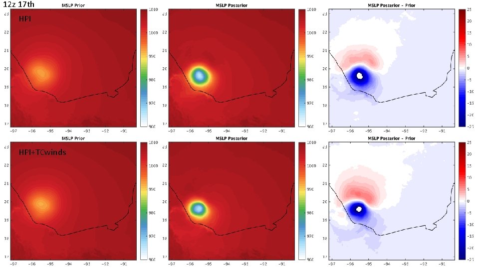
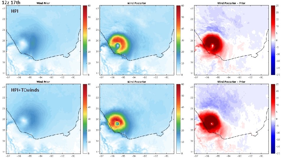
Experimental Set-up • 3 two-way nested domains of 27, 9, and 3 km respectively • 60 member ensemble • Forecast initialized 12 z on the 16 th • 7 hour spin-up time from 12 z to 19 z • Airborne radar data assimilated at 19, 20 and 21 z • HPI or HPI and TCwinds then assimilated hourly beginning at 22 z 16 th until 12 z 17 th • Alpha = 0. 8

No. DA Simulation: 12 z 16 th 12 z 17 th 19 z 16 th 20 z 16 th 21 z 16 th Airborne HPI Simulation: 12 z 16 th 23 z 16 th HPI 12 z 17 th HPI 22 z 16 th 23 z 16 th HPI + 19 z 16 th 20 z 16 th 21 z 16 th Airborne TCwinds 12 z 17 th HPI + TCwinds 19 z 16 th 20 z 16 th 21 z 16 th Airborne 22 z 16 th HPI + TCwinds Simulation: 12 z 16 th

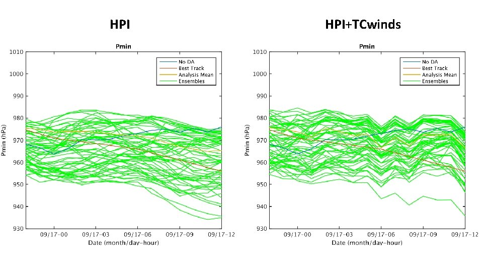
HPI HPI+TCwinds

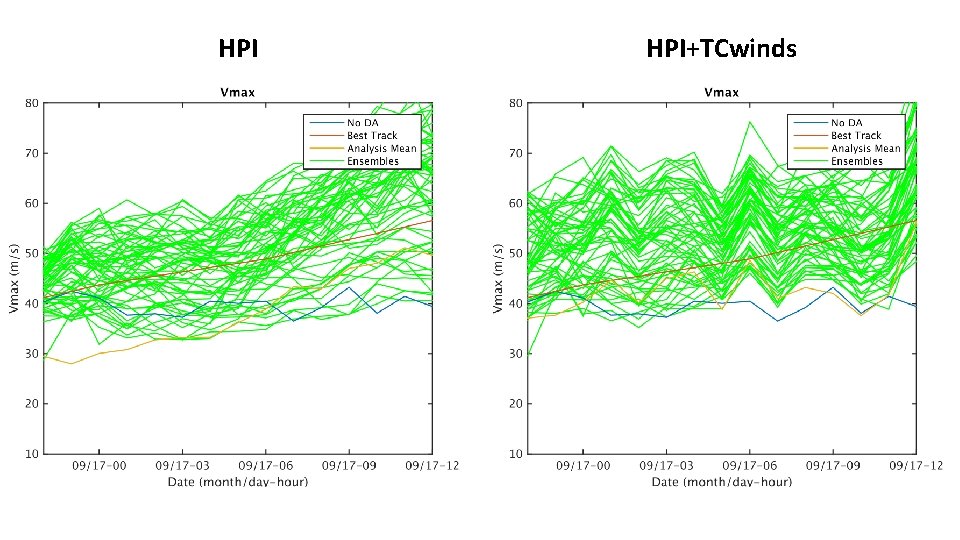
HPI HPI+TCwinds

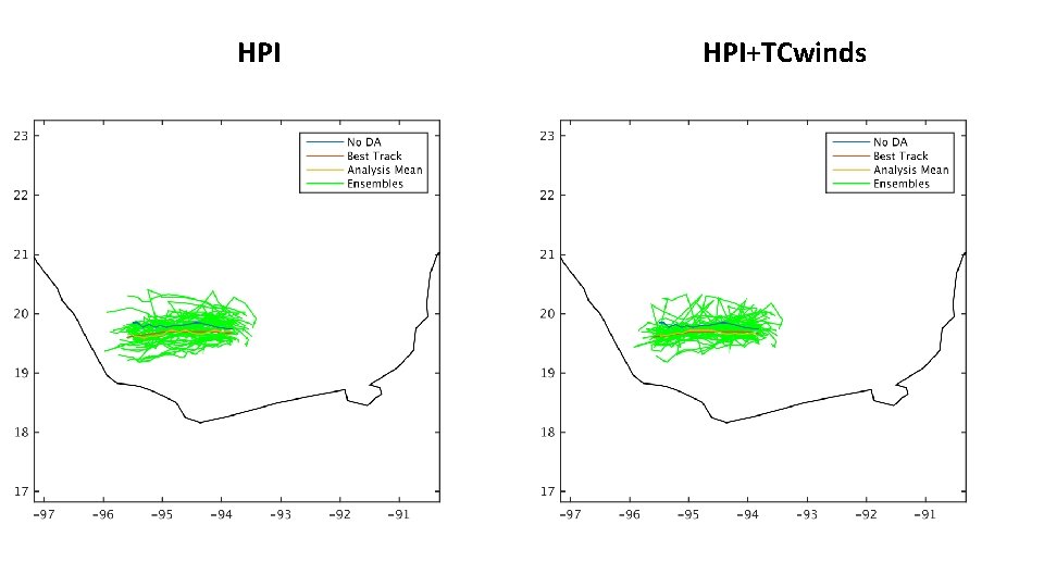
HPI HPI+TCwinds

6 z 17 th HPI+TCwinds

6 z 17 th HPI+TCwinds

12 z 17 th HPI+TCwinds

12 z 17 th HPI+TCwinds

Conclusions and Next Steps • Some benefit to assimilating quadrant wind radii estimates • Investigate 3 hourly assimilation of quadrant wind radii estimates. • Examine impacts on forecasts and impacts of TCwinds with other observations included • Examine better localisation methods and future reduced observation error of TC quadrant wind radii estimates